


The Kanani Abels linkup - is a route I put together at the start of 2021, in the hope of inspiring myself to do something longer and more difficult than I’ve ever done before. I definitely succeeded in that sense.
I chose April Fools’ Day because I decided this was an incredibly foolhardy mission for someone such as myself who gave myself six weeks to train for an activity 20 km further than I’ve ever run before.
I decided I was going to do this route completely unsupported carrying all of my own nutrition, water and any other clothing or items that I might need. To refill my water, I would only use natural running water off the mountain in the flowing streams.
The weather forecast was for a really warm day for Tasmania, which was 26°C. So I decided to take off early in the morning pre-6 am to avoid most of the heat of the day. This meant that I’ll be running in darkness for 1 to 2 hours so I head torch was going to be needed which was fine.
I took off at 5:40 am in the middle of Salamanca in Hobart city centre, the capital city of Tasmania in Australia. Running through the dark streets and parks of Hobart was a little eerie as I made my way towards the Hobart rivulet track where I found my first gravel Trail. I took the rivulet track up to the Cascades walking track, up myrtle Gully track, to junction hut. The Myrtle Gully track is notoriously steep and challenging, in the dark it was that and more. By the time I made it to Junction Hut I was about an hour into the effort and needed some energy already.
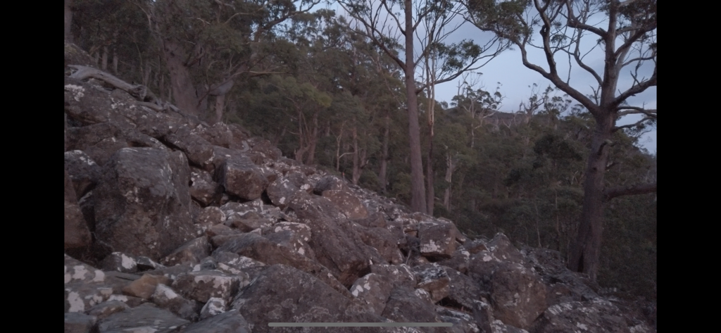
Even though I was only an hour and a quarter or so into this run my head torch ran out of batteries (Damn). It was still dark for another hour, but luckily the moon was mostly full and there was enough ambient light that I could tackle hunters track, a notoriously technical trail of Boulder hopping on the northern aspect of Kunanyi.
I made my way up Hunter’s track and came out at pinnacle Road, then slowly jogged and walked my way up to Big Bend Trail.
I was already hurting at this point the intensity was far more than I had expected myself to give this early on and I did wonder how I’m going to moderate my effort to ensure that I get to the end.
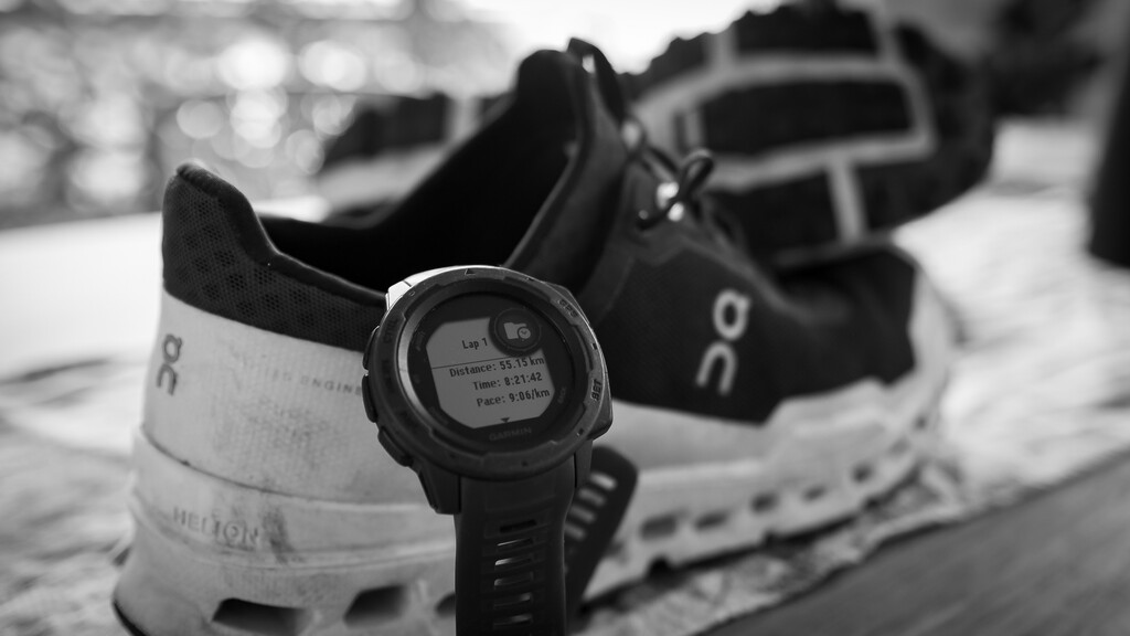
This is a completely new thing for me to go beyond 30 km with significant elevation knowing it’s going to take me 8 to 10 hours, I had no idea what I needed to do now in order to get to the end I was going to have to learn on the way. Nothing like diving in the deep end.
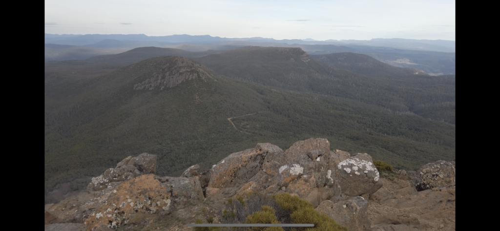
I’m on my way through big bend track and Mount connection track, all the way to the East West trail which the first three of my able summits peel off from.
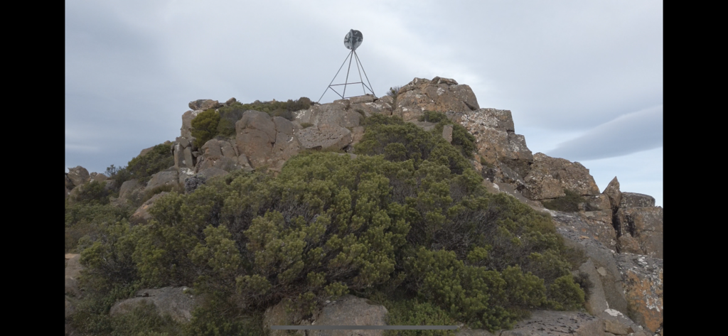
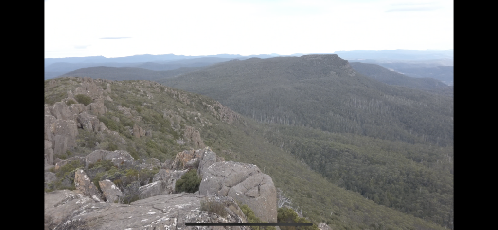
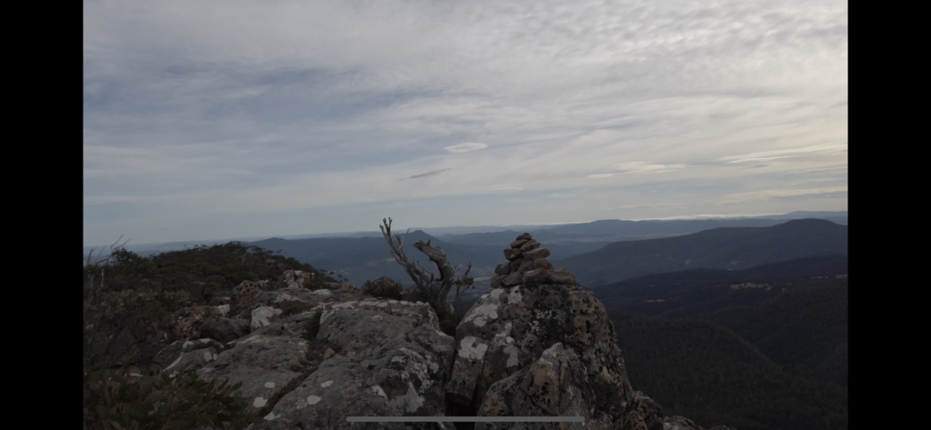
Collins bonnet was the first summit. It’s a pretty standard, well marked trail with a pretty easy ascent to the marker. The next summit was down the east west Trail and then a short climb up from the trail head to reach Trestle mountain. The approach to the Trestle summit - which is mostly unmarked other than some man-made Cairns - was my favourite of the day. To top out, you just find the highest pillar to climb on top of to ensure you complete the summit. After getting back down to the east west Trail off of trestle mountain, you make your way along to find the Trail head for Mount Marian. The approach to Mount Marian is a completely uninspiring wombat track with rugged undergrowth that shredded my legs and untied my shoes, twice! There are barely and markings towards the top before I found the larger than normal man-made cairn which indicated it’s Summit.
This was effectively “halfway.” But I knew it was only gonna get worse with regards to fatigue from then on, exponentially!
So I made my way back down the East West Trail to Mount connection Trail to big bang trail back onto pinnacle Road and then up to the summit of Kunanyi; Mount Wellington.
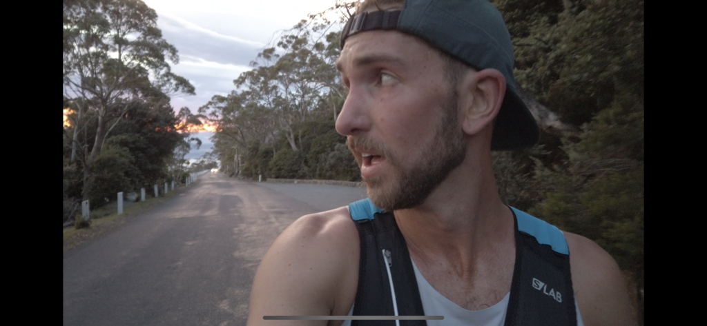
The real challenge for me physically in this run came after I got down from Kunanyi to Fern Tree, where I hit the very well groomed, slightly downhill track of Water Works - pipeline track. The cramps for setting in strong right from my calf to my hamstring; I couldn’t manage my speed and was running too fast, I was stopping regularly just to rest my legs or my lungs or just my body generally, because I didn’t know what was hurting; I was just hurting everywhere. I had hit the crux of the effort. The terrain was the easiest I’d had all day, yet my brain was focused on the heat, sweat and discomfort I was feeling. This was my low point.
When I hit the streets of Hobart I swear if a taxi had of driven past I would’ve flagged it down to take me the final two or 3 km to the finish. My vision was completely blurry. Every time I stopped, I felt like I was going to fall asleep, I was in a total haze.
When I was standing still, everything was moving; when I was moving everything looked still.
I did make it back to the dock at Salamanca and immediately lay down in some water lapping over the cement landing. A friend of mine was there to meet me at the end and thankfully go and get me a ginger beer while I took a power nap in the water.
I completed this effort completely unsupported filling up my water bottles only from natural streams or running water on the mountain. I learned a heck of a lot about these types of efforts and nutrition during them, because that’s where I could’ve done a whole lot better. I can’t look at another GU Energy gel, they just didn’t work for me. Solid food too seemed not to work or I chose the wrong types for me. The flavour fatigue of sweet things was too much and because of that I was actually avoiding taking in calories when all I really needed was calories.
It took me a solid 30 minutes of swimming in the dock at Salamanca, to feel capable enough to walk the kilometre back to my car and then drive home. I couldn’t call anyone because my phone had bricked itself during the run, trying to unlock itself.
This was by far the hardest thing I’ve ever made myself do. It has set the bar and given me a taste of something that I want to taste again.
My reason for doing this; my reason for creating this route, was to inspire in the first instance, myself to do something long (relative term) and difficult, and then - put it into the world and see just how fast somebody else can do it. I can look at others times and understand, to some level, how they might of felt doing it because I’ve intimately been where they have been.
I know I am nowhere near the fastest that can do this, that’s not what I am trying to prove to myself by doing it. I want to share a feeling, an effort with others that take on this epic effort. The time has significance of course, but the effort is what matters.
So for now I am stoked with my effort. It was everything I had right now.
Maybe I’ll revisit it sometime in the future? But for now I’m looking elsewhere.