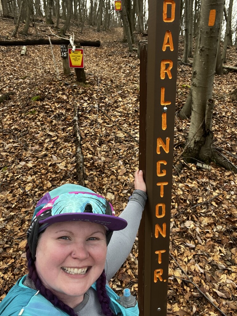
The Darlington Trail has been a part of my training grounds for the past few years, especially after I moved to the Mechanicsburg area. I have always had the idea of submitting the entire trail for an FKT route, and someone else had the same idea as well. I thought by now there would be a women's time established but since there is not, I decided to go for it!
After a miserably rainy day yesterday, I decided today's (Sunday, March 10th) weather would make for a more enjoyable time on the trail. I dropped my car off at the end of the paved portion of Tower Rd. in Marysville, near the Eastern Terminus of the Darlington Trail. I was dropped off at the top of Miller's Gap Rd., which is the closest parking lot to the Western Terminus of the trail. I used the radar tower access road and game lands trail to shortcut a little on my hike in to the Western Terminus, approximately 1 1/2 miles.
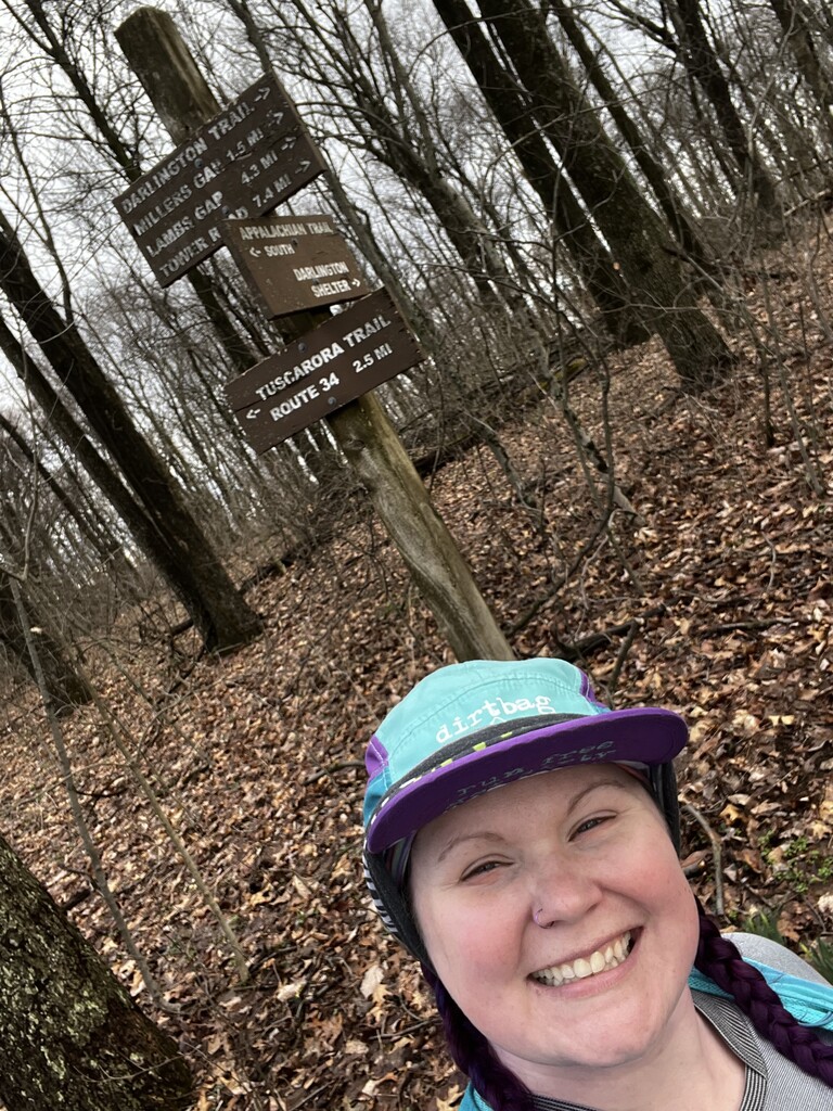
I decided to run this FKT from West to East because it is a net downhill. I knew there would only be a few short uphills over the course of the trail. I restarted my watch at the intersection of the Appalachian, Darlington, and Tuscarora Trails, and the FKT began! The trail is mellow in the beginning, well-worn with hardly a rock in sight, following along the ridge line of Blue Mountain. To my surprise there was some standing water along the top of the ridge throughout the day.
Quickly enough, the trail turns to a technical slate minefield, which extends over Miller's Gap on the North side of the mountain. I use this time to eat some gels and remember to hydrate. The trail once again rounds the top of the ridge line, all is calm, and the miles click away once again. Here is where things really start to go downhill, well the trail at least. As I descend into Lamb's Gap I clock my fastest mile. I crossed Lamb's Gap Rd. and found myself taking another fuel hiking break.
From Lamb's Gap, the trail once again turns into a mess of twisty shale for a bit as it slowly begins to descend the North side of the mountain. I came to a game lands road intersection, and the trail becomes a fire road for awhile. Then more descending until I reached the lowest point of the trail, where one must hop on some large rocks over Bryson Hollow Run. At this point I was kind of over the whole ordeal as the Eastern side of the trail is not as well maintained. There were a lot of blowdowns and thorns encroaching the trail.
I knew I had to climb Little Mountain somewhat to reach the end of the trail, and I knew once I came to a sharp left turn that the end was near! I gave one last climb my all, and once I rounded the top of the hill I began running as fast as I could. The gate at the Eastern Terminus was a sight for sore eyes!
I walked about 1/2 mile down Tower Rd. to where I parked my car. I would only recommend trucks or Jeeps try to park at the actual trailhead as the road is pretty beat up. I consumed 4 Huma gels and carried 2 500 mL flasks of water, one with 2 scoops of Tailwind. I probably drank half of my water.