MCMILLANS WALKING TRACK
Julian Bowring and Jack Garner set off on Friday, September 20, at 1.45pm, to attempt the McMillans Walking Track. We hoped to beat the current Fastest Known Time in the Self-Supported category of five days, four hours set in 2021.
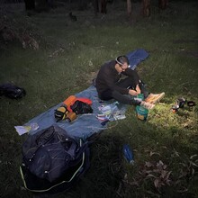
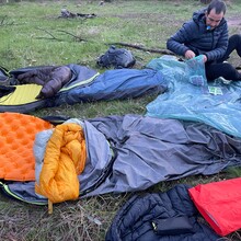
We had a single food drop at Breakfast Creek, with food for Sunday evening and Monday day. We carried the remainder of our gear for the entire run, estimated to be around 13kg per person. Each person took a bivy, sleeping mat, sleeping bag, wet weather gear, spare clothing, food, head torch, battery pack, and toiletries. We also had a stove, two gas bottles, a Garmin InReach Mini, and a few other miscellaneous items.
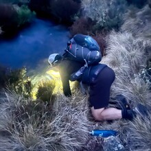
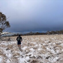
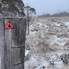
We both slept in Outdoor Research lightweight bivvies (circa 528 grams, including pole), which worked well. However, you do get condensation and starting early in the morning and finishing well after dark gives you a limited time to dry anything out. We both took lightweight, high-fill, down sleeping bags/quilts. We weren't cold, but we slept in every piece of clothing we brought the first night as the temperatures dipped to -4 on the Dargo High Plains, and it even snowed.
I wore a pair of Salomon trail running shoes for the whole trip, which worked well, although I had the inevitable black toes, blood blisters and general wear and tear on the feet by the end of the run. I have since come across Sport Shield, which applies a barrier to the skin of the feet, which I intend to try out for the next multi-day adventure. We used Salomon fastpacking packs (XA 35), 35-litre packs that are a hybrid between a trail running vest and a hiking pack. They worked pretty well, although, with 13kg on your back, there is some inevitable bounce. Interestingly, carrying the weight was probably the most physically demanding element of the run, and I found myself with some pretty severe shoulder and arm pain in my left arm by the middle of day two.
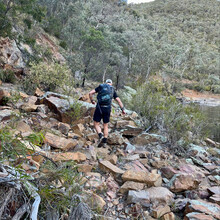
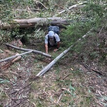
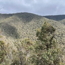
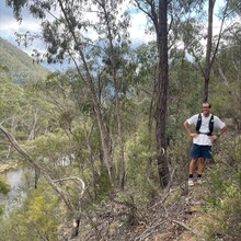
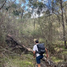
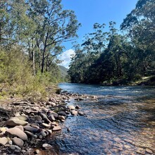
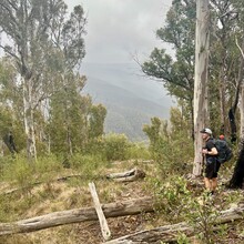
We used Gaia GPS on our phones for navigation the entire time. This worked well if you kept your phone in aeroplane mode to conserve battery. Large portions of the track aren't marked at all, and other sections are either extremely overgrown or marked sparingly, so navigation was the most critical part of the trip. This variation in track condition was the most crucial factor in the time it took us to cover various distances. For the section of the trail along the Moroka River and up along Playboy Creek, it took us 12 hours to cover 30km. Then, once we reached Moroka Rd, we did the next 30km in half the time, a testament to the impact that navigation and track conditions can have on your moving time.
Safety-wise, we carried a Garmin InReach Mini. Julian is with Telstra and had a bit of reception in a few high spots; I was with Optus and had almost no reception the entire trip. The InReach Mini allows for emergency two-way texting and location sharing. Considering how remote you are in sections of the track, a rescue would be extremely slow in coming even once you'd raised the alarm. With this consideration, you had to approach the trail mindfully, especially at night and towards the end of our trip when brain power was waning.
The food consisted of dehydrated meals, 2-minute noodles, cups of soup, gels, energy bars, lollies, beef sticks, and carbohydrate and electrolyte powder that could be mixed with water; this worked reasonably well. The highlight was the Back Country cooked breakfast that we had one morning, which was a real winner and had a whopping 700+ calories. The lowlights were probably everything sweet towards the end of day four; my stomach had had enough glucose and didn't want to keep anything down.
- 222.20km
- 9,893m vertical gain
- 28,068 calories burnt
- 81 hours 45 minutes 47 seconds (3 days 9 hours 47 seconds)
DAY 1: FRIDAY, SEPTEMBER 20, 1.45PM
- Cobungra to Dargo High Plains - 26kish
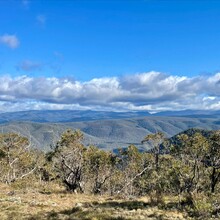
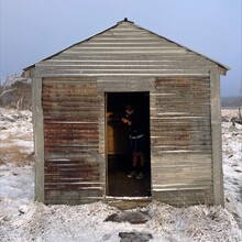
We began at 1.45pm on Friday, September 20 from Cobungra. During the first few hours, we had smooth running, relatively well-marked tracks, and high enthusiasm. The Mayford Track down to the Dargo River is incredibly steep; you drop about 500 vertical meters in a 1.85km. We stopped at the Dargo River to fill a 4-litre bladder for cooking that evening and the following day. We then had the distinct pleasure of carrying the bladder (which we affectionately named baby) up out of the valley to Lankey Plain Hut. As we neared the ridge line, night began to fall, the rain began, and visibility dropped considerably. We made it to the hut just as the first snowflakes began to fall. Considering the snow and winds of up to 65km per hour, we spent the evening inside the hut, which was a blessing. The overnight temperature dipped to -4, and we woke to an incredible white landscape.
DAY 2: SATURDAY, SEPTEMBER 21, 6.26AM
- Dargo High Plains to Moroka River - 60kish
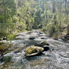
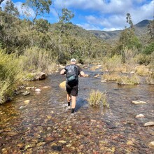
We woke early and were back on the trail by 6.26am. The first section of the trail off the Dargo High Plains Road isn't marked, as it runs through some private property; this, combined with fresh snow lead to slow, winding progress. Navigation became much more straightforward once we made it onto the White Timber Spur North Track. We continued down towards the Crooked River, which we crossed about 23 times in a few km. We then had the pleasure of coming through Talbotville Campsite, an incredibly isolated, idyllic spot; I've pencilled this one on the list of places to head back to and linger at rather than just pass through. We continued moving at a decent pace and, after crossing a particularly rickety bridge, landed in Eaglevale. From there, we detoured to check out Dungey's Hut and collect some water for the evening, but the hut was no longer accessible. That portion of the national park now appears to be private farming property, although a quick Google after the run suggests that the hut has been restored and can be visited. We ended up camping a little further up near the end of the Wonnangatta River.
DAY 3: SUNDAY, SEPTEMBER 22, 6.32AM
- Moroka River to Breakfast Creek 60kish
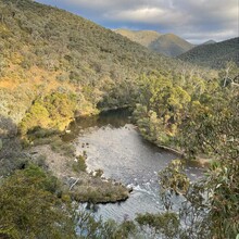
We were again back on the trail at 6.32am. Where the Wonnangatta River meets the Moroka is a spectacular spot. However, the trail up the Moroka is nonexistent for the most part, meaning bush bashing, walking through the river and very slow going. We paused at Playboy Creek for lunch and followed the general direction of the trail up past Beths Peak and towards Moroka Rd. This section is also very sparingly marked, so for the most part, you are bush-bashing or simply trying to pick the best lines. The first 30km of the day were the slowest going of the entire trip and took us almost 12 hours, a lesson to us that it's not the vertical gain or distance that matters, but the track markings and condition. As the sun dropped, we pushed on into the next valley, passed Kellys and McMichaels Huts, and tried to fortify ourselves for the night climb up and above Mount Tamboritha and Little Tamboritha. We finished a little before 1am in Breakfast Creek. Despite the fatigue from the day, we were very excited to feast on stale, flat coke and chips along with our regular dehydrated dinner meal from our food drop. It's incredible how delicious food tastes when you've built up a good appetite.
DAY 4: MONDAY, SEPTEMBER 23, 7.30AM
- Breakfast Creek to Woods Point 70kish
The final day. After an incredibly brutal previous day, we gave ourselves a sleep-in and were back on the trail at 7.30am, after 4ish hours of sleep. We climbed out of the valley and down to the Macalister River. We spent a few minutes looking for the best place to cross, and we thought we would end up having to swim it, but thankfully, it was only just above waist height at its deepest point but moving rapidly. We hiked out of the valley and trailed through some incredibly green and lush farming land in Licola North. September is the rainiest time of year for the track, and the land was showing it. The trail was mercifully easy to navigate for most of the day, with a decent amount of 4WD and well-marked jeep tracks. The climb out of the spectacular Rumpff Flat Camp Site was relentless, with around 830 meters of vertical gain in 5.5km; thankfully, you didn't have to think about navigation. From there, we had the wind at our back as we wound our way into Woods Point, where we finished around 11.30pm, elated to be done.
You finish something like this with mixed feelings. You've gone three and a half days with relentless pain and having to mentally motivate yourself to take every single step, which is extremely fatiguing. The few days afterwards were probably most marked by feeling mentally vacant rather than specific ailments, although our feet certainly weren't a pretty picture either. All of that said, you also really miss it once you finish. There is a single-mindedness on the trails that seems to be missing from everyday life. There is hardship but also simplicity, the contentment of doing one thing at a time and being surrounded by the wonders of nature.

