

I decided to go for this run somewhat on a whim after several weeks of crewing for Nick Fowler on his supported record attempt on the PCT. In about a week, and after much encouragement and convincing from Nick, I threw together my plan and did a short bit of recon. While it all felt last minute, this attempt was not without significant hard work, training, and repeated failed FKT attempts over the course of several years.
My intentions for this record were to follow the precedent set by Nick on his self-supported record in 2024 - connected footsteps, no ferries, and red line as much as possible to create a “pure” route. It also meant that I would tackle more miles overall than the previous women’s records while still trying to set a faster time (421 vs Krista’s 402 and Becca’s 371.)
To accomplish this, I chose a favorable tide window and organized my entire itinerary around the crossing of two major tides - one on day 2 (Sand Lake) and another on day 7 (Sixes River). Needless to say, this was an exercise in logistics, organization, patience, and trust in timing.
Ultimately, I did need to take the blue line on two short occasions for a total of 2.7 miles and stuck to the 101 on three separate occasions, once to walk around the Tillamook Bay which requires a ferry on the red line (+8 bonus miles) and twice for personal safety for about 30 miles total.
None of this would have been possible without my dear friend and men’s self-supported OCT record holder, Nick Fowler. His endless amount of trail beta, tide information, and daily support and encouragement were invaluable, and really helped this record come to fruition.
I also had an incredible amount of help and support from my friend and math wizard, Kat Sinclair, my running coach, Jenny Quilty, and my partner Sven. While this was a self-supported effort, I truly felt supported in every aspect.
Finally, I’d like to dedicate this run to my sweet friend Norah Kelly who lost her battle with cancer ten weeks prior to the date of this record. Norah lived her life on purpose. Her sense of wonder, adventure, and meaning inspire me to continue living this short life as audaciously and courageously as possible. We live once, make it count.
Trip Report:
There is much to say about this adventure but I’ll leave the finer details for another time and space. All mileage info came from Coros and is uploaded to Strava for public viewing.
I love the Oregon Coast and it was so special to run across the entire state where my partner and I have lived for the last ten years. The OCT is a very unique type of trail, different from any I’ve experienced before, and it was filled with beauty, adventure, and fun!
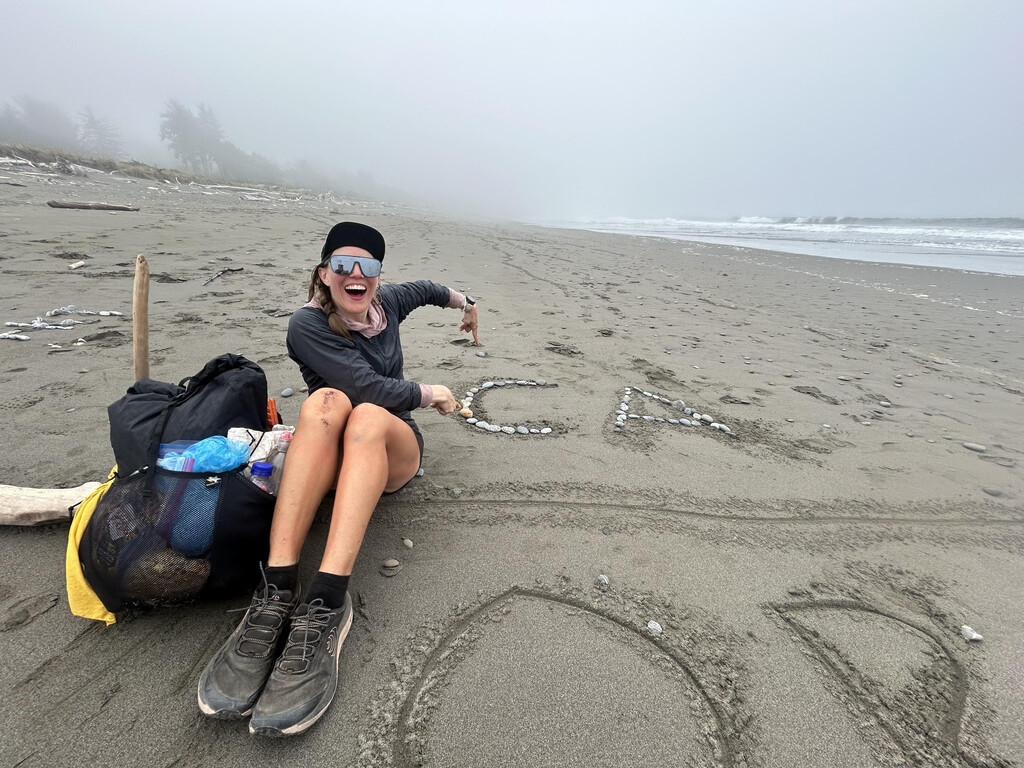
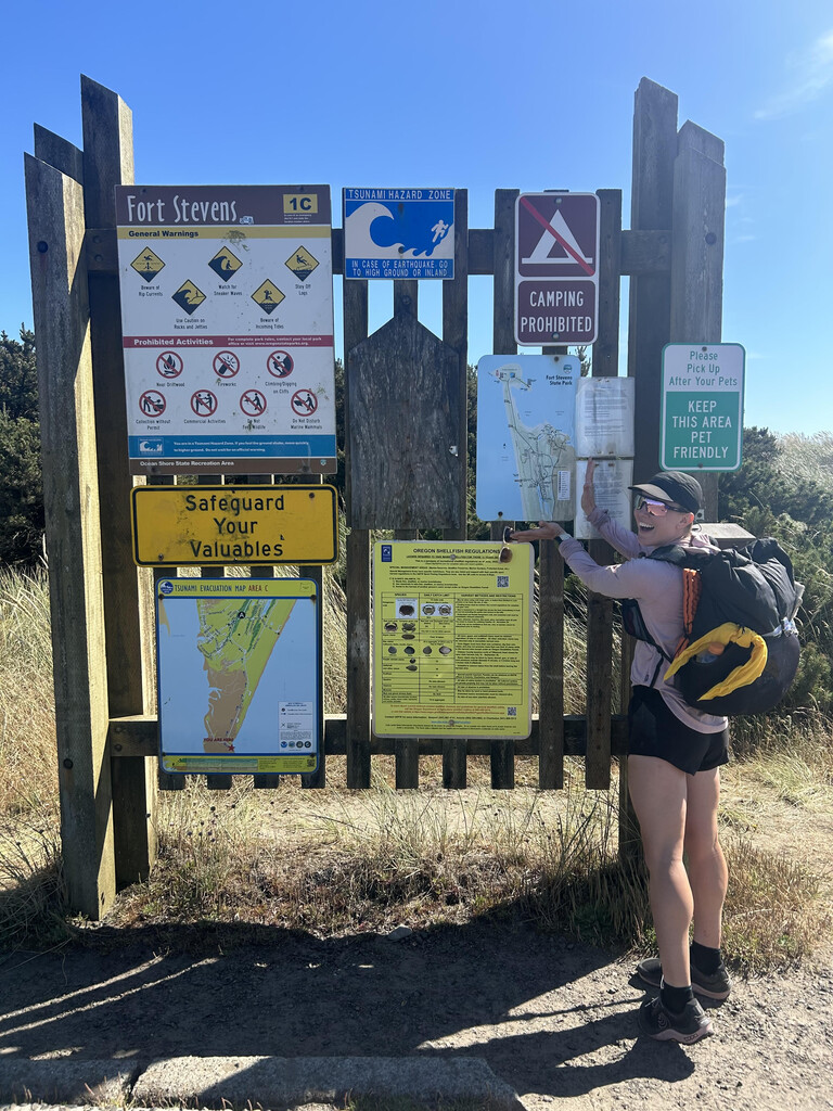
On Saturday, July 5th at 4:30pm I started my attempt from the WA/OR border in Fort Stevens State Park and finished on Sunday, July 13th at 12:11pm at the OR/CA border on the beach in Crissey Fields State Park. Time stamps are on Fort Stevens State Park sign starting photo and ending screenshot of GPS location over the Oregon/California line. Times are also on the Coros files.
- Day 0 - 21 miles
- Day 1 - 56 miles
- Road walk on 101 around Tillamook Bay to avoid mandatory ferry on the red line
- Day 2 - 54.7 miles
- Blue line .5 mile for high tide in Neskowin
- Day 3 - 48.2 miles
- Cold/wet all day, slept in a pit toilet to try to stay warm
- Day 4 - 48.2 miles
- Took 101 for 7 miles in the morning to avoid hyperthermic conditions on the beach
- Out of water for a long time, begged for some from bougie Inn guests
- Day 5 - 53 miles
- Day 6 - 41.9 miles
- Rock climbed over crashing waves to get around the tide at Fivemile Point.
- 38mph wind gusts and boat advisory storm on the Pacific. Couldn’t take the 101 to avoid because it would mean skipping the Sixes River crossing in the morning, the crux of the entire hike.
- Day 7-8 - 97.9 miles
- 35 hour final push, two dirt naps (12min and 6min respectively)
- No water for at least 30 miles, begged for some from a hotel.
- Backtracked to 101 on Meyers Beach because fog and crashing waves made it look impassable in the dark.
- Stuck to 101 for the last 23 miles for personal safety. Followed by a man in a truck at five different trail access points. Potentially a hallucination.
- Channeled my inner road marathoner and ran for the final five hours to get the overall women’s record.
- Blue line 2.2 miles to take the bridge over the Winchuck River.
- Stopped watch and took ending photo/screenshots approximately 100 feet over the stateline into California to ensure the entire length of Oregon was crossed.
https://www.strava.com/activities/15021156002
https://www.strava.com/activities/15031403505
https://www.strava.com/activities/15056759624
https://www.strava.com/activities/15056758503
https://www.strava.com/activities/15067198619
https://www.strava.com/activities/15104407308
https://www.strava.com/activities/15104453777
https://www.strava.com/activities/15104456184
Comments
Edit: The road walk on day 1 to avoid the mandatory ferry was around the Nehelam Bay, not the Tillamook Bay.
Additionally, wanted to add that my total mileage for this route was 420.9 miles (per Coros) including all bonus miles. Official red line miles likely closer to 415.