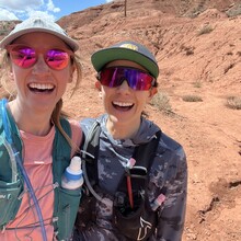
Climbing, sliding, and leaping into each others arms-this is a route that will bring your running partnership to new levels !
As a disclaimer, we decided to do this Wednesday, drove out Thursday night and, historically, we aren’t great navigators. So likely the things that gave us difficulty wouldn’t affect the average human.
We began our journey at the visitor center at a spry 6:05 AM and traveled counterclockwise to watch the sunrise and minimize soggy shoe time. Let it be known that the visitor center bathroom is not open until 8- but there is a park 3/4 mile away with bathrooms.
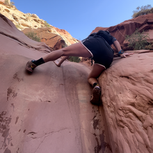
We climbed through absolutely beautiful rocks in the frying pa and we were glad to have it done early before the heat of the day.
Missed a turn despite staring at our maps and headed toward Cassidy arch trailhead and facilities instead of staying in the wash.
After trotting along the 24 road for a bit, we discovered that finding Fremont river and the lower spring canyon trail was real detective work. Keep your eyes peeled! Shin deep water, but our feet dried quickly. Bushwhacking GALORE. The trail was quite overgrown and slapping us in our faces. Battle wounds were won.
After this, the trail is pretty straightforward, but not totally dry- some puddles that we found were easy to dodge.
Climbing up the “dry falls” was quite the mixed route approach. At one point we got shin deep in water and rock climbed up a fall, only to find the following “dryfall” was a more menancing climb with a tit-deep waterhole at its base. So we downclimbed onto a branch leaning against a rock- this was only slightly sturdier than it sounds- I dismounted onto the landing and then turned to catch sweet, muddy kat in my arms. We then crawled through a rock hole to scale onto the reroute around the waterfall- which I would highly recommend starting with. Watch for the path on the right !
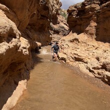
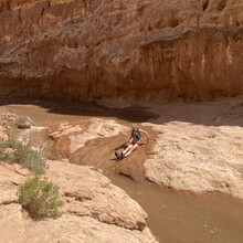
Sulphur creek is very much a thriving creek at this time. The last 4-5 miles were pretty much all beepbopping through water. Nice cooldown on a hot day! Mostly shin-deep, but waist-deep going down some of the splishysplashies. There was a friendly, but terrifying snake guarding the last waterfall so we spent a while looking at maps to figure out how to route around. Stay on the right side!
It then drops you right back off at the visitor center! What a blessing!
-Don’t underestimate- the gpx file underlists the mileage. We were both around 26-27 miles.
-We brought 2-2.5 liters of water each which was perfect.
-This was an incredible route and we are so thankful for Jason Hardrath to share it so we could have a memorable adventure! We look forward to someone beating our time.
❤️ , kat + katie