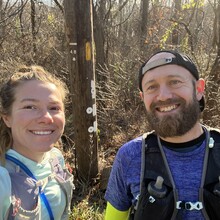
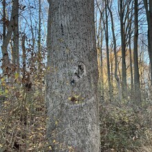
Around 9am Saturday, Brandon parked his car in a nearby development, and we walked approximately .75 miles to the start of the Historic Brandywine Trail. Neither of us had run any of this previously, but we knew we were looking for white blazes. The beginning part of the trail was well marked and we got through the first few miles with very little trouble.
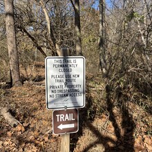
Our spouses (shout out to Katie and Mark!) generously agreed to crew for us, and they first met us around mile 11 with water and more food. The beginning portion of this route was predominately road and, while Brandon and I prefer more trail, it was relatively easy to navigate. We did second guess ourselves a few times, but didn’t have any major issues until we got to a section of trail with a sign indicating the trail was permanently closed; we followed another trail that closely paralleled the original and did not have to deviate very far.
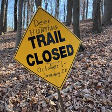
Shortly thereafter, we met our spouses at another “aid station” around mile 18 and continued on our way. Again, following white blazes at this point was easy, although around mile 20 we followed white blazes but noticed that there was a slight discrepancy between the blazes and what was shown in the .gpx file. Another slight re-route occurred about 2 miles later when we got to another section that the trail was posted as closed from October-January due to deer season. We were able to skirt around the section by following the road and linking back up with the original trail maybe half a mile later.
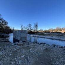
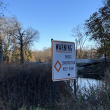
We came to our third “aid station” at the Pocopson Post Office/Ace Hardware/Veterinarian around mile 25, grabbed some more water and food and were on our way. This section proved to be the most difficult in terms of navigation and terrain. Around mile 30 we came to a part of trail that should have been an easy crossing of Brandywine Creek by way of bridge; however, the bridge was under construction, aka non-existent. We spent several minutes trying to find a good spot to cross the creek; fortunately we found a spot that wasn’t very deep but did have to backtrack a bit in order to do so.
After the bridge debacle we continued on, and once again the route was a balance of pavement, gravel road, and single track, but the blazes were placed much more sporadically, and the trail was not well maintained. This led to a lot of time spent consulting the .gpx of the route, bushwhacking, and second guessing whether or not we really were in the right spot. Around mile 32 we encountered our biggest navigational error of the day, when we missed a faded blaze that indicated we should have turned right. We ran along a gravel road for about half a mile before realizing our blunder and needing to backtrack. At some point we crossed into Delaware, although there was no line indicating or fanfare as I had hoped.
Eventually we found Katie and Mark at our fourth and final aid station around mile 32. At this point, we knew we were only a few miles from the end and it was getting dark, so we grabbed the bare necessities and kept moving.
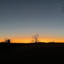
We hammered as best as one can after 35+ miles and eventually found ourselves in Brandywine Creek State Park around sunset. We were happy with our efforts but after 38.5 ish miles we were also really happy to meet Katie and Mark at the car and call it a day.

