TRAIL NAME:
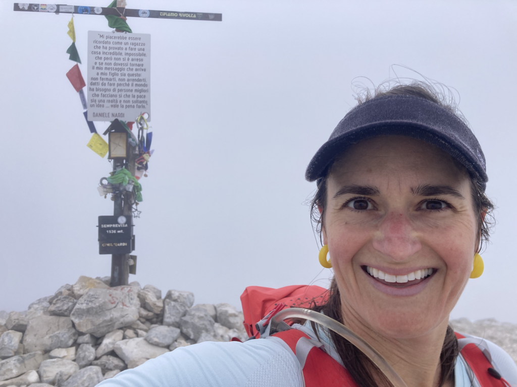
The trail to the top of Monte Semprevisa takes you to the highest point in the Lepini Mountains. The trail carries the name of an Italian climber who, in early 2019 died during his ascent of Pakistan’s 26,660-foot Nanga Parbat via Mummery Spur. Daniele Nardi was only 42 when he died.
GETTING THERE and BACK:
This trail is a lovely option for someone traveling through Rome, as you can get there fairly easily from Rome via public transport. From Rome Termini, take the train to Latina (35-45 minutes, 5 euros). From there, take the bus about 20k to Bassiano, and walk about 2k to the trailhead. The buses from Latina to Bassiano are infrequent, so from Latina you can also opt for a taxi (23 euros in 11/22) from the station right to the trail head. It’s not likely the taxi driver will know the name of trailhead, but once the taxi gets to the Bassiano junction (about 2k from the trailhead) be ready with the map to lead the driver there. For the return to Rome, there might not be any taxis from Bassiano so know the bus schedule in advance. Poor cell reception in Bassiano.
BASSIANO TOWN:
The town of Bassiano is tiny, but will have some food and water needs.
ROUTE DETAILS:
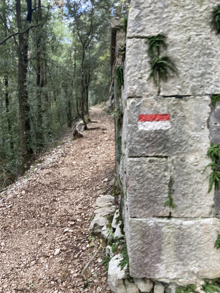
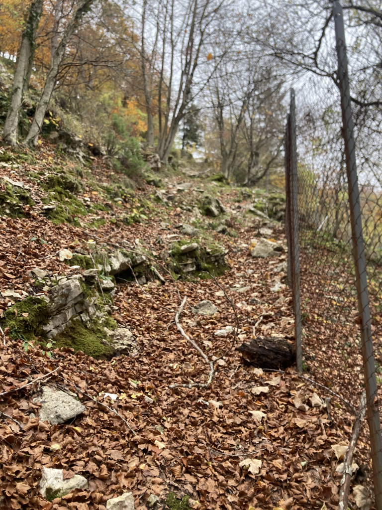
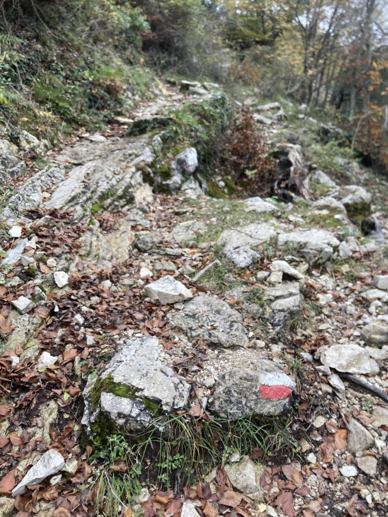
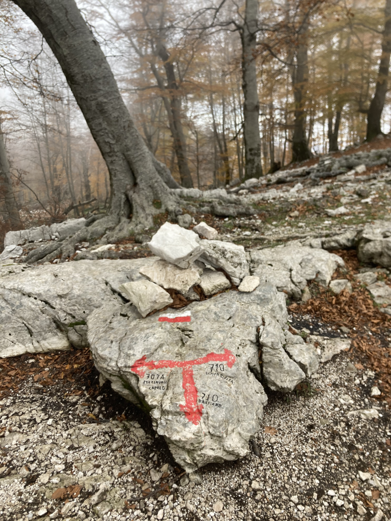
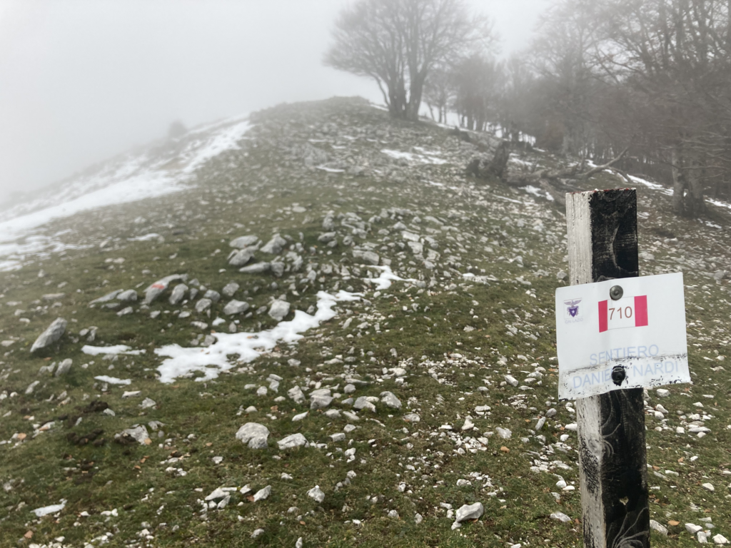
The trail starts from “Parcheggio Fosso Sant’ Angelo” (parcheggio = parking). Look for the sign on the left of the road that has the trail’s name “Sentiero Daniele Nardi” and begin the ascent up the rocky terrain. The trail follows the path of the aqueduct and is very rocky. A few times along the ascent I had to pull out the map (I use Maps.Me app) and ensure I was on the right path, such as around mile 1.3 (2950 feet of elevation). There, be sure to stay right to continue up, instead of veering left and down to an aqueduct. At 1.8 miles the trail meets the wide gravel road and heads left along the gravel road. (To the right is a refuge called Rifugio Liberamonte, but the trail goes left and does not go to the refuge). After 0.2 miles along the road, at 2.0 miles (3500 feet), the narrow, rocky trail picks up again to the left. From here to the peak, continue to look for the red/white trail markings on rocks.
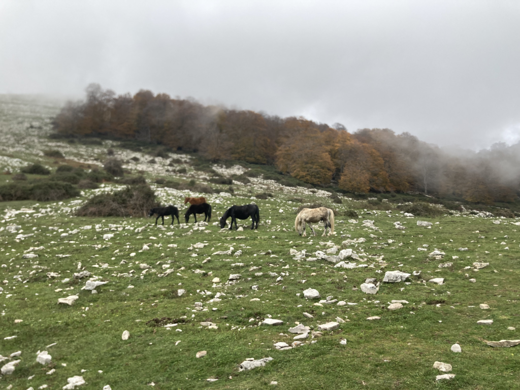
After struggling to find the trail a few times (it was covered in fall leaves) I eventually made it to the beautiful open pasture. The red/white trail markings continue through here and at one point in the pasture, they were marked on stakes because there were no rocks tall enough to mark. While ascending through the open pasture, keep an eye out for wild horses and other grazing animals. Beautiful.
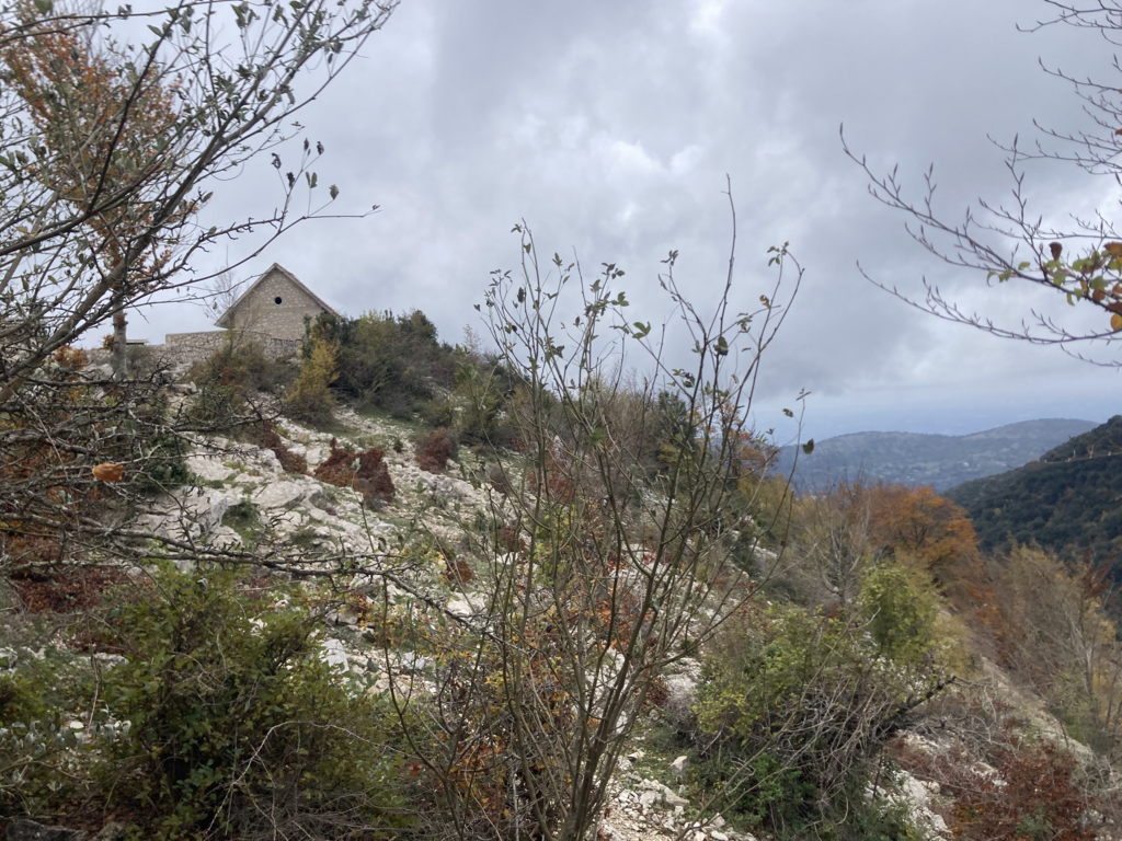
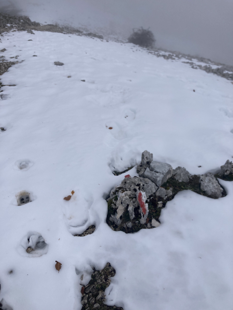
At about 3.0 miles (4600 feet) there were two options to get to the top for the final .6 miles or so. One option hugs the mountain to the right and is more exposed, the other goes left and stays in the trees. Both are on the Strava map and the Maps.me map. I took the rocky/exposed route out and the covered/tree route back. There was snow the last few hundred feet of elevation gain and on the peak, as it was late November for me.
PEAK:
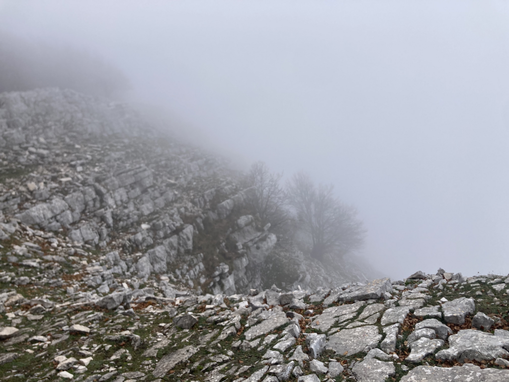
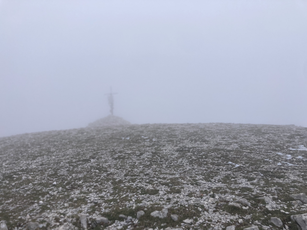
I hear the view up there is spectacular (I mean, they named it semprevisa - forever view - for a reason, right?), but the clouds and storm had rolled in and I couldn’t see a thing beyond the cross that contained a sign with the words of Daniele Nardi.
DESCENT:
I took the descent a bit slow, as I didn’t see anyone the entire route, and without cell reception, I couldn’t risk a fall on the technical (for me) terrain.
FINAL THOUGHTS:
Highly recommend this amazing route!