
(Jase Trimmer) 15.11.21 - this FKT attempt was from East to West. 2 x individual Strava activity links are included from 2 x different athletes from Day 1. For the remainder follow the athlete's Strava history.
------------------------------------------------------------------------------------------
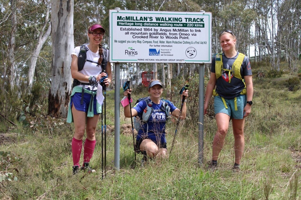
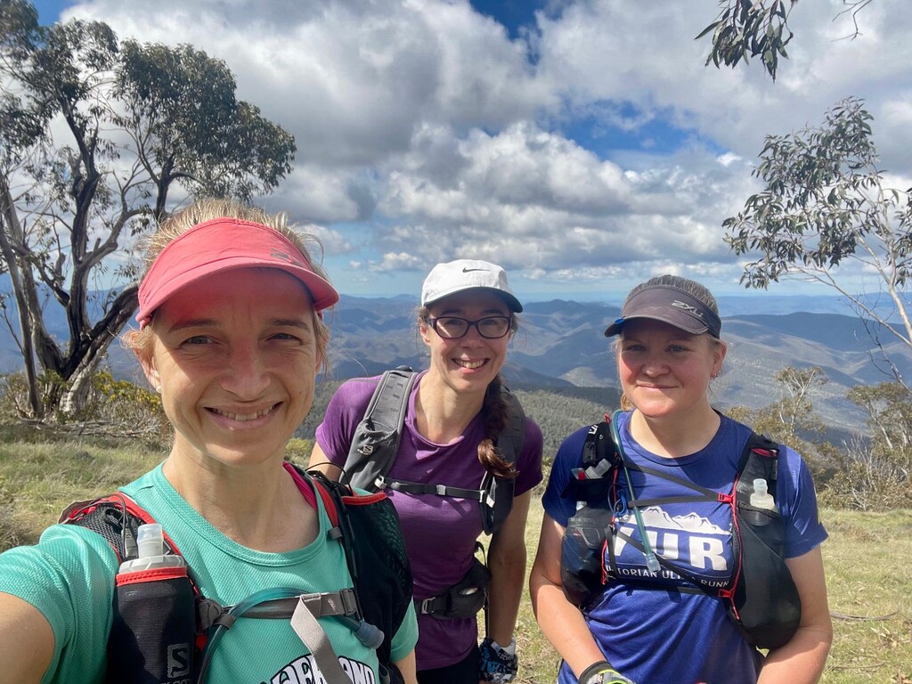
Jenine, Kez and I had decided to attempt an FKT on McMillan’s Walk, when, after completing two back-to-back 50km days at Mt Buller in Feb 21, we were keen to challenge ourselves with something similar, but bigger. We found the MWT and thought that 220km through the remote parts of the Victorian Alpine sounded the perfect challenge. We felt 5 days might be possible, and after talking to George Mihalakellis who had completed the walk in 5 and a half days without support, we thought we would give it a try, but with the support of Jonathan Ennis-King, and in some sections joined by Scott Beams.
Day 1 – Cobungra to Lanky Plain Hut (26km, 1,300m vert)
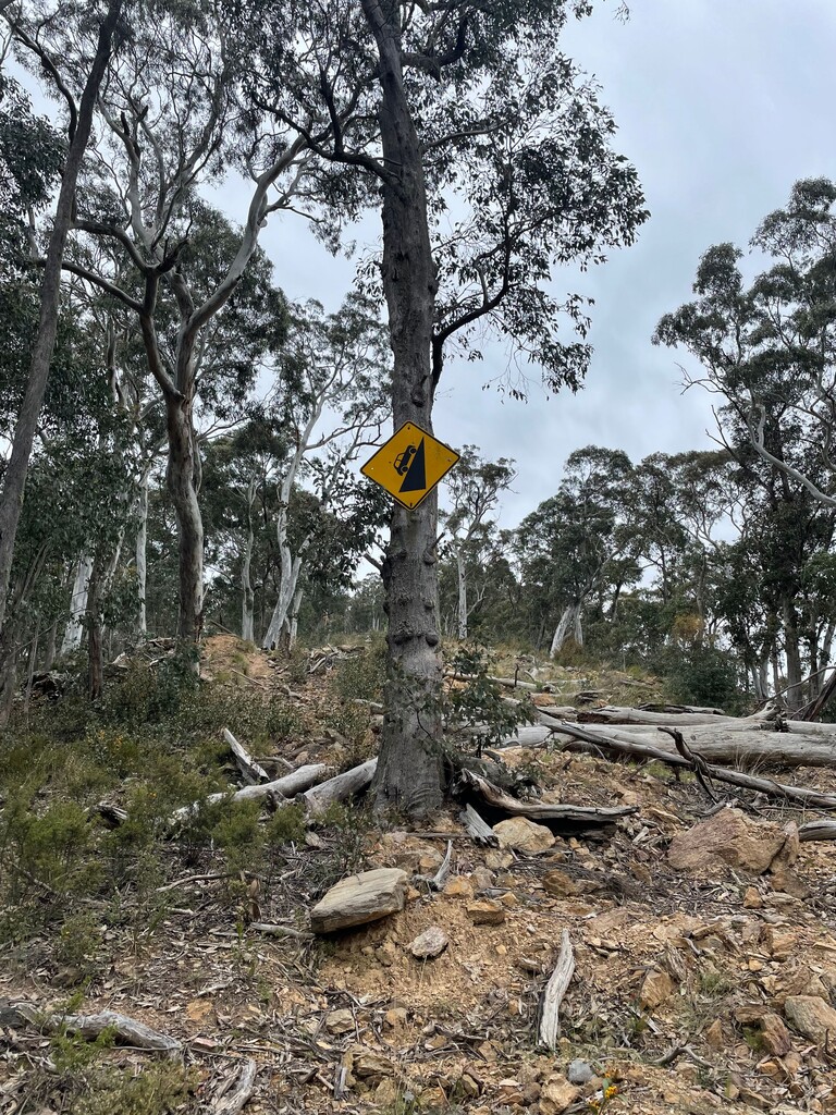
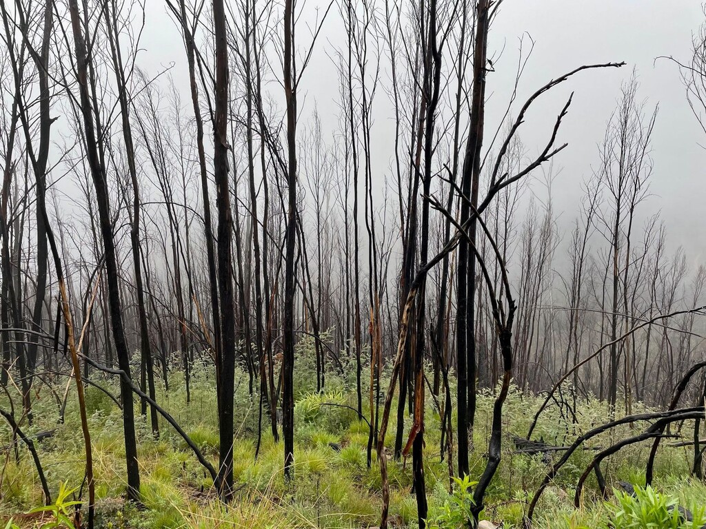
Our first day started with around a 5hr drive from Melbourne to Cobungra, after which we stepped onto the MWT at around 1:30pm. It was a warm, sunny afternoon and we ran/hiked through beautiful open alpine grasslands with sweeping views. We made good progress up until the point we hit Mayford Track, an old un-used 4WD track, with a very steep descent, and with logs covering the track the entire way down, making for very slow progress. The guidebook described this section as very steep and loose underfoot and warned us that care should be taken. Kez, however, had no better words for the section than carnage. We did have a laugh, though, when we reached the bottom, to find a sign indicating a steep road, that looked like a car driving at about an 85° angle.
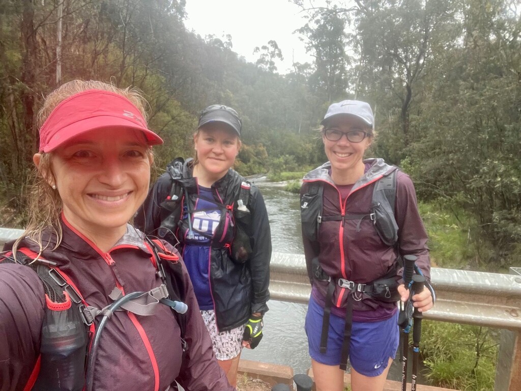
We then crossed the Dargo River, our first of many river crossings over the 5 days. We had been worried that it may be deep and fast flowing and that we may have to retreat only 15km to our FKT attempt, but it was no problem at all to cross, and so we happily continued on, to the long slow hike up Treasure Spur, where the weather changed from a hot sunny afternoon to a cold and rainy one with mist obscuring our views. Once at the top, we joined King Spur Track, where we had expansive (yet misty) views across the mountains and could see snow on the tops of some of the peaks in the distance. We made it into Lanky Plain Hut just before 7:30pm, to see Jonathan there with the car, giving us time to set up our tents and organise ourselves in the last of the daylight. It was a very wet and rainy night, and none of us slept particularly well that evening, as the rain seemed never ending and we all worried about Jonathan getting the (2WD) car out of the wet and boggy road the next morning…
Day 2 – Lanky Plain Hut to Eaglevale (54km, 1,400m vert)
Our alarms went off at 5am the next morning, and we made plans for Jonathan to contact us via the satellite phone to send a message to the Garmin Inreach to let us know that he had made it out safely, and if he couldn’t, we would hike back to him, rather than continue forward. We left camp by 6:30am, and after a short section down the road, we were very soon on an off-trail section where we were hiking through the peat bog plains following a boundary fence before meeting the White Timber Spur North Track for some easier running/hiking.
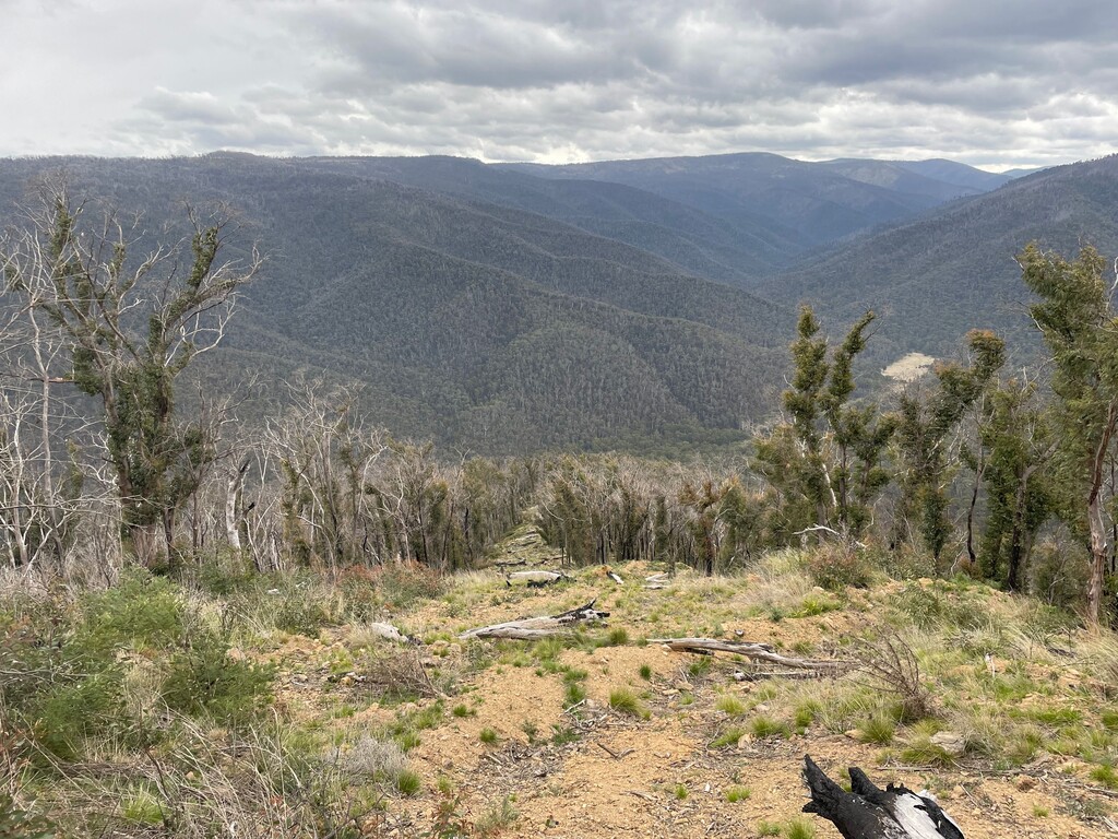
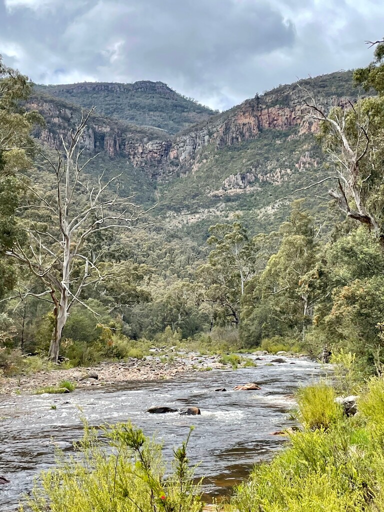
The section that morning was beautiful, with the rain having stopped, but everything covered in a soft mist and lovely cool temperatures. After around 20km, we started descending off White Timber Spur down into the floor of the valley, where we followed Thirty Mile Creek and then Crooked River for most of the afternoon. It had such a remote feel to it, and with spectacular views of the river curving its way through the mountains, and as you looked up the hills were so large, it really made us appreciate the enormity of the walk we were taking on, and its remoteness.
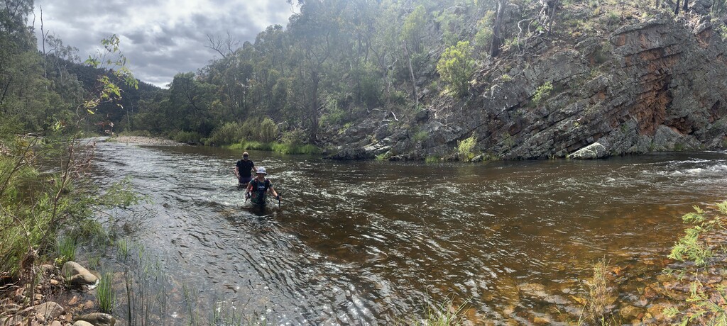
At around 40km in for the day, we reached the campground of Bulltown, where we followed a 4WD track, with 23 river crossings before making our way to another large campground at Talbotville. The next 3km from there was possibly one of our slowest sections, as we fought our way through blackberry to finally cross the Wongungarra River, where we met Jonathan, who had come to meet us, and we hiked the last 7km up and over Mount Cynthia Range with him, down to the campsite at Eaglevale, which we reached just before 8pm. Jonathan had set up all our tents for us, and had everything ready for us to collapse at the end of a very long day, measuring in at 54km, through tough, but spectacular terrain.
Day 3 – Eaglevale to Arbuckle Junction (44km, 1,500m vert)
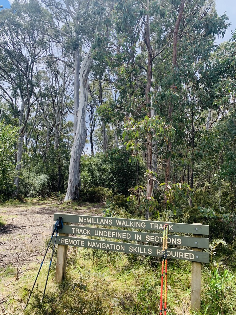
After another 5am alarm and this time a 6:15am departure, we headed off for what we knew would be a shorter day, but our most challenging in terms of the terrain we would be covering. A large part of the day went through the Mt Darling-Snowy Bluff Wilderness Zone, where we knew there were minimal/no trail markings and we would essentially be following the river for most of the day. Our expectations in that respect were met, and it took us 8 and a half hours to cover around half the distance for the day, much of it spent either crossing the river to find a passable section on the other side or hiking in the river itself, before we picked up the trail at the bottom of the Moroka River Track, which we needed to follow for a few km along the river, before beginning the long ascent up to Volkswagen, which would be our campsite that evening.
However, what we did not expect was that not long after leaving the river, the beautiful sunshine disappeared behind a cloud, and suddenly, we were met with lightening, thunder and a massive downpour of rain creating flash flooding out of the smallest of creeks and all pouring down into the Moroka River. We were abundantly grateful that we had finished the river section at that point, as we would no longer have been able to continue safely until the water went down.
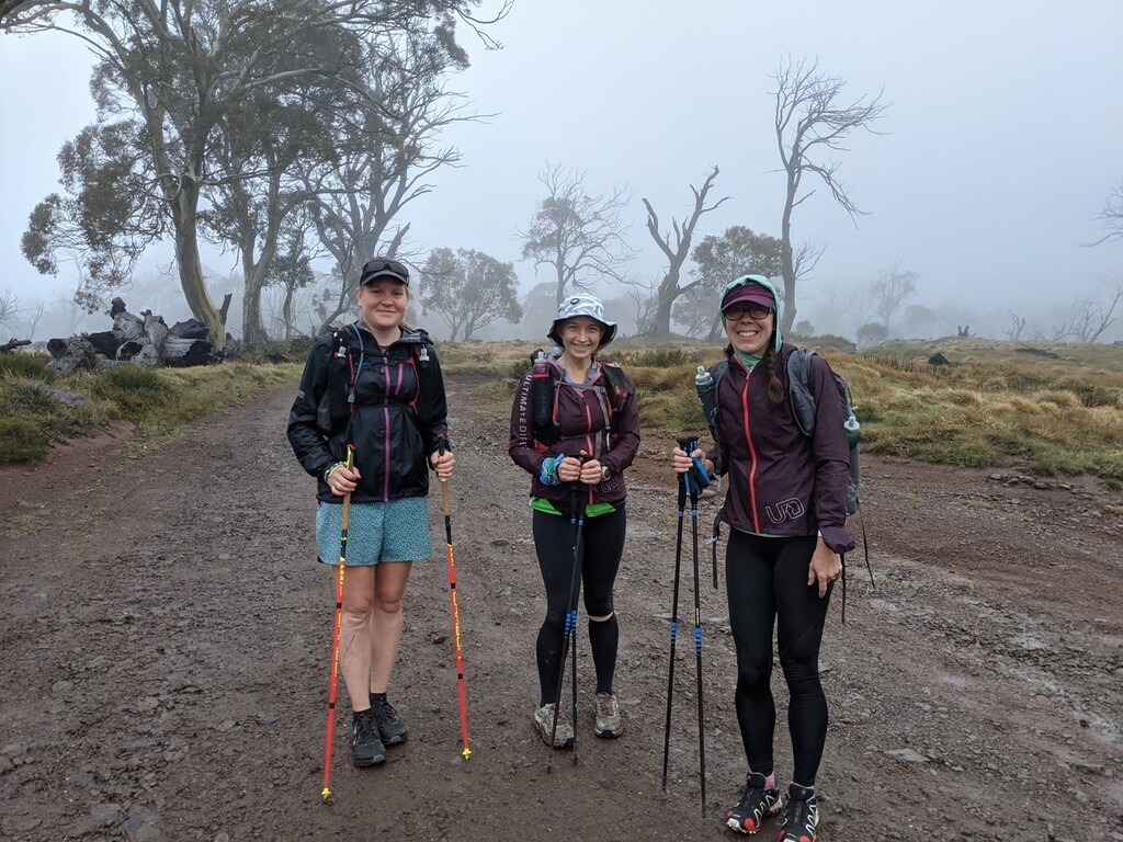
In this section, Kez took the lead and carefully picked out the trail for us, heading uphill. It was very undefined, and we zigzagged across the side of the hill a few times as we ascended our way up to the saddle near Beth’s Peak. Along the way, the rain cleared, and we nearly cried tears of joy to see the vehicle track that would take us to the campsite. To add to the joy, we then saw Scott, who had run out to meet us and keep us company for the last section. From the campsite at Volkswagen, he then drove his car out a further 5-6km down the road to Arbuckle Junction, allowing us to run that section and then get a lift back to the campsite, where Jonathan had set everything up for us again, and Scott cooked us the most amazing sausages on bread to go with the rest of our typical camping dinners that evening. It was a perfect end to a day that words cannot even describe the emotions of – the beautiful scenery, wild weather, exhaustion starting to creep in and the joy of company of like-minded friends.
Day 4 – Arbuckle Junction to Heyfield Jamieson Road (52km, 2,600m vert)
Another 5am alarm and a 6:30am departure had us starting the morning in glorious sunshine with a short hike up to Kelly’s Hut and then along the high plains a lovely camping spot at Shaw Creek and along to the base of Mt Tamboritha. Scott joined us for around 7-8km that morning, before heading back to his car, and then off to support Isobel Ross in her huge run from Mt Buller to Melbourne CBD.
We climbed up the short section to the top of Mt Tamboritha, across to Little Tamboritha then along a ridge that we had known in advance was filled with short spiky shrubs and then down the steep descent to meet Jonathan on the way down to Breakfast Creek. By the time we got to Breakfast Creek, it was only 1:30pm but we were already exhausted and so we stopped to eat lunch and regroup before tackling what we knew would be a very long afternoon, as the steep climbs combined with long distance and many sections of difficult terrain was always going to make Day 4 the hardest.
After our break, we slowly hiked our way up the steep climb to Smith Street, in what was now very hot afternoon sun, sighting a big tiger snake on the track, as well as meeting a hunter on his way back down the hill carrying a huge deer over his shoulder. We then slowly descended the steep spur on the other side, down to the Macalister River. Crossing the ford across the river cooled us down a little. We kept going, though, and hiked up a small hill through some private property, down the hill on the other side, and then began our long slow jog up the road to the saddle and back down the other side on Middle Ridge Road.
On the road section, it began to rain steadily, so we popped our raincoats on, before being asked by a local couple if we would like a lift in the back on their ute, which we politely declined. Finally, we reached the turn off to the Rumpff Flat campground and began a long steady hike up McMillan Spur Track, rising from around 400m elevation to 1,250m over the space of 5km. We camped at the corner of road and McMillan Spur, arriving with our torches on, just after the sun had set, with Jonathan having boiled water ready for dinner and set up our tents, ready for us to collapse until our next 5am alarm reminded it us that it was time to begin the next day.
Day 5 – Heyfield Jamieson Road to Woods Point (48km, 1,600m vert)
The final day! We headed out just before 6:30am on a road section, followed by a short section of trail up and over Mount Shillinglaw, seeing Jonathan briefly at the 10km mark, then onto another road section, then meeting Jonathan again at the 15km mark. Despite this being one of the easiest sections of the track, we managed a small navigational error, adding an extra km to our total, as well as a small face plant on the road. I’m sure it was the tiredness of the cumulative effort catching up with us.
We then began the hilly section of the day, descending slowly down a steep trail to Black River, back up steeply on some off trail section then old logging road to Champion Spur Track, where we sat in a small bit of shade for 20min to prepare ourselves for the home stretch. Then, slowly down the steep trail into Stander Creek, and back up a steep 4WD track to Johnson Hill, where we met Jonathan who joined us for the last section of steep climbing. As we neared the car, we were met by Scott again, which was a complete surprise, as we were not expecting to see him again, but he had run up from Woods Point and decided to join us for the last 7-8km as we shuffled our way to the finish line.
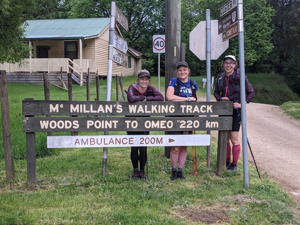
Those last km were a mixture of off-trail sections, overgrown river crossings, easy river crossings, trail and road, before we finished in Woods Point to the sound of the locals cheering us over the finishing line. We had done it! 4 days, 5 hrs and 30min and so many memories that we will cherish forever. Our huge thanks to our support crew as well as all of our VUR friends who followed us on the tracker and sent encouraging messages to us.
Reflections on the FKT attempt
For others who might like to attempt something similar, we thought we would share our reflections, both on what went well, and what we would have done differently with the benefit of hindsight…
What went well:
- Having the guidebook for the walk and reading it multiple times over before the hike. We used it to work out how long we would take each day, where we could camp, where we could drive in to, to get support, where we could get water along the way, how long and what conditions until the next place to get water, etc, etc
- Taking a page of track notes for each day of the hike, kept in an easily accessible location. It was easy to refer to, and allowed us to keep moving, rather than need to get out our phones and look up Avenza maps each time we became a bit unsure. With the combination of track notes, topographic maps, three of us to spot the trail markers and Avenza maps with the course loaded on, we were able to make it through with only very minimal navigational errors.
- Going as a group of 2-3 people. It not only allowed us to share such an amazing experience with friends, but we also helped each other laugh (and also stay safe), when things weren’t going as planned.
- We also had a Garmin Inreach with satellite comms (borrowed from Jonathan ??), which meant that people could track us, which was a great safety measure, and we could also communicate without mobile coverage, if/when required.
- One of our team members works as a nurse, so she was amazing in ensuring we capture any allergies, medication, medical history, emergency contact numbers, etc. before we started, which was helpful. And, ensuring we had fully stocked first aid to look after all of our cuts and scratches each evening. So, whilst the walk is most definitely possible to do without a medical professional with you, it is important to be prepared and to look after yourself and each other on such a long and remote walk.
What we would do differently next time:
- Think more carefully about the impact of lack of mobile coverage. Whilst Jonathan had a borrowed satellite phone, it was a bit tricky to get working and there were times when we would have benefited from being in contact with each other. We also should have worked out the route for him to drive between locations and have downloaded mapping apps that would work without mobile coverage.
- Take a 4WD as a support vehicle!! Although we mainly used just the 2WD roads, in wet, foggy and muddy conditions, a 4WD would have resulted in a lot less worry for us all, and probably better sleep in the evening as a result
- Again, on the support side - check for road closures, and plan in advance. We faced roadworks that caused a huge detour and a day of 9-10 hours in the car for Jonathan, which could have been researched and planned for that better.
- Also, when supported, looking slightly beyond the MWT itself for campsites is an option. Eg. we could have stayed at the Lost Plain campsite, rather than Volkswagen and Connor’s Camp on the last night, rather than just an open clearing on the side of the road.
All in all, though, it was a wonderful experience, and whilst I don’t think any of us are likely to race out any time soon to do the course again in that time, it was something that all of us will remember and treasure the experience forever.