For this segment given it's short length, I figured I'd run it one way, then ride my bike back to my car. So the night before, I went to Lake Singletary State Park and talked with the ranger. He allowed me to chain my bike overnight to the wood racks next to the workshop.
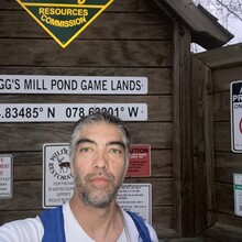
The next morning, after a false start because I forgot my electrolytes in the car I started over. So with my 3 liters of water (was expecting a warm day), 12 gels, and two granola bars, a baggie of electrolytes & BCAAs, a rain jacket, and my PLB, I began my full run attempt at 7:10am at the orange gate to the Suggs Mill Pond Game Lands. After about 1.85 miles of tough soft sand, I finally got to the easier packed dirt roads, and then eventually out to the open roads of Bladen County. About 6mi into the run, I got chased by some dogs. Eventually, the owner came out and called them back and I was able to continue. The sun broke through the clouds and it was actually pretty nice running along.
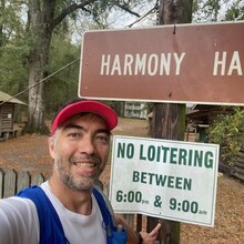
Once I got down to River Road, things started getting a little more overcast but the rains (which were forecast to start at 8am held off). At the intersection of Burney and River, I took the half mile out and back to the Harmony Hall Plantation. I touched the sign in front of the gate and took a picture. I headed back down River and took a right onto Burney. Followed this down to 53, and turned left onto Gum Shaw Rd. towards Ruskin. Everything felt easy through this portion where I eventually turned onto Salter's Lake Trail (actually a dirt road) which I guess turns into J.C. Bulter Trail (also a dirt road) until I reached another orange gate. Here things were a little tricky, but the official MST follows the trail which is almost directly opposite the gate. The trail is marked for hiking and has white diamond (square?) blazes. The reason this is tricky trail follows alongside another dirt road and eventually dumps out onto it further down. But to navigate this trail always follow the white diamond blazes, eventually you'll see signs for the Bay Trail. This trail comes out to an open area with lots of structures and fences. I fumbled around trying to figure out the right way to go, but essentially, there is a small opening in the fence directly across the dirt road where the trail ends. Go through the opening and follow the paved trail towards the two white buildings. The furthest white building is the Jones Lake Visitor Center, follow the trail past that to the parking lot and out onto the road to continue. I stopped at the Visitor Center and used the bathroom and refilled my 2L water bladder. When I got out of the bathroom is when the rain started to come down (which is why there is a lack of photos until the end).
Once out to the road, I took a left crossed a small narrow bridge over a barely perceptible stream and then took an immediate right onto Sweet Home Church Road. I passed the Turnbull Creek Educational State Forest and ran was seemed like a never ending road through lots of rain until I reached Rt 701. The next section along 701 was tough cuz the rain was the hardest during this section and this is by far the busiest road along the route. Even though it's only a 3 mi section, this felt like a really long section. Likely due to the less than ideal conditions and the added weight of the excess water. Eventually, I squeezed out some water from my body bottles to lighten the load. Eventually, I turned onto White Lake Dr which I was familiar with from my old triathlon days.
At the end of White Lake Dr. I turned left onto Rt 53, knowing this was essentially the home stretch. A few more miles of road before I hit some dirt roads/trails to the finish. I made the turn onto Singletary Lake Trail and was disappointed that this was more of the tough soft sand like at Suggs Mill Pond. Definitely not conducive to kicking it into the finish. But I managed, knowing any time was the fastest time at this point. But in my haste, I almost missed the turn onto the lake trail after I crossed the tiny wooden bridge that brings you into the Singletary Lake Park area. Then figuring out that the trail dead ends at some cabins and then picks up on a VERY soft sandy road behind the cabins on the opposite side was a little tricky. Eventually that deep sand road leads to the paved park roads and towards the park entrance.
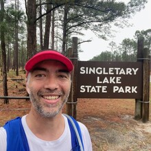
The entrance of the park has two entry gates, an interior one (which is where the GPX file ends/begins) and about 500ft closer to the road is the primary entrance gate. I finished my run at the primary entry gate right next to the road and the Singletary Lake Park sign. I finished in 6 hours, 36 minutes and 56 seconds. I think finishing at the primary gate is a better ending point to make things easier on anyone wishing to do the entire Segment 14. This way anyone starting Segment 14 early in the morning would not have to enter the park before the park opens (8am) in order to start.
Overall it was a good run, I was surprised how much the additional weight of my pack and the softness of the sands (even though it wasn't much) tired out my legs. My pace after refilling my pack with water was significantly slower than before. I'll have to go back to training with a pack so that this isn't such an issue in the future. I had to wait about 30 minutes for my legs to recover enough for me to even think about climbing on my bike to head back. But I managed and with a short stop at a gas station to refuel with some real food, I was able to make it back to my car by about 4:30pm.


