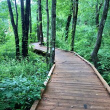
On June 12, 2021 I completed an unsupported thru hike of the Boroughs Loop Trail in Massachusetts.
This trail is a “charm bracelet” connecting land trusts, reservoir lands, state parks and municipal parks through 5 towns. It is still under construction, with 2 small unfinished sections, which you can walk around. When it is complete, the loop will measure 33 miles.
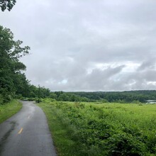
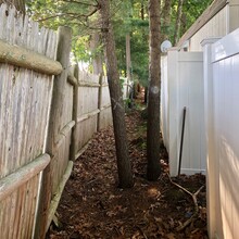
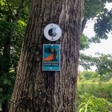
Some notes for those interested: several miles of the trail are still unmarked with the loop insignia. I had to use the maps and the awesome GIS that the loop organizers make available in order to link together the local trails for those sections. There is a fair amount of pavement, either on paved bike paths, roads or sidewalks. There is plenty of water if you bring a water filter. It is relatively flat. There is a section (I’ve included a photo) where the trail corridor is only a few feet wide, traveling between backyards. I ran through that part to get it over with quickly. Pay attention to intersections and road crossings. I got off track quite a few times. You will also see two "prongs" on my route where I went to the points where the unfinished sections of trail will intersect with roads.
I parked at the Marlborough High School and then walked a few feet to the trail, then walked the loop back to my starting point. I carried all my own food and water for the day. I did carry a filter and stopped to fill up once.
Overall, I really enjoyed hiking this suburban trail. It is extremely varied and there were many beautiful spots. However, I did visit every type of housing development available and got lost in a few of them! Obviously, someone can do this MUCH faster than I did, by running, not getting off course and not taking breaks, but I wanted to make sure there was a female time on the board. Good luck!

