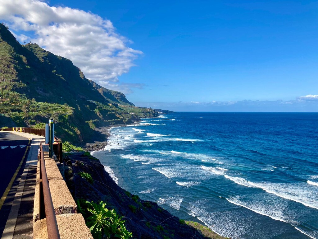
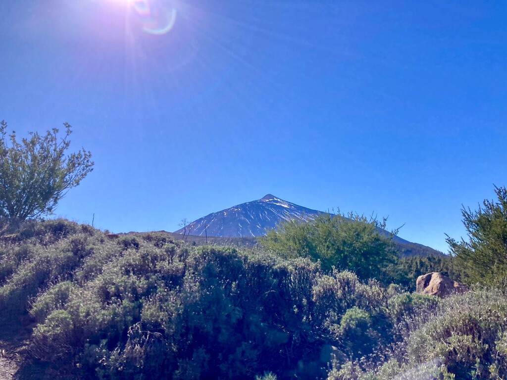
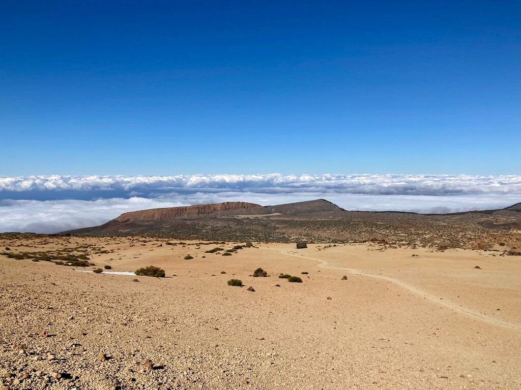
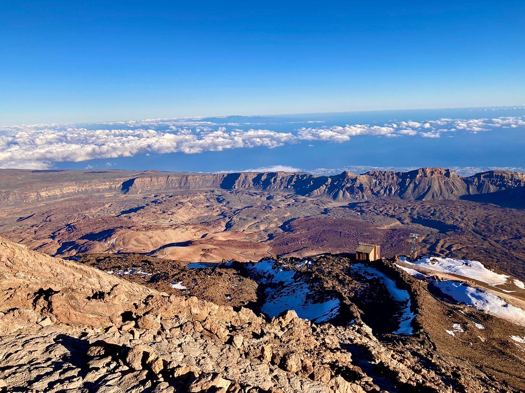
Being quite centrally located, Tenerife's high point Pico del Teide offers infinite possibilities for 'sea to summit' routes. This one is the island's "official" route, and fairly direct, i.e. very little respite from climbing :-) While the route does pass by several lookout points, the best views are near the top on a clear day.
Strava segment for the ascent --> https://www.strava.com/segments/33647984
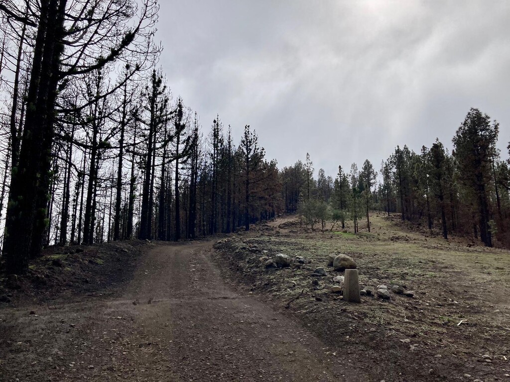
In recent years the route has gained visibility and become quite well signed. Easy to follow but not so easy to complete - particularly if you go for the round trip (=leg-destroying downhills). The terrain contains some early road sections, but is largely gravel path, sand, or irregular rock-hopping. Please choose footwear with adequate grip, and note that some early portions of the route are slippery even when dry and sunny.
Specific to today:
It was 18C/64F (late January), but felt much warmer as the sun is increasingly strong the higher you go. Teide got an unusually large snowstorm about a month ago, and the areas above ~2500m/8000ft have not fully melted yet. One week ago, the trails at the top of the route were still closed to normal foot traffic, as the snow was making it difficult to see where the path was, not to mention how much of it was iced over. This week the temperature has risen considerably at the higher elevations, and i was able to traverse around most of the remaining snow.
Specific to my experience:
I couldn't wait for the snowmelt to finish as i'm not in Tenerife that long, plus i'm still recovering from a very recent ankle sprain, and i already knew i wouldn't be able to catch the cable car down the mountain after finishing, due to the time of my Teide summit permit... so all in all, knowing these huge factors would all be sub-par (the state of the route, my body being tired and broken, logistics forcing extra miles on my feet) -- took it easier than i normally might on the higher parts of the route. This was absolutely essential for my health/safety, considering the altitude and generally being under-supplied to treat the FKT as a full-on "race".
Food/water - unsupported:
Brought a few gels/small snacks and 4 water pouches (~1750ml total), finishing all of it. Would have liked to have one more 500ml pouch but it's a lot to carry emergency gear/higher altitude clothes/food and 2 liters+ of fluids on my small frame.. and a bad back :-)
That's a personal limitation -- please please please bring a lot more than i did if you're planning to be out there 5+ hours -- there is nowhere to replenish water or snacks en route, and if you don't get the cable car back down the mountain, it's a very long extra hike to the other parking lots / bus stops. I would also recommend hiking/running poles *if* you know how to use them effectively (which i don't, so didn't have them) -- they will save your legs and back, speed you up, and can be useful in an emergency situation.
Note that most people who run this route for time are Supported (e.g. others are meeting them along the way with more supplies), or Self-Supported (e.g. hiding extra water/food for themselves in advance, for pickup along the route).