


Day 1
Hike 1: Isolation, 12.9 miles, 3,377 ft. elevation gain, 5:07:08 elapsed time
Hike 2: Wildcat D, Wildcat A, Carter Dome, South Carter, Middle Carter, Moriah, 18.6 miles, 6,525 ft. elevation gain, 9:44:33 elapsed time
Totals: 31.5 miles, 9,902 ft. elevation gain, 14:51:41 hiking time, 1:20 driving time, 7/48 peaks completed
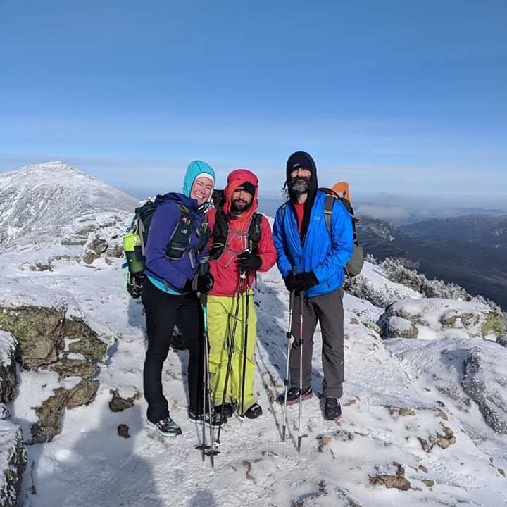
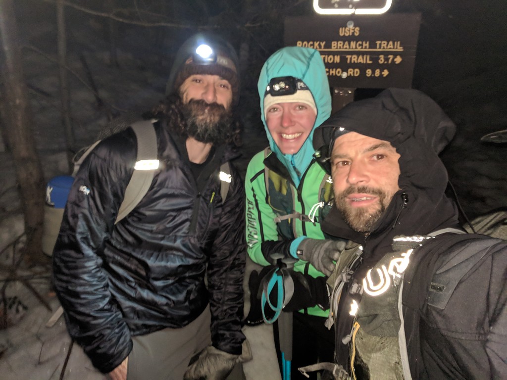
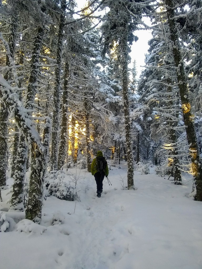
We started our Fastest Known Time attempt at the Rocky Branch trailhead at 5:48 a.m. We had a fairly well-packed trail all the way to Isolation, so we wore spikes the whole way and didn't even carry our snowshoes. We watched a beautiful sunrise through the trees as we were ascending. The river crossing was a little tricky, but we found a spot about 20 feet upstream where we could rock-hop across without getting wet. It was very windy up high, and the summits of the Presidentials were all in the clouds. We originally had hoped to do a Presidential Traverse on our first day, but decided to wait for better weather, so we were happy to see that it looked like we had made the right choice. On our way down we ran into our friend Nate and his dog Piper, the only ones we saw the whole way. Next up was the long traverse from Wildcat to Moriah. We wore our snowshoes up the Wildcat ski trail for the televators, then had nicely packed trails all the way to the hut. Nate caught up to us again by the hut junction, and we chatted for a bit, then we stopped at the hut to get some warm water and take a little break. We put the snowshoes on again for the climb up Carter Dome, then carried them until after North Carter where we started post-holing on the less-traveled trail. Once we got to the Stoney Brook junction, we left our packs and snowshoes behind for the out-and-back to Moriah. From there we had an easy descent out to Stoney Brook Rd where we walked to our friend Erin's house. After driving down to Wildcat to pick up our car, we came back to Erin’s to spend the night.
Day 2
Hike 1: Waumbek, 7.7 miles, 2,931 ft elevation gain, 2:52:37 elapsed time
Hike 2: Madison, Adams, Jefferson, Washington, Monroe, Eisenhower, Pierce, Jackson, 20.5 miles, 8,610 ft. elevation gain, 12:22:46 hiking time, 45 mins. driving time
Totals: 28.2 miles, 11,541 ft. elevation gain, 15:15:23 elapsed time, 16/48 peaks completed
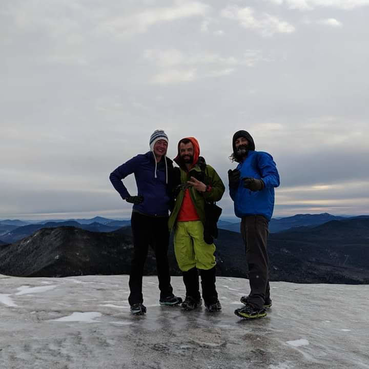
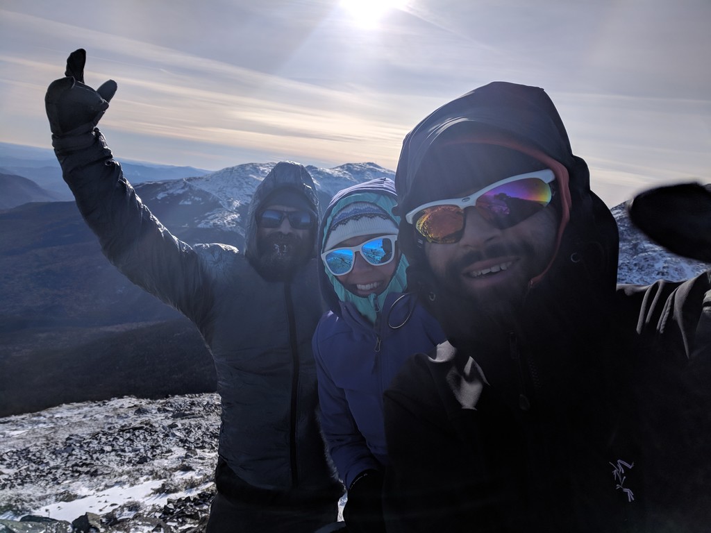
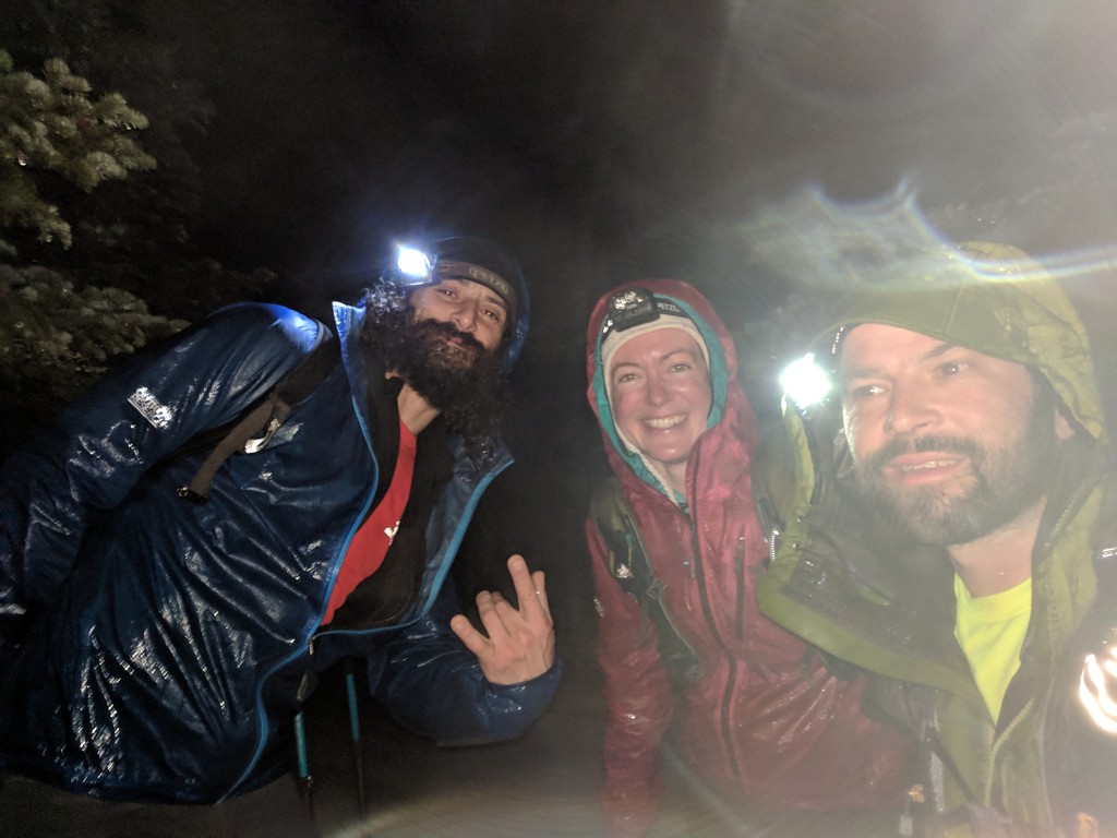
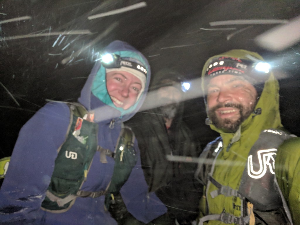
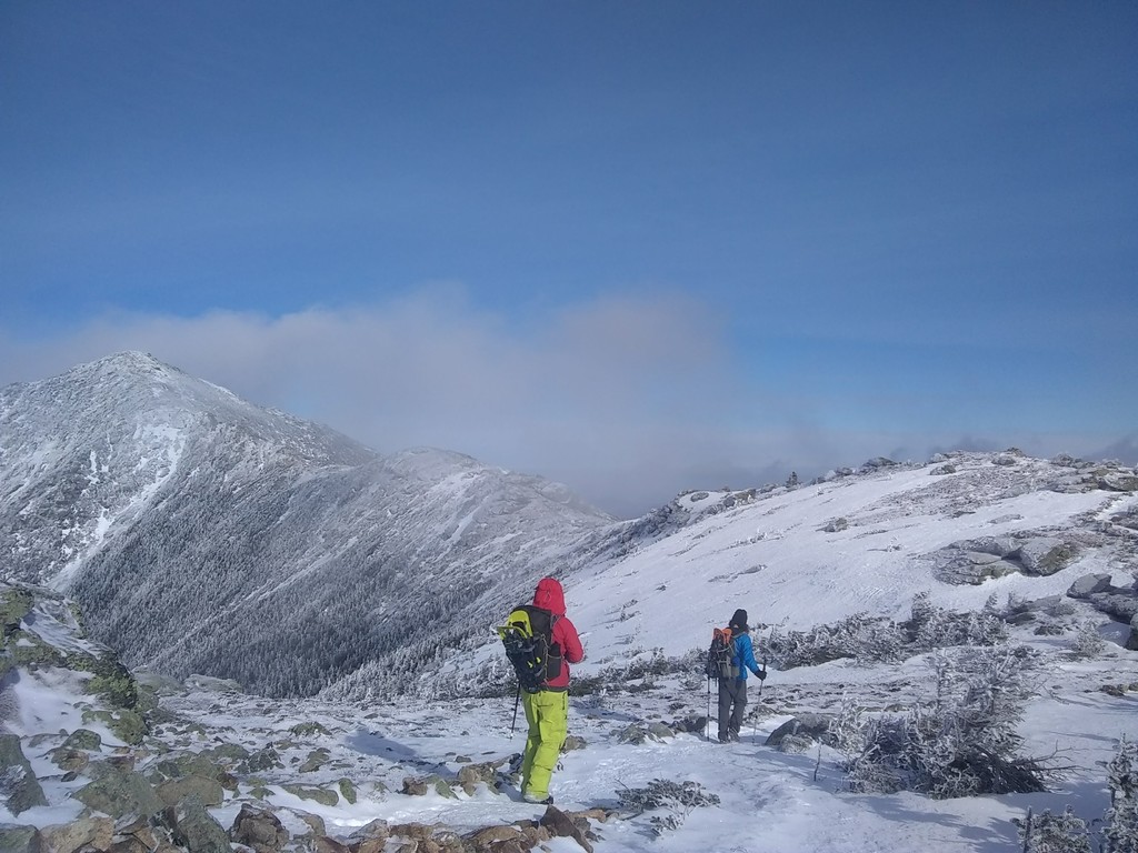
When we checked the higher summits forecast in the morning it said winds of 30-50 mph with gusts up to 90 diminishing to 15-20 mph. We were still nervous about doing a Presi Traverse in those conditions, so we started the day with a quick warm-up on Waumbek. We parked at the gas station thinking we wouldn’t make it up the icy road with light snow on top, but we probably would have been fine if we had tried. The trail was very icy down low and firmly packed snow up high. We didn’t bother with spikes until the lower half of the descent. The Presis looked calm and clear from the lookout so we decided to make a move since bad weather was in the works for the next day, and we were running out of time to be able to fit in that hike without having to do a lot of extra driving. On our way up Valley Way we ran into Nate again who was doing laps while waiting for the wind to die down. He later caught up with us to summit Adams, and then went his own way again. It was very windy and cold on the summits of Madison and Adams, but from then on out it was mostly calm. We had varying trail conditions, from solid snow fields, to powdery drifts, to bare rocks, to glare ice. We wore our spikes all day and didn't carry snowshoes. The southern Presidentials were very icy, and we all fell several times on the descents. My knee started hurting pretty badly towards the end, and I couldn’t keep up with Jason and Andrew so they went on ahead and we all finished at our own pace. We had pre-spotted Jason’s truck at the Highland Center before we started the FKT attempt, and all 3 of us slept in his truck that night in Crawford Notch. It was so windy that the truck rocked back and forth all night, and at some point in the middle of the night it started sleeting. The air mattress Jason and I were using popped, so we were laying on the bare truck bed. A friend recognized Jason’s truck and shined a flashlight into the cab at 2 a.m., which woke Andrew up. Needless to say, none of us got any quality sleep.
Day 3
Hike 1: Cabot, 7.7 miles, 2,712 ft elevation gain, 3:44:56 elapsed time
Hike 2: Hale, 9.7 miles, 2,656 ft elevation gain, 3:55:45 elapsed time
Hike 3: Field, Willey, Tom, 9.6 miles, 3,516 ft elevation gain, 5:03:16 elapsed time
Totals: 27 miles, 8,884 ft elevation gain, 12:43:57 hiking time, 2:10 driving time, 21/48 peaks completed
We woke up to three inches of sleety snow on the ground, and it was still coming down hard. We were very unrested and unmotivated to get out in the weather. We drove up to the Highland Center to use the bathrooms and get water for the day and ended up having to wade through knee-deep drifts covering the sidewalk. We decided we better revise our plan for the day a bit and return to the cars we left at Appalachia the day before to pick up our snowshoes. We had intended to do Tom, Field, Willey, and Hale before leaving the Notch, then hike Cabot before picking up our cars and spending the night in Gorham again. We reversed the order, which meant we wouldn’t be able to stay in Gorham that night, and started with Cabot via the unmaintained trail in Jefferson. We took advantage of being in town and got breakfast at the gas station on our way through. The sleet had turned to rain by the time we started, and we got completely soaked. We used the snowshoes a bit on our way up the unmaintained trail, but didn’t bother with them on the way down. We hit up the gas station again on our way back to Crawford Notch. We were kind of glad we had a lot of driving to do on this day because it gave us a chance to dry a lot of our stuff on our heater vents along the way. We lucked out with a little break in the weather for our hike out to Hale. The trail was packed with just the few inches of new, wet snow on top, so we post-holed it. It was raining again by the time we set out on our evening hike of Tom, Field, and Willey, and we got a second set of gear completely drenched. We did the post-hole thing again and did not regret it. The fresh snow was easy on the knees, so we felt good enough to do quite a bit of running on the descents this day. After finishing we drove to the Sawyer River Rd trailhead, did some more dashboard laundry, and slept in our vehicles there. When I laid down that night, I commented that my legs didn’t actually feel that bad. Then about 10 minutes later it hit me, and my hips and knees and feet were throbbing. From that night on none of us slept well because laying down was so painful.
Day 4
Hike 1: Carrigain, 13.8 miles, 4,252 ft elevation gain, 6:02:17 elapsed time
Hike 2: North Tripyramid, Middle Tripyramid, Whiteface, Passaconaway, 16.4 miles, 5,253 ft elevation gain, 8:36:32 elapsed time
Totals: 30.2 miles, 9,505 ft elevation gain, 14:38:49 hiking time, 1:45 driving time, 26/48 peaks completed
It was still raining when we got up in the morning, but it let up soon after we started hiking. Carrigain was completely untouched, but the old track underneath the new snow was still firm enough to hold us so left the snowshoes behind. When we returned to our cars, we found an unexpected treat from Erin, who had dropped off a pair of new shoes that Andrew had ordered along with two bags of fresh donuts! We wolfed them down in seconds! From Carrigain we had a long drive around to the Kanc for the Sandwich Range Traverse. It took us forever to get through the traffic in Conway, so we didn’t get started on our traverse until 2:30 p.m. As we hiked the temperature dropped from 40̊ into the single digits. The trail was partially broken out, but we still wore snowshoes for most of the hike because it seemed a little easier with them on. We had a little trouble following the trail through the Sleepers, but not as much as when we went through there in early December. We had a mishap crossing the river on our way out the Oliverian Brook Trail. The rocks were icy, and Jason fell in and got soaked up to his waist. Thankfully we were only 2 miles from the truck, so we booked it out from there. Another night in the truck for Jason and I, while Andrew decided to make the hour drive to Lincoln to stay in a motel.
Day 5
Hike 1: East Osceola, Osceola, 7.1 miles, 3,049 ft elevation gain, 3:31:51 elapsed time
Hike 2: North Hancock, South Hancock, 9.3 miles, 2,626 ft elevation gain, 3:42:48 elapsed time
Hike 3: Owls Head, 16 miles, 3,148 ft elevation gain, 7:21:32 elapsed time
Totals: 32.4 miles, 8,823 ft elevation gain, 15:03:01 hiking time, 30 mins. driving time, 31/48 peaks completed
Our 5th day on the trail started with a couple of easy hikes to the Osceolas and Hancocks. Both were packed like highways, and we saw tons of people out enjoying the nice day. We took advantage of the sun and hung all our wet clothes and gear up in our vehicles so that it would dry while we were hiking. Worked like a charm! We started our final hike to Owls Head at 2:45 that afternoon. We knew the trail had been broken so we didn't carry snowshoes. It was a rough pack, but frozen solid after the rain and subsequent temperature drop. The crossings were a little sketchy, especially in the dark, but we managed them just fine. We finished just after 10, then spent the night in a hotel after living outside for the past 4 days and 3 nights. It was glorious.
Day 6
Hike 1: Flume, Liberty, Lincoln, Lafayette, Garfield, Galehead, South Twin, North Twin, Zealand, West Bond, Bond, Bondcliff, 37.6 miles, 10,872 ft elevation gain, 20:19:26 hiking time, 20 mins. driving time, 43/48 peaks completed
We set out on our biggest hike of the week with low energy, but fully determined to crush it. And by "crush it", we mean "complete it without dying". We carried the heaviest packs we'd had all week with snowshoes, and lots of extra gear, food, and water. We planned to be out for 18-20 hours. The trail was mostly packed firm, but we wore our snowshoes for traction and televators on most of the ascents, and on the sections of Garfield Ridge and the Twinway that were not as well packed to avoid the occasional post-hole. We were socked in on the first couple of summits, but by the time we got to Franconia Ridge we had beautiful blues skies. We left our packs and snowshoes behind for all of the out-and-back summits, which was a nice break. The snowstorm started rolling in late in the day, and we hiked from Guyot through the Bonds in the dark in blinding snow. The snow piled up so fast that we had to wear our snowshoes to break trail on the Lincoln Woods Trail on the way out. After having wet feet for so long (and so many previous days), trench foot hit us hard during the last several miles, and our feet felt like the soles were being ripped off with every step. It was the most brutal slog out of Lincoln Woods any of us have ever experienced. We finished at 4 a.m. after 20 hours on the trail. We have never been more grateful to have a dry, warm hotel room to go back to after hiking!
Day 7
Hike 1: North Kinsman, South Kinsman, Cannon, 12.2 miles, 4,568 ft elevation gain, 6:39:35 elapsed time
Hike 2: Moosilauke, 10 miles, 2,877 ft elevation gain, 4:14:06 elapsed time
Hike 3: Tecumseh, 4.8 miles, 2,135 ft elevation gain, 1:58:00 elapsed time
Totals: 27 miles, 9,580 ft elevation gain, 12:51:41 hiking time, 1:40 driving time, 48/48 peaks completed
We stayed in our motel room until checkout time and didn’t get started on our last day of hiking until 11:30 a.m. We didn’t get much sleep because our legs and feet were hurting so much, but we needed the time to just rest and let our bodies recover a little. We started our day with the Kinsmans and Cannon in the rain/snow. We had a semi-packed track out the Fishin’ Jimmy trail, then broke trail to North and South Kinsman. We decided against breaking trail across the Cannonballs, and instead went back to the hut and broke out the Lonesome Lake trail up the back side of Cannon, then came down Hi Cannon which had been lightly traveled. From there we headed to Moose for an evening hike. The gate was closed, so we had to do the extra couple of miles of road-walking, but the trail was fairly well-packed, so we made good time. It was super cold and windy up top, so we donned our face masks, goggles, and puffy coats below treeline, and did not waste any time getting up to the summit and back down. After that we drove to Tecumseh for a 1:00 a.m. start of our final hike. We could barely stay awake on our drive there, but we crushed the hike in 2 hours flat. Our biggest motivation throughout the whole day was our goal to finish in under 7 days, and we did it with 3 hours to spare!
New Winter NH48 Fastest Known Time: 6 days, 21 hours, 4 minutes!!!
Beat the old record by 20 hours and 3 minutes!
Comments
HOLY SH*T!!! I'm planning on doing the Winter 48 this season so I was curious what the record was. Sincerely thank you for making this so unattainable for me that I don't have to even bother attempting to beat it. If you did it in 10 or 11 days then maybe I'd have a shot, but under 7!?!?!?!?! Now I can take my time and enjoy it over the whole season. To do the whole Pemi loop in 1 day in the winter is straight up insanity. Hats off to you all!