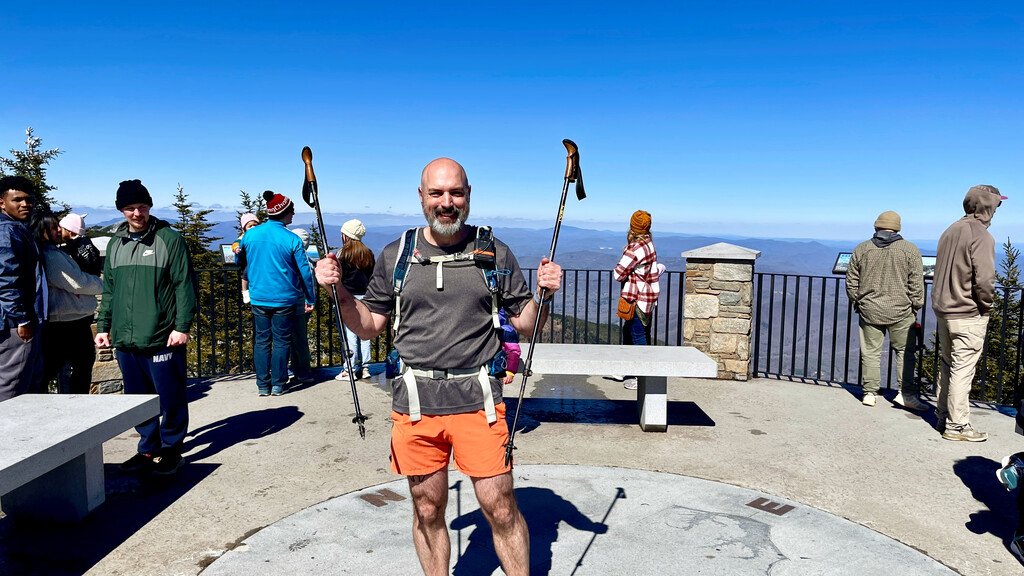
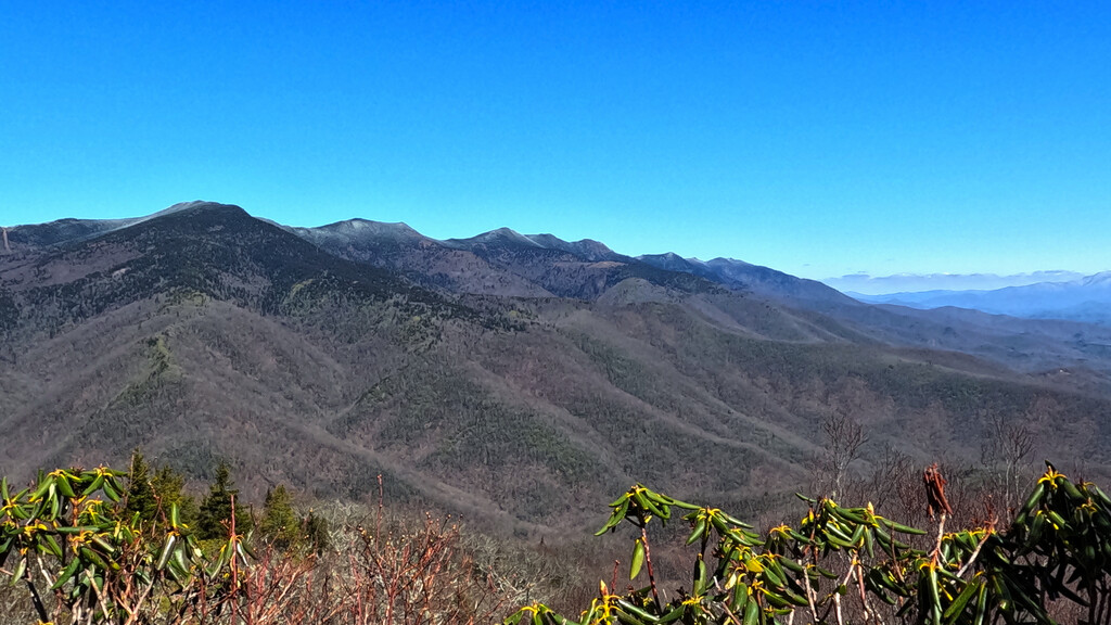
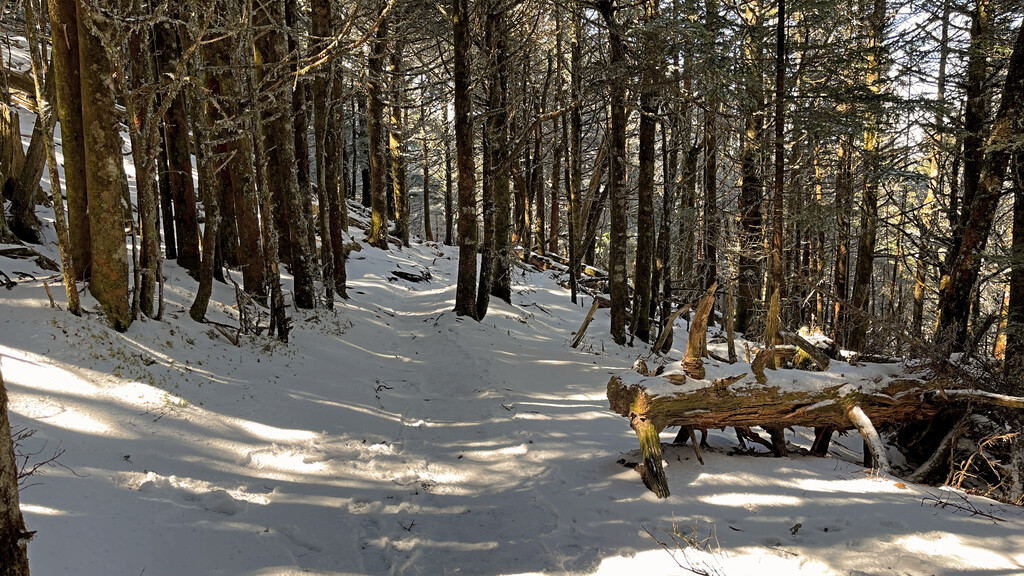
My journey began on 4/6/24 in Old Fort, North Carolina at Curtis Creek and Hwy 70, giving me at starting elevation of 1398'. I left the bridge at 8:00a, continued up to Curtis Creek Road, then took that 5 miles up to Cutis Creek Campground. At this point I turned onto Snooks Nose Trail and began the steep climb up. I grabbed a quick snack while enjoying the views from atop Snooks Nose (it was an ultra clear day) then continued up to Laurel Knob and eventually the Blue Ridge Parkway. The trail comes out at the Green Knob Overlook - another spectacular view - then continues a short bit down the parkway to the Green Knob Trail. I then took the Green Knob Trail up to the summit and then down the steep descent for 3 miles down to the Black Mountain Campground. I had seen snow all along the way thus far but the summit of Green Knob was the first ice I had seen; it would not be the last. I took about a 10 minute break at Black Mountain Campground before beginning the biggest climb of the day up the Mt Mitchell Trail. I made the steep familiar climb up and when I got to about 5,000' with about 2.5 miles to go, the snow started appearing again and soon turned into a real winter wonderland! This would have been more enjoyable if not for the ice though. Ice on the trail, with steep drop offs made for a slow go… especially the last mile. I finally saw sunlight and knew I was about to pop onto the summit trail, this indeed gave me more energy and a bit more pep in my step which carried over once I reached the paved path. A few people indeed looked at me like I was a bit crazy (we all know that it true) as I was running up such a steep incline. I stepped onto the summit marker then joyously took off my pack to take in all of the views. I again got crazy looks as I was literally just in running shorts and a t-shirt while all of the others there were in heavy winter coats, hats, and gloves.
The gate into the state park was locked when I had driven up to stage my car the day prior, intending to leave it at the bottom of the summit trail. A ranger told me that the road was closed due to snow and ice, so I had to leave my car at the adjacent overlook on the parkway, adding another 5 miles at the end of my journey. It pays to be nice to people - by chatting with the ranger the day prior, she recognized me as I greeted her and another park employee on my way down. She knew I had left my car at the gate. Once I got to the bottom of the trail, the park employee (Nat Wiseman) offered to give me a ride all the way back to my car - What a relief!
Route/Trails Hiked: Hwy 70, Curtis Creek Rd, Snooks Nose Trail, Blue Ridge Parkway, Green Knob Trail, Mt. Mitchell Trail (MST)
Total Distance Hiked: 19.1 Miles
Total Elevation Gain: 7667
Total Time: 7:54:09
Fully unsupported as I never gained water from any location and completed this journey alone after being dropped off at the start point; I only went with what I started with in my pack. There are plenty of options though along the way. Any decent trail runner should be able to easily beat this time as I slowed dramatically down with about 2 miles to go due to the snow/ice.