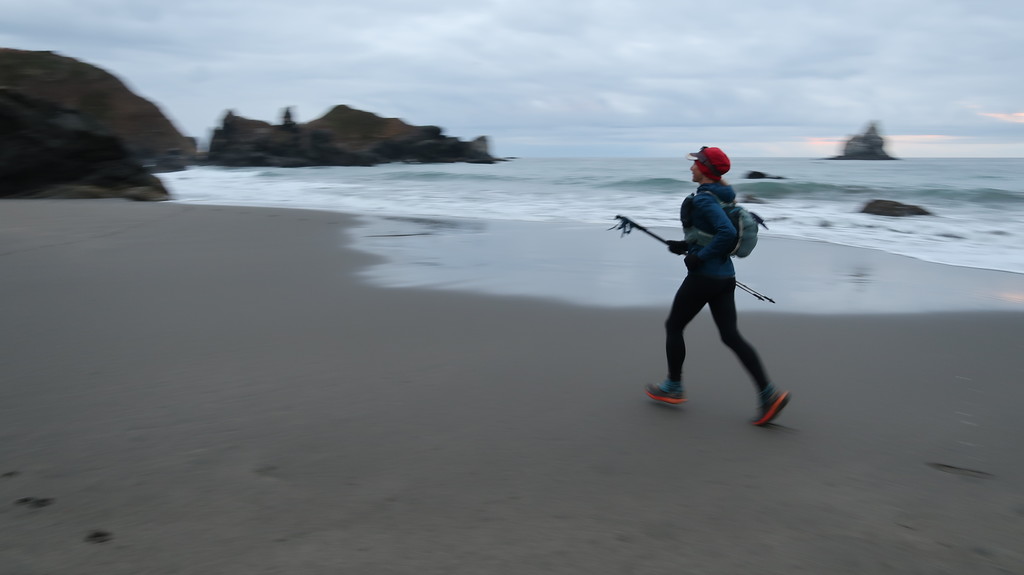
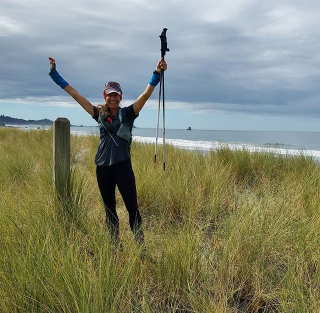
When I started the Oregon Coast Trail, I had no idea if I could finish it. On paper my chances didn’t look too good: middle-aged mom (check), no ultra distance experience (check), missed the peak week of training due to work (check). But the well worn quote from Leadville 100 founder Ken Chlouber is true: “You are tougher than you know and you can do more than you think you can.” Yesterday, I made it to the California state line in a new FKT of 13d 00h 14m (unofficial until I submit the verification data/reports). I toughed out painful shin splints the last hundred miles; I feel proud of that. The run also raised over $6,000 for the Immigration Counseling & Advocacy Program in McMinnville Oregon (it’s not too late to donate!). Before starting out, I wondered if I would feel lonely and disconnected on the trail. This was, after all, my first solo trip in over a decade. But all the texts and calls and messages from friends and family along the way, hiking the very final miles with @brady_robinson, and having family and Algin at the finish made me feel closer to the people in my life than ever.
Report: (more comprehensive report with many photos on Lucia's blog.)
I finished the Oregon Coast Trail this past Sunday, 9/16/2018, self-supported in a time of 13 days, 00 hours, 15 minutes. The previous FKT is supported at 18 days, 06 hours, 49 minutes. I started on September 3, 2018 at 10:13am PT (11:13am MT) and finished on September 16, 2018 at 10:28am PT (11:28am MT). (Sidenote: My GPX files appear to be in Pacific Time and my Satellite Tracker in Mountain Time.) Total mileage was 419.3 miles (by GPS) with over 40,000 feet of elevation gain. More importantly, the run helped raise more than $6,500 for immigrant rights in Oregon and was an absolute blast.
When I started the Oregon Coast Trail, I had no idea if I could finish it. On paper my chances didn’t look too good: middle-aged mom (check), minimal ultra distance experience (check), missed the peak week of training due to work (check). But the well worn quote from Leadville 100 founder Ken Chlouber is true: “You are tougher than you know and you can do more than you think you can.” I toughed out painful shin splints the last hundred miles; I feel proud of that.
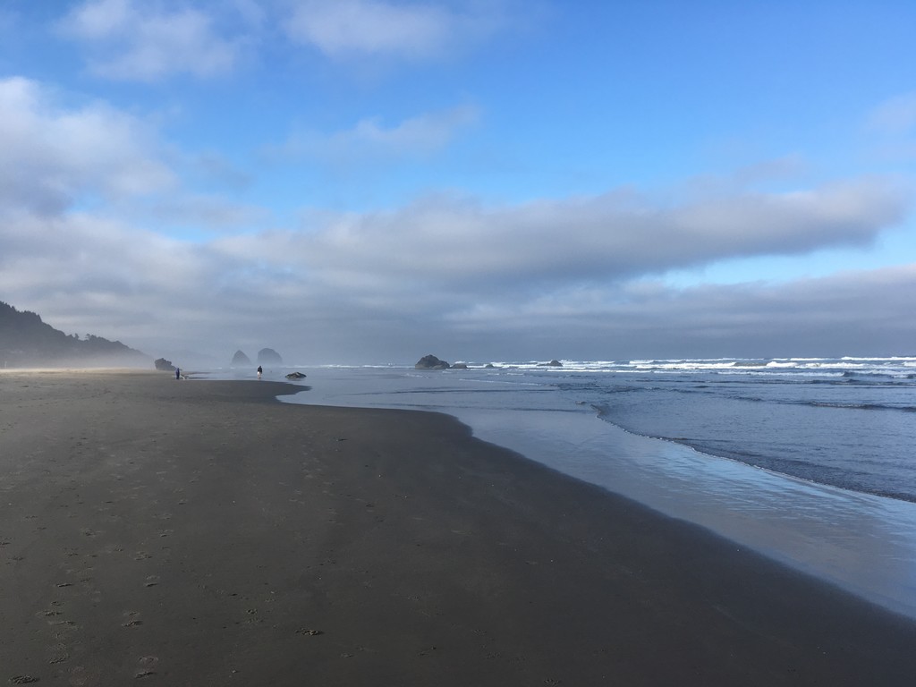
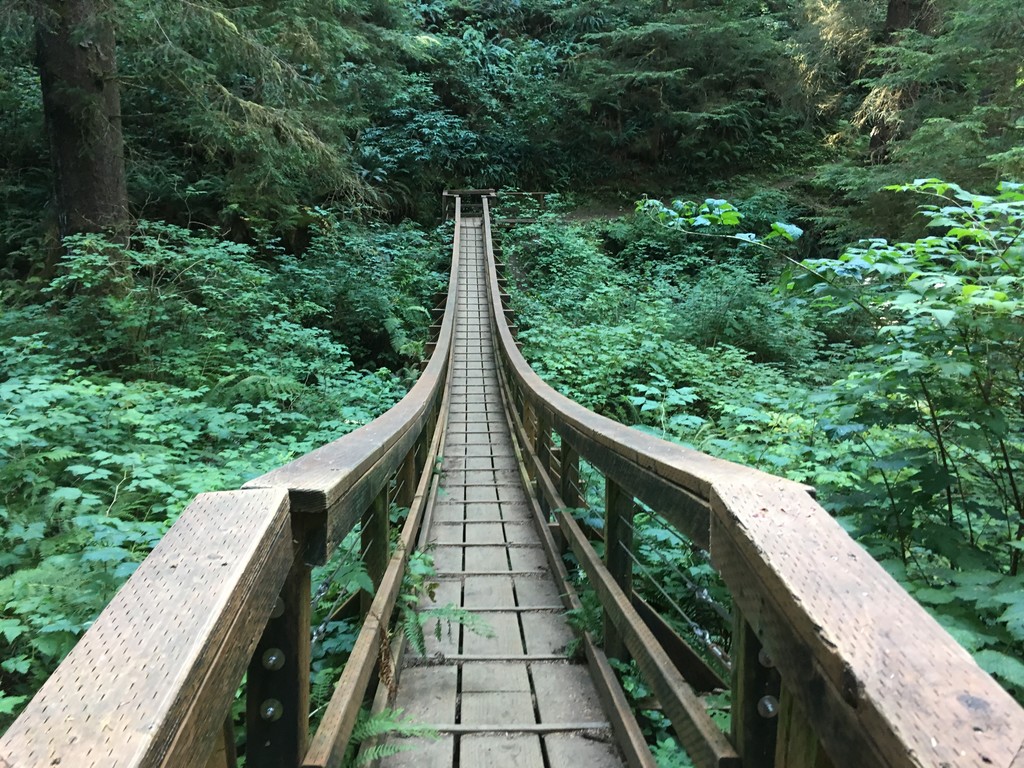
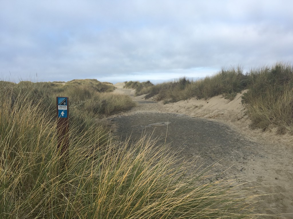
The OCT is a considered a "described route" versus a contiguous trail, like the Appalachian Trail or Pacific Crest Trail. The OCT strings together beaches, existing trails, side roads, ferries, and sections of Highway 101. The route is still evolving as the State of Oregon and advocacy groups work to replace highway segments with trails or ferries. Additionally, thru-runners and hikers will inevitably encounter high tides and seasonal conditions that make some rivers, beaches, and points impassable. For runners trying to move fast and put in high-mileage days, this means occasionally detouring inland to skirt obstacles (versus waiting out the tide for hours at a time). I used Natalie Larson's excellent, detailed FKT report on the California Coast Trail as a precedent for how to navigate tide-related impasses. Natalie notes that she often took an alternative route to bypass unfordable rivers and tide-dependent beaches. There are times I had to do the same. I relied on Day Hiking the Oregon Coastby Bonnie Henderson, which includes thru-hiking notes, as well as Oregon.gov and the Oregon & Northern California Coast 8th edition map for route information. There are a few spots where Henderson and/or Oregon.gov recommend short boat trips (under 10 minutes each) to keep the OCT along the shoreline and off of the highway. These boat trips do not shorten the route, but they do make it safer and more scenic. I took advantage of them at the Nehalem River, Garibaldi Marina, and Netarts Bay. Otherwise, I either forded bodies of water or detoured inland to bridges when water levels were too high. While I tried to adhere to the official route as closely as possible, part of the fun of the OCT is the navigation and creative problem solving. FKT purists may be uncomfortable with the variability of the OCT, but variability seems inherent in both "described" routes and coastal trails. Interestingly, even though the route I took deviated in spots from the one used by Ali Gieser and Robin Maslowski—due to tides, seasonal river flows, and being self-support (e.g. needing to hit towns for supplies and lodging)—our mileage was almost exactly the same: 425 for them and 428 for me. We both traversed the entire Oregon Coast from North to South, even if every step wasn't exactly the same. Future runners will find their own way from the Columbia River to the California border and experience the wild, diverse topography of the Oregon Coast along the way. Hopefully, someday soon somebody will do it in a truly blazing time. With bigger mileage days and less sleep, an experienced runner could knock off a lot of time from this FKT.
As a self-supported runner, I carried all of my own gear and purchased food and lodging along the way. If you are willing to put in 30 to 40+-mile days, it is possible to stay in relatively cheap motels every night. Water was available in towns, parks, and some waysides. I did not accept any outside aid, and I ran alone until the last night. My husband joined me for the final hours, which was such a special way to end the trip. I ran out of food while we were together, but I didn't take any from him (he felt bad and hid to eat).
Below is a download link to my verification package, which includes time-stamped photos (you can see the time data if you open them in Photoshop or other photo-editing software), Garmin InReach Satellite Tracker data, the GPX files from my TomTom GPS watch, and rough notes that I took each day. If this link is expired in the future, feel free to email me at lucia@waldenhyde.com. You can also login to see my tracker data (note: I set the track interval to 10 mins to balance verification with battery life):
Verification Package Download https://we.tl/t-KMTOOQCTkl
Tracker Login https://share.garmin.com/OCT Password: OCTFKT
I will be developing a full trip report with detailed entries and route descriptions on my blog: https://www.luciarobinson.com/blog/.
Here is my daily mileage on the OCT. I stayed in inexpensive motels, one lovely B&B, and an RV park. Highly recommend the Itty Bitty Inn in North Bend!
- 31.4 miles: Columbia River to Cannon Beach
- 30.8 miles: to Rockaway Beach
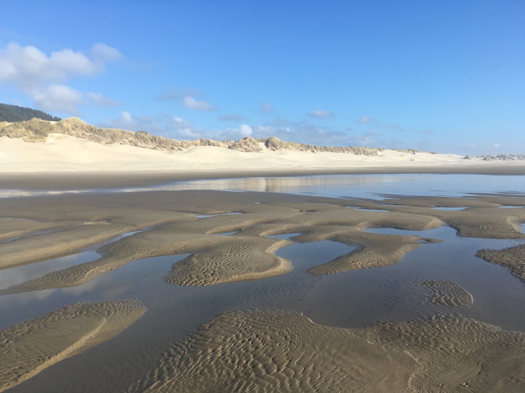
- 44.6 miles: to Pacific City (had to detour around Sand Lake)
- 22.3 miles: to Lincoln City
- 30.8 miles: to Newport
- 22.9 miles: to Yachats
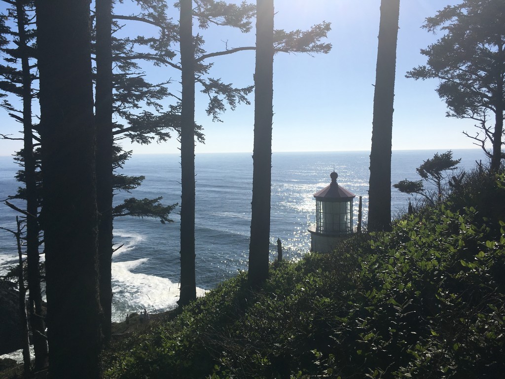
- 41.3 miles: to Florence
- 31.2 miles: Reedsport
- 23.3 miles: to North Bend
- 9.7 miles: to Charleston (start of shin splints)
- 42.6 miles: to Floras Lake
- 28.9 miles: to Arizona Beach
- 59.6 miles: to Finish (brief stop/sleep at Whaleshead Beach RV Resort)
Note: Distance data is from my GPS watch, which we all know can measure short or long at times, so take this with a grain of salt. My Garmin InReach mini was sending tracks at 10-minute intervals and so measured distance shorter (it creates a straight line between points on the map). You can download both the GPS files and see tracker data using the links posted above. -
Day 1: South Jetty to Cannon Beach, Jordan/Josh and family seeing me off. Peter Irendale (sp) wreck, families out for labor day, climb over Tillamook Head, mud, couple from kansas pray for you. Felt great. Missed turn at Gehart (sp), waded creek/estuary (lookup name), rejoined at Holiday Dr., Cannon Beach searching for food/hotel/high tide. Used beach and S. Hemlock Dr near beach. Missing my kids. Thought about myself as a kid. So phobic, but calm and strong and courageous today. Felt real strong on hills. Thought of all the runs with SJ, Katie, Jenn. Didn't listen to anything; just enjoyed sound of the ocean, wind, forest. 3,000 plus feet of climbing.
Day 2: Cannon to Rockaway. Beach, points, high tide, narrow trail off beach, 101, Arch Cape, Cape Falcon, Nekahanie Mountain, Manzanita beach, bushwhack, Jetty Fishery, hope, big swells, best crab, South Jetty, Manhattan and Rockaway beaches, family trips, cute hotel, Silver Sands, bodega burritos, potatoes, all the snacks. Legs feeling great.
Day 3: Rockaway to Pacific City. Dawn on Rockaway beach, fog horn, train tracks, Jeff, Jordan, Kat at the marina, Bayocean, Cape Meares, scramble over point, high tide, tiny trail up Cape Meares, picnic table, octopus tree, road, narrow shoulder (scary), oceanside, Netarts, fun ride across the bay with fun locals bought them beer, offered me a crab, Netarts spit, deserted, Cape Lookout, gorgeous trail up and over loved it, beach, Sand Lake, couldn't wade. loooong detour on roads, Pacific City in the dark.
Day 4: Pacific City to Lincoln City. First low. Missing kids, legs painful and achy, worried about right popliteaus, first 7ish miles are on road, regained the beach at the end of winema road (look up name of camp), beach is soothing, day is gray and misty. Take a long rest at proposal rock at the town of Neskowin. Consider getting a hotel in Neskowin. Decide to push to Lincoln City but promise myself just to walk. Perk up a lot. Big climb on the shoulder of 101 up Cascade Head, but shady and pleasant. Feel good again. Meet Michelle (fr-canadian). He's biking all of NA in a big loop. At summit turn off on gravel road 18??. Guidebook and FS maps differ. GB is correct. More climbing in shady forrest. Wonder if I am correct. Finally find connector trail. Not named, hope it is the right one. Gorgeous trail through forest. Wished I felt up to running it. 4 or more miles of highway shoulder to get to Lincoln City. See turnoff to McMinnville. Meet a lady tramp and another OCT hiker on the shoulder. Get a hotel in LC. It has laundry!! So excited for clean, dry socks. Order pizza, craving salad. Watch mindless TV
Day 5: Lincoln City to Newport. Dry socks last 20mins, dad's b-day, magical day, angel wings, queen anne's lace, yesterday sooo painful, today legs feel amazing. Ran more than I hiked, pain-free running. Saw whales outside of Depoe Bay. Lots of beach time (some at high tide), Devil's Punchbowl, Yaqui Head lighthouse, tacos, Shiloh inn, fisherman boots outside of doors, amazing nap, can see boats at night on the ocean, fog horn
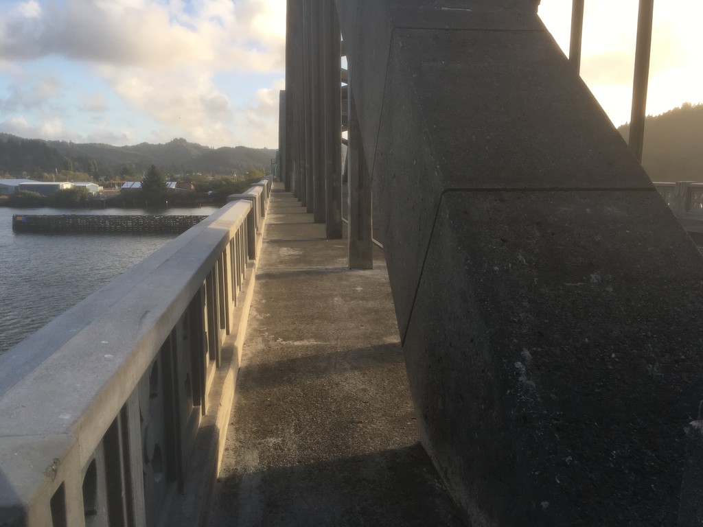
Day 6: Newport to Yachats. Felt off. Stomach unsettled. Ate a banana and drank a chocolate milk at a gas station heading out of town. Crossed first(?) Conde McCallough (sp) designed bridge. Art Deco features. Went out the South jetty. Long, slow breach walk to Seal Rock. Fun to see waves crashing into the rocks. Very foggy. Pretty Little footpath off the beach. Short highway section, back to beach. So foggy. Long beach stretch. Difficult sand. Dead shark!Still feeling bleh. Almost missed turn. Saw Al... Bridge rising out of the mist. Neighborhood roads to 101. Stopped at mini-mart; ate chocolate ice cream. Fun. Started feeling better. Crossed bridge. Deco. Saw harbor seals. Crossed into Waldport. Met man at gas station who shook my hand. Gorgeous beach. Tide out; fast/hard sand. Feeling much better. Stopped to enjoy the beach. Stayed at Deanne's Oceanfront Inn. Cute, old, family-run. Turns out it's 3 miles from any restaurants/stores. No taxi, Lyft, or delivery options. Bought corn nuts and chips from hotel and foraged blackberries from the hedge. Dinner! Watched the ocean and turned in early. Facetime with kids. Miss them a ton.
Day 7: Yachats to Florence. Early beautiful beach, 801 trail, Yachats farmers market, grocery store, delicious burrito, shared food with other tramps, Amanda Trail (gorgeous). Loved Cape St. Perpetua. Met couple on backside who had seen me in Yachats. Watch got paused when I changed layers. Notice about 2 miles later. Loved trail above the ocean. Gorgeous beach, the Hecta Head Lighthouse. Loved the trail up/down to the lighthouse. So cute. Ice cream and soda at gift shop. Gave me a burst of energy. Sprinted through the Hecta head tunnel. Long, scary stretch of 101, blind curves, narrow shoulder, back to beach. Pretty evening beach walk. Too Rhododendron road into Florence. Ran this road hard. Five or six miles to the hotel. Lighthouse Inn. Historic. Sweet innkeeper. Gorged on burger and onion rings from Dairy Queen.
Day 8: Florence to Reedsport. Really missing my girls, feeling pretty down. Stocked up at Safeway (gas stations are better for single serving sizes). Cool bridge out of town. Took South Jetty Road to Oregon Dunes National Rec area. Beach shrouded in fog. Couldn't see the ocean until right beside it. Only person on the beach for a long way. Enclosed in fog. Eerie, but cool. Enjoyed it. Finally saw some OHV folks and fishermen. Saw snowy plovers. Habitat closures. Crossed Siltcoos. Up to thoughts. Ten....(sp), very high. Over waist. Turned back. Regrouped on driftwood. Hiked back up beach. Bummed out. Took the Oregon Dunes Loop trail to 101 access. Hot, hard travel in the dunes. Low on water. Got a trickle at the trailhead from a broken spigot. Long road section. 10 miles on the 101. Big hill climb. Cool small town of Gardiner (sp, look up history). Nice small bridges into Reedsport. McDonalds burger and fries also Coke, Gatorade, and ice cream. Facetimed with girls. Sweet and painful.
Day 9: Reedsport to North Bend/Coos Bay. Wrangled over choice of route. Kayakers Tenmile Creek high. No easy escape through the dunes. Used the 101. Nice shoulder most of the way. Cheesecake to settle stomach. Shin flare up, German guy from cruise ship. I smell so bad, big bridge into North Bend, Got in early. Itty Bitty Inn. Awesome. Rik innkeeper, so great. Fried chicken from Ashcroft Market, nice rest. Nap. Worried about shin. Homesick.
Day 10: North Bend to Charleston. Shin/ankle issue. Walked slowly to Charleston. Talked to Sarah. Got hotel. Elevating and icing. Laying here helping me recommit to trip. Curious about the trail again.
Day 11: Charleston to Floras Lake. Inspired by Shenoa Creer to push through shin/ankle pain. Rise from deep emotional/physical low. Packed at 1:30 am, napped until 4:30, got underway before dawn. SevenDevils Road. Enjoyed pre-dawn, liked gravel part. Shin so painful. Kept going. So happy to return to beach at Seven Devils Rec area. Gorgeous. Tide low, creeks easy wade. Bandon. New shoes. Lamplighter lady kind. Sad to leave old ones. Couldn't put them in trash. Iced shin outside grocery store. Sympathy for homeless folks. Returned to beach at Beach Loop Road, Devils Kitchen. Crazy beautiful beach. Ocean big, rough, and very turquoise. Creeks easy to wade. Tide high, beach in Plover area very narrow. Ran out of wet sand. Very foggy. Lost nerve. Backtracked to last possible exit. Walked out to 101. So many 101 miles. Determined. Pain. Dad presence. Queen Anne's Lace. Cannon on mail box. Watch battery died. Langlois. Market, cig sign. Market owner. Greasy Spoon pizza. Amazing. Gorgeous bucolic foggy walk to Floras Lake B&B. Fancy. Love the B&B. High thread count sheets. Innkeeper so kind. Proud of getting through pain. Big day. Comfy bed.
Day 12: Floras Lake to Arizona Beach. Slept poorly. Shin pain, plus worried about river crossings. Woke up unsettled. Enjoyed meeting owners/caretakers of the B&B. So nice. Liz is a runner. Husband gave me a little map of the Blacklock Point trails. Very helpful. Ate small breakfast and headed out. Very foggy. Beach beyond lake soooo difficult. Black sand beach. Fine ground pebbles. Sink with every step. Steep angle. Painful on shin. Got to Blacklock Point trails. Beautiful trails. Rhodos like WV. Loved these trails. Beach on the other side, difficult but beautiful. Afraid of the Sixes River. Met a very nice woman, Tara, on the beach. She said, "You are having the perfect day!" I think she meant the weather, but it made me rethink my mood. I asked about the Sixes and she laughed and pointed—the Sixes had formed a sandbar at it's mouth. I walked right across. Could see the Cape Blanco lighthouse in the fog. I ran into Tara again, and she showed me where to exit the beach over Cape Blanco. We hiked together a bit. I reminded her of her friend Clarissa. Tara is a bird artist. I went on down the trail. This area reminded me of Canaan Valley/Dolly Sods. There were even rhododendron over Blacklock point. Missed an intersection on the south side of the cape and ended up on a horse trail that also went down to the beach. The beach was wild and beautiful, but even more difficult to walk. I asked everyone I passed about the Elk River. (I grew up on the Elk River in WV, so many WV and dad references on this journey). Everyone said it was passable, even with the tide coming in, and indeed it was. Beautiful river. Family looking for agates. Soaked shin. From there four more miles of impossible sand that sent burning pains up my leg. I lost it. It seemed like I would never get off that soul crushing beach. I was moving way too slowly to finish on time. I called Brady and I cried for the first time on the whole trip. I don’t cry easily. Sometimes I wish I could cry more easily. He told me he and the girls were coming to meet me at the finish. It was going to be a surprise, but he told me at just he right moment. It lifted my spirits. I made it to Port Orford in a lot of pain. Shin, plus big blister on my left inside heel from the change in gait and/or new shoes. Bought groceries and ice. Checked into a very cheap motel. Ate a carton of potatoes, rice, mac n cheese, and chicken. Then two donuts. Sooooo good. I perked up after food. Decided to push on to Arizona Beach. Beautiful evening night hike. Old Coast Highway Trail and the 101. Mountainous away from the beach. Could run a few uphills. Downhills are excrutiating. So glad to get in more miles. I get to see my babies soon!!!! Love them so much. Arizona Beach hotel by the state park. Ramshackle place. Only took cash. I had just enough (plus a few dollars). Comfortable. Slept better.
Day 13: Arizona Beach to the Finish. Got up before dawn. Shin/ankle painful, but I was ready to see my family. Mid tide, so highway around Sisters Rocks. Dropped to Nesika Beach. Sky lightening. Gorgeous. Happy to be on the beach. Sand a little hard. Shin super painful. Guidebook says route off the beach is at the South end of town. Not so. All private property now. North end. Had to backtrack and scramble up bluff. Went to the little market/post office in Nesika. Bought food and ice. Iced my leg outside and charged devices. Carried on. More Old Coast Highway, Otter Point. Trail to Bailey Beach. Pretty, soothing, sea cave. North jetty of Rogue River. Crossed bridge into Gold Beach. Feeling tired. Stopped to eat at the cafe in the refurbed cannery place. Felt awkward, dirty, and smelly in the crowded tourist restaurant. Ordered clam chowder, turkey club, and fries. Sipped the soup, but felt nauseated. Packed the rest of the food into ziplock baggies. Charged devices. Returned to beach at the South Jetty. Listened to URP interview of Ricky Gates while he was on his transcon. Felt like I had a better window on his experience and enjoyed the interview. High tide. Harder beach walk, but shin feeling better untaped. Enjoyed seeing looming Cape Sebastian, occasionally disappearing in the fog. Wondered about finding the trail. Youtube video + guidebook warnings. Fun dogs on beach. Put on music for the first time on trip. Belting anthem songs into the wind. Alone of beach signing my head off. Fun. Pumped. Got to the base of Cape Sebastian. Could see the trail. Rested on driftwood, dumped sand from my shoes and ate bacon from the club sandwich. Talked to Brady. Family would meet me on the other side of the Cape for a visit. I perked up. Almost manic high. Practically ran up the Cape. Steep, but felt awesome. Knew I would see family soon, but also savoring some of the last moments to myself. Views from the top. All the land I had walked. One of the highlights of the trip. Pretty trail down south side. Downhill hard on shin/ankle. Glorious turquoise water. Seastacks. Hunters Cove. Freaking amazing beach. Family not there yet. Kept walking. Heard a keewee up in the dunes. Ran up! Brady, Tessa, Molly, and Katie. Huge joyous hugs. Clung to Tessa for so long. Went down to hang out on the beach at the crazy beautiful sea stacks. Rock with KJ, tweens off to explore beach. Then Megan, Jordan, Sammy, and Cora arrived. "Mom, can you hold my shells?" Hahaha. So fun to see everyone. Ate my squished sandwich for dinner. Grossed out Megan. Made a plan for Brady to meet me later to pace me in. Family left to go get dinner. I pushed on. Passed the Pistol River. Closed off with a sandbar. Might have left the beach too early, not sure in the dark. Crossed dunes to the highway. Walked highway for several miles. Last solo night walk. Hung out at Milepost 343 (I had started at 313 that morning) to wait for Jordan and Brady. They arrived. B and I started the final push. Samuel H Boardman trails. Pretty nigh woods. Narrow trails; a little hard to navigate in the dark. Moon above secret beach gorgeous. Sound of ocean. Peaceful. Amazing catch up with Brady. So special. Love him tons. Eventually detoured to the 101 to find our rest spot for the night near Whaleshead Beach. Got to RV park where we had a "cabin" reserved for a quick rest. Nearly out of food. Oreo crumbs, gross french fries, two ginger chews. Did not take any aid from Brady. He felt bad eating. Hid to eat. 44 miles so far for me. Quick hot tub; felt great. Slept for a few hours. Fateful setting the alarm. Knew would be over 12 days. Ok with that. Woke up at 4:30, going at 5. Excited. Feeling hungry but good. Beautiful trails. Cape Ferrelo. Amazing Lone Creek beach. Glad Brady got to experience a perfect pocket beach. Hobbit tunnel into woods. OCT follows the 101 into Brookings. Long outskirts, Shin cramping, very painful, so hungry. About to bonk. Got to Shell station. Grabbed candy bars, chocolate milk, salami/cheese, and Gatorade. Gulped it down. Pushed on. In a lot of pain now on the pavement. Harbor Way, Oceanside. Brady poops. Finally McVay Rock State Rec Area. Back to the beach for the last time. Pebble beach. Hard, but pushing quick now. Round a point. Can see visitor center. Nice running sand. Took off. Running hard and with joy. Guidebook says post beyond the visitor’s center. Went there. Stopped. Took pics. Checked GPS. Not the border! Turned things back on. Ran to border. Photos at that post. Family, Al, poster, Register.
Comments
Just a quick update that my last name is now Powell.
XO
Lucia (formerly Robinson) Powell