
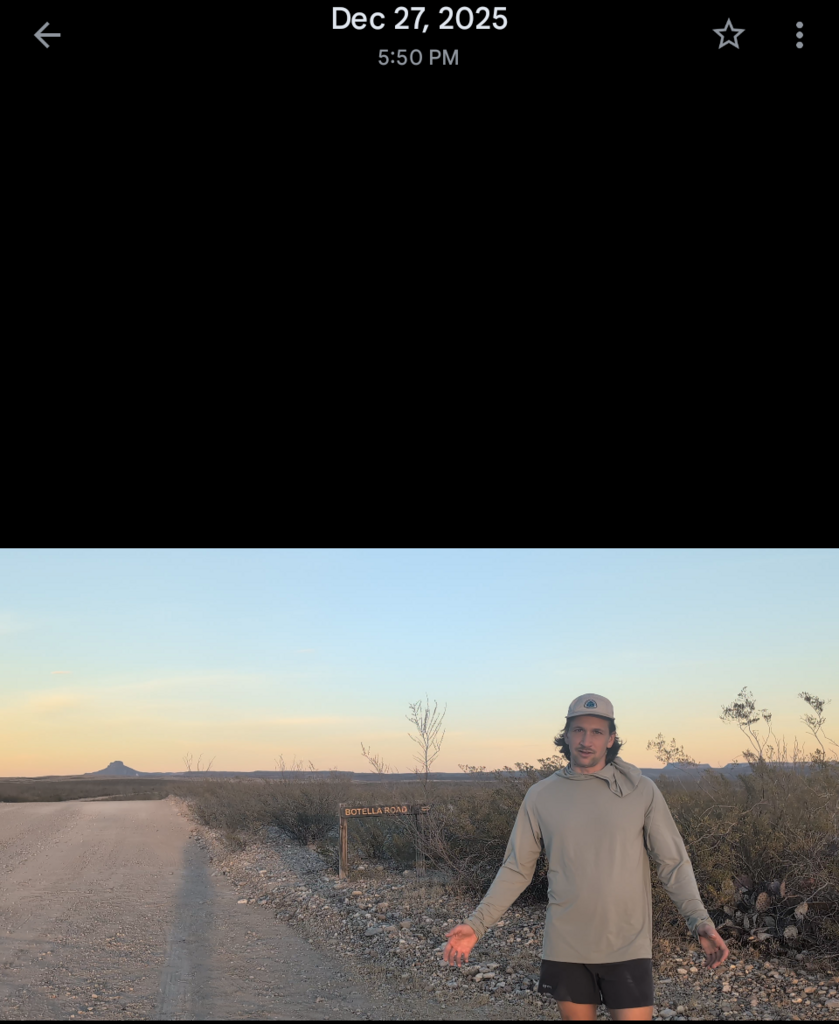
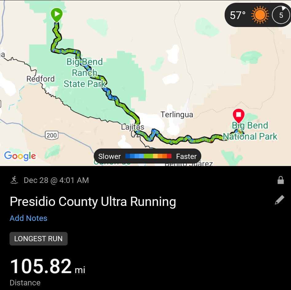
Three kind friends decided to join me in camping near the trailhead at casa piedra on the far northwestern side of Big Bend Ranch State Park on the night of the 27th. Just before 4:00 a.m. I woke up alone, walked to the trailhead with all of my gear, started my Garmin watch and inreach mini recording and headed into the dark. I had seen the landscape the night before and could tell it was pretty desolate at least around this part of the trail so I wasn't missing much for the first few hours before sunrise.
I made it about 10 mi before feeling hot spots on both of my feet in different places, but I was able to nip them in the bud with my headlamp on and an ample amount of leukotape while sitting on the side of the dirt road that comprised the first 10 or so miles of trail. Right, as the sun was starting to break over the horizon, I hit the first first off Trail section of the Big Bend 100: the low Western portions of the wash that comprise Terneros Creek. I was glad at this point that the sun was coming up because it would have been harder to follow even though it's a pretty wide wash at that point. I hadn't made it but a couple miles before running into flowing water which I was very surprised to see. The park rangers themselves were very cryptic about water access in the park for understandable reasons but I was not expecting to see this much this early on. I followed the flowing water for a mile before making the decision to dump some of the 6 liters I was carrying to save some weight. I had already worked out that I would have enough regardless of creek water because I wasn't drinking that much in the cool morning air. By the time 8:00 a.m. rolled around and the sun was fully out, I ran into the first and only party of people I would see on the majority of the Big Bend 100. A group of eight being guided by Tyler Priest (a pretty well-known guide in West Texas) we're enjoying their time in camp on the side of the creek when, and much to their surprise I walked through they're camp which was unavoidable due to it being pretty close to the creek in a narrow corridor. We exchanged pleasantries and Tyler and I bonded a little bit over having both thru hiked the PCT previously. It was a nice conversation but I had to keep moving considering I was trying to do an fkt. They all seemed to understand that and wished me luck.
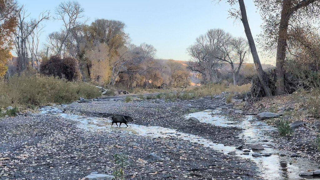
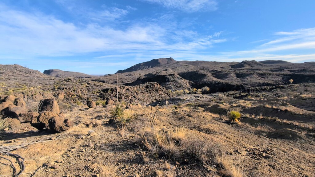
As I followed the creek Eastward the sun was starting to beat down a bit harder getting into mid-morning. The cottonwood filled canyons. There were truly beautiful and I was able to see some javelinas who didn't much care about my presence at all. Again, I saw plenty of pooled and somewhat running water throughout these areas. Once the route led me to a large fence across the creek, I had no choice but to turn South and follow a rudimentary road up the ridge to a higher higher access point into leyva Creek. I did get lost a little bit in the undergrowth in this area but it didn't slow me down too much. Leyva Canyon itself was one of my favorite areas in the state park. There were plenty of small pour offs and little tinajas with again a surprising amount of water. At one point I came around a bend and heard a large animal wrestling its way up into the rocks, but I was unable to get a good view on what it was. Something inside me hoped it was a mountain lion because based on the size and agility it couldn't have been much else but I didn't really see it. This part of the trail winds back and forth through oxbows in the creek near little caves and areas with plenty of interesting geology exposed on the ground. I would really like to come back and visit this area. Pretty soon, however, I was up again onto a high plateau and a dirt road which led me to my first brake spot of the day which was about 27 miles in at the Saeceda bunkhouse. I spent about half an hour sitting down. Resting my feet here because they were hurting after going that far without a single real rest. The water weight had added up and was causing a little bit of pain.
After cameling up here, I continued down the dirt roads which lead to Eastward across the plateau in the state park until exiting them onto the trailhead which brought me down into the Fresno Creek watershed. This area was all a blur because by the time I was here I was starting to get very hungry and the sun was getting close to setting. The one memorable area I did see was Mexicano falls which again I would love to come back and visit especially if I could reach it from the bottom. The trail itself accesses the South South rim above the falls which give a great view into the area but don't allow you to get very close. I didn't have much time to enjoy it as expected and I continued down canyon towards the wax factory lacolith and a road system which would ultimately lead me out of the park but not before sleeping for the night. Throughout Fresno Creek there were also areas of running water and pools like the west side of the park. I decided to save some time and give myself a little bit of rest at about 7:00 p.m. after the sun had gone down. I sat on a rock and cooked myself. Dinner very quickly and ate it over the next half hour as I continued down canyon before it. Ultimately selecting a campsite at 9:30 p.m. about 5 mi short of the Park exit. It turned out to be a very windy night and cowboy camping doesn't lend itself great amounts of comfort in these situations. (I didn't bring a tent for weight savings and honestly considering the amount of time to set up and break down I wouldn't have used it anyways, I checked the weather before setting out don't worry). I had gone a total of 49 mi this first day and the tiredness I felt was enough to keep me asleep regardless of wind.
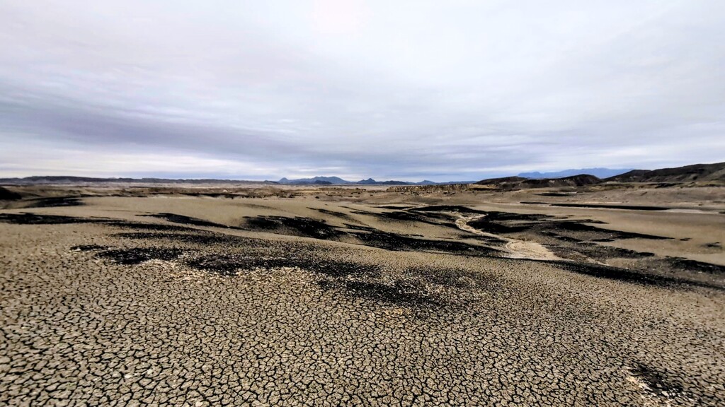
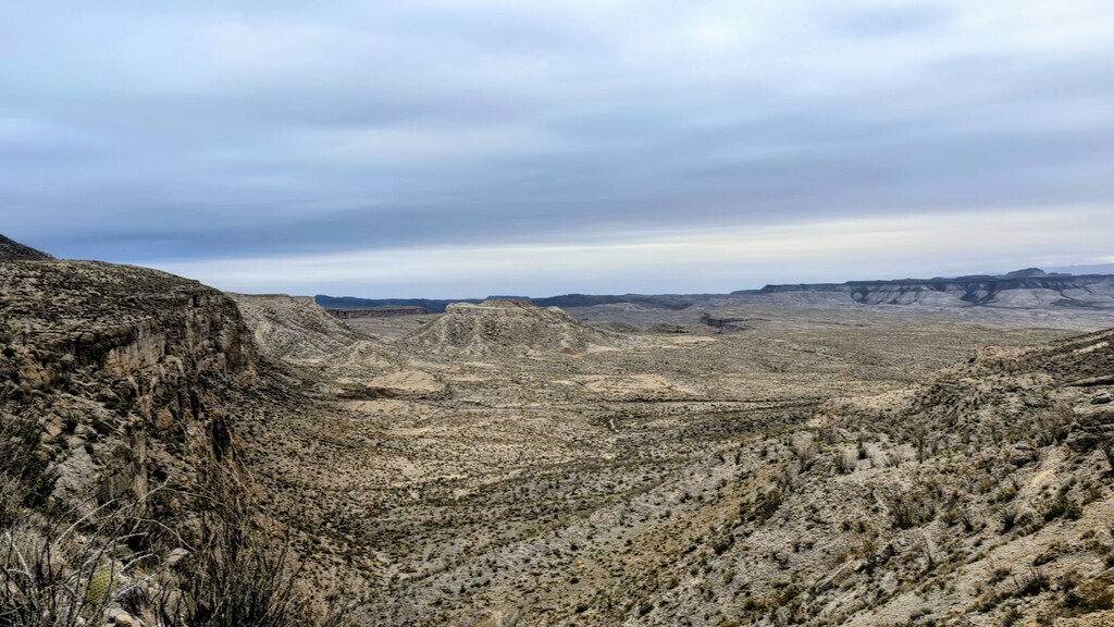
I woke up at about 6:00 a.m. on the 29th and set out before the sun rose down the dirt roads which ultimately led me to Barton Warnock visitor center. I arrived here just before 8:00 a.m. as the ranger who issued me my permit was opening up. I collected water and let her know I had left the park. She had requested me to do so considering the distances that I was asking for on my permits. Once I left I walked the mile or two down the side of the highway through lajitas and wasted a little bit of distance wandering through the resort itself because the GPX track provided for the fkt ran this way. The trailhead to enter the Mesa de angila however does not leave from this area and so it required me to backtrack north a little bit so that I could actually access the national park. I crossed the open Basin before the climb into the Mesa and passed by a single hiker coming down the steep climb who asked if I was backpacking to which I responded "I guess so" (I didn't have time to explain my conflicting thoughts on whether this masochistic competitive activity qualifies as backpacking). He responded and you said something along the lines of " it's beautiful up there. Have fun". If any part of this route was fun coming off the Mesa was not it. The climb up onto the Mesa and the traverse across it were not particularly difficult and were notably pretty. The descent off the north side of it however, was arduous, slow, confusing and ultimately much more difficult than I expected. I had planned on doing this portion and descending to the flats below the Mesa and getting to Terlingua Creek by noon but it took me till about 3:00 p.m. to get through this area. The mud flats and creek washes north of the Mesa were particularly slow-moving because of the softness of the soil under my feet. The silver lining was that this area had the most diverse geology I might have seen anywhere not just in this part of Texas but in my travels all together. Every tiny fork in the watershed that I would walk into would have mixes of different types of rocks I'd never seen before and it was interesting enough to keep my mind occupied. I had stopped listening to music and audiobooks because I was concerned my battery would run out on my phone and watch so the stimulation was welcomed.
Once I got to Terlingua Creek the most poetic singular experience of this fkt occurred. I sat down to eat my late lunch and camel up on water/filter water to carry up into the Chisos and thought about how much my feet hurt at this point. While I was collecting water, I noticed something odd about the creek conditions. Two branches of the creek had come together right where I was sitting and when I would stick my bottle under the surface I felt waves of cold and hot alternating. I realized that the right fork was actually a hot spring. I'm pretty familiar with this area and I was unaware that there was a hot spring here. I wanted very badly to take my shoes off and just soak my feet in that water but I knew I wouldn't have time so I stored it in my memory for another visit and continued on. This portion of the hike felt particularly slow. I don't remember the exact distance but I had to follow a dirt road out of terlingua abajo onto the Maverick road and then walk alongside it until the chimneys Trail. This took a long time and plenty of high clearance vehicles sped by me providing my eyes with plenty of dust to enjoy. By the time I got to the chimneys Trail, the sun was setting and made a diligent effort to get as far as I could before it was truly dark so that I wouldn't waste time wondering where the trail was. This is one of the only trails in the national Park that I had never hiked on before and I was glad to get to see it in complete darkness so that I could truly enjoy all the sights I'm sure are out there. I think at one point in time I did see the outlines of the "chimneys" features silhouetted against the Milky Way. I was really dragging ass at this point but my permit in the park said I needed to get up to the Homer Wilson Ranch area and so I pushed through to make sure I could do so. It had been very cold and windy this day so I didn't actually drink as much water as I would have otherwise. That water weight, The slight uphill grade and a headwind had made it a particularly tiring day. It was 8:00 p.m. or so by the time I got to the Ross Maxwell scenic drive. I would need to walk 3 or 4 mi on this paved road to access Homer Wilson and I'm glad to have reached it at night because the traffic would have been quite dangerous otherwise. Like the previous night I cooked my dinner before getting to camp. This time however, I crawled into a drainage culvert underneath the highway for some wind block and a little bit of cooking privacy before heading back out on the road. I made it the majority of the way up the Ross Maxwell towards Homer Wilson before I broke down and just couldn't hike anymore for the evening. I bushwhacked off a few hundred m into brush and found a suitable Sandy spot to stealth cowboy camp. Again, I fell asleep pretty much instantaneously and woke up at about 5 or 6:00 a.m.
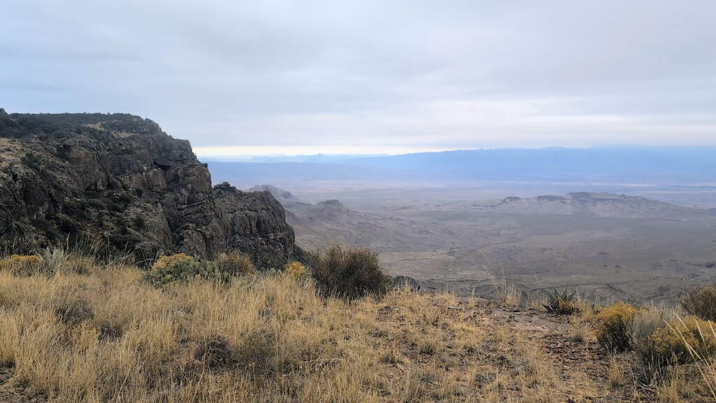
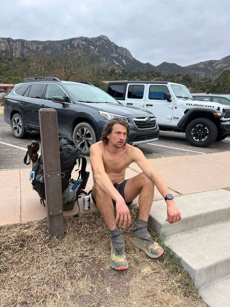
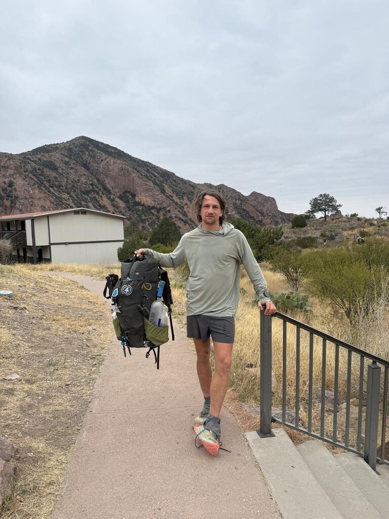
This final morning started in the dark and allowed me to get up into the trail systems in Blue Creek canyon near Homer Wilson Ranch before sunrise. I was very hungry and nearly ate all of my food before the main climb started. Once following the creek bed up to the oak Forest at the base of the chisos mountains themselves, the trail would switch back across the face for a gain of about 2,000 ft. It was slow going considering I was 95 mi or so in but I pushed through it and made it up onto the south rim. I still had 3 l of water by the time I was at the rim and so I started dumping water knowing I wouldn't need to get any from Boot canyon before finishing. Again, I feel like I carried an extra 5 to 10 lb of weight throughout the previous day but better safe than sorry I guess. Usually the south rim is the gem of the park and worth enjoying but I was ready to get this thing finished and have some real food in my belly so I made my way around the rim with little wasted time. I descended boot canyon and took note of the fact that there was plenty of water there as well even though the spring itself didn't appear to be running as far as I could see from the trail. It was at this point in time that I started passing multitudes of day hikers and overnighters which I politely found a way to get around. By the time I got to the junction to Emory peak and down pinnacles Trail. Realized I had enough energy to jog a bit to cut down on my time. I knew it wouldn't really matter because I was at least a day ahead of the previous record, but I still wanted to challenge myself so I stuck through it. I passed a very kind older Lady ranger who gathered was going to ask me for permits but when she asked me where I camped what and when I explained what I was doing she just said "oh don't let me stop you go ahead but be careful running down there. There's a lot of loose rocks." I did heed her advice and eventually slowed down a bit before making my way to the trailhead at the chisos Basin. My three friends who had dropped me off were already there hanging out, having spent the morning around the basin themselves. I finished and sat down on the curb and a wave of odd feelings hit me. I felt almost flu like for the rest of the day. I wouldn't say I was actually sick but I think somehow I had suppressed a lot of physical pain throughout the last couple days and once I was finished my body knew it and let me know.
The trip itself was more difficult than I had expected and I was beat after having finished, but it did open my eyes to a few areas around the state park and the Mesa de Angila which I hadn't seen before. It was a good sampler and has provided me with some insight on where I want to go back and visit next in a much more casual capacity. The Mesa and the Levya Creek and Mexicano falls area most specifically. If I ever tried this again I think it could be done possibly in less than 48 hours, but I would really need to optimize a few things both physically and logistically.