Ever since we hiked the Laugavegur Trail last year a seed was planted in my head about running the 55km route solo in one day.
The trail itself is regarded as one of the top hiking trails in the world ranked alongside Machu Picchu in Peru and The Milford Track in New Zealand.
The 55k route is in South-West Iceland going from the geothermal area of Landmannalaugar down to the deep ravaged gorges of Þórsmörk. Once on the trail you will realise the description is underrated.
Still in the middle of Covid with Iceland being one of few countries we could fly to and from the UK without the need to quarantine I decided it was the perfect timing. My husband had already planned to go to Iceland and in the spirit of the moment after a little convincing from him I booked my flights 1 week before I was due to leave. I had not really trained and felt totally unprepared but you live life only once.
One of the challenges was that I was flying on my own with no place to leave things, so everything I was carrying on the plane I was going to be running with and back home with (minus the food).
The plan was to do it totally unsupported so I had to carry all my fuel.
I had a Covid test on Sunday at 5pm and boarded my IcelandAir flight from London Heathrow at 9:25 pm.
Landed in Iceland at 11 pm and was in my cosy guest house by 1 am. I woke up at 5:30 am, had coffee and protein pancakes with almond butter and started my short walk to the BSI bus station to take the bus to Landmannalaugar. We started the bus journey at 7 am, I knew it was going to take about 4 hours so I just tried to relax.
The bus first travelled along regular roads then very soon along gravel roads which gradually deteriorated in quality. Our big bus with its off road tyres gobbled up the miles kicking up dust behind us as we went.
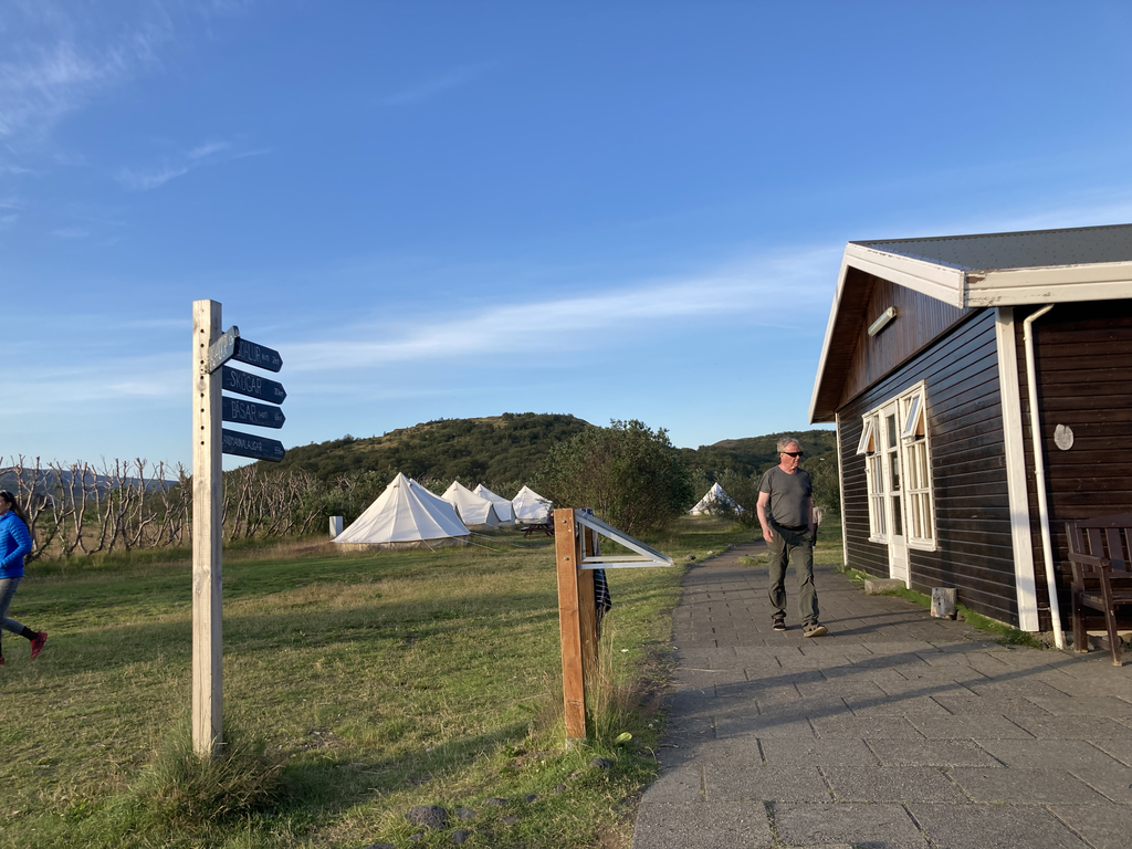
After driving through a treeless wilderness pretty much as soon as we left Reykjavik, arriving at Landmannalaugar I was surprised to see how hectic it was, there were loads of people and plenty of tour buses and 4x4's. It was a little odd seeing all these people milling around in the middle of nowhere as there are only a few accommodation huts, a small visitor centre and and a bunch of tents.
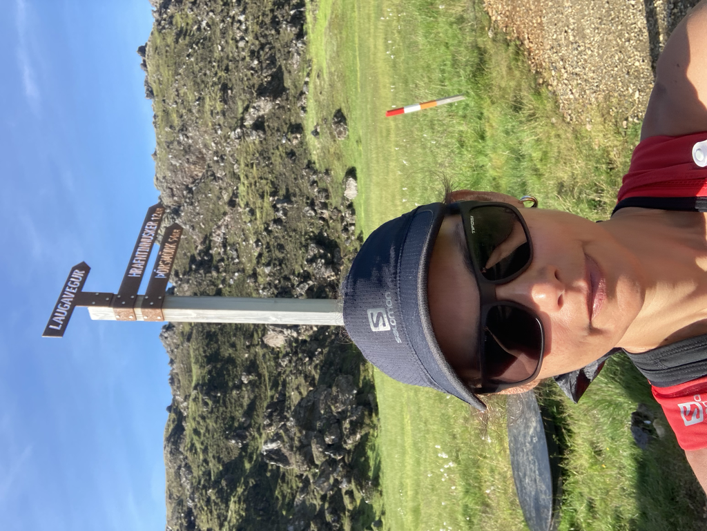
The weather was amazing, blue skies and warm and I could not believe my luck. Knowing how unpredictable the Iceland weather can be, in my 12L salomon active vest, I was still carrying, a waterproof jacket, a fleece, emergency blanket, headlamp, extra par of socks, gloves, buff, watershoes for the river crossings and a few maurten gels and maurten drink and High5 zero electrolytes tablets. Even though I am not a big fan of poles I knew from my hike the year before that hiking poles were a must especially crossing the rivers where the current can be fierce and it was! I filled up my water bottles (1L total) and set off just before 11 am.
So that was it, I was off along the trail. My next stop Þórsmörk 55ks to my south. I wanted to make sure I was going to finish before 9 pm as that was the time they stop serving food at my destination, also did not want to cross the last river in the dark, even with the effect of the midnight sun, sunset was at 10 pm and I was not sure how much light I was going to get past that.
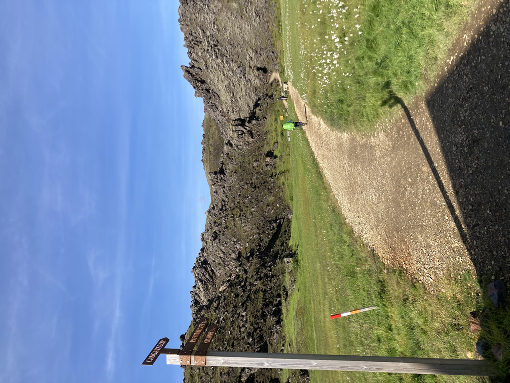
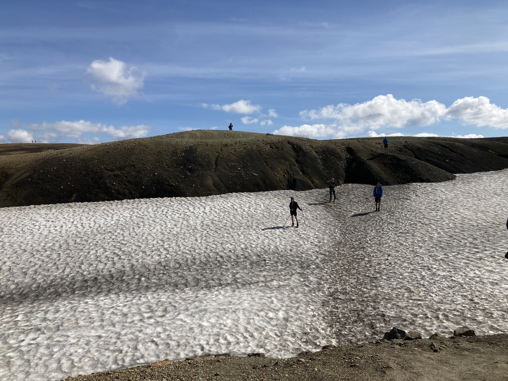
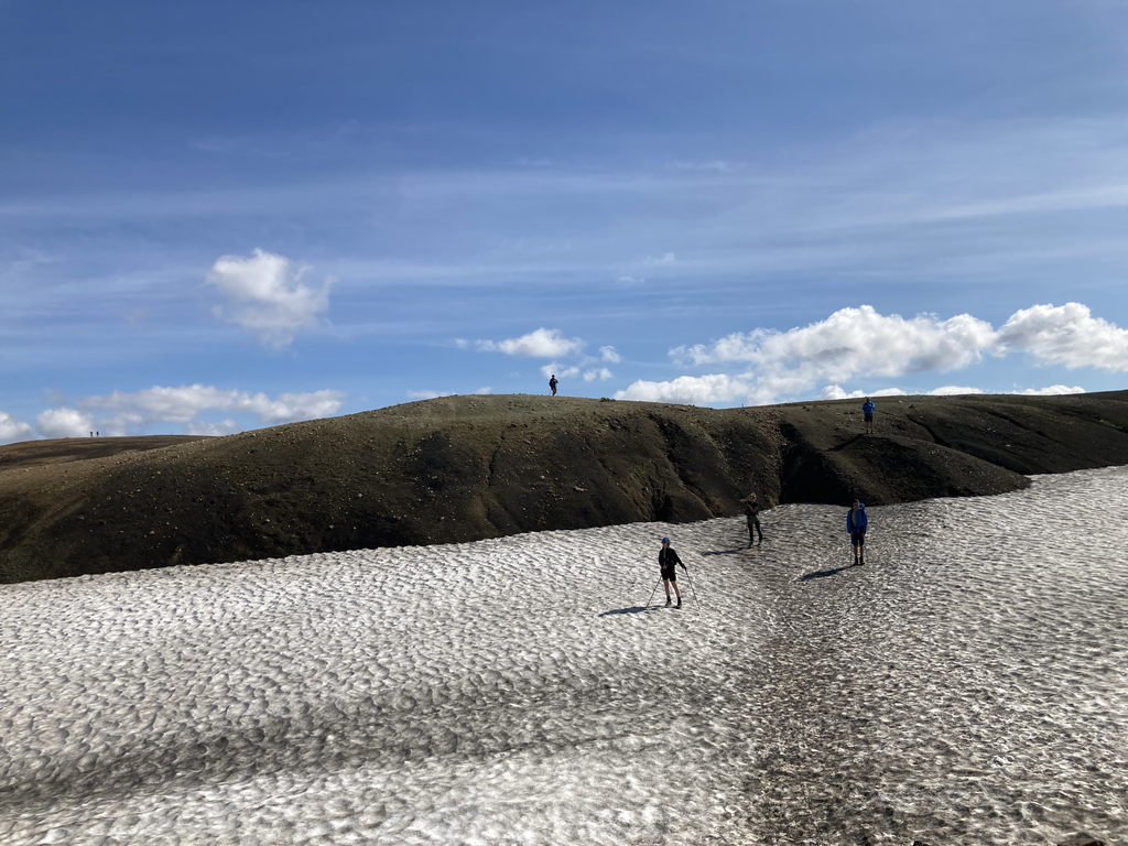
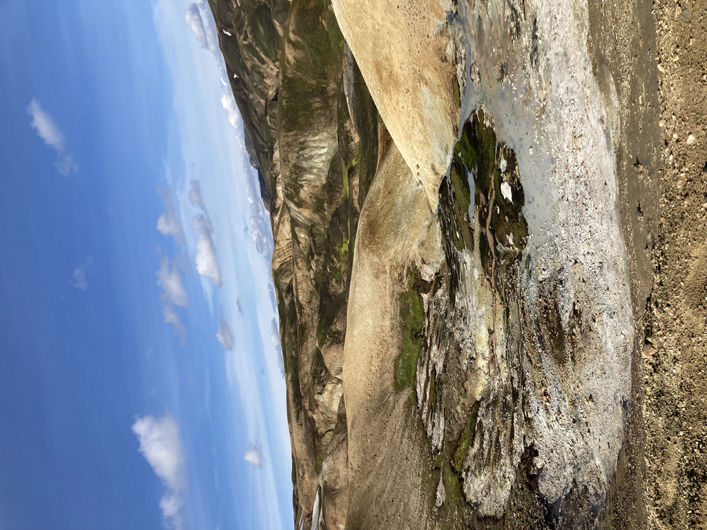
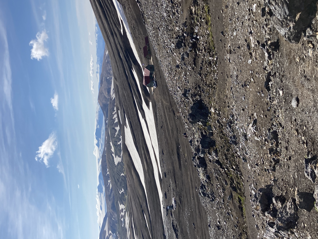
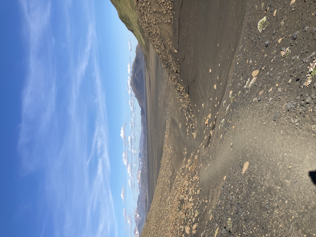
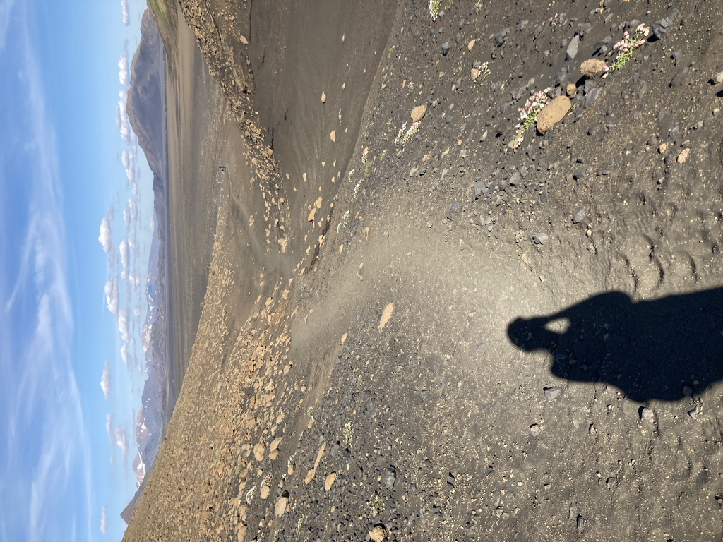
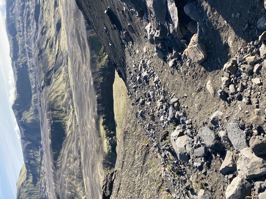
As you can see from the pictures the scenery is mind-blowing. I think my favorite part is always the first 20km even when they are the hardest. There were spectacular geothermal vents letting off steam all over the place, there was snow, and snow bridges that make for an interesting footing. The endless lava fields that just seem to go on forever and then the deep gorges at the southern end of the trail carved out years previously when volcanic eruptions melted the ice caps and caused huge amounts of melt water to rush down the mountains and into the valleys. Pretty spectacular and words and pictures don't do it justice.
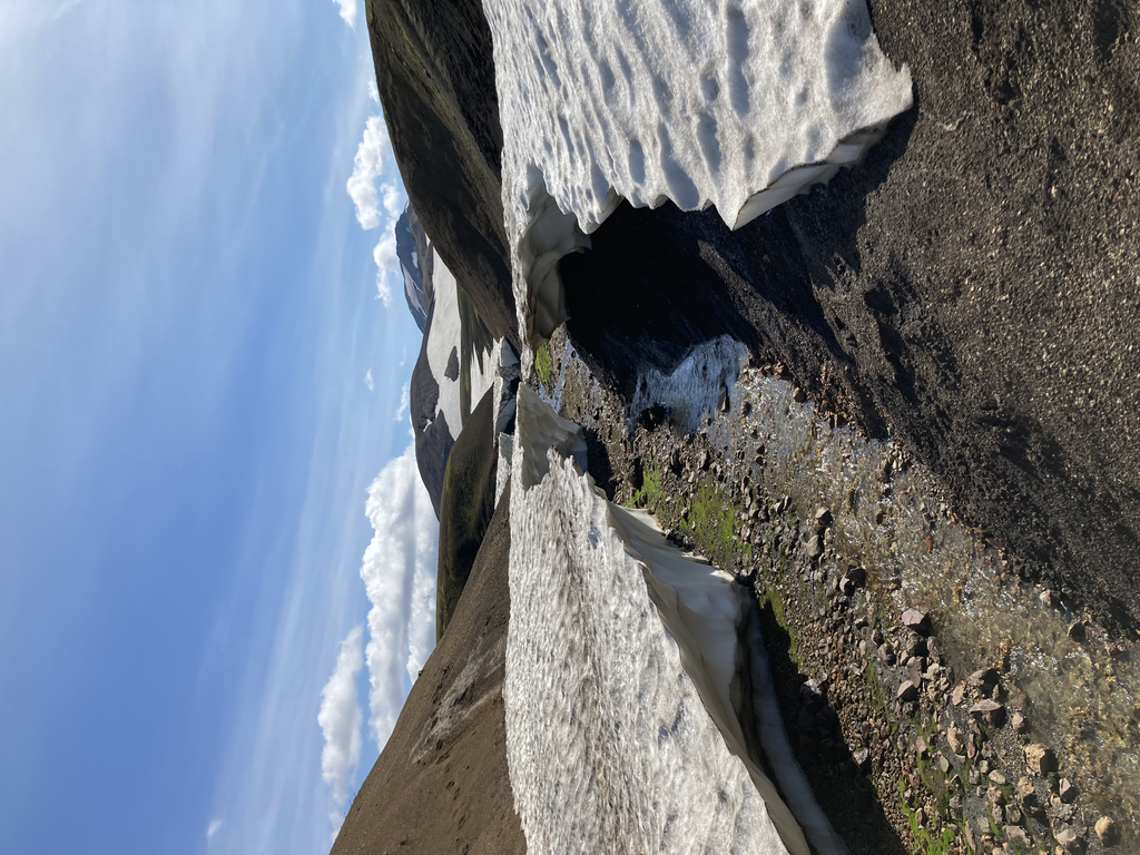
The first section from Landmannalaugar to Hrafntinnusker is 12km with almost 500m of elevation gain, looking at the striped rock in shades of reds, greens, and oranges, and walking on snow a bit here and there as well. The uphill is mostly gradual except for two very steep parts, which are nearly vertical. I was happy to see the hut at the time of the mountain that marked the end of the first section and and the highest point of the trail.
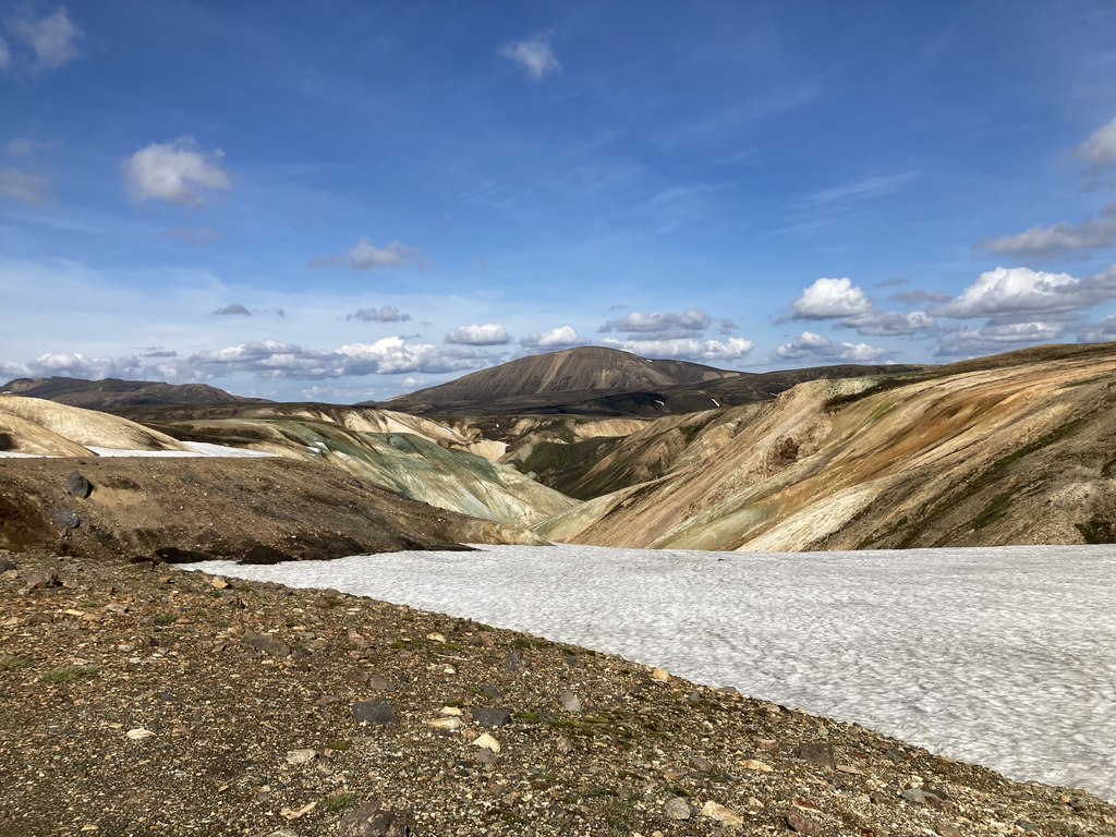
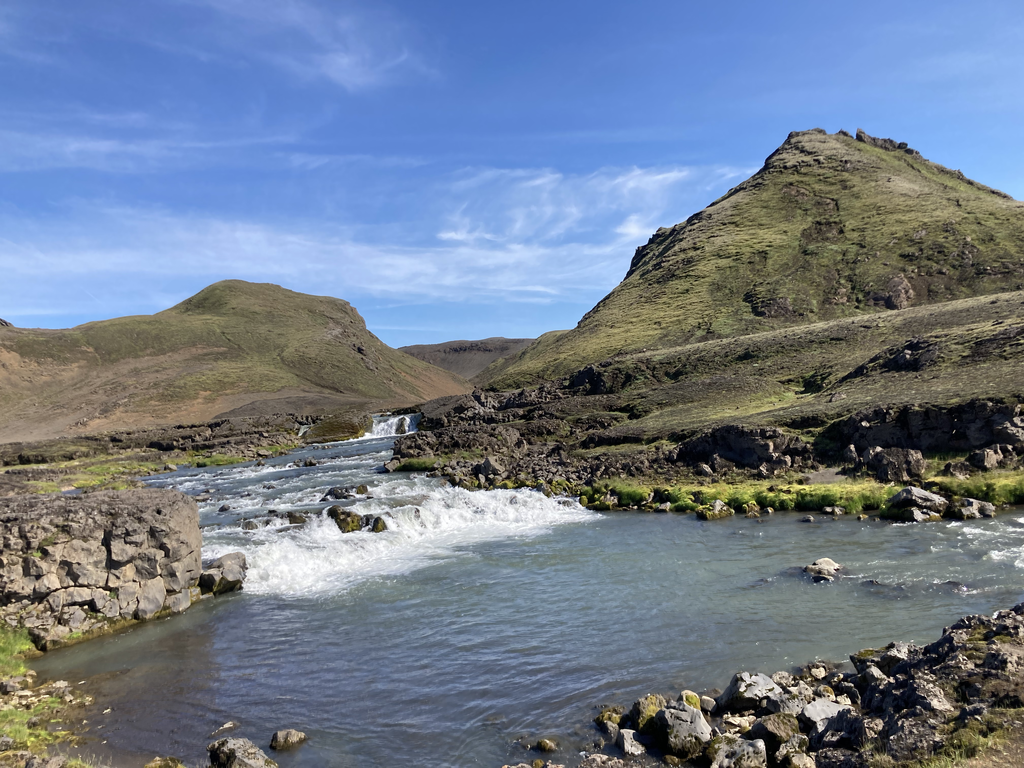
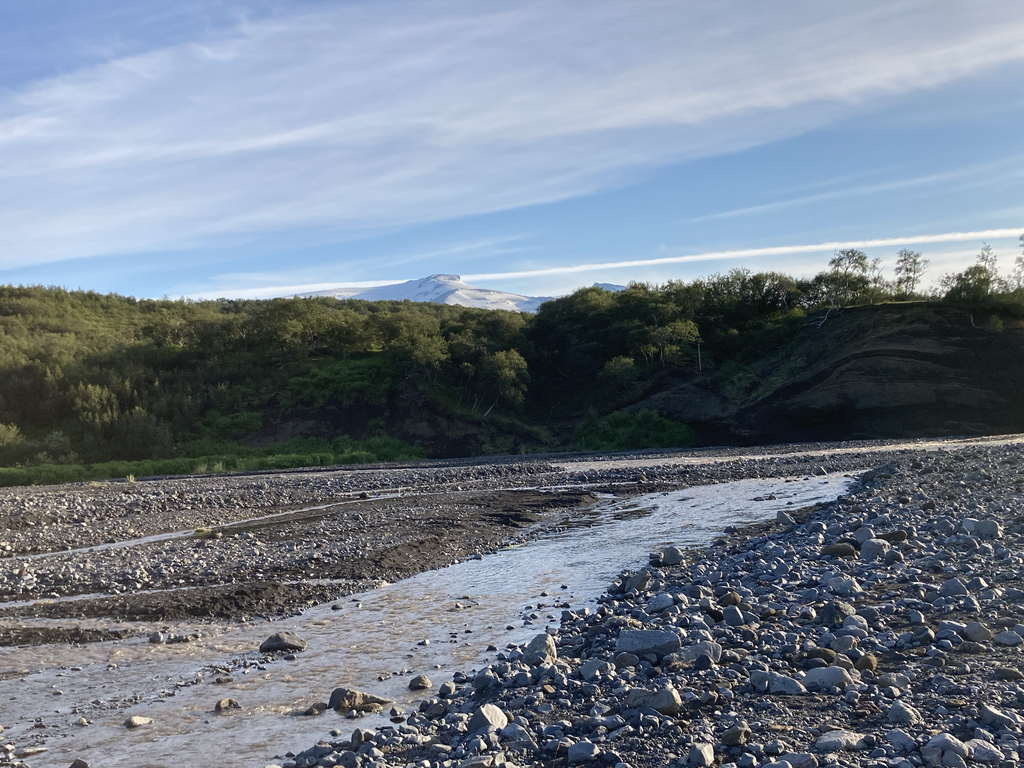
I continued through a flatish section, followed by a steep climb. With greens, browns, and snow here and there. I was so lucky to have a clear view, to see a glacier to the left and impossibly green peaks in the valley below. It truly looks like you’re about to descend into another world. There will be a few ups and downs, some of which are quite steep and on clay, here I was so thankful I had hiking poles, before a final steep downhill to the greenery below – and the first river crossing. This one was not too bad with the water below my knees. The river crossings are handy to refill the water bottles, in general as long as the water doe not smell of sulphur it is ok to drink.
Another 12km later and I got the lake and the second hut and just continued. From here the train got really quiet. I probably saw a couple of people in the next section, where I got a little desperate. Even when it was fairly flat. I found my second and wider river crossing. This one felt much colder to me than the first one, probably because there was more water and it was longer to get across and deep, the water got to my thighs.
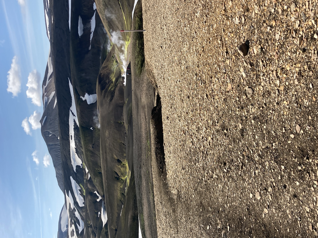
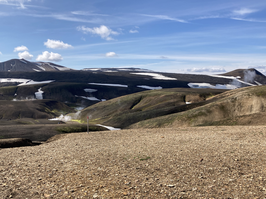
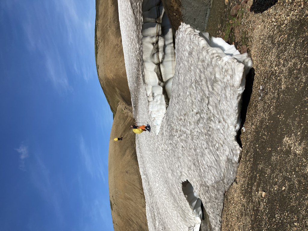
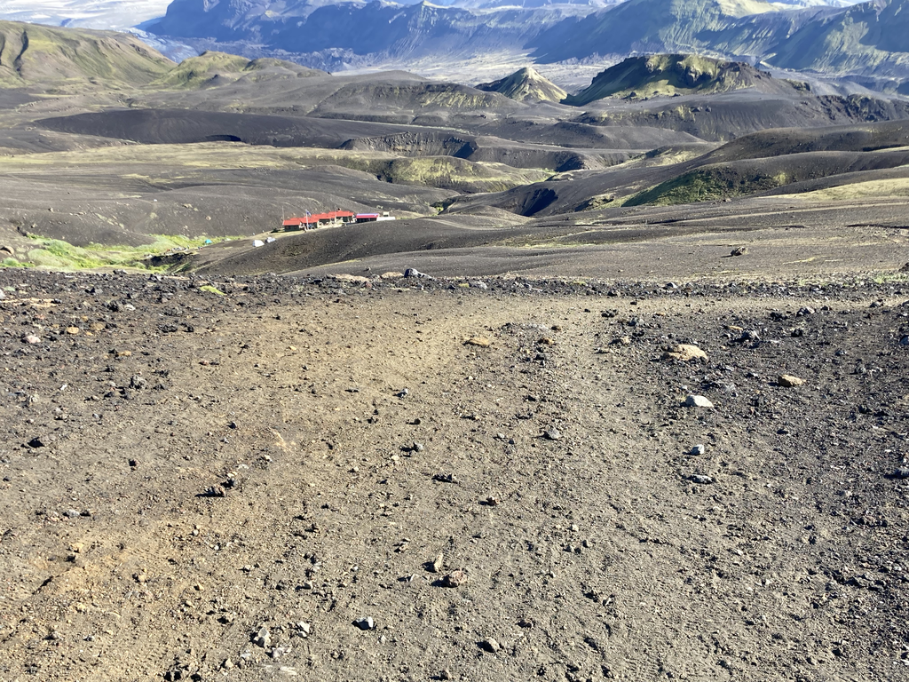
I used the river crossings as my rest, as I needed to change may shoes. After the river the desert started and It felt longer than what it was. It was windy and the black sand was not welcomed but my sunglasses helped. The landscape is mostly black with dramatic, jagged mountains. Here I realised that if I was going to do it again I would bring gaiters. The sand got all in my shoes and it was just not comfortable. This eventually took me past some glaciers and to a beautiful glacier view at Botnar, where the final hut before the finish is and where I stopped to take my shoes off the removed all the sand from my shoes. I was looking forward to the final 16km but not looking forward to the steep descent and the last river crossing.
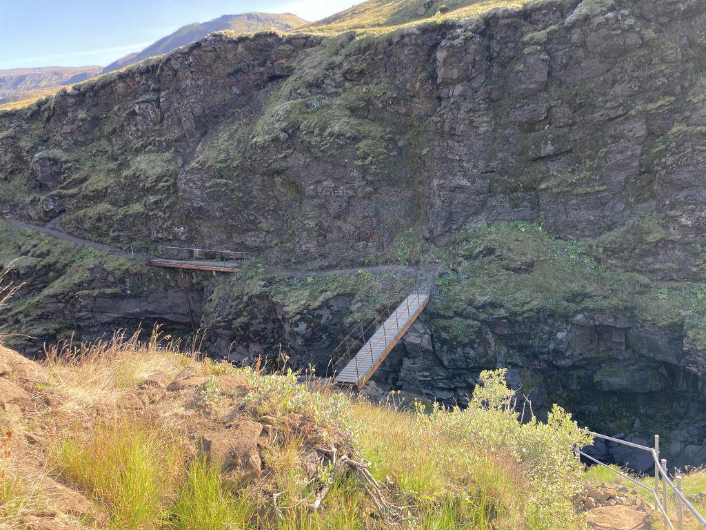
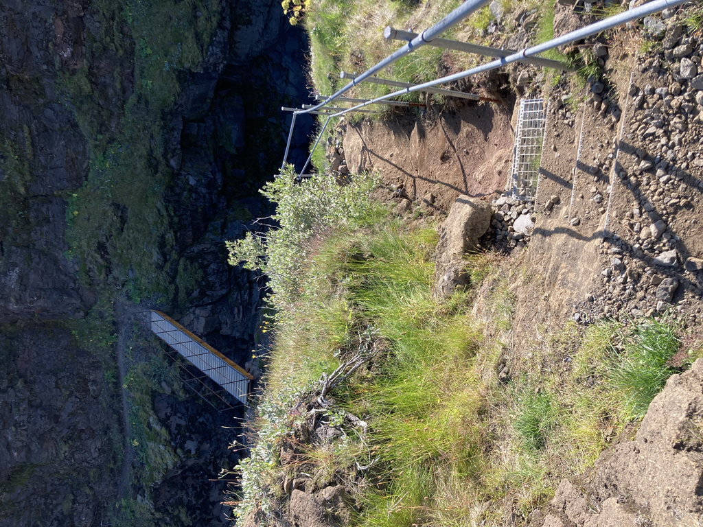
I went downhill a bit towards the canyon. There’s a steep descent down to a bridge where you cross the river, followed by the trail along the canyon edge with beautiful views.
You’ll follow this before another big uphill and eventual the big one, the final river crossing for the Laugavegur trail. I was already feeling drained and this was a pretty big river. It was the wider one and the current was strong the river was deep. Although it’s not necessarily deep, it takes a long time to cross because it’s quite wide. Normally you would watch other people do it first to see where the better spots to cross are but I was totally on my own and no one insight or coming close. I tried the first time and the current was so strong I turned back. I started looking everywhere trying to find a better place to cross, then tried again and this time I was just determined not to stop and after a lot talking to myself and managed to cross. This scared me and took every little bit of energy I had left but I knew I was now close. My feet were totally frozen, it took me sometime before I could start moving again
From here, it’ll be another uphill and then eventually a downhill to Þórsmörk. I got down to Þórsmörk in just over 9 hours, pretty shattered and ready for some warm and salty food, I was tired of Maurten gels. You know when you get to the end of a run or a long walk and all you can think about is the place you're about to crash for the night, the fact you can finally stop, and just relax? Well, as you can imagine, I had this great feeling towards the end of this run, I felt reenergised and tired, hungry and content all at the same time. I had made it in one piece and I was ready for warm food. I checked in the lava huts and had 2 bowls of vegan soup, salad and alcohol free beer. I texted my husband to let him know I was safe and at my destination, which he knew because he was tracking me with a SPOT tracer device I was carrying. I found my room, collapsed for a good night sleep ready for the the next morning to continue to Skógar on the Fimmvorduhals trail. This route was also breathtaking it took me past waterfalls and what was, to me, the most beautiful day with glacial views and water carved canyons all along the way. It’s also about a 1000 m gain and then loss, some descents I had to do seated they were so slippery and steep and it felt super intense to me. After 2 days on my own on the Icelandic trails I was happy to see my husband and get some rest to catch my flight back to London and get yet another covid test.