Start and finish at the Dam. The Wägitalrundtour has quite some history and the interpretation of the route has changed over the past years (http://people.ee.ethz.ch/~mhuss/download/waegital/geschichte_waegitaler…). In the beginning, the route was seen as a combination of all peaks in the vicinity of the Wägital. In the meantime, the consensus is more that the route follows the watershed of the Wägitalsee. So in comparison to the here published route, I left out Bockmattli but included Chruter.
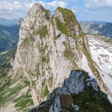
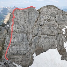
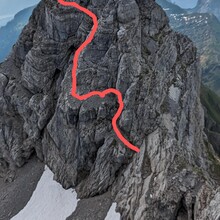
My definition of the challenge is: Follow the watershed of the Wägitalsee by staying on the ridge wherever possible. The route should include the "Brennaroute" up Schiiberg, the transition between Redertenstock and Mutteristock either via East ridge or through the Northeast wall as well as Ochsenkopf via Northeast ridge as these are the highlights of the route. The difficulty of the whole route is T6 with exposed climbing up to III depending on the exact route. The route requires a solid preparation and a good level of technical scrambling and fitness. There are plenty of detailed route descriptions to be found online for the cruxes of the route. Water can usually be found near Zindlenspitz, Oberalp and near Nüssen. But be aware, that they can also run dry depending on time of year.
I found perfect conditions, with still some snow left on Mutteri for a speedy downhill and fresh strong grass on the steep grassy slopes of Ochsenkopf and Ganthöchi.


