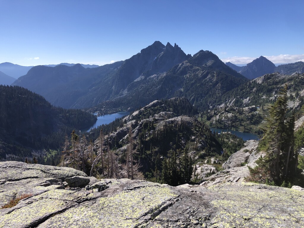
Route: I generally followed Mr. Canham's route, trying to learn from a few of his mistakes, and it went pretty well since I managed to only lose a few minutes to wrong turns. After the scramble (see below), the route is easy to follow if you're using GPS,consisting of fun rock-hopping with only a touch of scree. The only improvement I considered was to go south of Chikamin Lake. It looks fine based on pictures and maps, but it would be mostly scree rather than solid rock. Hard to say if it's better, but it is interesting to consider with the melting of the permanent snowfields on the north face of Chikamin. I assume it would still be considered the "standard route" on this lollipop, since you hit the named waypoints (if you tag Chikamin Lake). Chikamin Lake was totally socked in, so unfortunately I don't have a better report for you. If I did this lollipop before the snow on the north side of Chikamin Lake is melted out (which only happened a few days before this effort, based on satellite imagery), I would bring an axe and try that glissade; it could potentially save 15 minutes from the standard post-melting clockwise route.
The Scramble: I had previously scouted the base of the scramble up from the PCT and decided that going up the gully was the best option for me (not being a climber). (Get to this gully by going 200 yards past the high point on the PCT, then following a drainage up until traversing to the right under the cliffs.) I initially followed the left side of the gully, then cut over to the middle ridge when the gully split into a left and right branch. Neither the (climber's) left branch nor the right branch looked great, with the left being marbley (pebbles on slab) and exposed and the right being loose and hard to enter from where I was. So up the mini ridge in the center I went, biasing to the right. It's a bit loose in spots, but the few class 3 moves are on good rock with beginner-friendly holds. That right (east) branch might be better to go down unless it turns out to be marbley instead of just loose, but I'm very glad that isn't necessary for this route. (See my labeled pictures on Strava.)
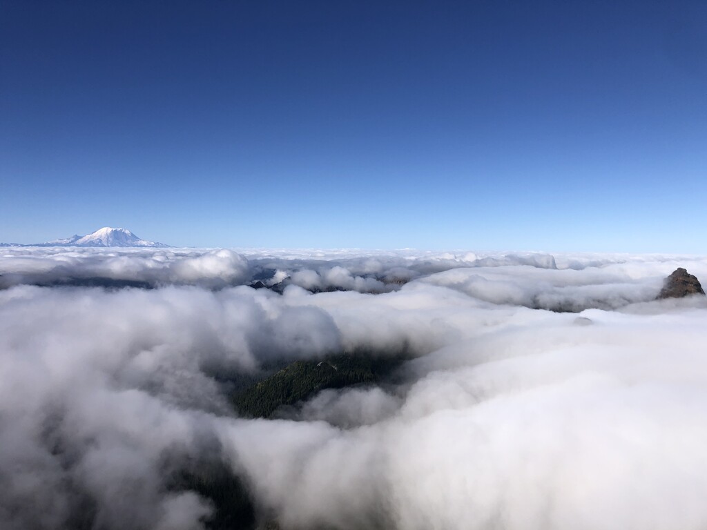
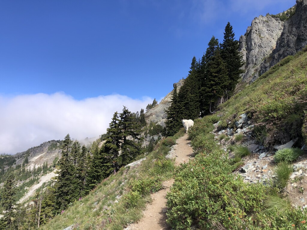
My run: I went solo and carried all my gear, filtering water at all the available sources. The dew point at Snoqualmie pass when I started was 45 F, with a high temp of 70 F, which is pretty cool for August. Cooler days happen but today had good cloud coverage for half the day and some rain a week ago made the trail faster, so I took this opportunity while I had it. Going up through the cloud layer (5500-6500') was wild, especially in the shadow of Chikamin when the fog turned an eerie blue (it's rare to so quickly pass from sun-illuminated cloud to blue-sky-only-illuminated cloud). I intentionally took it easy on the approach to make sure my legs were in good shape for what I thought could have been a sketchy scramble. It turned out to not be necessary, and making up my 20 minute lag behind Mr. Canham (at Ridge Lake) took some steady effort for the rest of the route. My legs threatened to cramp up around Alaska Mtn on the way back, but I managed to rehydrate and keep the glucose flowing to stay on track. At the end of the day, the off-PCT section appears to have added an hour of time on top of my otherwise average pace of 12:30 min/mi. Wildlife tally (in order of appearance): 2 grouse, 1 goat, 1 C-130, 4 F-14s.
Water Conditions: I usually only carried half a liter in my primary filter bottle but grabbed 1.5 L at Glacier Lake (using a 1 L soft flask) in preparation for the long dry stretch (8 miles to Ridge Lake). The ponds after Huckleberry Mtn (Huckleberry Tarns?) were dry except the lowest one looked like you could filter from it. I'm not sure how much the half inch of rain we got in the last few weeks helped this situation. I did not grab water here since I still had enough from Glacier Lake. I filtered at the creek 3 miles up the PCT (both directions), Ridge Lake (both directions), the pond just behind Chikamin Ridge (let's call it Chikamin Tarn while I'm making up names), on the way down to Glacier Lake (tons of options), and Glacier Lake itself.
Trail Conditions: Recent trail work has cleared all the trees across the PCT, but this is still a pretty rocky stretch so it's hard to relax except for the few miles closest to Snoqualmie Pass.
See my planned route with some research notes here: https://caltopo.com/m/UCPP2