I'd scouted this ridge in June 2020 from Mailbox to Bandera in search of "fun" runs near home. It was rainy and cold when I scouted Mailbox-Dirty Harry's, and I told myself I'd never do that section again. When I scouted Web-Bandera, the blueberry bushes were still plastered to the ground from the freshly-melted snow, forming a slippery abrasive mess, and I told myself I'd never do that section again. Well here I am, having done both of them (and more) again. I was inspired to do it by some chatter on the "PNW Peak Baggers" Facebook page. I had no reason to believe the trip would be much better this time, but dry foliage, dry rocks, and bushy bushes really made a huge difference. I think I might even do it again!
Time: Running out of free days this summer, I decided to take on the route even though the forecast called for warm, sunny weather. I haven't done any warm-weather conditioning, and it showed as I started to cramp up on Defiance. The cramps continued through the rest of the run and I continually dialed back my pace. I estimate it accounts for about 2 hours, so this route should be quite doable in 8.5 hours. I expect the fastest folks in the area could do it in 6 hours. Here are my splits (h:mm):
- Mailbox: 1:12
- Dirtybox: 1:28 (+0:16)
- Dirty Harry's: 2:21 (+0:53)
- Web: 3:32 (+1:12)
- Putrid Pete's: 3:43 (+0:11)
- Defiance: 4:19 (+0:36)
- West Bandera: 5:25 (+1:06)
- Bandera: 5:47 (+0:22)
- Pratt: 7:01 (+1:14)
- Tusk O'Granite: 8:40 (+1:39)
- Granite: 9:20 (+0:40)
Water: There are only 3 useful sources on the route, so I started with 4 L and drank 1 L from each source:
- Small trickle between Dirty Harry's and Web, right before leaving the main Dirty Harry's trail. Not sure how long it will last, but it was more than enough to filter from. A bit further up, there's the small pond at the head of Granite Creek. It looked like there was still water in it, but I didn't get close enough to 100% confirm.
- Mason lake.
- Island lake.
Route conditions for each section:
- Mailbox to Dirtybox: This is a bootpath with some scrambley moves. A little brushy, nothing painful.
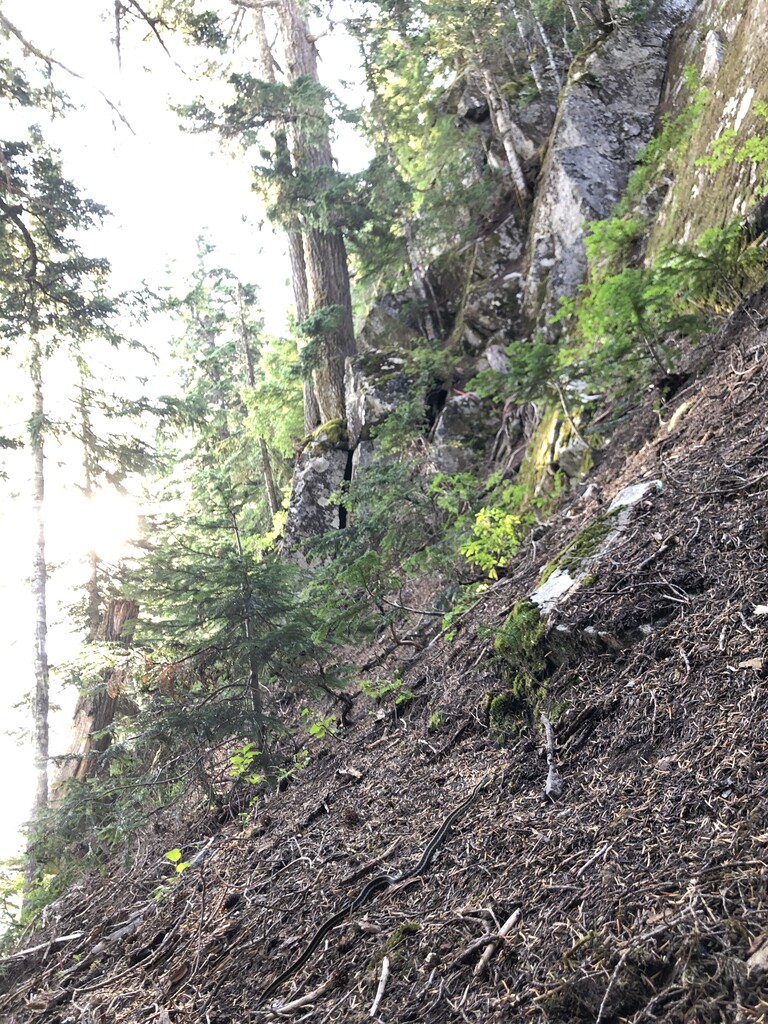
- Dirtybox to Dirty Harry's: As has been said many times, this is the interesting part. It alternates between knife-edge ridge, bushwhack, and side-hilling. I kept muttering to myself to "just do the ridge" knowing that staying on the knife edge is generally the best route. There's really only one spot you drop off the ridge. I'm no climber, but I really enjoyed the scrambling. The way I went never felt as sketchy as the Haystack scramble on Si. There are a few spots where it's tempting to put your full weight on a single boulder; these are the most dangerous spots in my mind (should the boulder move). The ropes on the last pitch are secure. There's even two ropes for most of it. I recall the pine needles being much more slippery when I did this in June. I did pine-needle-ski for about 5 feet trying to avoid the garter snake napping on the trail just before the ropes (see picture), otherwise the footing was solid.
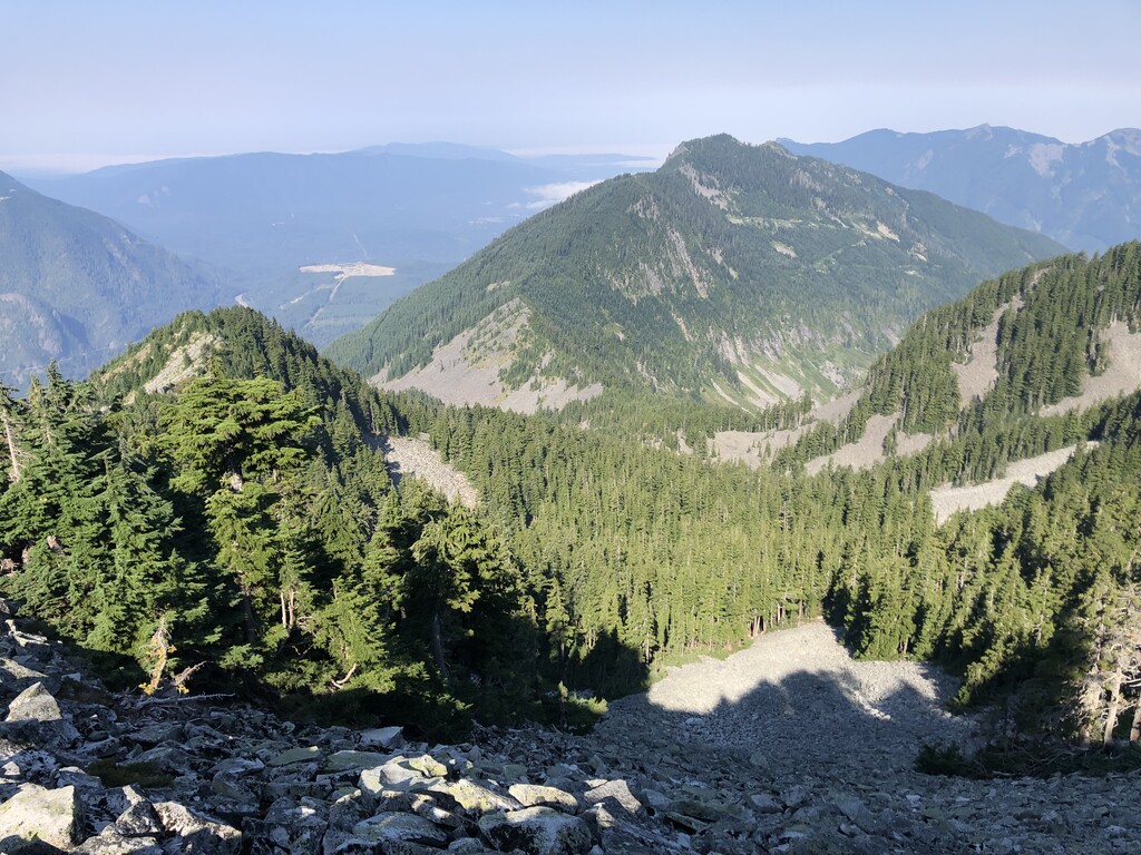
- Dirty Harry's to Web: Trail then bootpath then talus scrambling (see picture). The brush is stabby for the first 100 yards after splitting off from the main Dirty Harry's trail, then it's a good path. There were are least 3 varieties of stabby plant in that stretch, with devil's club surprisingly not making a memorable appearance.
- Web to Defiance: A popular ridge path exists, mostly 50' below the ridge to the south. Short detour from the path to tag PPP. Stay high when approaching the trail to Defiance.
- Defiance to West Bandera: My first significant deviation from Mr. Forbes' route was descending Defiance via the trail rather then the SE ridge. I'm sure the ridge is reasonable in spring, and it looked fine from the top, but I knew the bushes lower down would negate any benefit from trimming off 1/4 mile.
- West Bandera to Bandera: A fine bootpath, similar to Mailbox-Dirtybox but with more rock hopping.
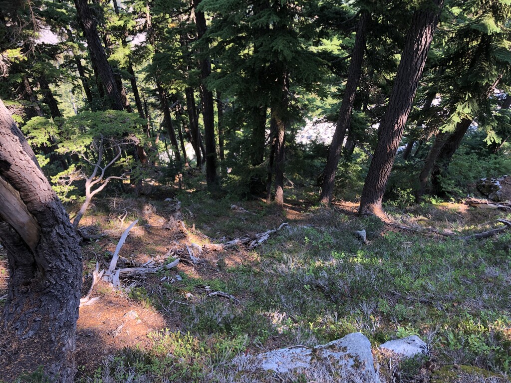
- Bandera to Pratt: The drop off Bandera was the worst 40 minutes of the day. With my experience from a scouting trip and using some new LIDAR data from the state, I dropped directly off the north ridge of Bandera (see picture). It's steep but has solid footing/veggie belays. Further down, I got into the same mess of cliffy thick blueberry bushes as last time. I followed a game trail then dry stream bed for most of the bushwhack. I saw some fresh bear scat, so I spent the descent chatting to the invisible bear. Wouldn't be too hard to sneak up on one, depending on how silently you bushwhack. I'm not convinced this route is better than going back around Mason Lake. I reckon you save 15 minutes, but at what cost? From the trail up to Pratt is a simple scree scramble, even with cairns.
- Pratt to Tusk O'Granite: My second significant deviation from Mr. Forbes' route was following the SE ridge of Pratt down to the trail rather than down-scrambling the scree. I saw multiple Strava tracks doing it, I've scouted the ridge from the trail at the bottom, and it is in the spirit of a ridge traverse. But it wasn't worth it for me. Maybe if you do it a lot and know the best way it would be fine. But I had some un-fun bushwhacking trying to follow the bootpath. From the trail, I joined the ridge where Mr. Forbes did, up some talus. The NE-pointing portion of the ridge route was surprisingly open and easy to navigate thanks to some big trees. After it turns to the east however, the trees get smaller and sticking to the scree on the south seems to be the best way. I ended up on the ridge or even to the north a few times, rarely with a happy ending.
- Tusk O'Granite to Granite: I don't remember much of this, maybe because I was significantly dehydrated. It's a cakewalk compared to much of the rest of the route. Apparently I stopped at the saddle to write a note for future me to "stay on the right side". Do with that what you will.
Gear: I brought knee-height gaiters and full-fingered gloves, thinking I would use them for bushwhacking. But it was never bad enough to warrant donning them. Maybe if the weather were cooler I would have worn them for the Web, Bandera, and Pratt bushwhacks.
See the route I followed and some notes along the way in the "Mailbox-Granite Traverse" folder here: https://caltopo.com/m/4ASJ