On Sunday, 10 July, I ran this segment of IAT in 13:08. Thank you much to previous runners Peter, Christopher, and Drew for their beta and inspiration!
My overarching goal was to run all the way across Dane County on the IAT, as described by the "Dane Drifters" IAT chapter. That involves 2 more sections of trail at either end so as to traverse the entirety of Dane County. I had learned of Peter's FKT journey and segment last year, and I didn't know it was lowered this year until just recently by Drew. Among those two, Peter began his FKT with several miles off-route right in the beginning, but he persevered; Drew's phone died at the end of a sizeable FKT effort, so he came back and ran it faster! Both of those stories had me inspired and intrigued, to push the route all the way through and try to keep the pace.
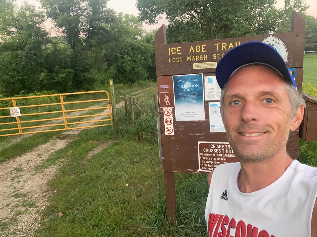
I started at 5:25AM, right around sunrise, as my Dad dropped me off just outside of Lodi. I crossed the marked Columbia/Dane county line at almost exactly a mile, in 11 minutes, and then crossed into the next section (FKT start) at 34 minutes.
The weather was great, with relatively lower humidity and high temps in the 80's F, when it could be much worse, and mostly clear weather. More clouds moved in during the afternoon, and they were welcomed. It also hadn't rained for a couple days, so the dirt on the trails were dry. The main things to contend with were shoes and socks that were immediately wet from dew in the numerous grassy field and meadows sections, and having my head/hair/hat doused in mosquito/deer fly repellent. Both of these things are familiar to anyone on the IAT. My gear mistake was not carrying enough water, as I had just over 40 oz total with a water bottle and a collapsable Lifestraw. I figured there was enough stream or swamp crossings, but they really weren't there in the 2nd half when I needed them, so I had sections of rationing. I also had pleasant hydration surprises like the bubbler at Indian Lake, bottle filler at University Ridge golf course, the vending machine at the soccer field in Verona, and maybe borrowing from a yard sprinkler.
My other challenge was the road connecting sections. One reason why I think routes like this have become popular is because navigation is "easier" with phone apps. I sketched some road turns on paper as a backup, but still missed several key road turns and had to backtrack, as I was rationing phone battery life and trying to memorize upcoming road turns with increasingly unreliable mental capacity. By the middle of the route, I was up about an extra mile from a few tenths of a mile missed turn and backtrack here and there. Eventually I figured out to click on the upcoming mileage for turns and try to remember those numbers as well. So myself or anyone could easily save time by nailing all the turns and planning water sections appropriately.
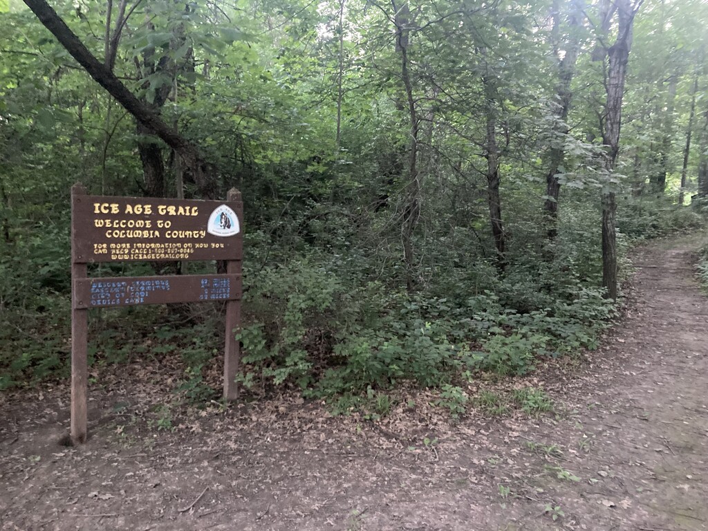
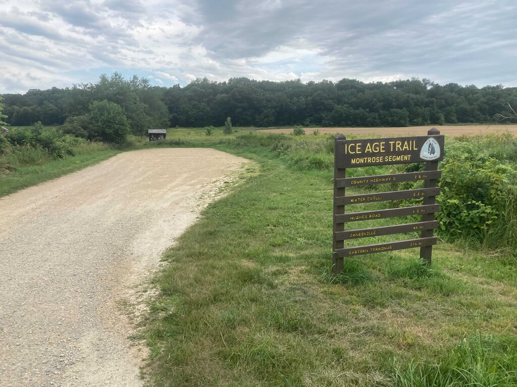
Also, the IAT is fluid and ever-changing. Note that there is a mile or so of new trail (through farmfield) just south of Cross Plains that is well-marked, and no appreciable distance difference than the previous road route and original route on this site. Also, there is a small section of trail (a few tenths of a mile) by Badger Mill Creek that seems to have been closed since late 2020, but should open again soon with a small trail re-alignment. My route here matches with the previous FKT, generally following the app for connecting routes and then following blazes on trail gets you there.
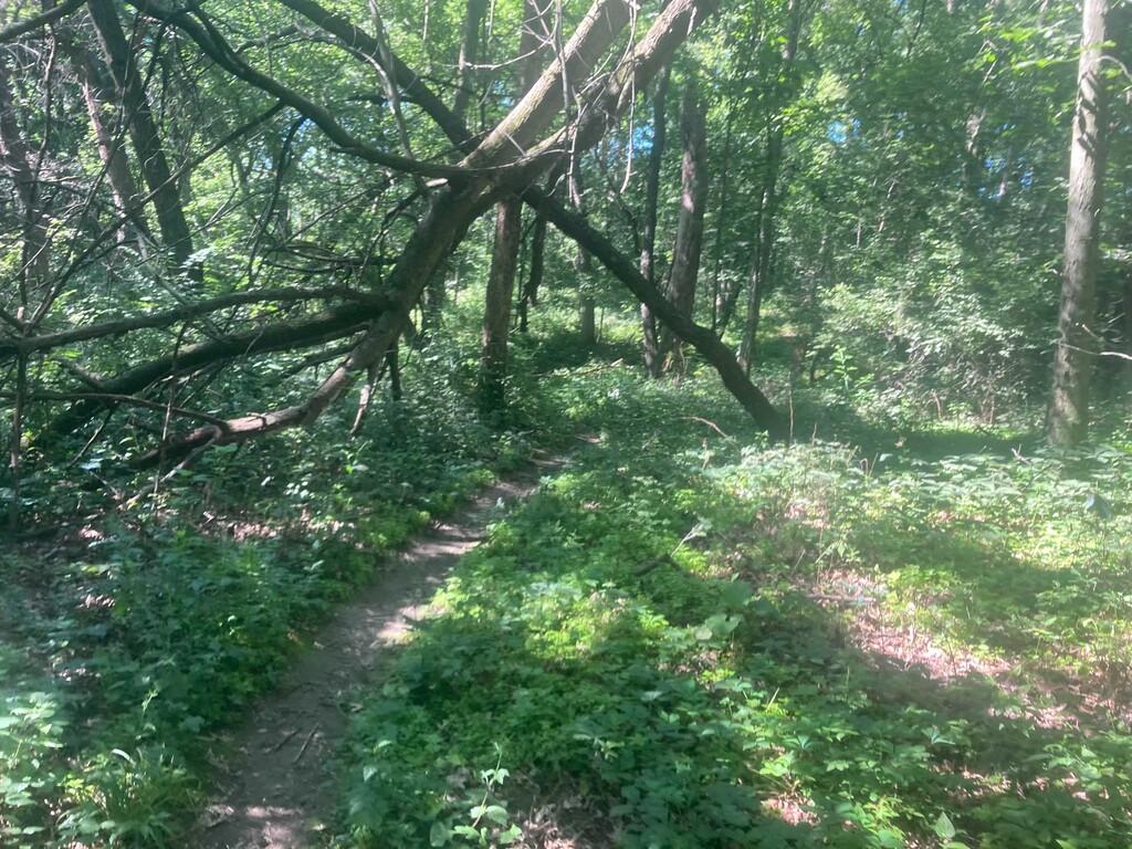
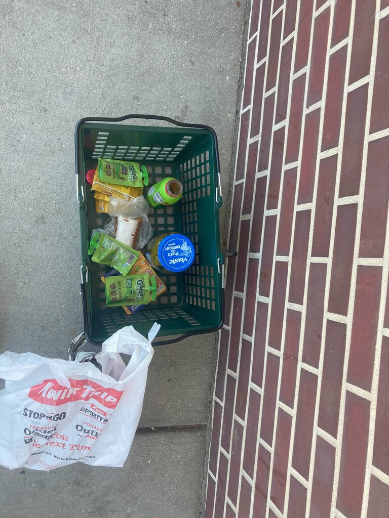
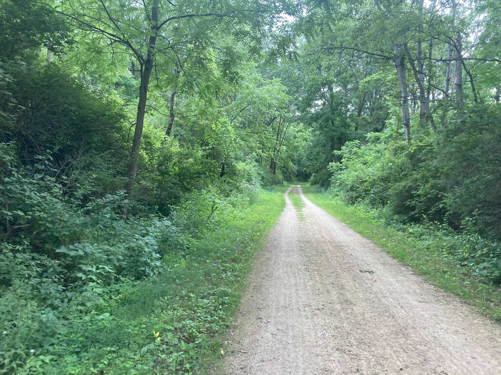
As for the run, things went well and the trail is smoother/more runnable than, say, Baraboo Hills or North KM. It was a really nice variety of trails and roads. I made sure to hit Springfield Hill loop as the others did, and also keep my eye out for the Liebetrau Prairie section as well. The town of Cross Plains has some nice markings on the road which is always appreciated for a trail town, and this is the halfway point -- physically and mentally. And spiritually: not only because of an IAT headquarters building (closed, but with a nice bubbler out front, and small bit of trail through native wildflowers), but also because of a Kwik-Trip. I stocked up on goods there, spending 20-plus dollars and minutes. You could be faster and thriftier there if you wanted.
Despite being refreshed with icy beverages, plus what I was carrying, I was too-soon thinking about water again, especially on exposed road sections. I was then sloppy with time on water stops, looks like about 7-8 minute detours at University Ridge and the soccer field. So now I was eating into my margin, having a goal of being under 13 hours for the FKT section. Some of the bike trail sections in Verona were quite nice, cool and shaded by limestone, and a bit different experience with more traffic on bikes. Some clouds were building and a bit of distant thunder, it cooled things off a bit but actually made it darker and harder to see in the wooded sections. I was focused on moving, not missing a turn, and not tripping. But I was still thirsty, and approaching a marked "stream or river" on the app, only to find a stagnant algae-filled farm runoff stream. But I filtered it anyway (another 7-8 minutes), it filtered clear but I mainly used it for sipping and possible emergency use.
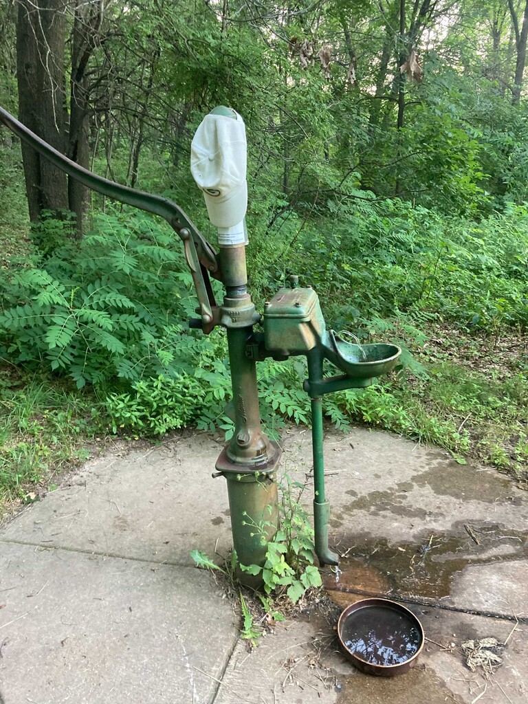
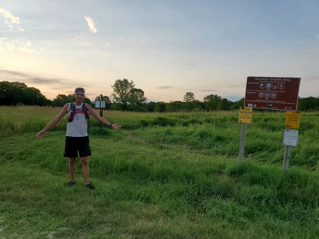
Finally I approached Brooklyn Wildlife and it was really clear I was not going to break 13 hours, and also I was still going to be late for meeting my wife. I didn't want to be just a few minutes under the previous (which can be annoying because the first person knows they could easily have cut a few minutes here and there) so I'm sorry I was closer than I anticipated! As these things go, once you have a goal you often start slipping into the minimum-ish to get it. I had to backtrack and wander a bit to find the final cutoff trail for the FKT finish, it was not obvious to me, but eventually you are going straight along a fenceline. I hit that parking lot in 13:08 from the FKT start (13:42 total), satisfied with that goal, and then backtracked to where I left the trail to finish out Dane County on trails (although at that point only a few hundred feet by road from the county line). After a bit of rolling, some fun downhill into tall pine trees, and then a wonderful water-pump, comically with a GB Packers hat sitting on top (I hope it stays). Although I was a mile from the finish and my wife was waiting and the clock was ticking, I could not pass up this marvel, so I drank joyously of the cold and metallic-tasting well water. And then at 14:16, I saw my wife in our car in an otherwise empty rural parking lot. For not the first time, I tromped out of the woods, tired and smelly and itchy.
I will be glad to read of anyone else's further adventures on these trails.
Cheers and happy trails!