
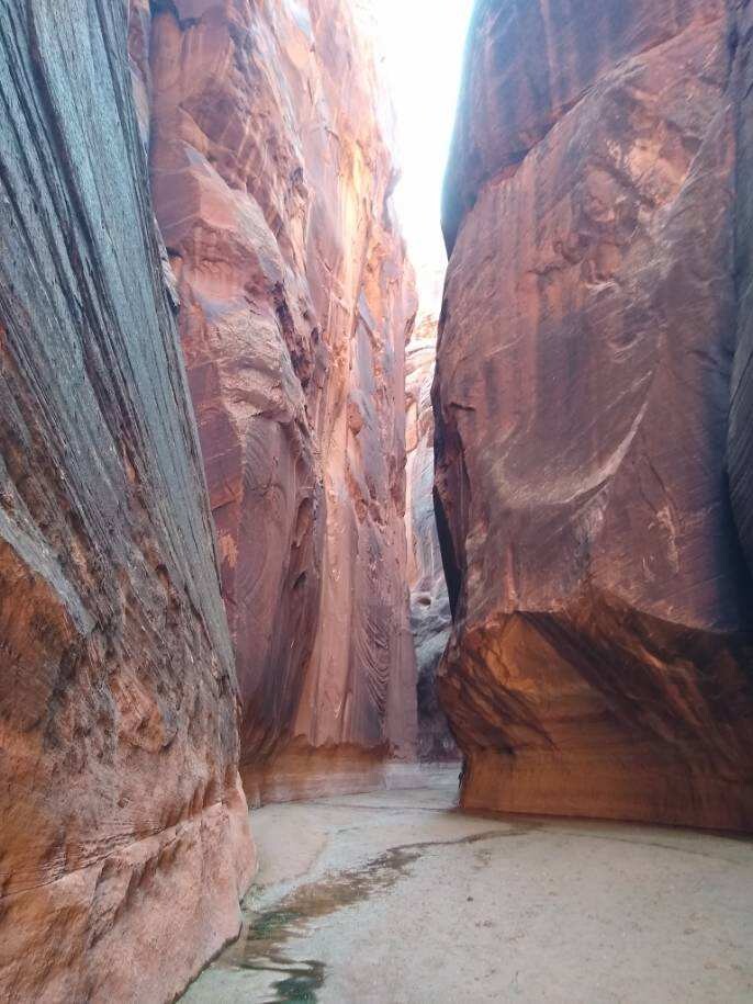

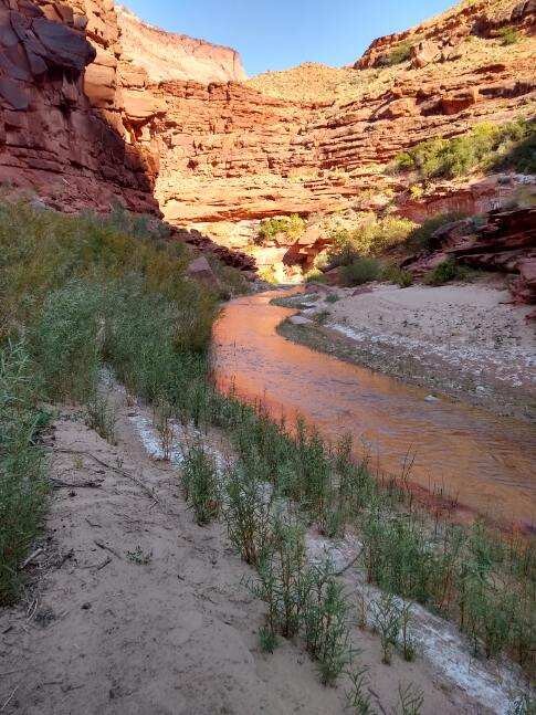
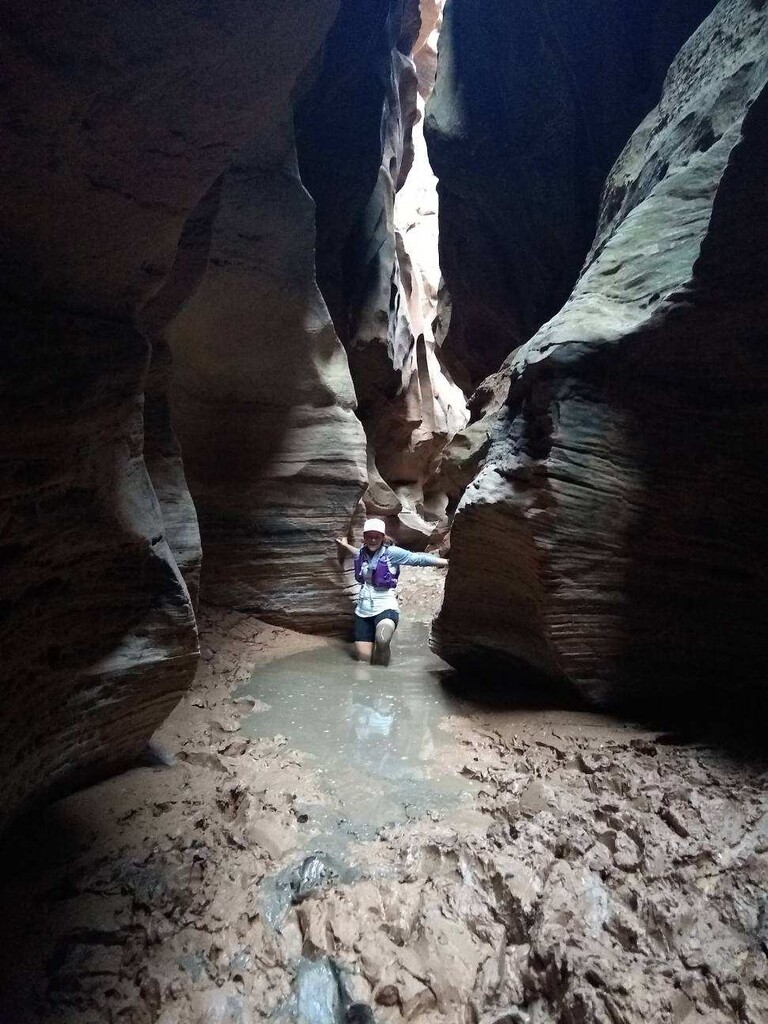
We started about an hour before sunrise, from Buckskin Gulch Trailhead (about 5 miles north of the Wire Pass Trailhead), which adds an additional 4* miles to the more common Wire Pass-Lee's Ferry route. We set out howling with excitement for the longest run either of us had ever done through a canyon that we had hiked over the course of 3 days about 5 years prior. We knew the beauty that we were in for, if not the mileage. The first 4.5* miles were in an open slick rock canyon before the narrows started. After about 1* mile, we met the Wire Pass confluence. Buckskin Gulch twists and turns, has rocky/cobblestone sections, hip-deep mud and a single rope down climb. Hundreds of feet of sandstone wall stretch above the trail, so narrow that they leave only a sliver of sky. The canyon walls are anywhere from an arms length apart to 10 or 20 feet. With the exception of the mud, there was very little water in Buckskin and we could mostly skirt around it when found. When we reached the confluence of the Paria, our GPS tracker said 18.7* miles. We had expected meeting the Paria at 16 miles, according to our route research, but nevertheless we were psyched and powered on. Once we were running in Paria proper, the canyon walls were more like 40-50 feet apart and sheer vertical sandstone. The Paria River is almost always running, and it was ankle deep for us with minimal silt, but it also had been a very dry year. We ran in and out of the river hundreds of times throughout the rest of the day.
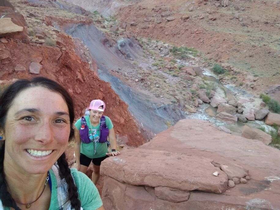
For the first 34* miles the trail was better than expected. We ran in ankle deep water onto hardened sand/pebbles on the canyon floor. We kept marveling at each other about how good we still felt. But at about 34* miles in the canyon opens a bit, the river gets deeper, faster and has more boulders. From then on it was hard to find shade. Running along the river became more difficult because the bank is steep and meets the river. Trails start popping up to offer higher and "shorter" routes over the river benches. Sometimes these trails are hidden. It was a gamble if the "shortcut" to climb up and down over the steep, sandy bench would be faster than taking the longer run along the river. Sometimes these trails were hard to find or the trail led to a campsite. Because of this, the next 10-11 miles were more challenging. At about mile 40*, the trail leaves the river and climbs steeply up on river right and gains about 200-300 feet above the river. The canyon is very open at this point and you get nice views of your future miles. Also, you have maybe 2-4 miles high above the river out of the water-- here we changed into a fresh pair of socks, considering this to be the final leg. We ran for a bit and then again met up with our meandering friend the river. From there on out we found ourselves climbing up and down the river benches, in and out of the river, and had to do a good bit of trail-finding to avoid the longer, rocky route next-to or through the river. In the end, our expectation was for 46 miles, but the GPS told us otherwise, and by the time we rolled into Lee's Ferry right after sunset we had complete 51.3* miles in 13 hours 5 minutes and 19 seconds. Thank goodness for families that are always ready for a party, with brats, beer and chairs in hand.
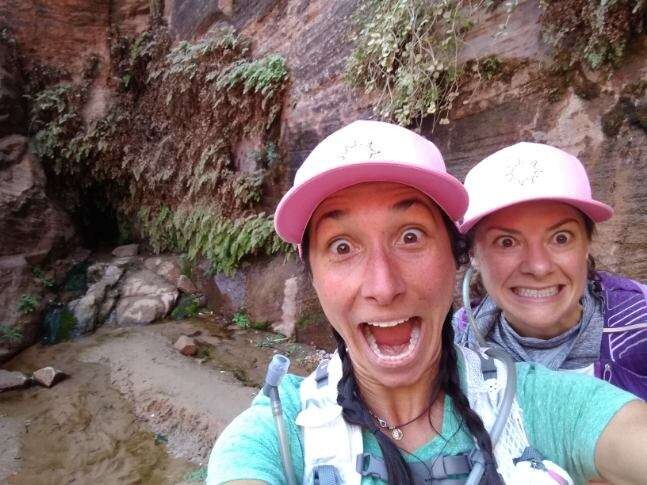
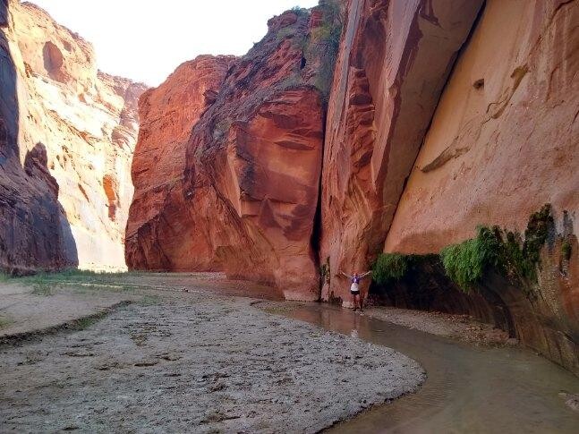
Water- We carried about 3 liters of water each, and refilled at natural springs within the canyon. The springs and campsites are not marked, so you need to keep track of where you are with mileage or canyon features. Our first refill was at Big Springs. Again we were expecting Big Springs to be at mile 22 per our map, but our GPS reported that we had run 25* miles. Other springs were listed before Big Springs, but we didn't find them. Big Springs was about 6* miles down from the confluence on the right side of the canyon/ river. There is a large campsite up on a river bank across from it and the spring is easy to find if you are looking for it. Usually you can hear the spring-- again, if you are listening for it (see picture of our crazy-eye faced picture- the Big Spring is pouring out of the rock hole behind us). We ran 13 more miles and topped our water off at Last Reliable Spring (mile 38*) preparing for the final push. The last 13 miles is through the canyon's widest part, it has major sun exposure so make sure you have enough water to make it to the end. Our backup plan was to use iodine tablets to treat Paria water if needed, but that wasn't our first choice because the water can be very silty and Paria Canyon sees many visitors.
Waste- you need to carry out all waste. The canyon is a narrow canyon with many visitors. If each visitor left their feces then there would be feces everywhere and detract from the canyon. We carried out all our trash and waste. For our solid waste we used and carried a wag bag.
*** all our distances were from our GPS device. They did not match the distances from a published Paria map we had. Distances likely vary depending on which trails are used to go up over the river benches and how much time is spent on trail vs. in the riverbed.
Comments
Awesome run ladies! The reason your GPS distances don't add up is because of the narrow canyon walls- GPS bounces off the walls and creates false readings outside the actual canyon, which adds both false distance and vert. You can see a number of clear examples on your GPS recording between Big Springs and Judd Hollow. That's why it's better to estimate mileage with maps rather than with GPS in terrain like this. My watch showed 54.6 miles when I ran Wire Pass to Lees Ferry which is clearly overstated, too.