


We attempted this route late in the season and were slowed by bad weather, including approximately 100km of snow ranging from 2-12 inches in depth. The section from Little White Mountain is unmaintained and unmarked over challenging terrain. We recommend completing this route under good weather conditions. This route requires good navigation skills, backcountry experience, and backcountry essentials. Depending on the time of year, there may be limited water from Cosens Bay to Highway 33. This route also includes a crossing of Mission Creek, which can be dangerous when water levels are high.
The Okanagan Highlands Trail struck me as one of the coolest lines you could draw on a map of our region. As soon as I saw it, I wanted to string together this multi-day trek into a first ever FKT. My partner in crime Julian Vicente thought the same, and after much planning and trip organizing, we set out on the OHT at 6:00pm on Friday night, planning to finish within 24 hours.
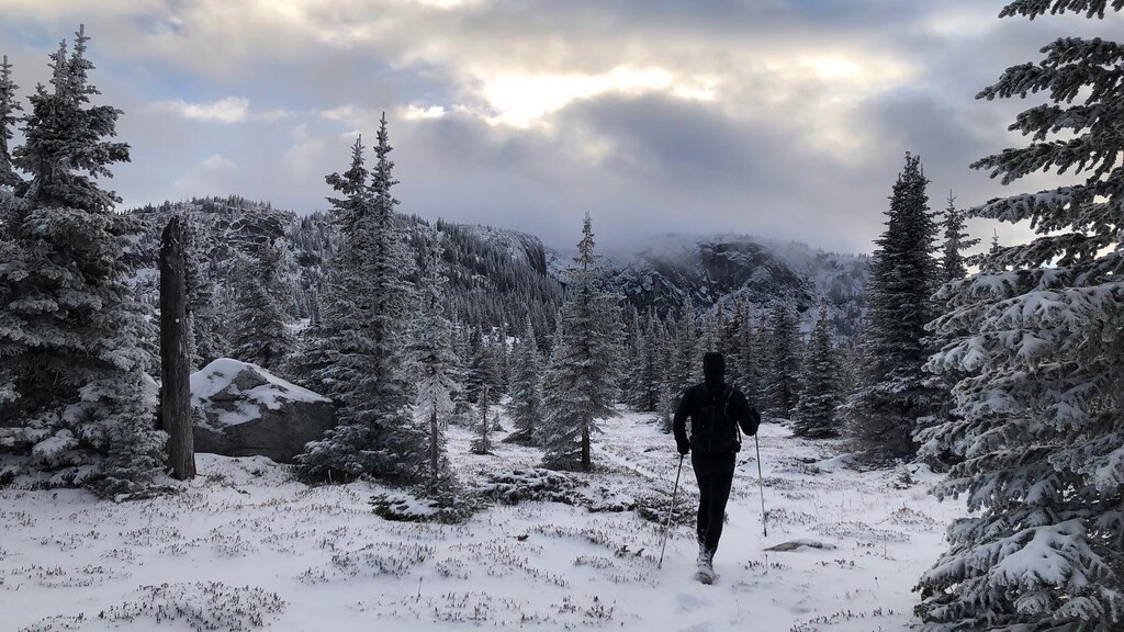
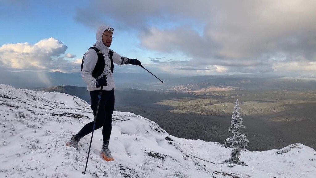
The first 62km went as planned, despite running through ankle deep snow most of the way and wading across a river at 5:00am. The next part of the run was more of an unknown. Things went great for the first 70km but snow, bushwacking, and navigation slowed us on our approach to Little White Mountain, making it clear this trip would go longer than planned. We broke out the light winter gear and climbed over the 2200m summit before dark, pushing through knee deep snow.
The next 40km were a disaster. As we moved across the wide alpine ridge west of LW, weather declined and trail markings were non-existent. We pressed on, assuming that the sub-alpine forest section would be better marked. It wasn’t. Instead, it was an un-maintained and almost unmarked section of dense bush and blowdowns (we had a 59 minute uphill mile over a jungle gym of blowdowns). We pushed on, using GPS watches to navigate. It was slow going, and we knew that time and the sub-zero temps would soon claim the batteries in our watches, headlamps, and phones. We found ourselves 30 kilometres from civilization in any direction, suffering from sleep deprivation and trying to stay warm in the freezing temps. Retracing our steps through the alpine at night and in winter conditions and during the night was not an option.
Preparation and teamwork is what saved us from an emergency bivouac in freezing temps. We had GPX maps on all phones and watches, an in-reach, extra batteries, a hand torch, ample food and clothing, 2 battery banks, and had compared pack lists before the trip to ensure we would be safe if all went south. By the time we emerged from the final mountain, we were down to navigating by taking compass bearings on a single watch.
What would I do differently? It would be more recon on trail conditions for new places and better mountain weather forecasting. I would also bring a map and compass for when all else fails. Hoping this reminds everyone to be safe out there.
⚠️Warning: do not attempt to follow our GPX after Little White. We got off-course several times in dangerous, unmarked, and un-maintained backcountry terrain.