
This route is a lap of the island of Malta. Malta is an archipelago consisting of 3 islands. Malta is the largest island and has the shape of a fish. I am Maltese and was mostly familiar with the Northern part of the island. I was very faithful to running as close to the shore as possible and hugged the coast as much as I could. In Malta we have the right to 15m from the foreshore but this was not possible at all times. Since covid, land owners or hunters closed access to foreshore in some places and placed gates and let guard dogs roam freely. There are ongoing court cases about this at the moment. NGOs are working to protect access. I found alternative routes (mostly longer paths) which were safer and reduced conflict with hunter/land owners. I followed public paths and did not trespass anywhere. I also took alternative paths to avoid dangerous dogs.
I chose to run in December as the weather is mild and could run for around 25k at a stretch with the water in my hydration vest before needing to replenish. I carried 2 ltrs. I was rewarded with a beautiful day in the morning, Summery but a wintery day in the evening including running in a deluge. The heat in the morning meant that the water I carried was not enough and I begged for water to a farmer and two families having picnics. They were happy to help. The downside is that it’s hunting season.
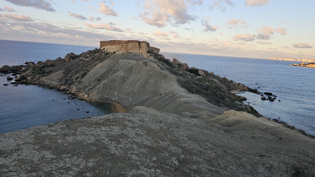
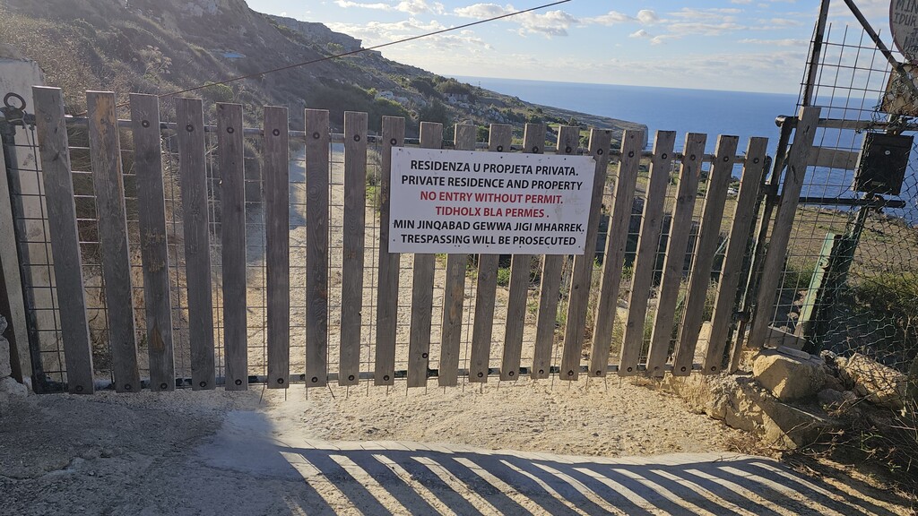
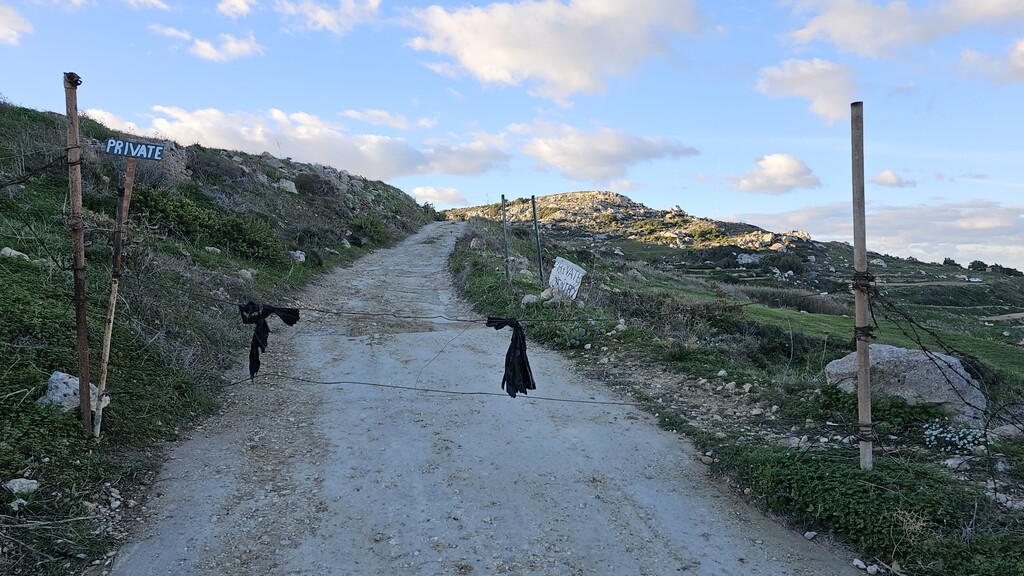
I started from Xemxija as it’s close to where I live and to do the most difficult running sections in the morning. I ran from the promenade towards xemxija church and the fire station, on the side of the fire station and down to mistra bay through trail. I followed the paths on the clay cliffs all the way to ghadira bay. Then I ran all the fish tail on trail. This also included a trail near the ferry behind Mellieha Bay hotel. This part remained faithful to the Malta circumnavigation. I ran along the coast through park tal-majistrall where I had hidden food and water. I continued along trail towards Gnejna, then up to a plateau leading to Fomm ir rih, where one finds a big wind vane with a cat on top. Here I found the first no entry (photo) so I had to reroute passing through Bahrija Village. This made the route a little longer. There is a small grocery shop which was convenient to buy some supplies. I ran past the school, down to a small valley where you have to pass through reeds. I was lucky enough to see an endemic water crab. It’s very rare and only found here. Then up a small hill. Another no entry (photo) and gate (ongoing court case), so even here I improvised a route which ran parallel to the foreshore route on asphalt unfortunately. Please don’t risk jumping the gate as it’s well guarded and the police will be called.
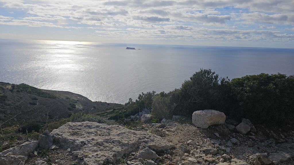
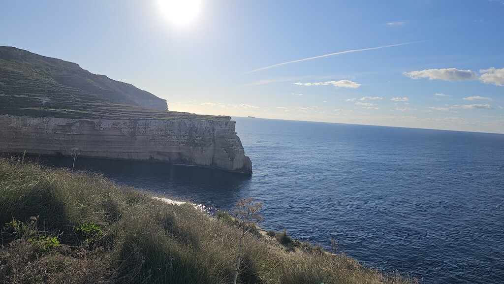
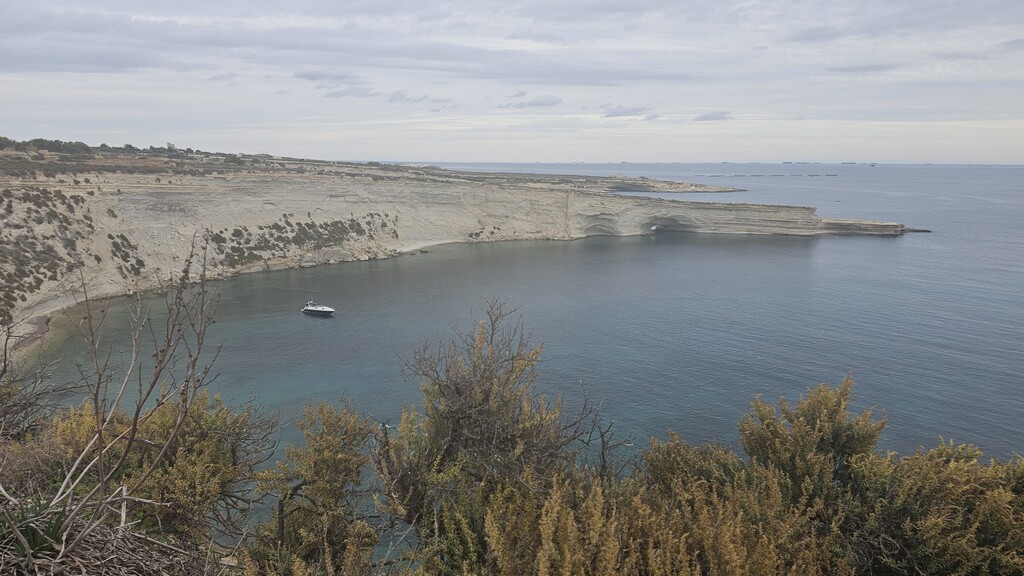
After this I arrived to Migra l- Ferha, ran up towards Dingli and ran towards Panoramika Road. At the end it’s trail towards Ghar Lapsi where there are public toilets. Then towards wied iz-Zurrieq. I had to abandon trail near the temples and continue road as near Garden of Eden I was forcefully stopped by hunters (even though I was 15m from foreshore) during a training run last week and had to go back. Then continue towards Bir Zebbuga (mostly road). This is a good place to replenish as there are toilets and shops. I bought food and drinks and rested my legs. Then continue running along the promenade towards Marsaxlokk. I had to reroute a part as there were lots of ‘savage’ guard dogs which looked very dangerous roaming around. They scared the bejesus out of me. There were also signs to ,beware’ of dogs so that the owners forfeit their responsibility. I was afraid of these dogs and couldn’t get out of there fast enough. Pay attention on the cliffs as the cliff edge is very crumbly. Then continue towards M’Scala. At Zonqor there is a kiosk, a pub, restaurants and toilets. I replenished and rested a bit here. At Smart city, I rerouted on the spot as I could not hug the coast since there is a new construction site. The security denied access. It’s impossible to pass. Further on, I couldn’t run through the Malta film facilities. They are filming Gladiator 2 and it’s heavily guarded. Continue towards the 3 cities starting with Rinella and Kalkara. Then through Isla and Birgu. These are very old towns from the times of the knights and very beautiful. Enjoy their uniqueness. Ample opportunities to replenish. Then from Bormla to Marsa it was busy roads and traffic. I rerouted here as I could not pass through the dock 7, which was open a couple of years ago while the main roads were being refurbished. Now it’s closed, so I found an alternative route using Google Maps. Then Floriana, Valletta and Msida. Valletta is truly a masterpiece. it was built by the knights circa 1565 and still retains its majestic feel. here you run along the most beautiful port in Europe. i could not go round the fort as the bridge was closed off. After that, sliema, st. Julians, the entertainment hub of the island. i ran here at night and it was full of people having a great time. it's very busy till the early hours especially St. Julians. The promenade was lovely and I felt safe. Very festive and enjoyed the lights, Christmas carols and the people. However, after that, at the end of Pembroke one has to pass through some trails to hug the coast. I ran through a place where the RAF used to train to shoot. It’s still used in the same capacity and there are warnings. It’s dangerous here during the day if they are training. I also felt very uneasy as there is a nearby derelict complex notorious for drug activities. Therefore, I also rerouted here for safety concerns and although I wasn't hugging the coast, i was very near. After that it was plain sailing to arrive at the finish passing through Bugibba promenade. Very pleasant.
My thoughts: a very picturesque route especially the North and the west coast. As a person running alone I felt safe everywhere except running in Marsaxlokk peninsula areas because I felt threatened by the dogs. I didn’t enjoy running towards Marsa due to traffic and it’s quite industrial. Other than that, it was a beautiful run, very scenic and unique. Don’t hesitate to beg for water. People are nice and ready to help. I asked a farmer and a couple of families for water as in the morning it was very hot and needed to hydrate more than I envisaged. I stashed food at Park tal-Majistrall and Dingli Cliffs, otherwise I restored randomly along the way. In the first 50 km approximately there won’t be anywhere to buy food or water so one needs to plan this part well.
I used Hoka speedgoat 5 which worked well both on trails and road. I used a 12 ltr hydration pack and carried 2lts of water during the day, then 1 ltr when I knew there were going to be shops around. I ran in a light short sleeve top but took arm warmers. I started with a wind jacket, but I also took a waterproof jacket. It rained heavily during the night.
I hope you enjoy it as much as I did.