First, thank you for maintaining this website! I don’t think I ever would have tried this crazy run without the inspiration provided by others – especially trailblazer Daniel Rau.
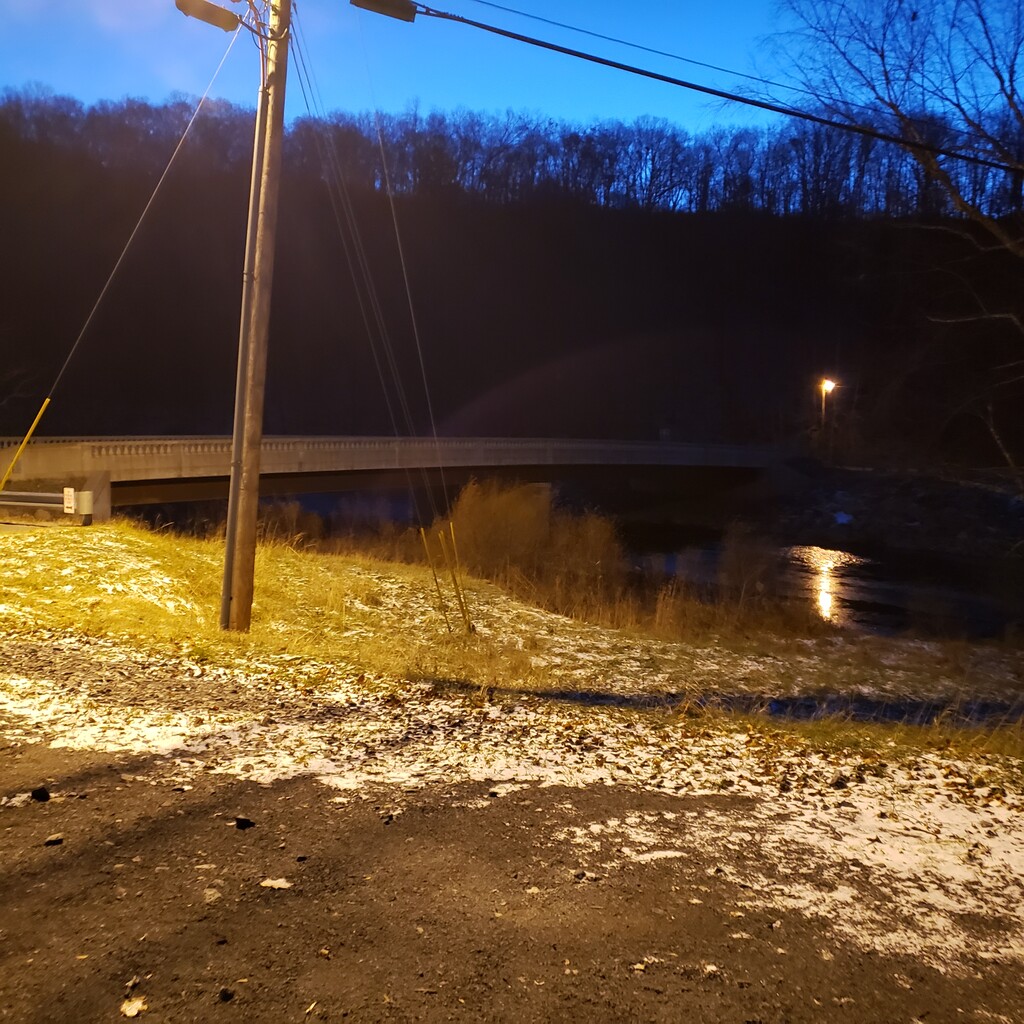
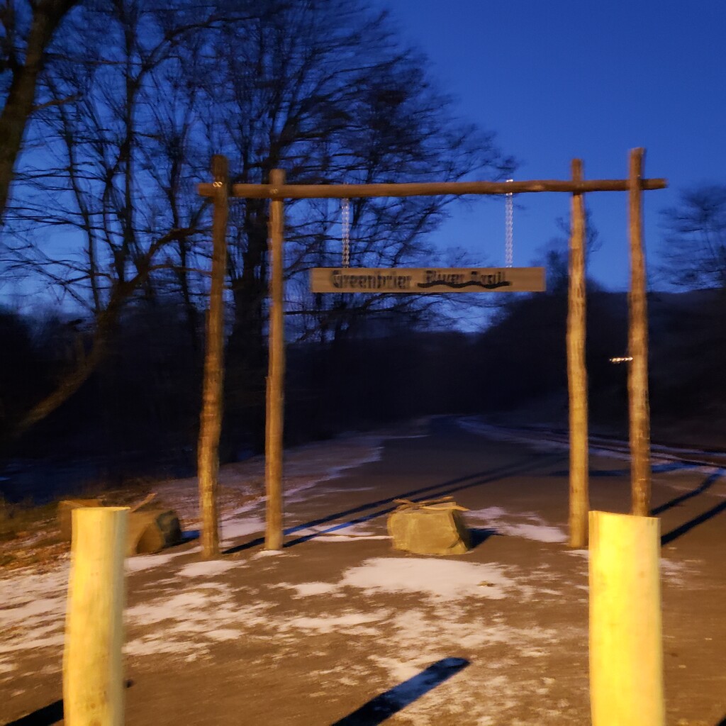
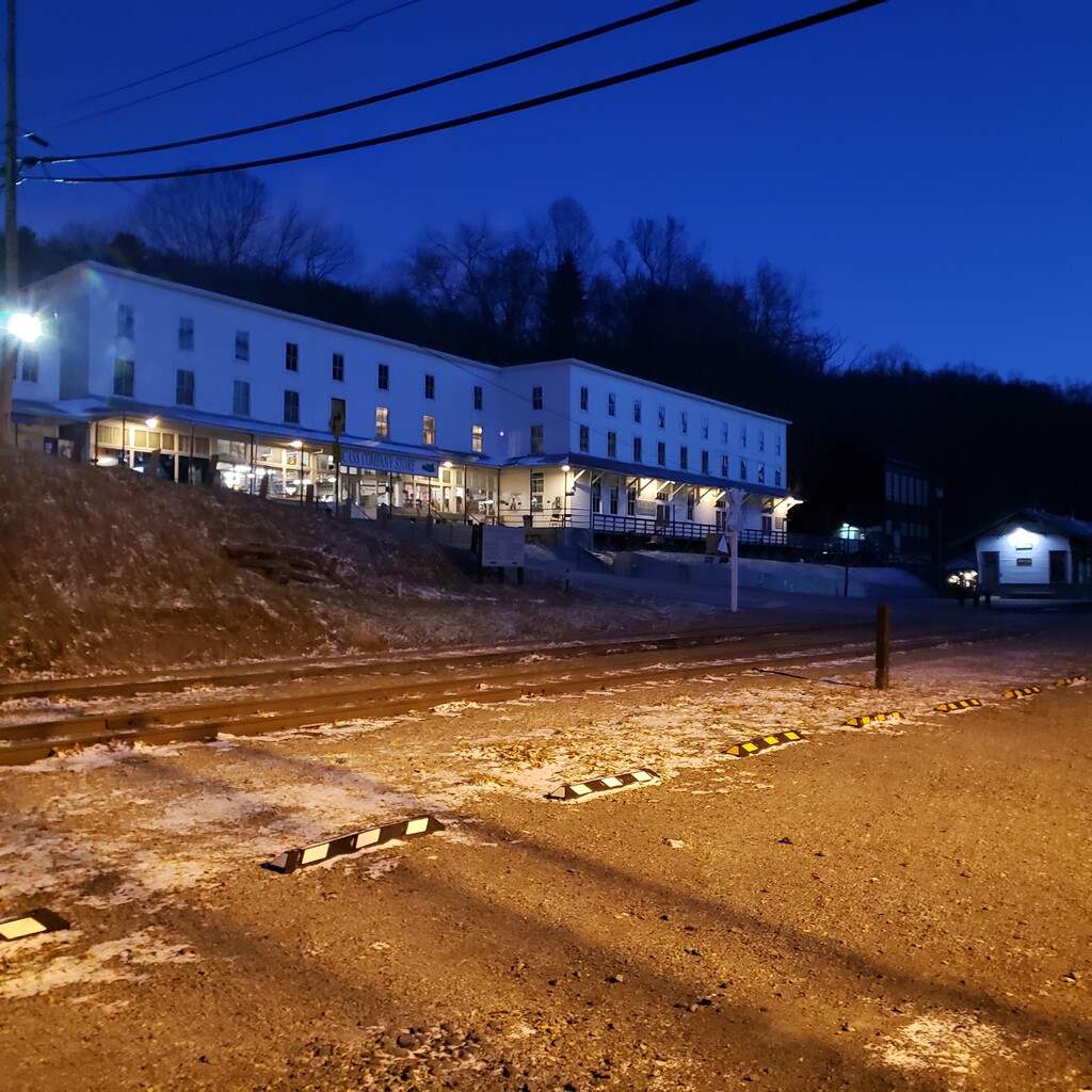
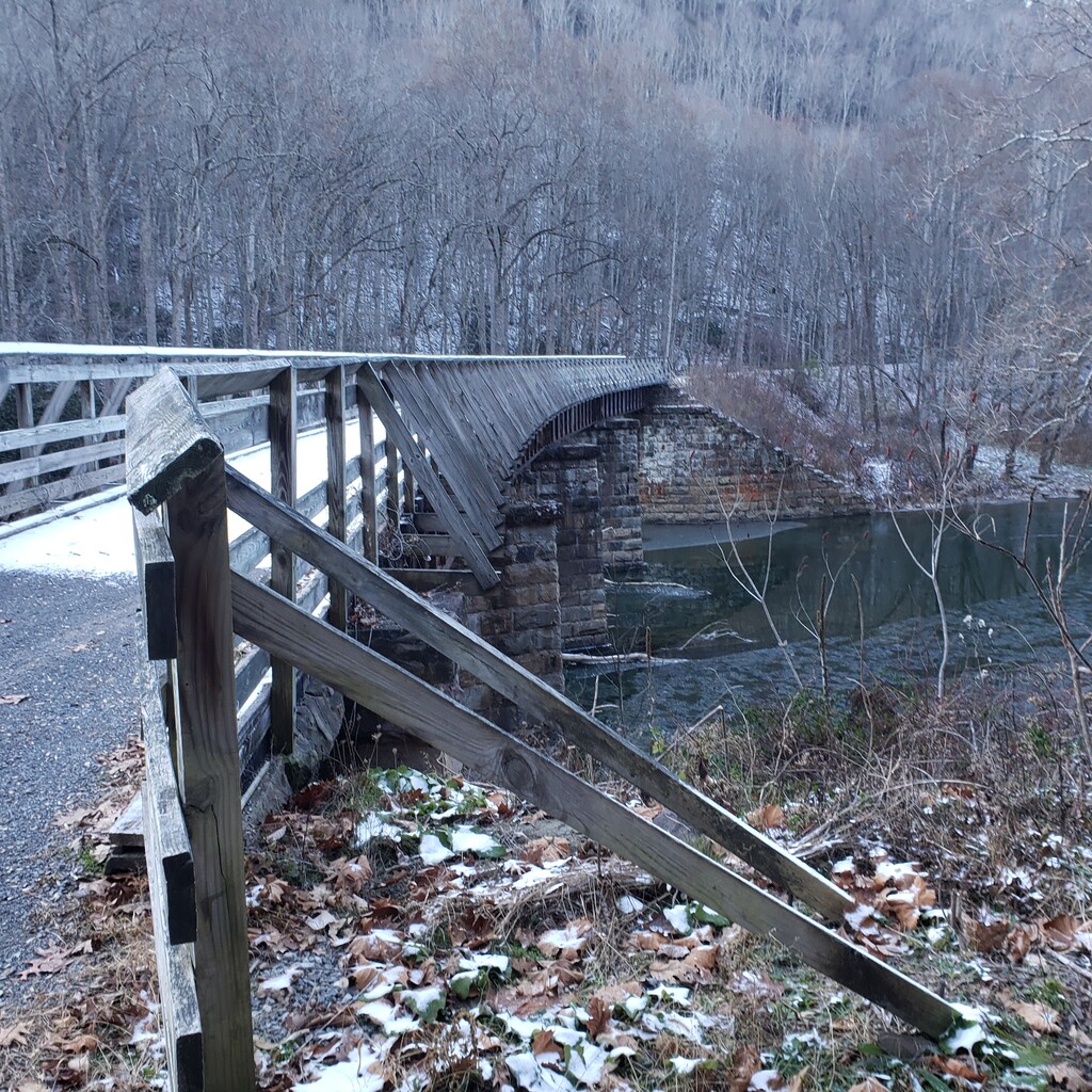
Second, I notice that my run was slightly longer than Daniel’s (and the route originally submitted by Randall Fiorentino). I began my run at the trailhead where WV Route 66 crosses the Greenbrier River in the heart of Cass. It seems clear that this is the northern terminus of the trail, and the most appropriate starting point. I have included a few photos (in the dark) from the spot where I started showing downtown Cass, the WV 66 bridge, and the fancy overhead sign denoting the Greenbrier River Trail.
Daniel’s GPX track starts at the Slabtown parking lot trailhead. Looking at my GPX track, my elapsed time and distance to Daniel’s start was 0:04:25 and 0.57 miles. Thus, my “apples-to-apples” time for comparison to Daniel would be 11:28:58. (My overall time was 11:33:23 and measured 79.09 miles on the Garmin.)
Finally, my FKT report…
PROLOGUE
Crunch. Crunch. Crunch. The sound of leaves breaking under my feet is both reassuringly familiar and maddeningly loud in the cold, early dawn. I’m excited for the challenge ahead and blissfully unaware that this will be virtually the ONLY sound I hear for the next 11.5 hours. My Greenbrier River Trail (GBRT) FKT attempt has begun.
THE LOGISTICS
The GBRT is marked with white monuments every mile, and I will refer to these in my report. The southern trailhead, just north of Caldwell, is about mile marker (MM) 3.1 and the northern terminus at the junction with WV Route 66 in Cass is about MM 80.9, for a total length of almost 78 miles. I ran from Cass to Caldwell (north to south), so the first marker I saw was MM 80.
I was able to do this run unsupported, after catching a ride to the trailhead in Cass (thanks Dad!). The GBRT is well-suited for an unsupported transit, as there are hand pump water wells available at four trail side camping areas. The longest stretch between wells is from MM 64 to MM 29, or 35 miles. This was the critical constraint – I had to carry enough water for roughly five hours of running to avoid filtering from the river. I was able to do this by carrying three liters of fluid (on a cold, November day).
For fuel I relied exclusively on high-calorie powdered sports drink (Maurten 320) and drank over 3000 calories of it during the run. While I would be happy to never taste Maurten again, I was able to consume and digest the drink for the duration of the run, which is rarely the case for me in an effort this long. Also in my pack was a phone and headlamp, and some gels and meds which I didn’t use.
THE BEGINNING
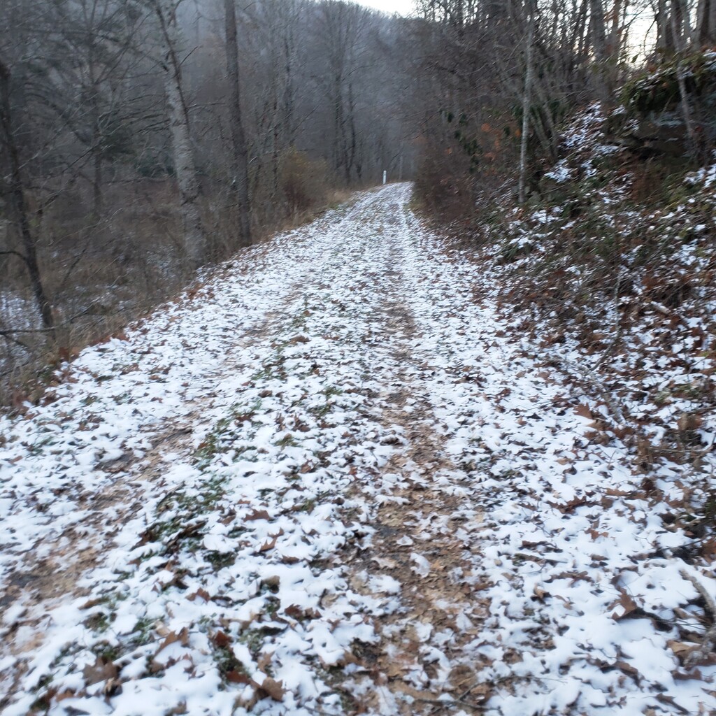
I started the run at about 6:40 am in Cass. It was quiet, dark, and cold – 18 degrees. My plan was a running pace of eight-minute miles with regular, brief walking breaks to relieve my leg muscles. I immediately encountered a problem with this plan – snow on the trail, particularly on the frozen mats of leaves. The accumulation from the night before was only one-half inch, but I was wearing road shoes with minimal tread, and struggled to maintain forward propulsion. I chose to adjust my stride and increase my effort, turning mile splits in about 7:45. In hindsight, I was moving too fast.
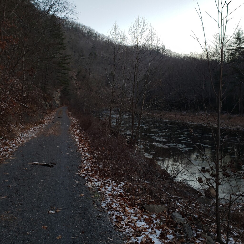
There was just enough light at the start that I kept the headlamp in my pack, and I enjoyed watching the deep blue sky turn to a rainbow of pastels as the sun rose. I took my first walk break around MM 76, and snapped a photo of the skim of ice on the river. These were the first of many lonely miles. And while human encounters were few and far between on this day, I wouldn’t describe any of the trail as wilderness. I don’t think I ever covered more than a mile without seeing some kind of man-made structure, though these were often primitive and uninhabited hunting cabins.
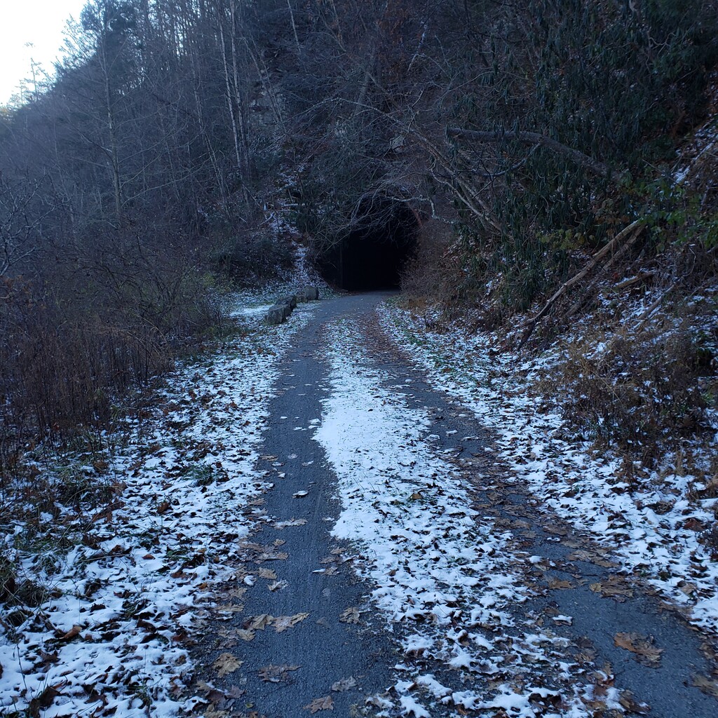
The snow tapered to no more than a dusting by MM 71, bringing to an end my traction troubles. I took another walk break of about 30 seconds, and developed a rhythm of walking once every two or three miles, which was a great respite. About MM 66, roughly 8:30 am, I caught my first glimpse of the sun rising above the mountain to my left. Almost immediately thereafter, I entered Sharps Tunnel and was immersed in the darkness. I used my phone’s flashlight to illuminate the path, and was pleased that it was well-graded with no potholes and minimal water. After exiting the tunnel, I followed the trail over a bridge crossing to the east side of the river and back into the cold shadow of the mountain.
Near MM 64 I found the well for my first planned water stop. I held my breath as I pumped the lever. If the well was not working due to the freezing cold or some other reason, my day was going to be longer and harder than anticipated. Thankfully, after about a dozen pumps, the water started flowing.
I stripped off my shell, pack, and gloves and got to work mixing sports drink in my two bottles and two-liter bladder. Trying to pump the well with one hand and hold the bladder with the other was particularly frustrating, but it still beat filtering from the river. Unfortunately, I managed to soak my hands and arms in the process – a potential problem in the still sub-freezing temperatures. Looking back, I spent over 10 minutes at each water stop, so that’s definitely an area of potential improvement.
As I was packing up, I encountered my first person – a hunter walking up the trail. He was incredulous when I told him my objective, and said I would be lucky to finish in 20 hours. I said something like, “Well, I don’t have clothes or food to spend the night out here, so I’m motivated to go fast”. We said goodbye and I started moving again, still at sub-eight minute miles.
Leaving the water stop I was as cold as I had been all day. My core was chilled due to the long break and my hands were numb from the water. I bundled up as much as possible and moved at a faster-than-comfortable pace to generate some heat. I was a little worried about being cold, wet, and alone when the trail turned east and I was once again bathed in glorious sunshine.
While deer and squirrels had been plentiful, my first exciting wildlife encounter was when a large osprey buzzed overhead. Not long after, about MM 58, the trail turned to asphalt for its five-mile stretch through Marlinton, the most developed section of my journey. I saw a few people in cars as I crossed WV Route 39, but no one on the trail. A little later I ticked off my 26th mile. One marathon down, two to go.
THE MIDDLE
Two marathons to go. While my running pace had already dropped to about eight minutes per mile, that realization led me to dial back further and start shooting for 8:20s. I was already tired, and beginning to realize the biggest deficiency in my FKT attempt – lack of distance training. While I had raced two marathons this fall, I hadn’t run a step over 26 miles in almost two years. It was going to be a long day.
And in a drastic change from ten miles earlier, I was also hot. I had packed away my shell in Marlinton, but with the temperature now above freezing, even my black base layer was too much when the sun hit the trail, which was most of the time around midday. The temperature would top out in the low forties, but fortunately sporadic cloud cover in the afternoon combined with my slowing pace kept me from overheating too badly.
I crossed paths with a cyclist on the paved path south of Marlinton and a jogger about five miles later. Together with the hunter, these were the only three people I passed along the first fifty miles of the GBRT. In between, about MM 50, I saw a bald eagle fishing the river. At MM 48, I crossed the Greenbrier River again on a trestle bridge, and I would remain on the west bank for the remainder of the run.
It was about this time that I realized how serpentine the GBRT is. With the sun at its mid-day zenith to the south, I watched it swing to my right and left as I alternated between traveling east and west. At one point, I swear the sun was behind me and I was heading north – away from my destination!
It was also around this time, well before the halfway point, that I stopped having fun. I started checking my watch way too often as I counted down the paces until my next walk break. My heart and lungs felt fine, but my legs were dead. It was another indication that I had gone out too fast – the first half of any run should feel easy.
I experienced a little emotional boost when I passed the halfway point at MM 42, but it faded quickly as I jogged down the trail. I finished my drink bladder and started on the bottles, on pace to be totally empty at the next water stop. I shuffled through the second and final tunnel about MM 32. It was probably due to my wobbly legs, but I felt its surface was more irregular and dangerous than the first, with plenty of mud puddles to hop.
Around MM 29 I stopped again for water, and again the well flowed. If anything was going to break me today, it would not be dehydration. Two marathons down, one to go.
THE END
So stiff! I guess I shouldn’t have been surprised that standing still for 12 minutes after running 50+ miles on poorly-conditioned legs made it hard to get going again. I could barely lift my feet for those first couple hundred yards, shuffling my feet through the blanket of leaves. Like most runners, I’m not prone to self-consciousness, but I was especially glad the trail remained deserted while I worked out my rigor mortis.
I never fully recovered, though, as 8:30 miles were now too fast to sustain, and my every-other-mile walk breaks stretched to 90 seconds. My running splits would approach nine minutes before the day was over.
On the bright side, my loneliness was mitigated somewhat as the trail was relatively bustling that afternoon. Over the next 15 miles I recall passing five groups, totaling nine people biking or walking. The last group around MM 14 was most memorable, asking how far I was going. I replied “eighty” (I guess it was too much work to say “seventy-eight miles”), which generated a literal roar of approval. I had fans!
I hadn’t realized how much the solitude had weighed on me until then. Even in a race with no spectators, there are still fellow runners with whom to commiserate. I’d had nothing but my own thoughts for ten hours, and I was getting sick of my own company. Thanks to those hikers for the morale boost!
About a mile later I encountered the unexpected – a hill! Apparently the trail had slipped into the river in the past, and the reconstructed path actually climbs a bit as it traverses the slide. The ascent couldn’t have been more than a couple flights of stairs, but at this point it was enough to make me walk.
While the fatigue and pain in my legs continued to increase in intensity, so did my certainty that I would finish this run with the FKT. My brain could only generate thoughts of pain, so I did my best to turn it off and run on autopilot. I did have to break out my headlamp around MM 8 as dusk turned to night and Venus replaced the sun in the southern sky.
A few miles later I was jolted by the sound of a truck’s engine brake on Interstate 64. It was the first loud noise I had heard all day and a wonderful sound since I knew I would hit the trailhead before reaching the highway. Perhaps two minutes later I was done.
AFTERWARD
Reflecting on the run one week later, I have to call it a success since I finished with the FKT, albeit half an hour slower than I hoped. My biggest mistake was undertraining due to not respecting the distance – 78 miles is always going to be a tough day, even on a flat trail. I have long appreciated the romance of self-propelled, self-supported travel, particularly on point-to-point routes, and this is certainly the most impressive on my resume. Thanks for reading.