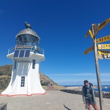
I hiked the Te Araroa Trail five years ago southbound and fell in love with New Zealand and the trail. The idea of hiking it again, this time with the goal of setting a self-supported FKT, gradually took hold over the years. Back then, I met Lucy Clark, who set the supported record at the time. It was through her that I first learned about FKTs, and since then, I’ve been following the FKT scene. I knew the time had come for me to take on an FKT attempt. The decision to go northbound was based on three main reasons: 1. To have a change from the last time, 2. Because my early February start meant that the weather in the south deteriorates more quickly in late summer, meaning I'd have longer good weather in the north (which turned out to be true), and 3. Because I wanted to tackle the more challenging sections first (i.e., the high elevation gain, more remoteness, etc.) – which also turned out to be a good thing mentally for me. I would do it exactly the same way again.
Te Araroa always offers new challenges, and after my experiences on the Appalachian Trail two years ago and getting more into Ultrarunning and -hiking, I felt ready to take this next step. Choosing the self-supported route was a clear decision for me because I’ve always hiked that way and don’t have a crew. It felt natural to complete the trail on my own terms, at my own pace, as I am used to.
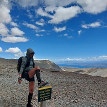
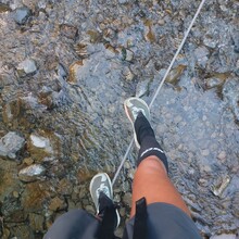
The route was a mix of everything—steep climbs, river crossings and incredibly scenic and remote landscapes on the South Island, extensive beaches, and vast forests, more towns and roads on the North Island. I usually started around 6 AM, or as soon as it got light, and often hiked until 8 or 9 PM, resulting in 14-15 hours of hiking per day. On the South Island, I mostly stayed in huts, but also did quite a bit of cowboy camping outside. In the North, where resupply was easier, I also stayed in hostels or motels more often. My daily distances typically ranged from 50-60 km, but I had some days shorter or longer—shortest being about 30 km and longest over 80 km.
I resupplied in towns, supermarkets, dairies, stores, and gas stations, just like all other hikers. The longest food carries were about 5 days in the South. In addition, I had two resupply packages mailed to me: one to Arthur’s Pass and another to St. Arnaud, as resupply options are more limited in these areas. These packages included one pair of replacement shoes, as I went through a total of four pairs of Altra Olympus shoes, the other 2 pairs I got in Hamilton and Wellington. Water was consistently available from the trail or nearby sources, and I filtered it using my filter bottle. Water procurement was never an issue on the Te Araroa. My food was fairly one-dimensional and lacking in vitamins during the first half, which led to gastritis and quite a bit of weight loss. However, in the North, I was able to eat more varied meals due to shorter food carries and more towns along the way.
During the South Island portion, I took three shuttle rides, as required by the trail for all hikers. These shuttles bypassed Lake Wakatipu, Rangitata River, and Rakaia River. Additionally, I took the ferry from Ship Cove/Picton to Wellington and from Russell to Paihia, also both essential and part of the trail. Since I was hiking northbound, I couldn’t do the Whanganui River canoe trip (which flows south), which is part of the Southbound route. Instead, I did the road walk along the river combined with a jet boat ride (where you can't walk any road), as most Northbound hikers do. This route is actually absolutely comparable in terms of length and time intensity.
I tracked the entire time using my Garmin inReach Mini 2 at 10-minute intervals. I also wore my Garmin Instinct Solar, which was tracking as well. However, after about two weeks, the watch could no longer sync with my phone, and as a result, I manually entered the remaining data into Strava. The issue could not be resolved while on the trail, but all the data is still stored on the watch itself. This experience showed me how important it is to have two different tracking methods with me.
I did not hike with any other person on the whole trail, not even for a short time, as I was usually faster than most and most other hikers were going southbound. However, I had many wonderful, albeit short, encounters with other hikers, particularly in huts at night on the South Island. In the North, I had a lot of heartwarming interactions with Kiwis, usually brief, either through Trail Magic or just random, spontaneous moments. When I faced issues with my calf due to a bite towards the end of the hike, I was especially touched by the hospitality and willingness of strangers to offer help. Other than that, I was solo the whole time, but I never minded it, as I knew what to expect, in fact I quite enjoyed being by myself.
The physical challenges were certainly more intense on the South Island, particularly with the steep ascents. However, I found the most difficult terrain on the North Island, where the constant road walking was tough on my feet. Despite that, I felt strong physically for most of the journey. Mentally, I was in great shape for the majority of the trail, but toward the end, some personal issues began to distract me. It was a reminder that life is happening on the trail, and I had to refocus. Yet, there were many moments of happiness, especially when I was alone, often singing and feeling pure joy. The South Island’s landscape was especially breathtaking, and I was often overcome with emotion. I also made it a point to leave my negative emotions in the woods, using the wilderness as a place for release.
I’ve learned a lot about myself. The trail taught me where my limits lie (which I don't think I have reached yet), but also how strong I am—both physically and mentally. I achieved my goal of setting the first self-supported female time and even surpassed all the supported female records, including last year’s team effort. This experience was a journey of self-discovery, growth, and learning. I feel stronger and more confident than ever, and I want to encourage other women to take on FKTs and push their own boundaries. The trail has changed me, and I’m definitely ready for more and tempted to do more FKT's.
The complete documentation of my journey can best be followed through my Instagram account @linazac


