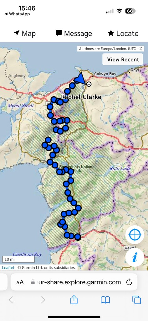
Seeing on this FKT site that no one had walked the mountain route of the Snowdonia Way, unsupported. I wanted to be the first.
Mountains are my favourite place to be and it felt appealing to me from that point of view. It was confusing as to the height gain. On this site, the GPX route said 9,000m. In the Cicerone book it said 12,500m.
I planned for a few months to set off in April. Less insects and no bracken was the aim.
Unfortunately an unexpected hospital drama stopped me going in April, so I set off in June instead. I carried with me 10 days of food. Approximately 2,000 calories a day. When walking the CWT last year, I lost a lot of weight. So for this walk I deliberately put weight on prior to attempting it. The food weighed just under 5kg. My total pack weight, including 750ml of water was 10.8kg.
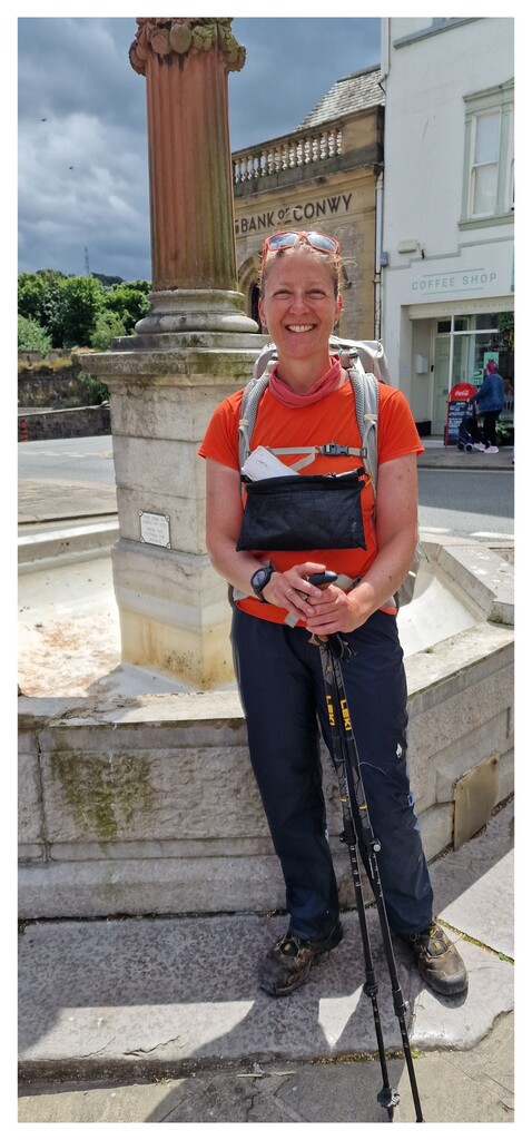
Leaving the start in Macynleth on June 19th, I was excited and also nervous. Once I started to walk, the nerves went. I wasn't aiming to be fast. Just to finish it in 10 days. My aim was to have a lovely time and enjoy the journey.
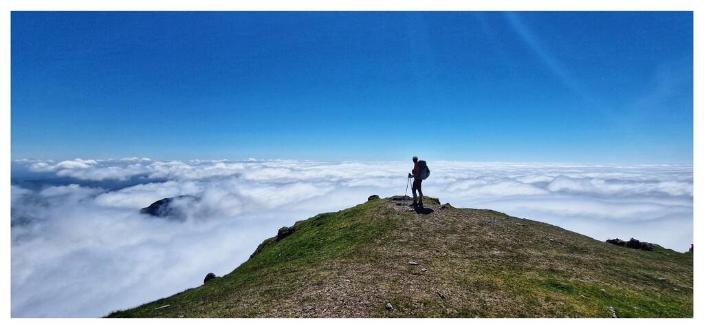
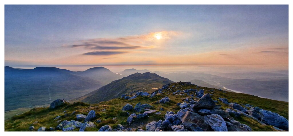
Oh my goodness.. it was amazing! The scenery from start to finish was stunning. As the walk progressed it got better.
There was a predominance of cows each day, that I found difficult. They're not my favourite. Sometimes I walked round them off the path, but never enough to alter my route.
I rarely saw people. For the days before Yr Wyddfa (Snowdon), I saw a total of 4 people on the hills. They had all been on Cadair Idris. The isolation was insane. It felt more remote and isolated than on the CWT. Which I loved.
Wild camping the route was easy in one way, because I could pitch wherever I liked, as I didn't have set places to get to. I just intended to walk past each town every day, so I was always ahead of the intended route in the book. It was hard in another way, because finding places with no cows, or a flat pitch was hard.
Bog was something I hadn't intended to be an issue. But there was so much of it. This really surprised me.
There was also a lot of micro nav. Particularly hard in low cloud. A large portion of the route was pathless and across tricky terrain. Bog, boulders, heavy growth of foliage and bracken at shoulder height in places. On some of the route, there were multiple fallen trees and brambles. Lots of the stiles were in disrepair and the Bridge crossing the river after Trawsfynydd was closed.
I stumbled upon a bothy after Trawsfynydd which was such a blessing. The weather was particularly bad that night and I'd walked for many more hours than planned, trying to escape cows. The location isn't well known, as the owners are apparently trying to keep it a secret after it became an issue for them when released on social media.
The weather was very warm during the days. Often I had low cloud which slowed my pace somewhat, as I have no points of reference to help me. At night the temperature often dropped considerably and I hunkered down in my tent. Overall the weather itself was very mixed. Some incredibly high winds over the last 24 hours made my final pitch at 760m very interesting!
Some of the sections of the walk were quite technical. For a general hill walker, they may find parts quite hard. Particularly down scrambling off Chnict. I did this in the wet and it took a lot of concentration with a heavy pack.
One of the hardest things to contend with was, when walking through towns and villages, past coffee shops and restaurants. I could smell fish and chip shops and see people eating. Occasionally when I met people on the route they would also offer me food or drink. I was able to not think about food most of the time, but when I did, I was exceptionally hungry. I found the dehydrated food was unpalatable after a while. Some days I'd only be able to eat half of it in the evenings and end up throwing the rest away. One day I found 4 fruit pastels on a path that had clearly fallen out of someone's pocket. I was so happy!
The best food I took was sweet and salty popcorn and Veloforte gel chews. I was losing a lot of water through sweat so the electrolytes were invaluable.
On the 26th June, when scrambling on Glyder Fach I tore the meniscus on my left knee. I had two choices. To end the walk and not complete it, or to finish the walk as soon as I could. So I decided on the latter. I compressed the next few miles in to less time. And completed the walk 1-2 days earlier than I'd planned.
For water I took a Watertogo filter bottle. And an empty Robinsons bottle. The filter bottle was amazing as I could take water from literally any water source. I did find two stand pipes on the route. Mostly I used rivers and pools on the way.
When completing the walk on Thursday 27th June at lunch time, I stopped my Garmin watch and saved the last days walk. I synced it to my connect app. For some reason, the app and the garmin weren't happy with having been unsynced for 5 days and the data didn't save to my phone. This really put a downer on my whole walk, as I'd obviously rather have the data saved in one place as proof. However, the mapshare live data is still there, as are hundreds of photos and a few videos of the last day.
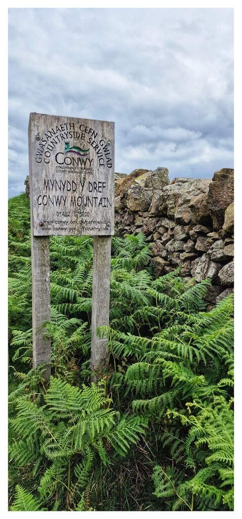
The people of Conwys and in fact, the locals on the entire route were lovely. So kind and so encouraging. They were all very interested in what I was doing. I had stopped to talk many times on the walk.
I didn't wash at all for the whole walk. Although I did sit in a lot of rivers and streams to cool off. I didn't take a spare set of clothes, just a couple of pairs of pants and in total, 2 spare pairs of socks. This kept my weight right down to a minimum.
I have decided to produce a pictorial guide of the walk, with all proceeds to go to Mountain Rescue. It was very apparent to me during the walk, of the risk we all take undertaking these pursuits.
This was by far the best thru hike I have ever done. From start to finish it was amazing. Very varied terrain with a lot of different difficulties. The views were insane. It was challenging carrying such a heavy pack, particularly with an ageing injured body. But one I would recommend to anyone with a love of hill walking and of wanting to find isolation.