https://www.drywashrunners.com/2025/03/the-tukson-50.html
The FKT project, here known as "The Tukson 50" has been a life-time in the making. My earliest memories include drawing maps of our local ski mountain pixel by pixel. I grew up hiking in Montana's US Forest Service and Wilderness lands, which required a deep knowledge and skill in reading topography maps in order to find my dad's favorite fishing spots. My interest and love of maps has always been there, my skill in reading and imagining them, my super-power. I dream in "topo".
Fast forward to today, and Strava has put that love of maps and topography on crack. That heat map, is the best thing ever created! I have got dozens of variations of the Tucson 50, remembered in a half dozen published maps on Strava.
These days I'm using maps to motivate and explore. As some elite racers will recite, in reference to their Why, "I race to train." In other words, for many it's about the running, the views, and less about finishing competitively in a trail-ultra. My why includes the map and the views. Nothing beats a ridgeline with a scenic mountain range to look at for inspiration and motivation.
And to take it a step further, the fun in creating this route was just barely eclipsed by the views I knew it would include. The Tucson 50 is an epic route. In contrast to many FKT's which include going an extreme distance and/or racking up insane vert, this route is designed to place the runner in some of the most spectacular desert scenery the Southwest has to offer. The Tucson Range punches way above its weight. These trails are world class, and as far as I can see, way way underrated by trail-runners. This route will be a classic, it's only a matter of time.
In these months leading up to the Tucson 50 I met RJ, a newer student to the art of the trail. Just months into his ultra career he's sending it, one ultra-effort at a time. We met at the Oracle 50K where RJ and I shared stories about a mutual love of epic things, he born of Goggins-like life-changing adventures and I of old and colorful tales (lies) of ultra mishaps. If I've taught him anything in our two runs together, it's unique sweetness of just going out and doing something stupid.
But it's not really stupid, is it? Honoring the ultra tradition of an early start, RJ and I started our Tucson 50 at "Astronomical Twilight which was at 5:12AM. We set out for a dusk to dusk ultrarun... Except that in the tradition of a Helgeson adventure the maths and the estimations were subject to more than a reasonable margin for error. Hence the "-ish". My maths called for one expert level trail at a time, which when combined did not make for a fast, efficient effort. My maths said that the route could take perhaps 15 or 16 hours. Instead the Tucson Traverse served us up with 22 hours instead.
-The Run-
The Tucson 50 started out well. Within a couple of miles it began to grow light outside. Cat Mountain went from an object of black, defined by the sharp absence of stars, to a colorful monolith in the golden hour of sunrise. Starting in the Robles Pass Trail System, we ran toward the Enchanted Hills Trail system eventually turning back toward Star Pass and then toward the start for the beginning of our epic ridgelines that defines this route's most notable features. The first such epic ridge began from Yetman Pass going up a community trail toward peak 3287. Epic views of the greater part of the Southern Tucson Trail system featured of course by Cat Mountain lording itself over all. From 3287, we could see the contours of the beginning miles of the Yetman Trail curving from it's start around us in a clockwise direction around the ridge. Basically this ridge ride is a short-cut for running the whole of Yetman proper. Views of Cat transformed to views of Bobcat ridge with Golden Gate behind it.
After 3287 we aimed back East to gain the start of Bobcat. Once on Bobcat we aimed back to the NW, staring at Golden Gate and her kingdom of diminutive wastes and washes and her very small house-sized boulders. By this time it was hot, and running three ridgelines two of which were very hard was taking five times as long as expected. We wanted to finish partially because it was shaping up already to be a truely epic route, deserving of its very own FKT.
Since slow was all that was happening anyway, we let ourselves be further slowed by the views too, as they were deserving of much gawking. Slow too were our aid stops. Down below Golden Gate and near old Tucson, my wife and two littles, 3 and 7 years old, brought yummy burritos, water and energy drink refills, changes of clothes, replacement batteries, and all the stuffs.
From there we turned WSW to outflank Gilbert Ray Campground before turning to the next ridgeline traverse known as Brown Mountain. From some vantages it could be considered as looking small, yet with the afternoon heat the short climbs were done methodical. Once on Brown it seemed much bigger than viewing it from Golden Gate Pass. On Brown, the views of Wasson's reliefs were turning more golden and less washed out, Saguaros already popping with that glowing green contrasted to a glowing dark red-ishbrown.
My mind chewed on this, my maths having fully rewritten the nature of this adventure as involving a lot of darkness and more slow running. I began to embrace this reality in my mind: Would I finish? Probably, yes! Would I be up much of the night? Probably. Yes!
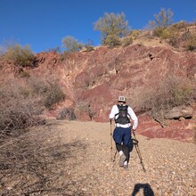
But my brain also imagined much of the second half as much easier and buffed out than what was actually the case. This run was hard, literally, though I didn't feel it that way in my body. In actual fact the future runner of this route should know, hard also refers to the type of soil. As in the lack of it. "Hard" means "rock-hard". Later on, RJ and I would joke, somewhere near 1:00 AM, that we'd found exactly 6 longitudinal feet of single track that would qualify as soft dirt or soil. Except for a 3-4 of miles of sandy wash, The Tucson Traverse featured smooth, solid-rock trail, a good bit of natural gravel, rock trail with boulders on it, sharp lava rock, ugly white rock, lots of other brown and red rock, and purple rock. Much of this trail should be considered technical. Except for elites, most runners will find most sections of this trail runnable but difficult to run efficiently.
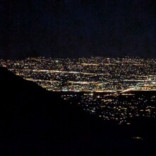
At Sunset RJ and I found ourselves climbing our last epic ridge towards Wasson's summit. I thought it fitting that the last glittering golden lights of our day shone so beautifully on Wasson's slopes, known by many as the Tucson Range's crowned jewel. From near its summit, we descended by starlight and headlamps into the final 15 miles.
During this section the first real problem of the day hit us at El Camino del Cerro Trailhead. I had called ahead to have my wife abort bedtime with the kids, shove the tired little angels in our car, and bring us our aid station. Upon arriving my wife dropped a pin that was unfortunately according to Google Maps 30 minutes away from where we were. I made the quick decision to have my wife drop our food and energy drinks and extra batteries a couple hours ahead of us on the trail, while we use the water I had dropped here yesterday to refill our reservoirs and bottles. Both of us had a lot of food still, so we were good. My rare foresight into trail problems (the cached water), also good.
Into the star studded black we marched on, still shuffling the smoother sections and hiking the rest. From El Camino to the Picture Rock's drop to Cam-Boh Trailhead there was lots of runnable rocky single track and a couple miles of very soft sand in various washes. At Cam-Boh we turned North until turning back East following the northern boundary fence-line of the West Saguaro National Park District. Right under Mt Safford we encountered the second and final quarter mile section of off-trail to meet up with the Stafford Peak Trail and then down more "official" trail for final 1.5 miles. RJ had roused a friend for a three 3AM-ish pick-up and somewhere in there (only the gpx will tell) we finished a 22 hour plus effort.
This route was legendary to me, and destined to be for others as well. I hope.


Comments
In researching the route beforehand NPS staff stated that there were no rules against hiking after sunset into the night. The Tucson Mountain Park Segment was run and finished during the "day" and I did not confirm night rules as it applies to being in the park after dark. Dawn to Dusk rules generally apply to parking and not necessarily to use of the park itself.