I had been dreaming about his idea for a couple of years. I had backpacked the basic idea of this route a couple of times in 4-5 days a long time ago but wondered how hard it would be to finish in one fell swoop. I finally got a chance to find out.
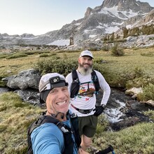
I invited my friend Jeff who backpacked it with me the first time around about 17 years prior. He had been running ultras so I knew he was in good shape and would probably be crazy enough to follow me into the backcountry for an adventure. He was, so he did.
Pre-trip: I left straight from work in Indian Wells, CA, drove an hour to meet Jeff and a family friend Kaden (19) who had just been starting his journeys into the mountains on solo trips and couldn’t pass on a free ride to the Sierra. I met them in Redlands and we headed for Mammoth Lakes, 5 hours away. We slept in the truck for 3 hours, and then Jeff and I woke up at 3:20am and set off at 4am. Kaden would later drive the truck into Yosemite Valley.
Trip:
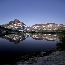
We enjoyed a nice chilly high 30s warm up traversing the 8 miles from Agnew Meadows to Thousand Islands Lakes in the dark. I had never seen so much water and mud across that section. Crazy amount of water this year! We arrived at the lake with the day’s first glow. As always, the view of Banner Peak behind the lake was breathtaking and it just stoked the fire to start this adventure! We saw a camper hanging out by her tent near the trail. It would be the last person we would see until Merced Lake (about 25 miles away). We all said good morning, and she asked if we were running and to where. When we told her we were running to Yosemite Valley, her eyes got a little bigger and then she warned us we were going the wrong way. She said the PCT is back behind where we came from. We laughed and said we’re not taking the trail there. She laughed back and said OK, have fun.
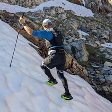
Once we reached the backside of the lake, the sun's rays began to kiss the peaks in front of us as we climbed North Glacier Pass. Definitely something out of a story book! So beautiful! We had some sun-cupped snow fields that we were able to cross in our running shoes without mishap until we topped out and looked over at the other side at the Catherine Glacier, Lake Catherine, and our journey ahead.
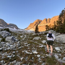
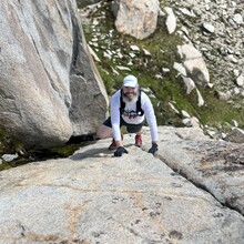
As we dropped down the other side towards Twin Island Lakes through tons of talus, grass patches, slabs and snow fields, we were constantly reminded that a careless step could end the day, and maybe worse. We knew there was most likely no one back here but us, however, our goal meant we couldn’t move too slowly either. We found a great route through the steep section, and made it to Twin Island Lakes. Once we skirted the rocky shore of the lower lake, we took off our shoes and crossed the outlet where the lake dumps into the North Fork of the San Joaquin River. The water was just above the knees, so it felt really nice. We headed up and over to the upper lake and then wrapped around the traverse across to upper Bench Canyon. You’re constantly walking at an angle as you traverse this section which makes it easy to roll an ankle. I nearly rolled mine five or six times through this section alone. Most of the terrain is loose so it pays to be careful. As we began to drop into Bench Canyon, so many great memories of this area came flooding back. The first area we dropped into is filled with a dwarf forest with water rolling smoothly over large granite slabs before you climb into the main upper canyon that looks like something out of Switzerland, Norway, or maybe Patagonia. I’ve heard Bench Canyon called the Shangri-La of the Sierra, and it truly is! The hardest part about a trip like this is that you want so bad to stop and enjoy it. Thankfully, we were too singularly focused on finishing. Otherwise, it would’ve been a long night.
We were already running behind on our projected time. My friend Jeff is in great shape because of his time running ultramarathons, but he hasn’t had the chance to practice in rugged terrain like this. Jeff’s legs were barkin' with all of the backcountry beating they were taking. It was nothing to be worried about, but we needed to slow down and look at the big picture for the day. We were hoping to make Blue Lakes Pass in six hours originally. However, we didn’t make it to the top of the pass until eight hours in.
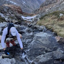
On Blue Lakes Pass I used my tracker to contact my son Wyatt. I had him call Kaden to let him know we were running behind on time. We slogged across the talus below the pass until we reached another long shelf, mixed with rock, grass and winding streams, until we eventually connected with the Isberg Pass Trail. We shuffled down to the Lyell Fork of the Merced River. I had never seen so much water coming down and it was mid September! I had an idea to make the route go down the Lyell Fork directly to the Merced River, but with so much water coming down the fork, and with Jeff's legs struggling, I didn't feel like it was a safe idea for the moment (maybe the next attempter should give it a shot and put in a variation?). We waded across the stream and continued on the trail until we connected to the junction that would take us to Merced Lake about 16 miles from the finish. Although Jeff wasn’t feeling 100%, he powered forward as fast as he could without feeling like he might lose control of his legs. Even though we were traveling mostly downhill at this point towards Yosemite Valley on trail, we still had to be careful because some of the trail was like large cobblestone which can be tricky moving fast on tired legs. Just before we connected to the Merced River, and the last descent into Yosemite Valley, I pulled away from Jeff. He had no problem finishing this tough traverse, but he decided he would rather take it slowly and carefully at the end, and I wanted to make sure Kaden had someone to hang out with at the end of the day.
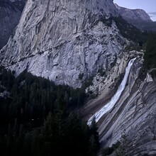
The way the Merced River cuts through the canyon between Merced Lake and Little Yosemite Valley is a sight to behold. As I rounded the corner at Little Yosemite Valley, and the sun had begun to set, the east side of Half Dome revealed itself and I knew I was almost done. It’s still hard to believe how much water was coming off of Nevada Falls just a couple of days away from the fall season! I caught Nevada Falls at last light and the colors were amazing! What a way to end an incredible day with such perfect weather!! I finished the descent to Happy Isles on the John Muir Trail in the dark, happy and ready for pizza and a shower! Jeff came in shortly after with half a pizza waiting for him. Great day! We ate, cleaned up, drove 1.5 hours to Oakhurst, slept in the car for four hours and drove the 6 hours back home! Haha! You do what you gotta do!
Rob's elapsed time: 16:31:23
Jeff's elapsed time: 18:14:04
Team time: 18:14:04
P.S.
I think this route could be done close to 10 hours and maybe under with a strong runner with good off trail conditioning. I’d love to come back and get it in12 and catch the bus back for a great self contained adventure! We’ll see…

