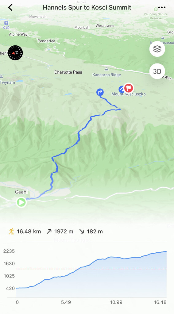
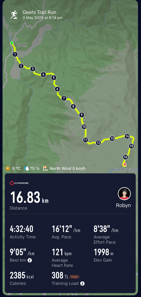
Never having seen this area, nor had opportunity to recce the route ahead of the attempt, I relied heavily on the GPX file.
I carried full emergency thermal gear and wet weather gear, plus a GPS locator SOS device, and rations incase the weather changed and I became stuck in the back country. It is important to note that this area is mostly inaccessible to emergency assistance and most of the route there is no phone reception. While it was a clear day on the day of the attempt, it had been snowing and a whiteout only two days earlier. The weather can be highly unpredictable and is rapidly changing in this alpine region.
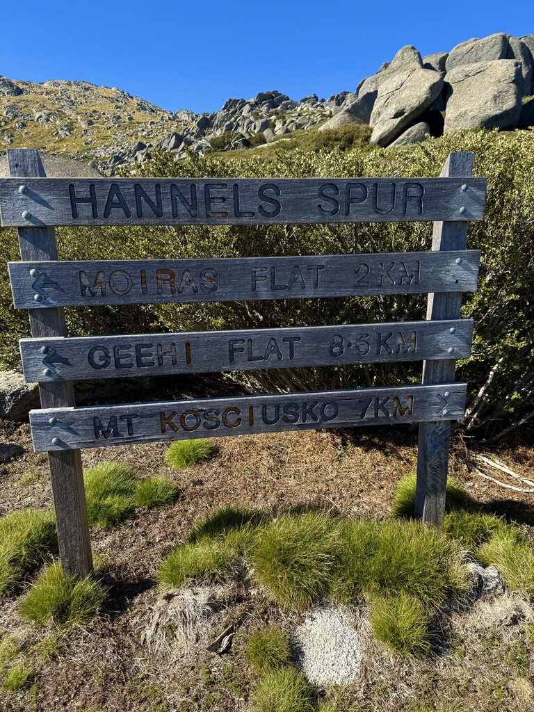
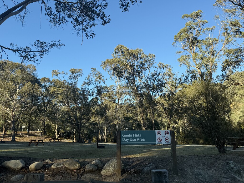
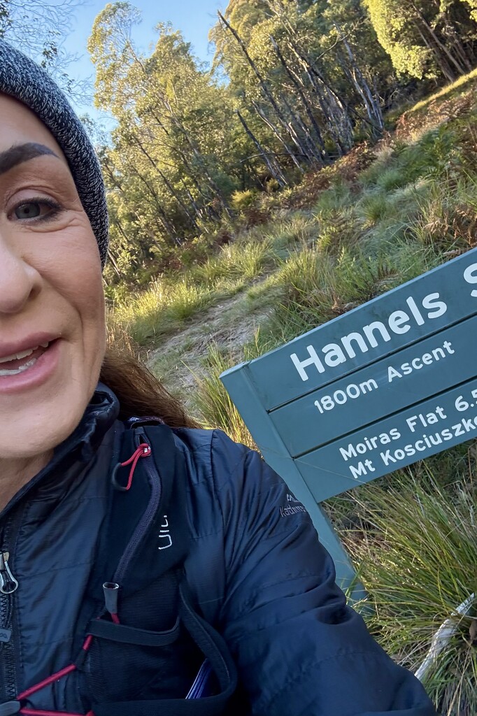
The river crossing before the Hannel's Spur sign (marking the start of the ascent) presented a challenge, as the river level was relatively high from recent rain, and my feet were completely numb from the crossing making it a challenge to run the most runable section while the toes thawed out.
The path up through the bush was reasonably easy to navigate, yet quite slippery due to the volume of leaf litter. There were many sections where the undergrowth was very thick, where you could not see your feel and made fast movement near impossible. I did see a snake in this section, and was very happy to be carrying two snake bandages for the unlikely yet worst case scenario. Tip: It is important to keep an eye out for the bright orange triangular markers where there are multiple animal tracks intersecting with the Hannel's Spur track to remain on course and prevent retracing your steps.
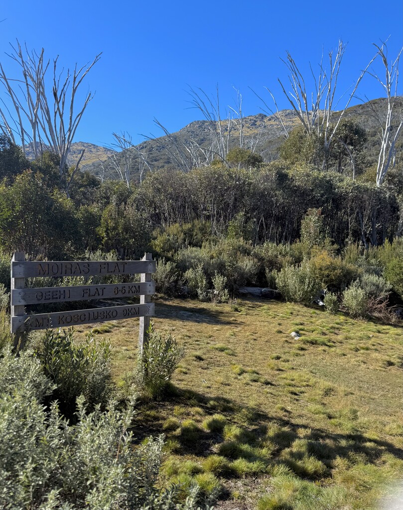
There is water available at both Moira's Flat and Wilkinson's Creek however you would be wise to carry a life straw or puritabs to be safe.
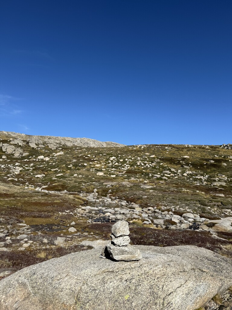
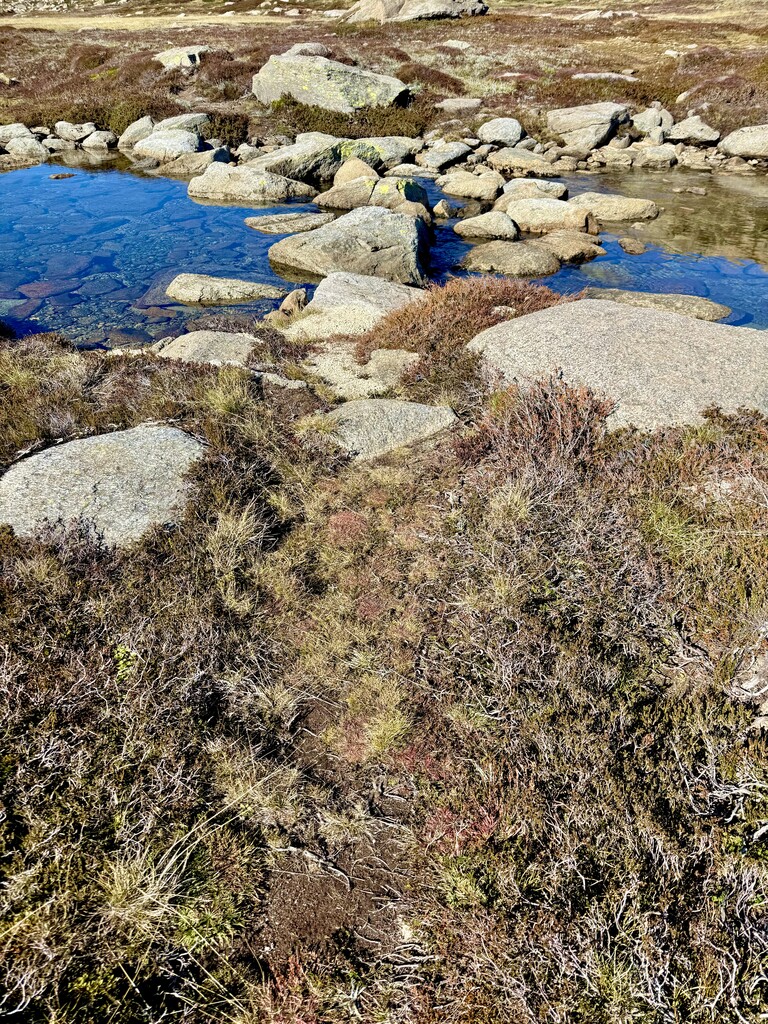
The most challenging section, given the plant growth over the summer and the limited foot traffic on this route, was finding and staying on the foot pad to traverse above the tree line alpine section across the saddle and towards Wilkinson's Creek. At times this was extremely challenging to locate and navigate causing some back tracking in this section. It is also easy to fall through the scrub into large gaps between boulders, should you get off the path.
Once up on Mueller's Pass and connected to the Main Range Walk it was self evident the remaining route to Kosci Summit. Dodging the day hikers walking up to the summit in the final 1.6km w as tricky being a weekend.
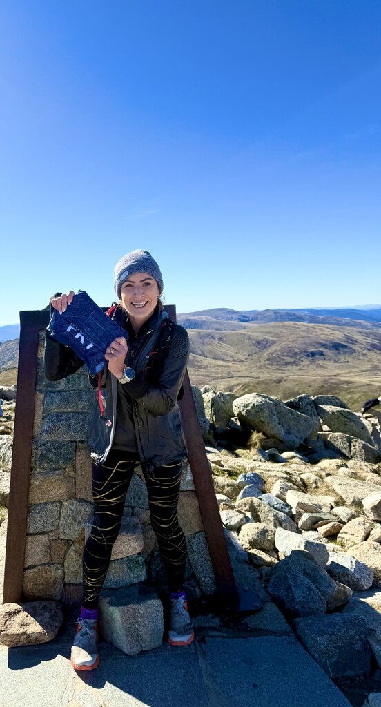
This FKT attempt might well turn out to be the Slowest Known Time submitted... however it was put down in an effort to see more female times submitted on FKT routes. #WomenWhoFKT
https://www.instagram.com/reel/DJOjvPpxCfX_dKRmwYxINjMdt0bLFOtcJcDxfw0/…