
Trip report and break down
Out and Back
Start: 9/9/2026 - 10.16am
End: 30/10/2026 – 9.58am
Time: 50 days 23 hours 42 mins
Kalamunda to Albany (SOBO)
Start: 9/9/2026 - 10.16am
End: 10/10/2026 – 4.46am
Time: 30 days 18 hours 30 mins
Albany to Kalamunda
Start: 10/10/2026 – 4.46am
End 30/10/2026 – 9.58am
Time: 20 days 5 hours 12 mins
Day 1:
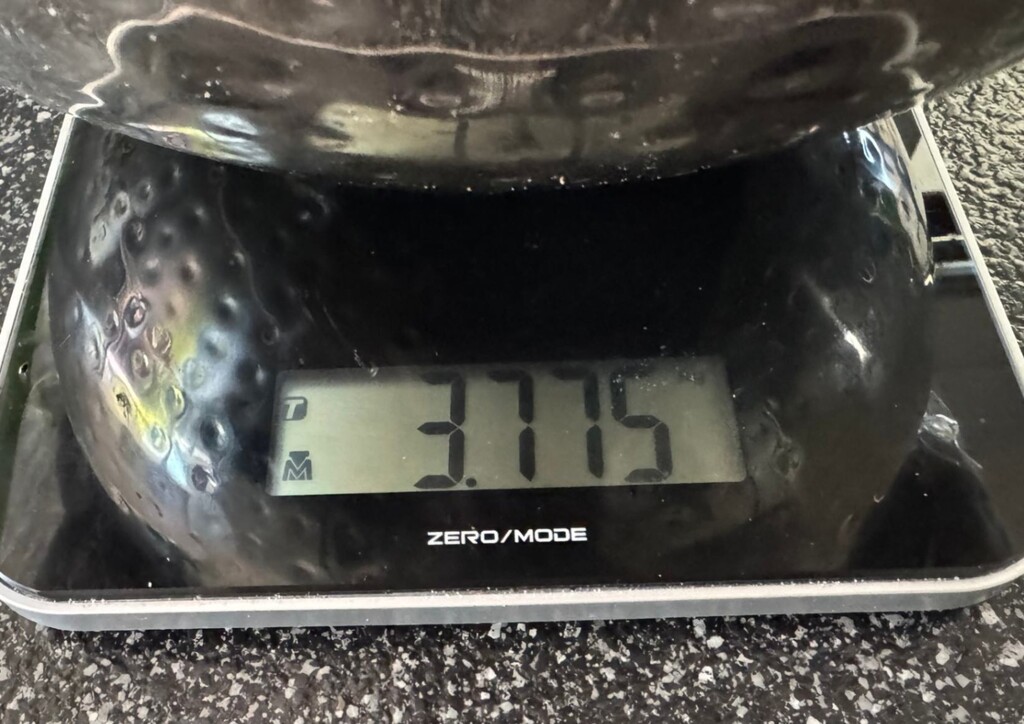
Goal was to just start the walk. Walked to Hewitt’s Hill. Short day, very heavy pack, over 35 kg.
Day 2:
Walked Hewitt’s Hut to Ball Creek hut and stayed at Helena Hut. I had to take a small diversion around Mundaring Dam as the gate was locked due to an early morning start.
Day 3:
Walked from Helena Hut to Waaleigh to Beraking and Mt Dale. Very hot dale. The last leg of this walk was very hot due to the weather but also the heavy pack. Got in after 8pm. I found out later I stayed at the same hut as the German man that was stealing peoples gear. Lucky I was staying in my tent I guess.
Day 4:
Walked from Mt Dale to Brookton to Canning Hut. There was a Bib track foundation group at Canning so there were lots of questions that night.
Day 5:
Walked from Canning to Moonadocks to Mt Cooke over two hills – a bit slow and steady as pack still very heavy and super mindful not to injur myself.
Day 6:
Walked Mt Cook to Nerang to Gringer. Met NOBO couple at Gringer. Guy was wearing Tarkine shoes.
Day 7:
Walked Gringer to Whitehorse hill. Did a single day today to set up getting around Dwellingup without epic km. Met a USA guy called BONES – that questions if what I was doing was possible and indicated that he felt lots of people tried FKTs but never succeed. I obviously ignored him. Turns out he was not successful in completing the Bib himself. Blocked the negative vibe from him.
Day 8:
Walked from Whitehorse to Mt Wells and down to Charoora.
Day 9:
Walked from Chadoora to Dwellingup. I had a shower at the public showers (as pre-approval permission from Keelan FKT guy said this was allowed as it was a public shower) – I charged all my power banks up at the visitors centre and walked to Swamp Oak. A small diversion was taken which has been in place for years for harvesting reasons (I think it adds a couple of km).
Day 10:
Walked from Swamp Oak to Murray and then on to Dookanelly. I got in after dark and just before the rain hit.
Day 11:
Walked from Dookanelly to Possum Springs. Only a single hut day walked today to set up getting around Collie.
Day 12:
Walked from Possum springs to Yourdamung and then onto Harris Dam. Harris Dam was very busy and I had to camp on rough ground as all spots were taken as I arrived after dark.
Day 13:
I walked from Harris Dam to the Collie junction. I didn’t go into Collie nor did I sign the visitors book there – this decisions was guided by Keelan FKT guy to do what Aarron Young did on his FKT in 2025. Collie is a side town so not required to go to and therefore I went to the junction and walked directly to the next hut. Yabberup.
Day 14:
I walked from Yabberup to Noggerup and then onto Grimwade. Nothing significant to report for this day.
Day 15:
I walked from Grimwade to Ballingup. Ballingup visitors centre was closed (see attached image) so the visitors book was not signed. I then walked to Blackwood and stayed the night.
Day 16:
I walked Blackwood to Gregorybrook and then walked to DRV and stayed in the Bib hut there. I didn’t sign the DRV book as the café was closed when I arrived and I couldn’t access the book.
Day 17:
I walked DRV to Tom Road and then onto Boarding House.
Day 18:
I walked a single hut today from Boarding to Beavis. This is always a slow day as it has lots of elevation and I was feeling tired. So listened to my body. There used to be a horrible diversion here due to a damaged bridge but it looks like it was recently removed. I was super grateful for this.
Day 19:
I walked another single hut to set myself up for getting thru Pemberton. Beavis to Beedleup Hut.
Day 20:
I walked into Pemberton thinking I could charge my devices however it was a public holiday and the library was closed. I still had enough charge to get to next town so I continued to walk to Warren.
Day 21:
I walked a single hut from Warren to Shaffer to set myself up to get to Northcliff early so I could charge up battery packs.
Day 22:
I walked to Northcliff visitors centre and spent about 4 hours there charging everything up fully. It was such a relief to finally get to charge things up after hitting visitors centres when they were closed. I probably should have called ahead and clarified the information on the internet. I walked out of Northcliff and had to take a horrible road diversion for 26km or so – see image sent. The diversion meant I had to stay in a shipping container on the side of the road (Not a safe diversion and this has been reported to the foundation my opinion on this diversion).
Day 23:
I walked from the diversion hut to Lake Maringup (start of getting wet feet) and then onto Dogpool.
Day 24:
I walked Dogpool to Mt Chance and then onto Woolbales. Out of the 11 times I have done this walk this is the driest I have seen the pingerup planes.
Day 25:
Saw the ocean today as I walked Woolbales to Long Point and then onto Mt Clare.
Day 26:
Walked Mt Clare to Walpole (Walpole visitors centre was closed so I couldn’t sign the book), then to Frankland river and over to Giants hut.
Day 27:
Went from Giants to Rams – just a single day to set me up to get through Peaceful bay.
Day 28:
Walked from Rams to Peaceful bay, signed the book at the front of café, then walked onto crossing with the canoes (4 on my side which was perfect), and then walked onto boat harbor.
Day 29:
Walked Boat Harbor to Parry Inlet to William Bay and then into Denmark. The sandbar at Denmark was not there to walk across so I did the road walk around to Nullaki which made for about a 72km day. I arrived at Nullaki late and no one else was in the hut.
Day 30:
Walked Nullaki to West Cape Howe and then onto Torbay. Had to stop midway for a storm to pass which was a good decision as the storm was a bit nasty.
Day 31:
Walked Torbay across the sandbar no issues (found out later the dredged it that afternoon). To Mutton bird and then to Sandpatch.
Day 32:
Sandpatch carried all my gear to Albany (not able to Sign book as it was 4am in the morning so took selfie at the visitors centre) and then turned around and walked back to Sandpatchthen to Mutton bird. I found out Torbary was not suitable for me to cross. It was dredged less than 24 hours prior there was a man in a boat helping people get across but unsupported meant I couldn’t access this. I had to take the official diversion which added an extra 19km. Please note I followed the exact gpx diversion on the FarOut App and did not take any short cuts to this diversion even though it was tempting as it is a weirdly long diversion. See gpx file. I got into Torbay late and a bit wet.
Day 33:
Torbay to West Cape How and back to Nullaki – set myself up again to get around Denmark.
Day 34:
Nullaki to Denmark via the road diversion. Prior to starting this walk I clarified this diversion which didn’t require me to go to boat ramp. Walked to William bay.
Day 35:
William bay to Boat Harbor. Single day and rested to set up getting thru Peaceful bay.
Day 36:
Started at night however had to pause just before canoes to recharge headtorch (if I was ever to do this again I would bring two headtorches with good lumens so night walking was easier and faster low lumens is too hard to confidently walk through some of the Bib) and wait for wind to settle before canoe crossing. Not ideal but reality of what I was doing. Walked thru Peaceful Bay and onto Rams. Was very hot day. Had a break at Rams for a couple of hours and continued onto Giants.
Day 37:
Walked from Giants to Frankland River and then to Walpole. Sat at Walpole for a few hours to do one last charge of all my devices. I wasn’t able to sign the visitors centre book as the centre was closed see photo evidence. I then walked up to Mt Clare in the dark and slept there the night.
Day 38:
Walked from Mt Clare to Longpoint and then to Woolbalesand onto Mt Chance. Arrived quite late and set up tent.
Day 39:
Mt Chance to Dogpool and then to Lake Maringup.
Day 40:
Walked the horrible diversion around Gardner and then into Northcliff and onto Schaffer – got in just after dark and set up tent.
Day 41:
Big day went from Schaffer to Warren and then to Pemberton – visitors centre was closed so I couldn’t sign the book and then onto Beedleup. I had to stop a couple of times to recharge headtorch in the dark which made it a 2am arrival into the hut.
Day 42:
I did a single day today as I didn’t feel very well and walked to Beavis and set up tent and slept for the afternoon.
Day 43:
I walked Beavis to Boardinghouse and then onto Tom Road.
Day 44:
Tom road – thru DRV – this time the café was open so I signed the book. Walked to Gregory brook and then onto Blackwood – I got in just after dark.
Day 45:
Blackwood through to Balingup – the visitors centre was supposed to be open but had a sign up saying back in an hour. Went onto Grimwade and then walked through to Noggerup.
Day 46:
Noggerup to Yabberup past the Collie junction and onto Harris Dam.
Day 47:
Harris Dam to Yordermung, Possum springs and then stayed at Dookanelly.
Day 48:
Dookanelly to Murray to Swamp to Dwellingup – had a shower and topped up battery packs and walked to Chadoorain the night.
Day 49:
Chadoora to Wells to Whitehorse and then onto Gringer.
Day 50:
Gringer to Nerang to Mondadocks and the onto Canning.
Day 51:
Canning to Brookton to Dale to Beraking to Helena to Balls and Hewitts and FINSIHED :o) I had to walk the small diversion around Mundaring again as it was dark and the gate wall across the Dam was closed – oh well.
My approach, equipment and verification
For this unsupported out-and-back, my main goal was to build a system I could repeat every day for roughly 2,000 km. I wasn't trying to carry the lightest possible kit. I prioritised reliable equipment, managing the weight, protecting my feet and skin, eating consistently, and minimising the time and decisions involved in everyday tasks.
Pack and daily routine
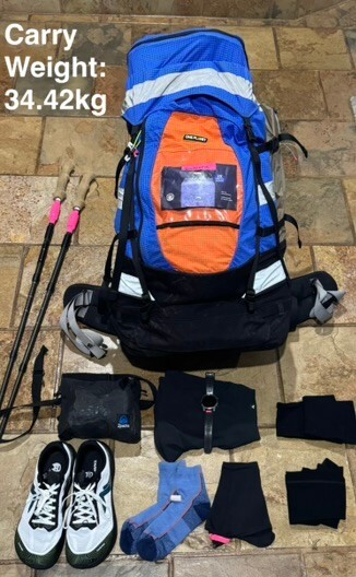
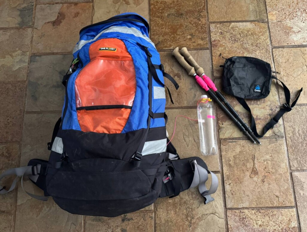
I started with more than 35 kg in an 85-litre One Planet pack. It was heavy, particularly in the early days, but I chose it for its supportive harness and ability to carry a substantial load comfortably. As food was consumed, the load gradually reduced.
I kept the things I needed frequently close to hand, including water, electronics and food, so I didn't have to keep removing the pack.
I generally aimed to start walking at around 3–4 am, using the early hours for walking while I was fresher, and adjusted the length of individual days around terrain, weather, fatigue and the next practical stopping point.
Food and hydration
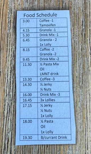
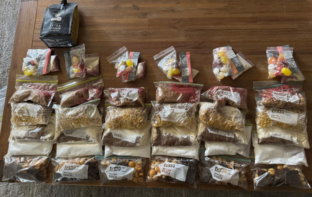
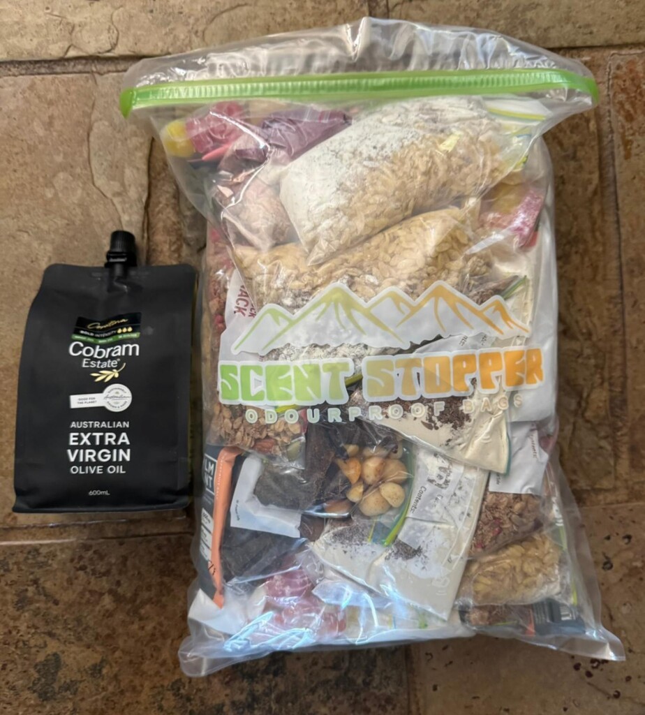
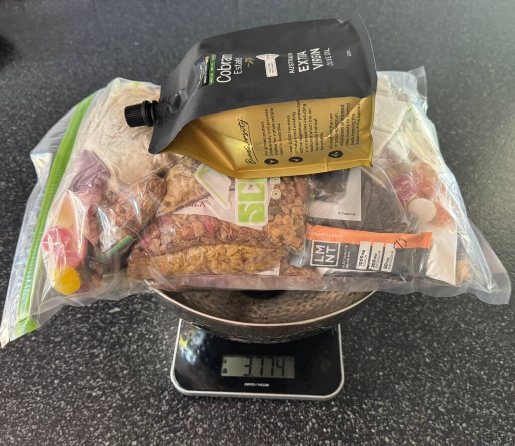
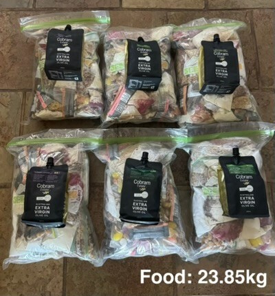
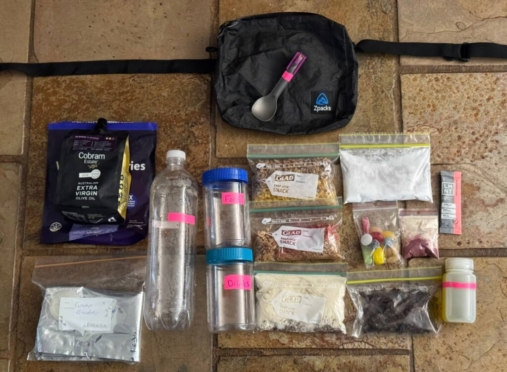
Food was one of the biggest compromises between calories, volume and weight. I planned around calorie-dense, straightforward meals:
-
Pasta with textured vegetable protein (TVP) and olive oil.
-
High-energy granola with freeze-dried fruit powder.
-
Smaller foods including jerky, macadamia nuts and lollies.
-
Whey-protein and coffee mixes throughout the day.
-
Maltodextrin and fructose to increase carbohydrate intake without excessive fibre.
-
Electrolyte drinks.
My planned daily olive-oil allocation was about 90 mL, helping increase energy intake without adding much volume.
To keep eating consistent rather than waiting until I felt hungry, I set 14 watch alarms, spaced about 75 minutes apart. A small Zpacks waist pouch held most of a day's food, along with containers for food and liquids, so I could eat while walking.
I knew that even with calorie-dense food there was likely to be an accumulated energy deficit, and I tried to manage that through regular intake and sensible daily pacing.
I carried a lightweight, narrow water bottle secured to my pack so it couldn't be lost, plus an additional lightweight bladder for longer water carries, particularly in the southern sections. I also carried backup water-treatment tablets. This let me vary water capacity without carrying multiple rigid bottles all the time.
Footwear, clothing and foot care
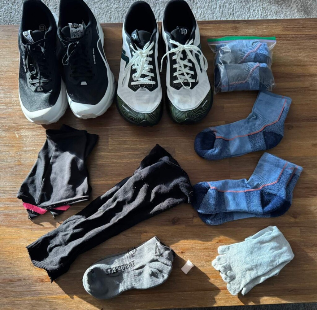
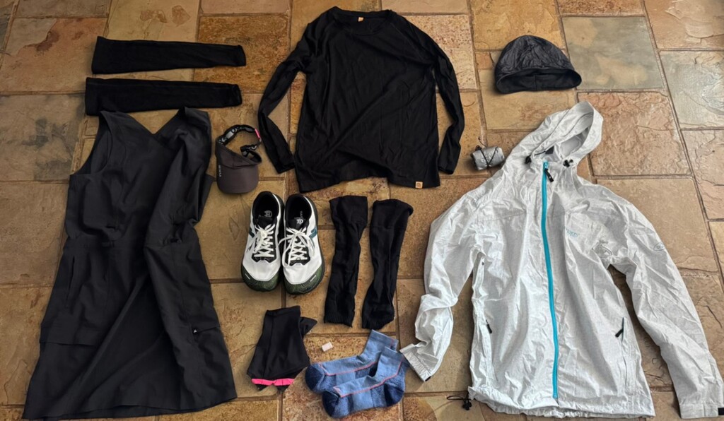
I used two different Tarkine trail-shoe models — Devil 3 and Giant — with the intention of rotating them during the day. The Giant offers a more cushioned feel, and changing models helped vary pressure points rather than repeating exactly the same movement and loading for the whole walk.
In prolonged wet conditions, I could favour one pair and keep the other dry where possible.
My sock system included Darn Tough socks, thinner alternatives for wet conditions, Injinji liners, and Dirty Girl gaiters to help limit debris entering the shoes.
My clothing was deliberately simple: a lightweight Macpac dress, removable merino arm sleeves, a visor, a merino layer and lightweight rain protection, with a few small items for colder conditions.
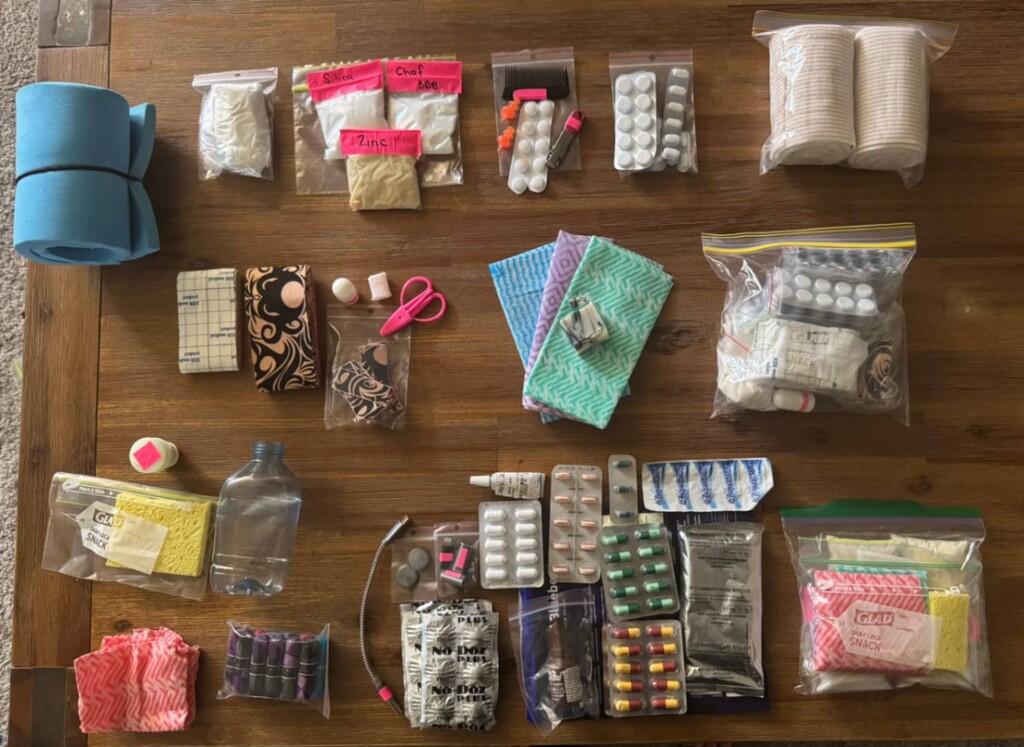
I also carried a compact foot-care and skin-care kit with tape, padding, anti-chafe products and basic hygiene supplies. The emphasis was on identifying friction or irritation early rather than allowing minor problems to develop over repeated long days.
Shelter and sleep
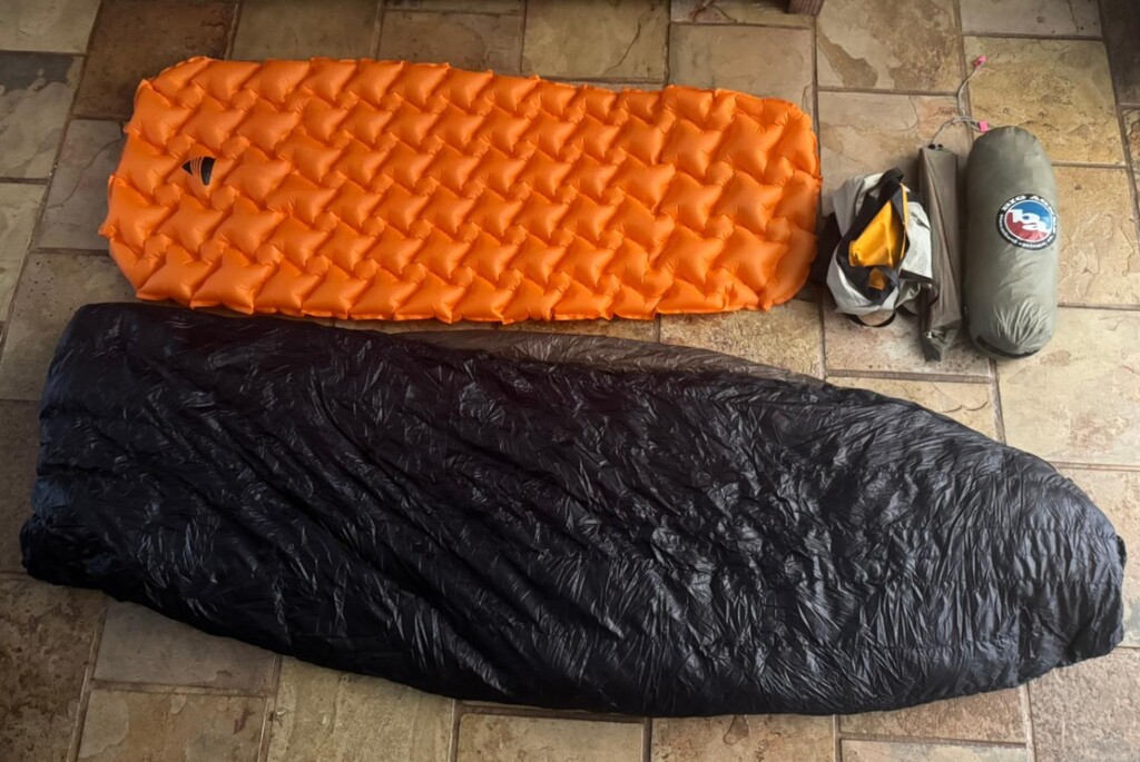
I carried a Big Agnes Copper Spur UL1 freestanding tent (approximately 1.1 kg), a compact sleeping pad and an Enlightened Equipment quilt.
I knew this setup well and could pitch the tent quickly, even when tired. The Bibbulmun shelters were useful, but having my own shelter meant I could manage sleep, insects, weather and late arrivals without depending on an empty hut.
For me, familiarity and reliable rest were worth some extra pack weight.
Electronics, navigation and charging
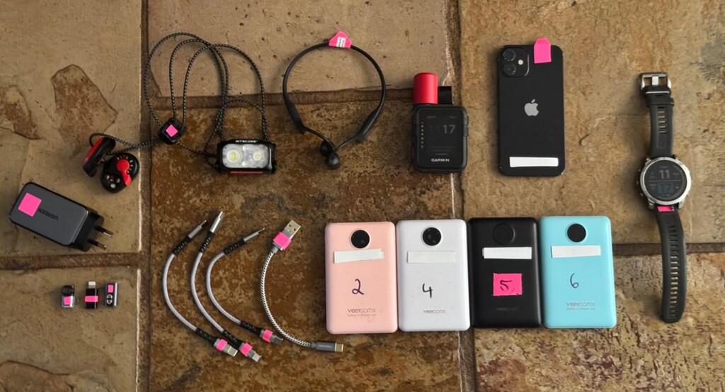
I carried a Garmin Fenix 7, Garmin inReach, iPhone 12 mini, two headlamps (Petzl e+LITE and Nitecore NU25), and four 10,000 mAh power banks.
I used a 65 W multiport wall charger, short cables and small adapters to minimise extra charging gear.
The phone had offline navigation resources, including FarOut and MapOut, although I aimed to minimise phone use and distractions. The inReach also provided an emergency SOS capability.
I had clarified the use of publicly accessible charging outlets before the attempt and used locations such as visitor centres when they were open.
Charging opportunities were not always available when expected, including on public holidays or outside business hours, so battery reserves and managing headlamp use became important parts of the walk.
Unsupported approach and evidence
FKT approved my approach without public live tracking before I started.
I recorded the walk using Garmin devices and provided the GPS files for review after finishing.
I also supplied more than 200 photographs of me at huts and available track logbooks, plus videos of my equipment and setup, including my pack, food, footwear, shelter and electronics.
Together, these materials support the day-by-day account and provide a way to check my location and progress without publishing my whereabouts in real time.
I used publicly available trail facilities and, where needed, public charging and shower facilities in line with the clarification I had sought in advance.
Some visitor-centre logbooks could not be signed because the facilities were closed when I passed through; my photographs and GPS records provide supporting evidence for those locations.
I also recorded the diversions encountered along the route, including locked access at Mundaring Dam, forestry and road diversions, and changed sandbar or estuary conditions near Denmark and Torbay.
Where an official diversion was required, I followed it, including the longer mapped diversion at Torbay rather than using offered boat assistance.
I passed the Collie track junction without making the side trip into town, consistent with the prior guidance I had sought.