WOOOOWEEEEE!!!!
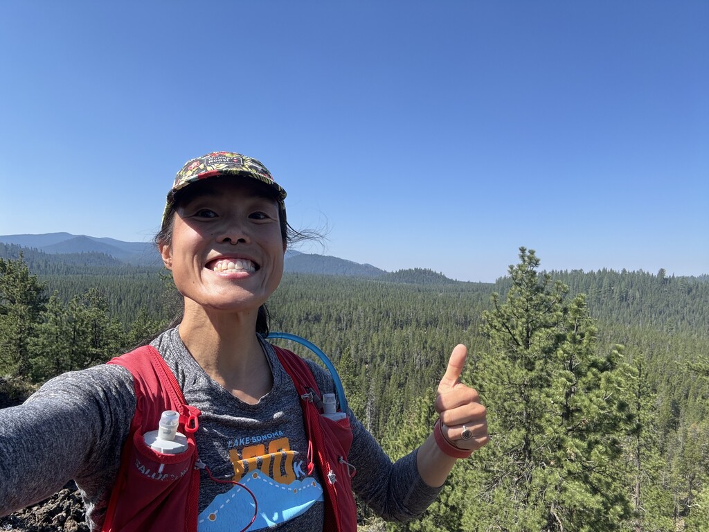
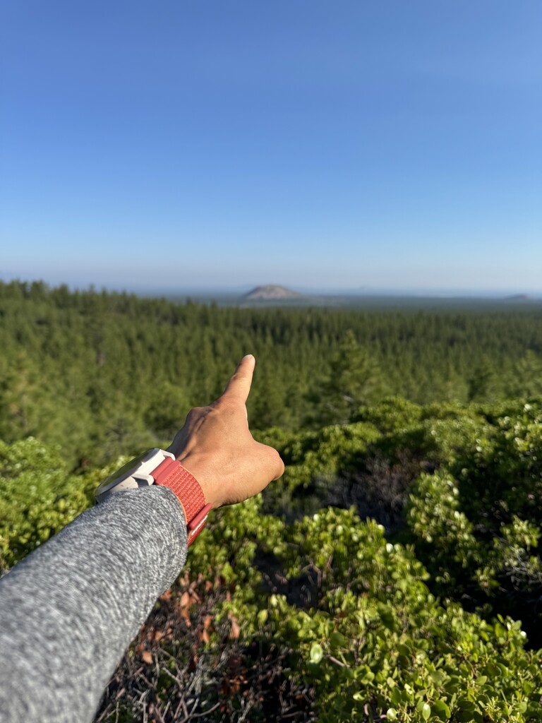
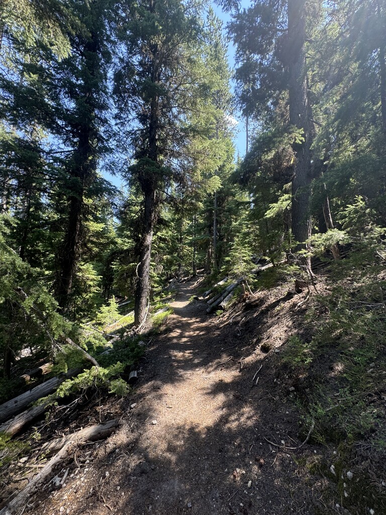
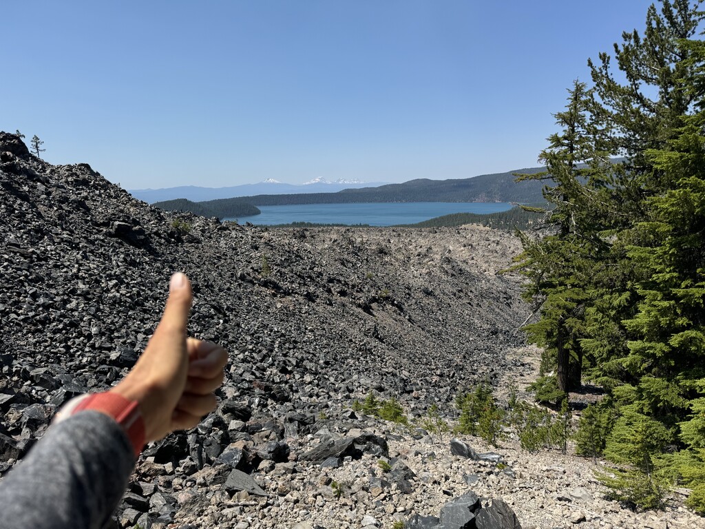
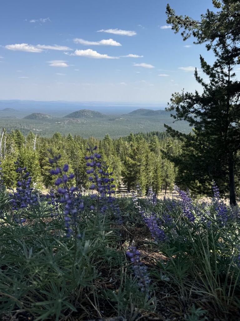
holy smokes! what a day! 10:15 minutes out there, almost entirely singletrack, connecting horse butte to paulina peak and then down my most favorite buttery 12-mile long descent!!!! a nice mix of mostly running through the ponderosas (aka SHADE!!!) with some fun forays into obsidian covered trails, skirting the lava flows, red martian rocks, sandy beaches at 7000' and gnarled whitebark pine. In mid-july, there was plenty of fun flower peeping including my new favorite... mt hood pussypaws!!! and despite seeing a total of 12 people on the trails the entire time outside of drivable areas (the campgrounds and paulina peak), the trails are super well maintained and very easy to follow.
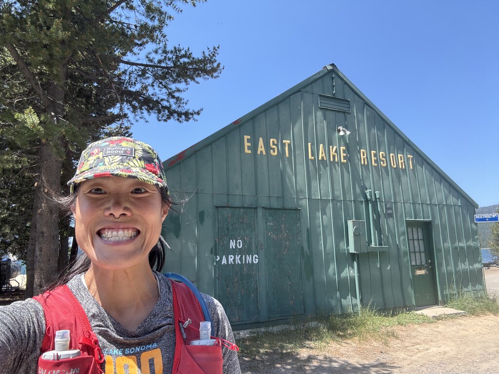
i started at 715 from horse butte with 2 liters of water, one flask filled with guayaki enlightmint yerba mate and one flask filled with tailwind endurance (2x200 cal packs). in my pack, i carried 26 donut holes from richard's ($3.50 for 12 donut holes, which pack 60 cals and 7 grams of carbs/donut. not too shabby!), 4 more packs of tailwind endurance (200 cals each), some TP and an empty ziploc to pack out my trash. 3 liters is a spicy amount of hydration to carry to get you to mile 28 especially when it's that hot out and i do not recommend. at all. lots of slow down miles as i had to ration my drinking to 3.5 ozs per mile for the first 30 miles while worrying about heat exhaustion and dehydration in the middle of nowhere with no cell service :) not really sure how this effort would have gone had i not come across 2 very small patches of snow (less than 8' diameter) that i used to shove down my bra, my pack and to refill my bladder. even with this snow/water resupply, i arrived at cinder hills campground on empty. i chugged almost a liter of water, refilled my flasks with tailwind, refilled my bladder, soaked myself down entirely and continued on from cinder hills campground. from here to the lost lake trails is pretty unremarkable but then ITS ON. lost lakes trail is FRICKFRACKING STUNNING and the views as when you reconnect to crater rim trail are fantastic. also SHADE! its just so nice that this route has SO MUCH SHADE !!!! so from the peak, maybe you're like me going oh yeah baby, it's all downhill from here. well... 12 miles is a long time to go downhill. haha. enjoy a few dips in the last 6 miles and before you know it, you'll be done and drinking a cold fanta while you try not to puke in the stream 10' from a guy sitting in his camp chair in the shade in the water. i ate 19 donut holes before my stomach said no more so on a hot day, i take that as a win. plus that meant i had 7 donut holes to enjoy once my stomach stopped being a punk.
so cool, so fun, and pretty challenging to do without support or water caches. who's next??
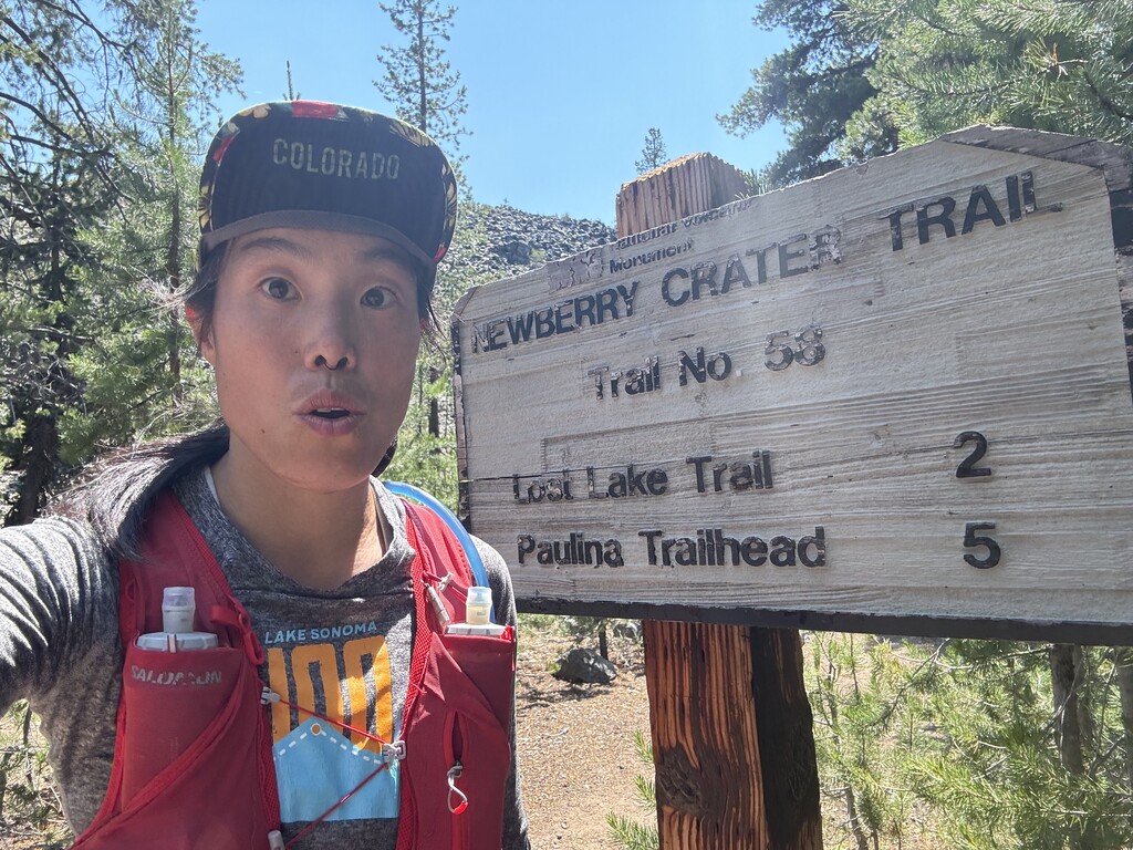
my gpx file differs from dirk's (the original submission) because i went later in the year when snow was not an issue. as such, if you follow the gpx he submitted, it deviates pretty significantly at the approach/descent from paulina peak because of snow. instead of just following the line (as I am apt to do), make sure to screenshot the description he put up with trail names and just follow the very obvious trail. there are a few points where navigation might get a weensy bit tricky, so i thought id detail them in case someone as directionally challenged as me goes for this :)
1. DO NOT MISS the turn for cinder hills campground. as dirk says, it's 2 miles in when you first start on the crater rim trail. there is a sign. it happens around mile 26. you'll probably be on the lookout for it as you will be running on empty with water reserves by this point. i found the water spot was more like mile 28 rather than 30.
2. after refilling water, i chose to run through the campground on the road rather than returning to the trail. i stopped to take a pic with the east lake resort sign and then i got confused. from here, you'll leave the campground road and then cross the main road towards the RV park. the trail continues behind the RV park (this will all make sense when you're out there).
3. maybe 2 - 3 miles before the peak, the gpx deviates greatly from the trail. just trust your gut, stay on the crater rim trail. there's really nowhere else to go. you'll cross a gravel road and the trail continues on the other side, about 50 feet to your left. it's not always the easiest to spot, or like dirk says, go to the peak on the road.