This very demanding traverse went smoothly, and I was fortunate with the weather. The progression was as follows:
-
Start on 08/15 at 12:01 am in full self-sufficiency until the evening of 08/16, when a friend joined me.
-
From 08/17 to the evening of 08/25, a friend followed me with a van, meeting me at agreed points so that I could sleep in it. Otherwise, we did not meet specifically during the day, except sometimes for a few kilometers in the evening so he could also get his daily run in. I was fully self-sufficient throughout the day, with efforts ranging from 8 to 15 hours. For food, I carried my sports drinks, gels, and other nutrients, and used mountain huts (refuges) when possible to resupply. For water, I refilled in rivers, villages, and huts. I had no issues with water except on the first 60 km section between Menton and the start of the Mercantour, which is very dry and has few, if any, huts.
-
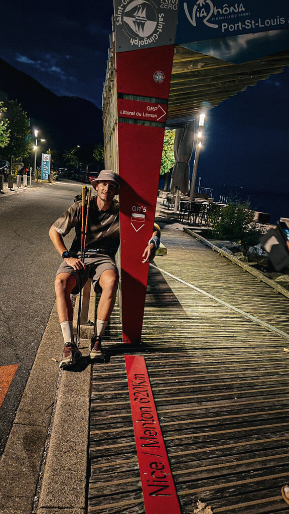
On the morning of 08/25, I set off again in full self-sufficiency for an “ultra mode” push, moving for 37 hours without stopping, covering the final 130 km between Les Contamines-Montjoie and Saint-Gingolph. I endured two storms during the night that weakened me, but I wanted to finish in style.
I carefully followed the GR trail markers, so the actual track differs slightly from the official proposed route for several reasons:
-
The presence of alpine pastures requiring detours of 50–200 m.
-
Storm Alex in 2020 destroyed the entire GR in the Boréon / Vésubie valley. A temporary route was still in place on some sections, and a newly inaugurated GR appears to have opened this year, based on the fresh trail markings and improvements.
-
Certain paths now cross private land (restaurants, summer activities), requiring detours of 50–200 m.
For these reasons, I suggest replacing the initially proposed track with the one I completed, which represents the most accurate version of the route to date.
An extraordinary adventure, my first time on this kind of format, and one that now makes me want to take on other FKTs—and to propose some myself.