
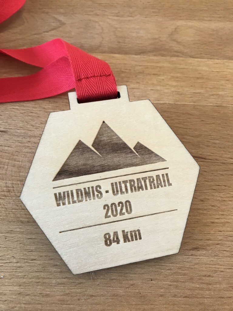
85,75 km in 09:49h.
Overall the complete Wildnis-Trail is devided into 4 sections (which are 1day hikings trips each):
Höfen-Einruhr
Einruhr-Gemünd
Gemünd-Heimbach
Heimbach-Zerkall
Start and finish of each section is located at the visitor centers (so called ”National-Park Tor”).
Each section is between 17 and 24km long. There are good options for filling up water at the visitor centers (or nearby petrol stations / cafes). The official gpx data, provided by Städteregion Aachen shows 84km length in total. I ran 85,75km – keeping in my some small deviations due track changes. Overall, I have to say, that the gpx data is not always 100% in line with the signs on the track. I definitely recommend to follow the signs on the track, as the gpx data shows some no longer existing paths….
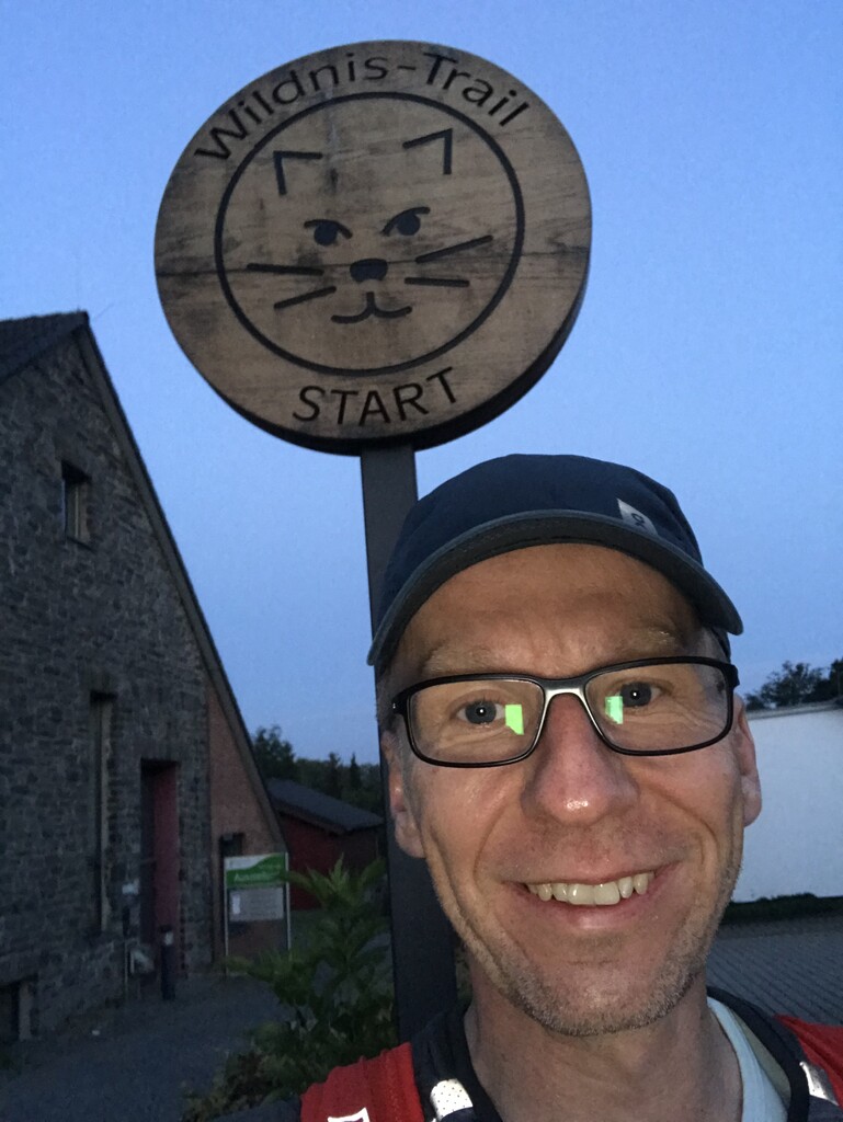
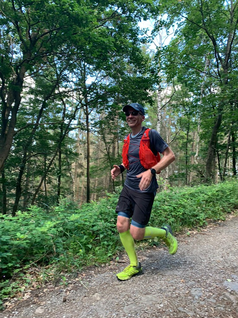
I started the run at 05:00 in the morning in Höfen (Parking next to the visitor center, vending machine for parking tickets). No other people around, btw. haven´t met any other people on the track before kilometer 35, which surprised me, as the conditions have been ideal for hiking tours…
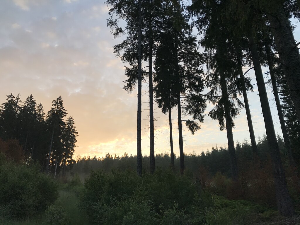
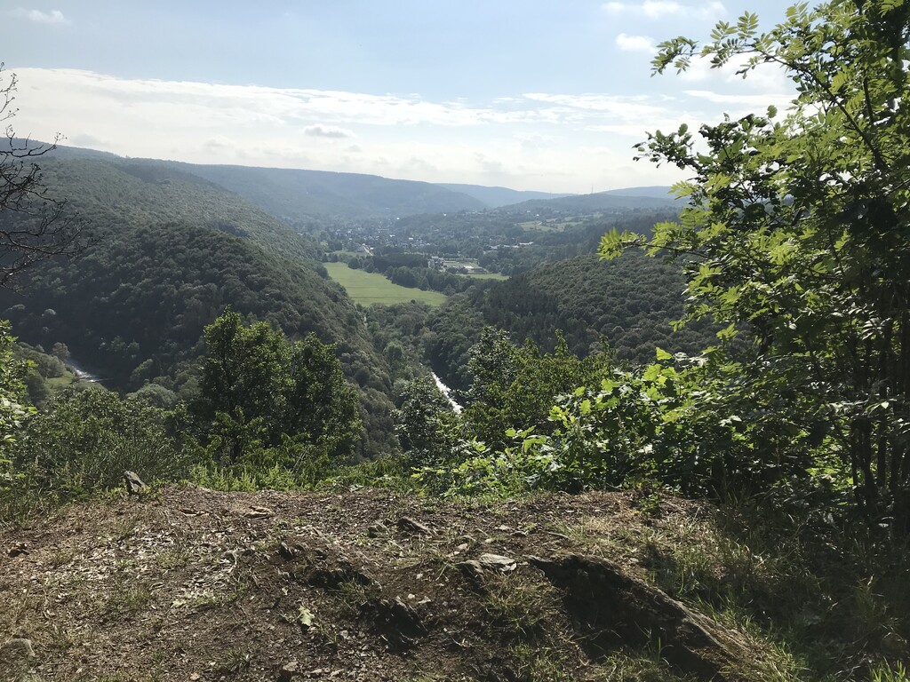
The track starts with a single trail downhill (which required directly some focus, as it was still a bit dark). What follows is a very nice mix out of wide gravel path and small single trails. The track leads through small valleys in an completely uninhabited area. At km 15,5, after a semi-steep incline the track reaches a high moorland (Dreiborner Hochfläche). Here (exactly at km16) I recommend to follow only the signs. The track has changed versus the gpx data and I found myself in bushes and neetles, and for some minutes, I thought being at the Barkley Marathons…
The following paths are again beautiful single trails. There is another important remark for km 19 (might be at 18,5) at a sign called Hirschrott: the track pretends to go straight, slightly down – but in fact you need to turn sharp right (before the sign) uphill through a small steep channel.
Passing the small village of Erkensruhr you need to turn right uphill at the church (sign missing). The path is divided into an easy version, and the real version. At the real version, a steep incline followed, which forced me to hike and safe some energy….
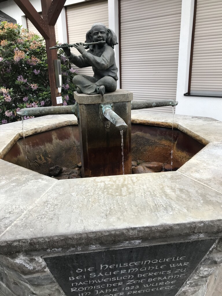
A long downhill leads to Einruhr, half way, there is a beautiful view on the lake and village. As the Kiosk in Einruhr was closed that time of day (opens at 08:00) I used the drinking water fountain right behind the visitors center, so called Heilsteinquelle (watch out the taste of the water is kind of special).
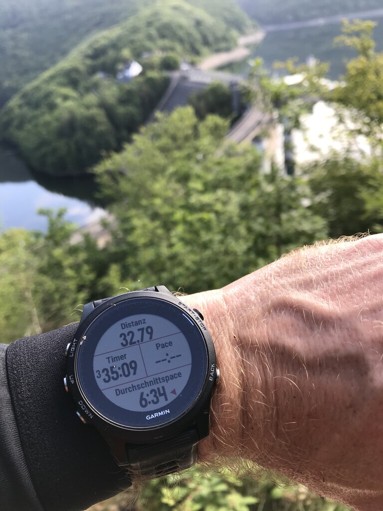
The track follow the lake (again some deviation between signs and gpx) and in between there a nice views on the lake. There is a longer incline (in between a nice view on the dam of Urfttalstausee) up to the plateau of Dreiborner Hochfläche. Here again, deviation between gpx and signs, which drove me kind of crazy, before I realized that in this case both path are nearly parallel. It was getting warmer with no shadow of trees… There is also the “Wüstung Wollseifen”, a former village which was abandoned and later on used as military training area. Here I met the first people on the trail some hiker, coming from the other direction. There is a valley in between before climbing for Vogelsang and while running downhill I was suffering from pain in my left foot, questioning if I´ll complete 84km….
Passing the former Nazi-Training-Academy (today memorial IP Vogelsang), I made my way towards Gemünd, enjoying again some nice views on the valleys around. The last km towards Gemünd felt definitely longer than in reality…. Again gaining some additional meters of high vs. gpx…
In Gemünd there is end of stage 2 and start of stage 3 at the visitor center in the town. Shortly after Gemünd the track is passing a dark valley (due to trees) towards Wollgarten. The now following part is less spectacular but most of the track was “runnable”. I was glad, that the track is mostly covered by trees giving shadow, as temperature was raising. At km 58 (in my case at 59,5) there is the monastery Mariawald, well known for their soup – but I passed by without any soup. Again the tracks proceed with up and down through the forest towards Heimbach. In general, there was no deviation of gpx versus signs in this 3rd section. After passing by the castle of Heimbach, I reached the visitor center in Heimbach (next to a petrol station, good for water refill).
In the following section, especially in the shortly following incline, I was suffering, due to the heat, some 70km already in my legs, and I needed to push myself climbing uphill as quick as possible. Again the track remains unspectacular, just a last downhill 3km before the finish in Zerkall is demanding some focus and strong legs. Still on the last few hundred meters there is some deviation, but with the finish almost in sight, I didn't care anymore…
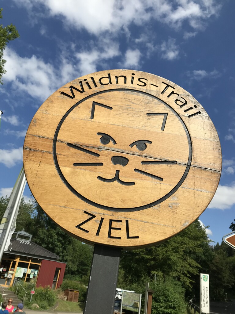
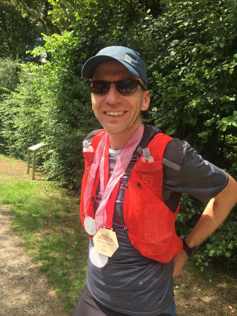
I reached the visitor center in Zerkall, the finish of the 4th section and the totals Wildnis-Trail after 09:49h of running, with a total distance of 85,75km. My family was waiting and cheering for me, awarding me a specially created medal for this unique adventure.
Overall the Wildnis-Trail is a beautiful track, personally I would rank section 1 and 2 way more attractive than the following two, but this might be caused due to a tunnel view after 45km elapsed ?.
Great track, great conditions - great experience!