I uploaded the route a while a go and since then I've noted that the .gpx has been changed?. Just a note that the .gpx isnt right its made it longer and there's a section missed out.. I'll talk through the correction later and ask admin to update or just use my strava file as a guide.
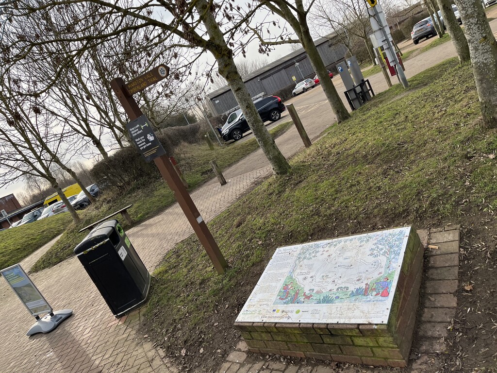
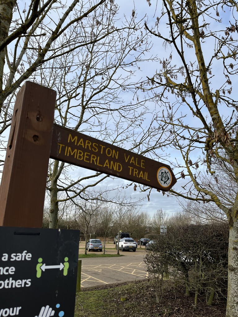
I started from the Forest centre as there a sign and a Map there (as per photos) I read through the reports of the previous FKTers and noticed a few points to watch out for.
I went for a clockwise loop as it gets the hills out the way in the first half. As you come out the Forest centre and turn left by the Church there's some ploughed fields to deal with and then you cross the train line, note when you cross go right and then left down a little lane. Then you are up a big section of roller coaster hills that run around the Proving ground ( In the Summer they run a 5k where you get to run around the alpine circuit and the 4x4 track, its awesome)
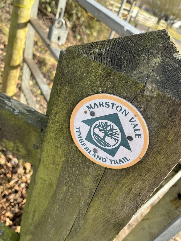
As you come up the big hill towards the golf course, look out for the Timberland Sign Decals, the route takes you right and then left in a zig zag chicane, if you find the golf course on your left hand side youve gone wrong.This part is nice you get a load of time back running down the GSRW/Timberland trail. As you hit a road hill up towards Milbrook you branch away from the Greensand Ridge Walk and head down the road a but further ands then turn right ( its easy to stay on the GSRW at this point so watch out)
As you come up another hill you are back on on the GSRW towards Ampthill park, follow that all the way, as you enter the Park head straight and you will be on the Ridge in Ampthill park with some great views, this part you have to concentrate as the signs are hard to see, you will see a lodge in the distance head towards that keeping it on your right and then take the path straight out the park towards some houses and down into Ampthill, it's really easy at this point to think you need to head up to Houghton House but that the GSRW route, you need to head down into the middle of Ampthill and straight through towards the Church where you turn left. The route from the church takes you up towards Houghton House , the fields are boggy, uphill and a lot of gates. All the signs are there you just have to look out.
As you approach Kings Woods, don't go in it, stick to the right on the path that hugs the side of it as you come down the side the downhill gets fast and then at the bottom turn left, so Kings wood is always on your left, in the distance you'll start to see the Stewartby towers, keep them In view. There some farmers fields to cross here and some bridges with the signs on , keep a lookout. At one point you come through what feels like a Garden onto a driveway, the route suddenly appears from the left taking you down a small overgrown path towards the main road. Care full as you cross as this is a busy one.
As you've crossed the road you head over a field and then turn right keeping the bush on your left, you are approaching now a part where i've seen a few people go wrong as you come up the path keep to the path that forks left, the other path puts another mile or so onto the route. As you come over a little bridge the route gets boggy and feels a bit wrong but carry on and head under the railway and then turn right straight away, ignore all the other paths and head down the path that stays near the green fence with the railway line on you right. As you come off the path and turn left you are in Stewartby, you'll see the signs for the Trail on the Path Lampposts. Head down the village and then left by the big village hall and the path takes you around the corner and then you re enter the Forest Centre, from there it's about another 2.5 k of flat path with the lake on your right.
All in all I got my navigation spot on from using the Timberland leaflet from the Forest Centre and reading the descriptions.I feel that's really important in an FKT attempt as its really a test of speed and preparation.
Two bits to really concentrate on for me are the exit out of Ampthill park towards the town centre and then that fork left after you've crossed the busy road towards the end before you hit Stewartby.
A good day out, let me know if you give it a go and I can help with anything.
Tim
Comments
*correction...at the end the flat path back to the start , the lake is on your left ( not right like I put in the report)
Apologies for the typos, it was late when I typed this up!