The Whitefish Trail currently consists of 12 trailheads and 42+ miles of natural surface trail composed of stacked loops, scenic overlooks, single‐track trails, and gated logging roads, stitching together a mix of state, federal and private lands. It serves as the anchor project of Whitefish Legacy Partners (WLP), the nonprofit organization whose community-minded mission has furnished permanent protections on thousands of acres of vulnerable parcels while establishing a sprawling network of trails readily accessed from town.
My objective in running this route was to round out WLP's monthlong “Hit the Trail” fundraising challenge (each mile logged = $1 in matching grants) and highlight its remarkable conservation achievements by linking up the existing network of trails girding the city while teasing out the missing puzzle pieces, as set forth in the 91-page "A Trail Runs Through It Master Plan," which was adopted by the City of Whitefish in 2006 and serves as a guiding document for land conservation, recreation and education.
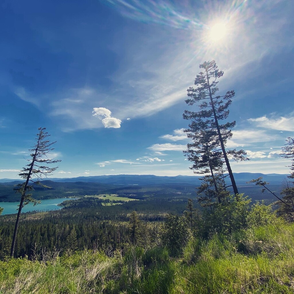
At the risk of grandstanding, the braintrust behind the Whitefish Trail had the foresight to recognize way back when that increased urbanization and development pressures were reshaping western communities like this one, which serves as the gateway to Glacier National Park and the Bob Marshall Wilderness Area, and their determination to protect 13,000 acres of State Trust Land, which was on the chopping block, poised for sale to the highest bidder, has led to the preservation of even more acreage for wildlife habitat and recreation. They’ve been setting the bar for grassroots conservation and collaboration for more than 15 years, and their work is proving even more critical as the COVID migration reaches a fever pitch, transforming the Flathead Valley at a breakneck pace.
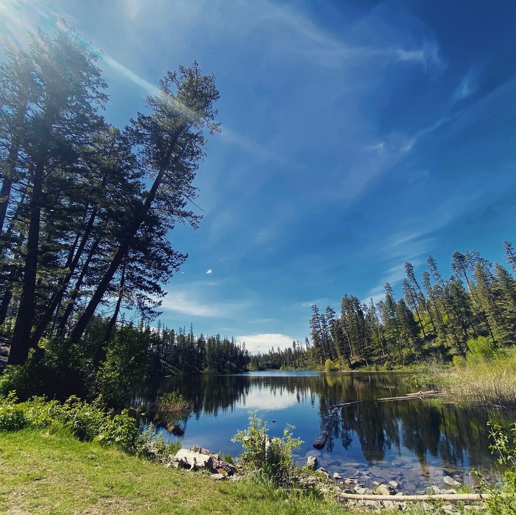
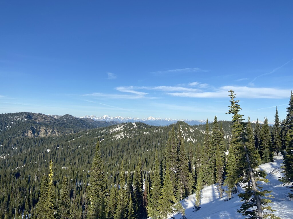
The route itself links up Lion Mountain, Skyles, Beaver Lake, Woods Lake, Swift Creek, Smith Lake, Big Mountain, and Haskill (Reservoir), deviating from the official Whitefish Trail above Woods Lake and following the access road to the old user-developed "Back 9" trail, which leads down to the railroad crossing and Delrey Road. From there, it's a brief section of paved road to the Swift Creek Trailhead, which tracks along Swift Creek, crosses Upper Whitefish Lake Road and connects to Smith Lake.
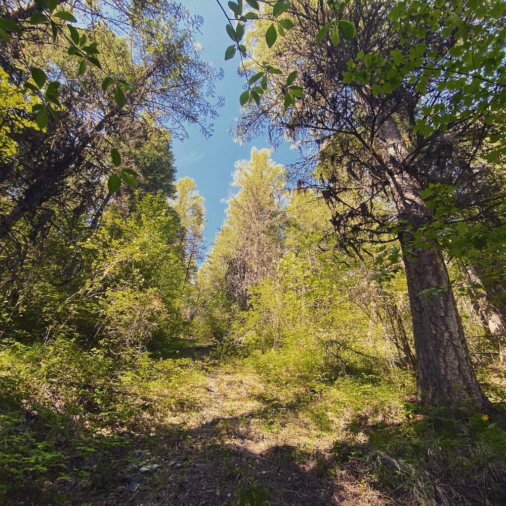
The trail ends here, and from the foot (southern end) of Smith Lake the route requires navigating game trails and old logging roads adjacent to Smith Creek while ascending 2,000 feet over ~6 miles to tie in with Taylor Creek Road. Although it's not posted, there are private parcels in this section, so take care to consult a mapping app like OnX to negotiate the property line and stick to the old Plum Creek/Stoltze acreage, on which public access is allowed. This section affords rarefied views of the stunning Whitefish Lake Watershed and the Upper Whitefish Range.
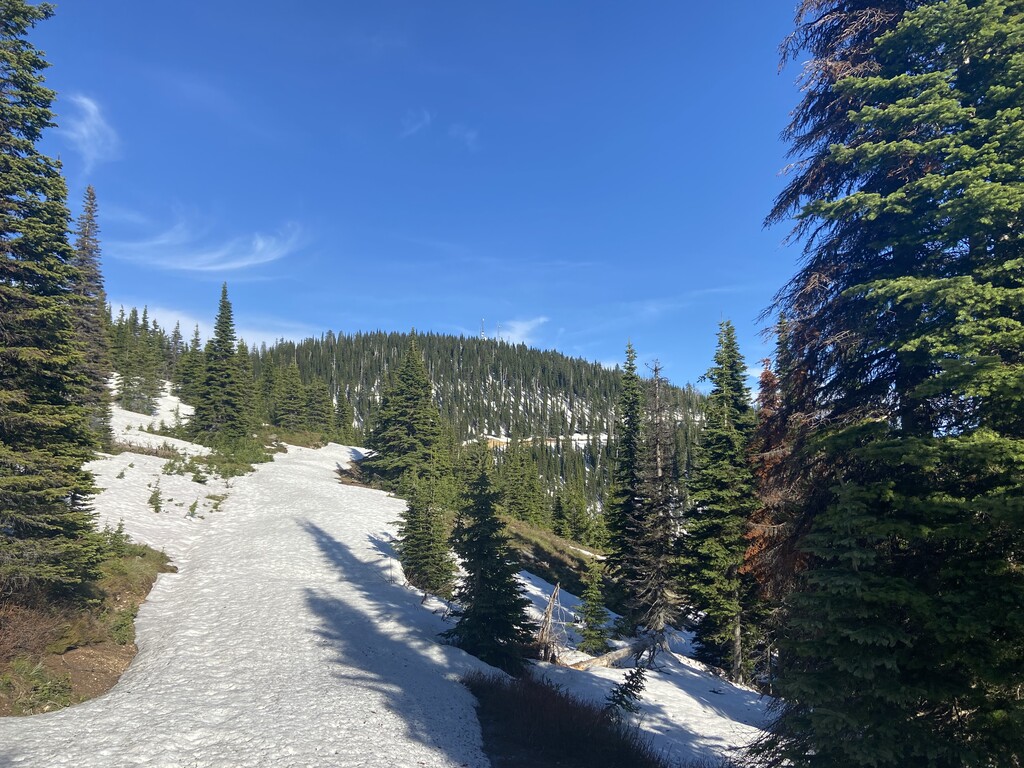
At Taylor Creek Road, the route heads east for ~5 miles to the summit of Big Mountain at Whitefish Mountain Resort (WMR). From here, I chose to run straight down Toni Matt and connected with the WMR XC trails at Wolverine Pond. This leads to the upper terminus of the Reservoir section of the Whitefish Trail, which is mostly downhill to the Reservoir Trailhead off Reservoir Road. Then it's a few miles of pavement through town and back to the Lion Mountain Trailhead.
There are options to extend the route by adding loops and overlooks in the Beaver/Woods Lake area, and the construction of a new three-mile section of trail connecting Swift Creek/Smith Lake to Haskill Basin (approved by the Flathead National Forest in 2019 as part of the Taylor Hellroaring Project) will likely allow trail users to bypass Big Mountain altogether, but I think the Biggie summit gives this route major style points. I also started the run by tagging Lion Mountain, also not necessary but adds vert and style points, given its significance to the local community.
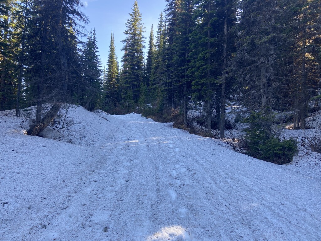
I carried a 12L vest with eight gels, two Clif bars, eight saltstick caps, a sandwich I never ate, and three 500-milliliter soft flasks of water. I refilled two of the bottles from Smith Creek, and refilled again using snowmelt near Hellroaring. Given my late start, the heat and the fact that I was alone, I paced very conservatively and was slowed to a sustained slog once I hit snow on Taylor Creek Road, at just below 6,000 ft. altitude. The road remained buried until the summit at Big Mountain, but I felt good the entire day and didn't mind the added challenge, although I would've preferred to have kept running this section.
I hope someone gives this a go. Again, my objective was to showcase the conservation legacy of WLP, especially as we enter our "summer like no other" in the Flathead Valley, but it could be done a lot quicker, especially when all the snow melts of Taylor Creek Road, probably by mid-June.
Support your local trails! It really is about more than the trails themselves.