

IMPORTANT NOTE ABOUT NEW RULE – FKT FOLKS PLEASE READ!: The standard has been that men’s times start at the first trailhead and end at the last summit, while women go trailhead to trailhead. This puts women at an inherent disadvantage, both because they have to descend the last mountain and because the difference in ending point might impact which mountain you choose to finish on. My trailhead to last summit time was 3 days, 11 hours, 48 minutes. However, I am submitting my trailhead-to-trailhead time of 3 days, 12 hours, 35 minutes. I ask that going forward everyone completes the NH 4,000 footers TH to TH, that way we’re all playing by the same rules. I have agreement on this change from other 4,000-footer record holders such as Stefanie Bishop, Bill and Briana Tidd, and Andrew Drummond. If the FKT folks wouldn’t mind reflecting this change in the route description that would be amazing!
Xander and I also released a long podcast talking about our experiences on this effort on 6/29/2022. The podcast is “From The Backcountry” and it’s episode #13.
Overall Stats:
- 175.8 miles
- 70,556 feet of vertical gain
Day 1 – 10 mountains, 47.8 miles, 17,914 feet of vert
- Carrigain - https://www.strava.com/activities/7338031088
- Pasaconway, Whiteface, Trips – https://www.strava.com/activities/7338037862
- Hancocks - https://www.strava.com/activities/7338038609
- Osceolas - https://www.strava.com/activities/7338040806
- Tecumseh - https://www.strava.com/activities/7338063942
Day 2 – 16 Mountains, 45.1 miles, 18,409 feet of vert
- Flume, Liberty, Lincoln, Lafayette, Owl’s Head, Garfield, Galehead, Twins, Bonds, Zealand, WFT Range - https://www.strava.com/activities/7344166183
Day 3 – 15 mountains, 45.9 miles, 17,969 feet of vert
- Jackson, Pierce, Ike, Monroe, Isolation, Washington, Jeffy, Adams, Madison - https://www.strava.com/activities/7348371059
- Wildcat D, Wildcat, Carter Dome, South Carter, Middle Carter, Moriah - https://www.strava.com/activities/7348374662
Day 4 – 7 mountains, 38.0 miles, 16,264 feet of vert
- Cabot - https://www.strava.com/activities/7349195988
- Waumbek - https://www.strava.com/activities/7349930919
- Hale - https://www.strava.com/activities/7353427392
- Cannon and the Kinsmans - https://www.strava.com/activities/7353430767
- Moosilauke - https://www.strava.com/activities/7353433337
Trip Report
This was really a team effort through and through, and I hope to hammer that point home throughout this trip report. This all began last August (2021) when I took my first shot at this route. I only made it through one day before calling off the attempt. It was blisteringly hot, I got behind on nutrition early, I pushed the pace way too hard, and I was still fatigued from a large effort earlier in the summer.
I took a few months to regroup, but I knew in the back of my mind that I was coming back for it. I felt like I needed to put my best effort forward on this route for multiple reasons. First, I was really drawn by the idea of being the first person to simultaneously hold the supported and unsupported FKTs for the New Hampshire 48. Second, pitting myself against the time of someone with the incredible accomplishments of Andrew Thompson, (AT speed record holder, Barkely finisher), seemed like a challenge that would push me to my limits. Plus, the fact that the record had held for over 7 years told me that I’d need to give it my absolute all to even have a chance.
In November 2021, I asked my best friend Xander Keiter if I could convince him to join me for an attempt in June 2022. We had run hundreds if not thousands of miles together at that point, including a 3-person run of the 100 Mile Wilderness (shout out Nik Hase). He agreed, and we began the process of meticulously planning every detail of the route. Luckily, we had my notes from my last attempt to base our plan around, but we went way deeper into the planning and ended up with a 20-page document of every possible detail including route details, logistics, pacing, nutrition information, mental and physical keys to the game, and more. Shortly after we began planning, our friend Hayes Hart-Thompson asked us about filming a documentary of the attempt. They followed along with us throughout the entire process, so keep your eyes out for that film later this summer!
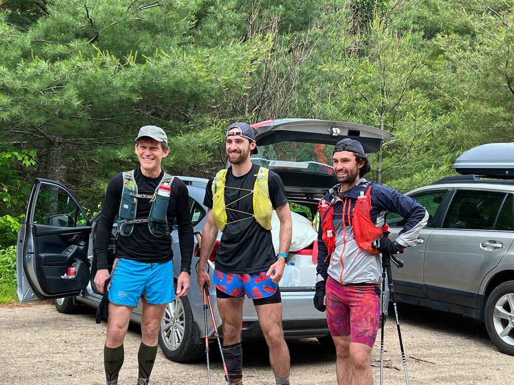
The early stages of training were rough for me. I was dealing with nagging tendonitis in my foot from Bubba’s Backyard Ultra in October (thanks Run the Whites), followed by IT band syndrome in the same leg. I wasn’t really able to do much training besides PT until mid-March. However, once things kicked up, I was able to get in a bunch of big mile training days, and Xander hit his training plan pretty smoothly. (Shout out to our PT Ithamar Jotkowitz for getting/keeping us both healthy.) Throughout the Spring we began to put together a list of possible pacers. Our dads Eric Peterson and Chris Keiter had already agreed to be our primary support crew, so we were all set in that department. Having them available and willing to take time off work was huge for us because due to the weather, we wouldn’t know our start date until a few days in advance.
When mid-June rolled around, we were ready to go and waiting on a good weather window. The window of the 18th-21st looked pretty decent, and starting on a weekend meant it would only require our dads to take 2 days off of work, so we settled on that. Unfortunately, things began to take a turn. Saturday looked increasingly gross, with 90+ mph gusts, windchills around zero degrees, and up to a few inches of snow. We pushed the start date until Sunday because there was no precipitation forecasted, but the winds were still supposed to be incredibly high. This caused us to make a last-minute change of plans on Saturday:
Our original plan was to have our first day be the day that you now see as our day 2. What ultimately was our first day was supposed to be our day 3, and then day 4 was the reverse of what it ended up being, meaning we would end our effort at Mount Cabot rather than Moosilauke. Because of the ridiculously high winds, we didn’t feel comfortable going up onto Franconia Ridge on day 1. Instead, we stuck day 3 at the beginning of the effort and then flipped day 4 so that the end was at Moosilauke rather than Cabot. Looking back, this was absolutely the correct call and may be a better route generally.
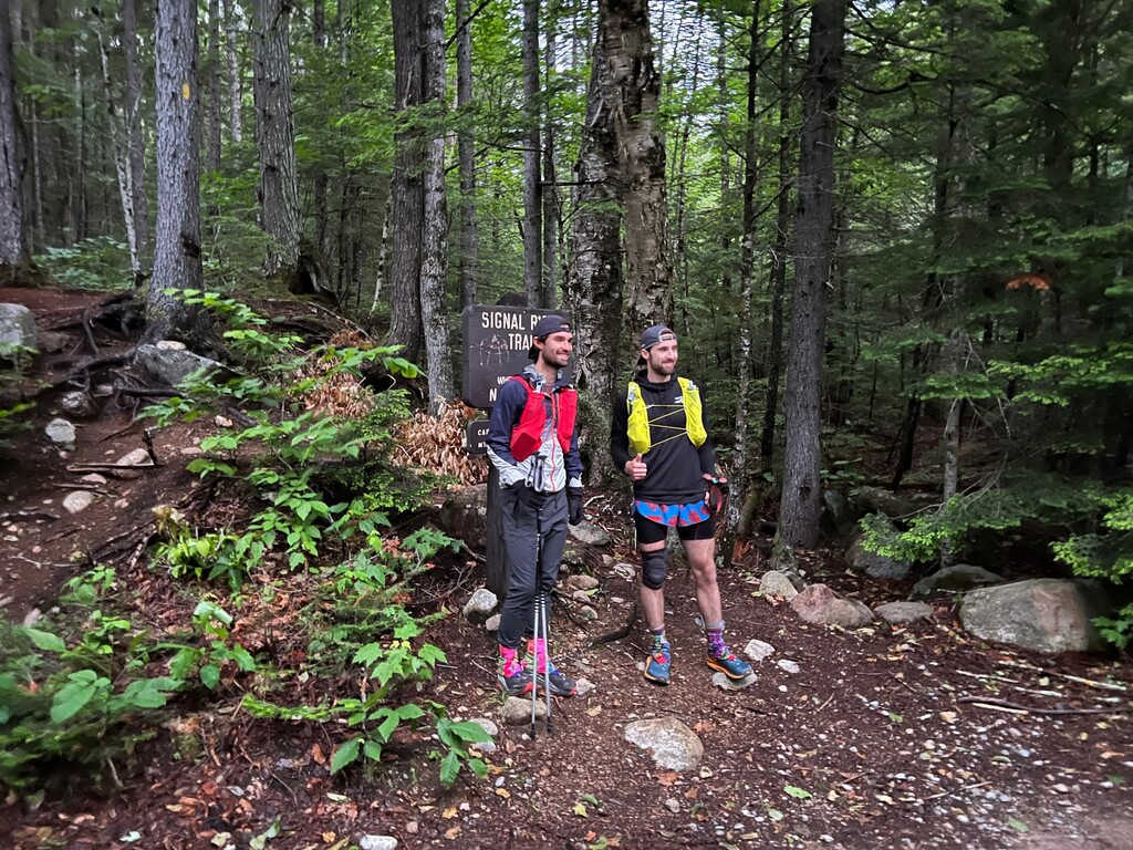
On Saturday, Xander, Chris, Eric, Hayes, Emma Kuhlman (shout out to Emma our last minute filmer!), and I headed to Larry’s house in Bretton Woods to prepare for our planned start time of 5:01am on Sunday at the Signal Ridge Trail up Mount Carrigain.
Day 1
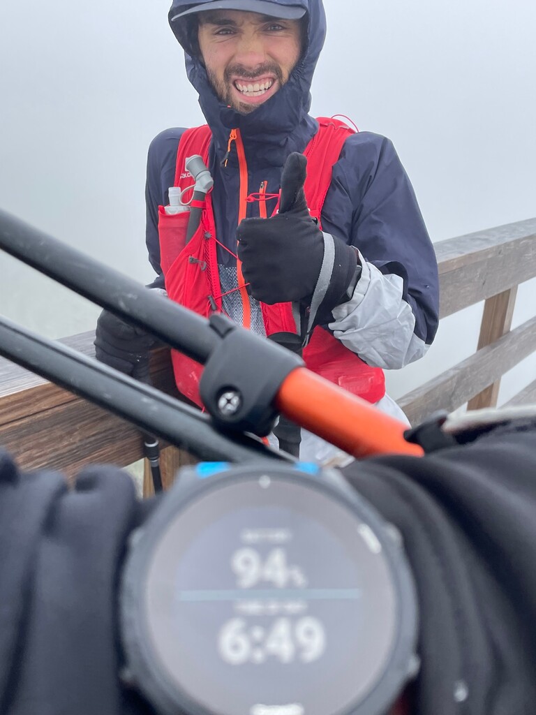
The next morning was surprisingly dry because the raging wind had largely dried things out. It was cloudy and cold at the bottom of Carrigain, and we knew Washington got a little bit of snow, but we didn’t think we would need micro spikes on Carrigain and left them behind. On the advice of Bill Tidd, I didn’t eat anything until right before we started. At the trailhead I ate a banana, tied my shoes, and we headed up Carrigian at 5:01am on 6/19/2022. Most of Carrigain went very smoothly and we spent most of the time convincing each other to walk slower and discussing different aspects of what lay ahead. One fairly sketchy section of Carrigain was the few hundred yards of exposed ridgeline on the Signal Ridge Trail. Crossing this short section was brutal each way. The wind was so strong (80-90mph+ gusts) that it was difficult to move forward, and climbing the summit tower at the top was incredibly difficult in the wind. Definitely the right call to avoid Franconia Ridge on this day. We were delighted however to find no snow on Carrigian. We summited at 6:49am and made our way back to the parking lot by 8:20am.
Our dads greeted us with our new packs that were all ready for the next section. Our strategy for this hike was to have two hydration packs and switch them out at every resupply, that way our dads could prepare the second pack for the next section and just hand it to us when we arrived. This would also be a good time to discuss our fueling strategy. We use a product called Infinit, which is a total nutrition powder that is mixed into our water. Our packs could hold up to 3 liters at a time, which equates to having the capacity for 5 hours of fuel. Some of our blends contained caffeine, some did not. We ate a few bites of regular food at certain points, but our fueling throughout this effort was at least 95% Infinit. We took in around 6,000 calories of Infinit per day.
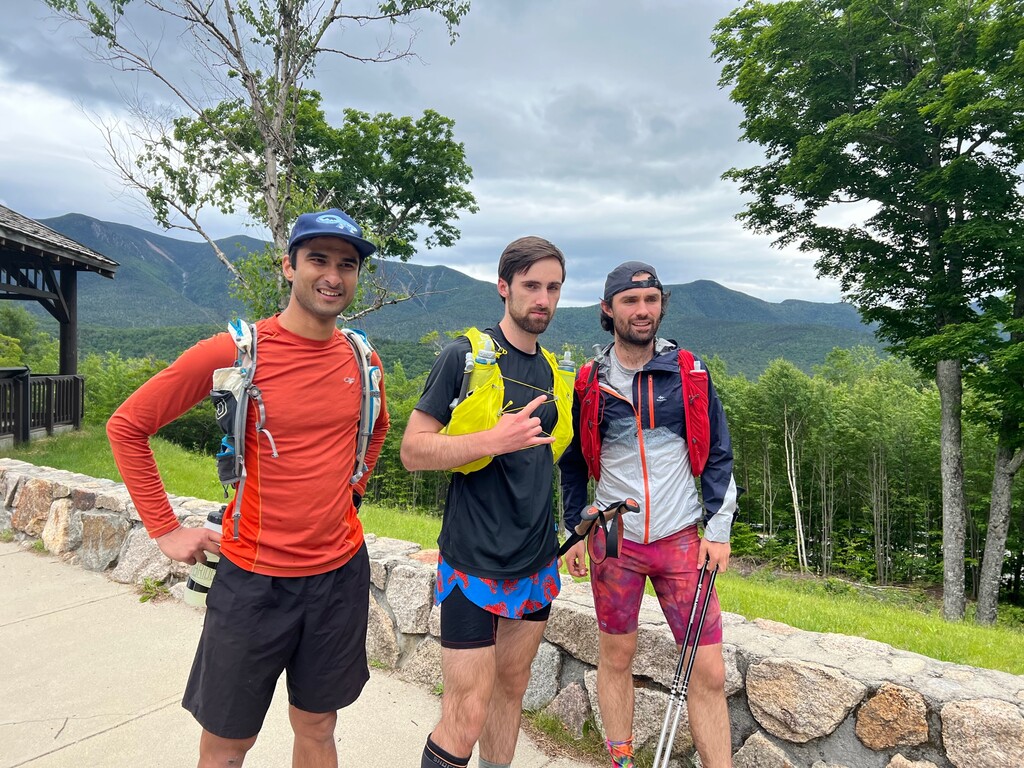
We hopped in the cars and quickly made our way to the Oliverian Brook Trailhead where the wise sage and elder statesman Bill Tidd was waiting to pace us. Cool and cloudy, the weather continued to be nearly perfect save the wind. Due to our good planning, we had almost no more exposed terrain on this day. We began this next section at 8:48am, working our way up to Passaconway. Bill and Xander were feeling good during this section and chatting, but the Infinit was not sitting well with me, so I kept to myself for a while. I’ve had this feeling before and know that usually it’s a passing feeling. Xander and I summited Passaconway at 10:40am, and Bill avoided the summit loop in order to filter some water. This section was scheduled to take us a bit longer than 5 hours, so Bill carried a bit of extra Infinit for each of us. We made our way to Whiteface’s summit at 11:45am, by which point my stomach issues had mostly resolved. The spirits were good as we traversed the Kate Sleeper Trail over to the Tripyramids, hitting the summit of Middle Tripyramid at 1:10pm and North Tripyramid at 1:28pm. We descended the Pine Bend Brook Trail, during which there was much bemoaning the ridiculousness of the first bit of the descent. We made it through, however, and arrived at the Kanc at 2:42pm to the support and film crews as well as our next pacer – my good friend from college Theja Putta.
Eric and Chris were once again on the ball with new packs and quickly took us over to the Hancock Notch Trailhead. We began the gradual ascent up from the road at 3:03pm. During this first day, our strategy was simply to go at a pace that was comfortable and sustainable. For me, that meant not feeling like I was working and being able to easily hold a conversation, even on ascents. We chatted with Theja about a bunch of different topics, just anything to stay busy and pass the time. We reached South Hancock at 4:38pm and Mt. Hancock at 5:05pm. Spirits were still high and we were both still feeling great as we made our way back to the cars by 6:27pm.
This was a very quick resupply and drive over to the Greely Pond Trailhead. In the parking lot we began to get some sprinkles, but it seemed to be pretty transient. We started up the Osceolas at 6:36pm, again with “Mr. Consistent” Theja as our pacer. We reached the first summit at 7:48pm and the second at 8:14pm. At this point Theja turned around and headed back to his car while Xander and I descended the south end of the range to Tripoli Road. The sun set and we slapped on headlamps perhaps 30 minutes before reaching the road. We were both still feeling very good physically.
Eric and Chris picked us up and drove us to the bottom of the Waterville Valley Ski Resort. There we geared up for our last hike of the evening, which would be totally in the dark. Honestly, this hike dragged a little bit. I think we were both feeling the effects of the night hiking, and we both plugged in to music to pass the time. Remaining consistent, we started the climb at 9:27pm, summited Tecumseh at 10:32pm, and hustled back to the bottom by 11:10pm.
One snag with the support crew was that my dad Eric was able to take Tuesday and Wednesday off from work, but needed to be in the office (as business mogul Rick) on Moday. Thankfully my brother Ben Peterson took Monday off from work, and while we were climbing Tecumseh, Ben and Eric switched off for the evening. Ben jumped ahead to the Oseola Vista Campground and set up camp for the night while Chris picked up Xander and me from Tecumseh and drove us over. This was a fairly inefficient night. We weren’t horizontal until probably midnight, but all the same we still felt good and made good time.
Day 2
We tried to sleep for approximately four hours, except that someone’s snoring kept me awake for about half of that time (still love you Ben). We quickly tore down camp and got on the road, taking the rather long drive from the Osceola Vista Campground to the Basin (codename “Vault Toilet”). There we once again met up with the film crew and god king Bill Tidd. Bill would pace us on this next section, which is easily the most difficult 20 miles of the entire project (this section contains 4 brutal climbs (Flume, Owls Head, Garfield, and South Twin), as well as two lengthy bushwhacks). Moreover, the whole day was scheduled to be about 50 miles with zero road crossings. Our support crew would need to hike into the Galehead and Zealand huts in order to resupply us. Expecting this section (The Basin to the Galehead Hut) to take around 9 hours, it was well over our Infinit carrying capacity. Bill, the hero that he is, therefore started off carrying 4 servings (2.4 liters for EACH of us) of extra Infinit. For this reason, it was decided that Bill would ascend Liberty Springs while we ascended the brutal Flume Slide.
We began climbing at 5:00am. Xander being the runner and me being the hiker, he generally edges ahead of me on flats, gradual ups, and gradual downs, and I tend to catch up on steep ups and downs. This strategy has worked for us very well in the past, and this trek across Franconia Ridge was no exception. Parts of Flume Slide were quite wet and disgusting, but we made fairly quick work of this beast of a trail, reaching the summit of Flume at 6:42am. I was a bit ahead, but I knew now that we were on the ridgeline, Xander would quickly catch up, so I continued to Liberty and summited at 7:09am. This was shaping up to be another cool and windy (but not dangerously so) day, with no clouds in the sky. Perfect hiking weather.
We reconvened with Bill at the Liberty Springs Junction, I took a moment to retie my shoes, and we continued on the ridge. The harshest wind we experienced this day was unsurprisingly on Lincoln and Lafayette, but we made quick work of them, summiting at 8:14am and 8:34am. With Franconia Ridge out of the way, it was time for the first bushwhack of the day – the Lincoln Slide. This slide dips eastward off of the hump between Lincoln and Lafayette, and the accompanying drainage leads all the way down to the Lincoln Brook Trail. Luckily the wind was blowing southeast, so once we were on the slide we were protected from the wind.
We followed the slide to the bottom and then followed the drainage for quite a while before bailing off into the woods to the south. The moving was painfully slow, but Bill gave us good advice throughout and got us to the Lincoln Brook Trail in a descent time. Once we reached the bottom of the Owl’s Head herd path (which I almost overran, but was saved by Chase Hall and his crew), we took our extra Infinit from Bill and began the steep climb up Owls Head. The vertical went quickly and we summited at 10:52am.
At this point I was a little bit worried about our pace, but we were still doing alright. We went straight past the summit and began the bushwhack off the north side of Owl’s Head. I was in the front navigating, but I began by following the wrong ridgeline, which quickly lead to us getting pretty turned around. After several frustrating attempts to reorient, I asked Xander or Bill to take the lead because I was exceedingly frustrated. I had led us into a steep section with thick brush and swamps. Our feet were soaked, we were barely moving, and we were covered in scrapes. Xander jumped into the lead and took directions from Bill who guided us in the right direction. I made up the rear, pissed off at myself and muttering obscenities under my breath.
We finally found our way to the trail, just a few tenths of a mile from 13 Falls Tentsite. I sat down on the trail, totally dismayed. Bill encouraged me to get up and to keep our legs moving, so I did. Our first 10-15 minutes up the Franconia Brook Trail towards Garfield were silent, but my mind was spiraling. I knew something needed to change mentally, so I tried to speak up.
“I need some help right now, because I’m having a really hard time shaking the idea that…” my voice cracked and for the first and only time on this effort, I started crying. “I’m having a really hard time shaking the idea that I just cost us this whole thing.” Xander was also in the toilet emotionally, but both he and Bill reassured me that I didn’t blow it. Bill, being the analytics hero that he is, walked us through the numbers and reassured us that we could make up the time. It became evident that we needed to drop Hale from this day (making it a 45-mile day instead of 50), and add it to the last day, but that we still had time to do that. With a solid plan and a path forward, we shook ourselves back into shape and plunged up towards Garfield.
There were a few more minutes of silence, and then Bill goes, “I know that was pretty miserable for you guys, but I was having an awesome time!”
We summited Garfield at 1:28pm. Because we fell behind on the last section, we didn’t have enough fuel to make it the last bit to the Galehead Hut. Bill bailed us out once again by giving us some of his fuel. It was here that we broke off from Bill – he headed back across Franconia Ridge to his car at the Basin, and we headed towards Galehead. We met up with Ben and Chris at the Galehead Hut and took a 15-minute break. Ben, (colloquially known as “Big Talker” or “The Hammer”), would join us as a pacer for part of the next section. They had carried up all of our food for the next section a well as new kits. Our feet were soaked from the bushwhack, so we changed socks and shoes and then quickly grabbed Galehead Mountain at 3:12pm.
After returning to the Galehead Hut, we geared up and soldiered up the last truly brutal climb of the day, South Twin. After hitting the summit at 3:51pm, we jumped ahead of Ben and worked our way to North Twin and back. We summited North Twin at 4:15pm, rejoined with Ben near South Twin, and made the long trek over to the Bonds. We were in much better spirits at this point. We still had about half of the miles left for the day, but we’d taken care of nearly 70% of the vertical. Spirits were high as we rode along Twinway over near Guyot. The sun was now at a beautiful point in the sky and the weather remained cool. Around here Ben parted from us and headed towards the Zealand Hut to get ready for our resupply. Xander and I headed to the Bonds, hitting Mount Bond at 5:44pm and the beautiful and breezy Bondcliff at 6:09pm before doubling back to West Bond at 6:57pm.
Once again, we were back on the relatively tame Twinway and had a few miles to go back over to Guyot and eventually to Zealand at 7:53pm. From there we headed down towards the Zealand Hut, arriving shortly before dark. Arriving at the Zealand Hut was a huge spirit lifter. A trail crew and many hikers staying at the hut had come outside to cheer us on once they found out what was going on through our support/film crews. I know we weren’t able to verbalize it at the time, but know that we really appreciated all of you!
After slapping on headlamps, we left the hut and, after making a short wrong turn onto the Ethan Pond Trail, corrected course and headed down the A-Z Trail towards the Avalon area. I let Xander know how much I despise this section of trail ahead of time. It’s overgrown, repetitive, and makes me feel like I’m in purgatory (especially at night, which seems to be the only time I find myself on this trail). He kept me in good spirits and we made our way through it by taking turns insulting on the trail.
Finally, we made our way up to the ridgeline, first taking care of the out-and-back spur to Mt. Tom, which we summited at 10:39pm. We then made or way across to Field and Willey at 11:01pm and 11:30pm, respectively. Under a cool and stary night, I was plugged into my phone and looping “Satellite” by Harry Styles. Big mood music. After passing by the summit of Willey, we began the last section of the day, the descent off the south of Willey. I’ll say it, the descent off of the south side of Willey is straight up treacherous, especially at night, especially when you already have 40+ miles on your feet. It’s basically just wooden steps nailed in to the face of a cliff, and it’s a few degrees away from being a ladder. Absolute no-fall zone. Even though I’d done it before, I joined Xander in being livid about the descent, but eventually we joined up with the Ethan Pond Trail and got down to Willey House Station Road at 12:33am. At this point Ben and my dad Eric switched off once again, and Eric resumed the primary supporting role for me (Chris was Xander’s primary support throughout).
Day 3
Determined to get another 5am start, we were horizontal by 1:00am and slept for 3.5 hours. Weirdly, Xander and I both felt as though it was an incredibly refreshing 3.5 hours of sleep. We hopped in the car and Eric drove us the short distance to the Webster-Jackson Trailhead. We were met here by Ski the Whites business mogul and avid Hoka fan Andrew Drummond, who would pace us through Isolation. Running a tad behind, we ultimately began our ascent up Mt. Jackson at 5:15am.
Both feeling really good, we chatted with Andrew about various things (mostly unrelated to the task at hand) throughout the southern Preidentials and generally had an easy time making our way through these mountains. Andrew was carrying some extra unmixed Infinit powder for each of us, which we planned to have him fill up at the Lake of the Clouds Hut. Despite feeling really good and spry, Andrew would later tell me that “Xander looked really good and you looked like you should look at this point in the effort”. I’m pretty sure that’s his nice way of telling me that I looked like garbage. In any case, we summited Jackson at 6:23am, Pierce at 7:20am, and Eisenhower at 7:45am. I jumped ahead of Xander slightly on this section, but this made sense since it was mostly uphill. When we made it to the Monroe summit loop, Andrew jumped ahead so that he could get our Infinit ready by the time we got to the hut. Xander and I summited Monroe at 8:34am.
After hustling down to the Hut and taking our newly mixed Infinit from Andrew, we linked up with the Camel Trail over to Davis Path and began the long out-and-back to isolation. I remember regretting not putting on sunscreen and hoping that it wasn’t too late for my poor skin by the time I got to Washington. Somewhere in the beginning of the Isolation section Xander stopped to pee, and little did we know that this was basically the last time we would hike together on this effort. The rest of the way towards Isolation Andrew jumped back and forth between us, making good conversation and keeping things positive, but Xander never quite closed the gap. His ankle had begun to feel weird and not as springy as before.
After summiting Isolation at 10:21am, I went back down the summit spur and ran into the two of them fairly quickly. Xander was only a couple minutes behind. I continued on, and Andrew stayed with Xander until he left down Rocky Branch Trail back towards the town of Jackson. Moving back up into the alpine zone, past Glen Boulder and Boot Spur, I kept looking back and using landmarks to see how far behind Xander was. The gap had widened, but only to maybe 6 minutes or so. After taking the Lawn Cut-Off, I linked up with the Tucks trail and motored up to the summit of Washington at about 12:16pm. Feeling good, I took a somewhat lengthy break of 15-20 minutes and applied sunscreen provided by the crew (too little to late apparently).
Unfortunately, the gap had widened substantially and Xander didn’t arrive at the summit until right before I left. Our pacer for the next section Declan Kiley (one of the few guys out here younger than us sending big time stuff) had caught up to him on the last climb and would accompany him for the next section. Xander was clearly in a great deal of pain and discomfort, but seemed to remain very determined. He took a short break and basically left Washington at the same time as me. I quickly started jumping ahead of Xander and Declan, speeding around Clay and making my way to Jefferson at 1:42pm. The rest of the northern Presi traverse went smoothly as I continued to feel very strong, hitting Adams and Madison at 2:32pm and 3:06pm.
I passed Xander and Declan on my way back down to the Madison Hut. By my calculations I was at least 15 minutes ahead of them, which began to worry me. Xander also didn’t say much when they passed me. I kept my eyes on target and sped down Valley Way, reaching the Appalachia Trailhead area at 4:25pm. At the bottom, my pacer for the next section – noted meme lord and internet troll Jack Kuenzle – met me a few tenths of a mile up the trail and talked strategy for the next section. He convinced me to give him basically all of my stuff and just carry my phone and one soft flask. Coming from a backpacking background I have always considered the weight of a hydration pack to be fairly negligible and didn’t think it would matter much, but he was totally right. Also, as a side note, Jack had finished dropping a time of 26 hours 9 minutes on the White Mountains 100 only 5-6 days earlier. The fact that he was out there with me at all was nuts.
From the beginning our A goal was to get the record together if possible and the B goal was to get the record between us if A wasn’t doable, so it was decided that I should continue on to Wildcat and keep going my pace. I told Chris that if I got to Moosilauke before Xander and he was still out there with a chance to finish, I would sit next to the summit sign and wait for him until the last minute.
Jack, Eric, and I arrived at the Wildcat Ski Resort and Jack and I started ascending the ski trails at 4:52pm. With much less weight on me, we moved quickly and bagged Wildcat D and Wildcat at 5:46pm and 6:27pm. Jack did a fair amount of complaining about how heavy his pack was for a guy who demanded to carry everything, but I suppose he gets a pass since he, you know, carried everything, and ran a brutal 100-miler less than a week prior. We made the slow descent into Carter Notch and then up to Carter Dome by 7:19pm. Somewhere along here Jack let me know that his knee was acting up from the run and that while he would finish this section, he doubted he would be able to pace on day 4. Again, pretty soft but pretty fair. We continued on to South and Middle Carter at 7:57pm and 8:21pm. It was shortly after the summit of Middle Carter that we succumbed to the unfortunately reality of night hiking.
Continuing towards Moriah, I was still feeling great all things considered, but definitely was feeling the fatigue and achiness of what nearly 135 miles does to the body. Jack kept conversation interesting and let me borrow his waist lamp that was basically a flood light. Between the added visibility and the good conversation, this was one of my more enjoyable night hiking experiences in recent memory. However, I was really worried about Xander hitting this section alone in the dark since it was clear that he was in quite a bit of pain. I periodically looked back towards the Carters as we neared the summit of Moriah, but I never saw the light of a headlamp. We summited Moriah at 9:57pm before motoring down to Bangor Street at 11:18pm. When I got to the bottom, my dad let me know that Xander had excruciating pain in his ankle by the time that he got to the bottom of Madison (and really at the summit of Washington as well), but that he still started the Wildcat Traverse 45 minutes after we started.
I told Eric to be in touch with Chris and let me know what was going on. Meanwhile, although I was exhausted, I felt generally good and knew that I needed to put myself in the best position to compete for the record. I took off my shoes and socks but otherwise just slept in my hiking cloths in the back of the car. Eric made the drive over to Cabot, and I told him to wake me up at 1:00am. At that point I would decide if I would start up Cabot or sleep for another hour.
The road to Cabot is usually gated at night, but we called ahead of time and had it left open for us. Apparently while I slept there was a whole bunch of shenanigans with a sketchy tucker who had “gotten lost” and driven all the way down York Pond Road, and also a gaggle of youths that were just apparently running around out there. Cabot has always been kind of spooky to me. In any case.
Day 4
Eric woke me up at 1:00am, just as I’d asked. “Do you want to go now or sleep another hour?” I believe that my response was something to the effect of “f*ck it, the quicker I get this mountain done, the quicker I’m done with night hiking.”
I put on a fresh pair of socks and tied a fresh(ish) pair of shoes. While I got ready, I asked Eric if he’d heard anything about Xander. He responded “he has summited Moriah, apparently he’s about 4 miles from the road.” Okay, not great. He must be moving pretty slowly to still be that far away from the road, but Xander has always been better with short-sleeping than I have, and according to my quick math, he would theoretically still be headed up Cabot between 3:45am-4:15am. He would still be in the game.
I headed up Cabot by myself at 1:29am. Still using Jack’s waist flood light, the trail was lit up quite well, and I just kept telling myself that this was the last mountain that I would have to climb in the dark. I felt fine all things considered on the flat run-up and then steady climb upward. Again, Cabot is pretty spooky to me at night. The trails are kind of weird, and the Cabin always seems to be creepy and empty. I summited at 3:13am and then hustled back down. On the descent, I kept wondering when I would see Xander’s headlamp headed up the trail. As I hit the flat section and neared the parking-lot, I started to get a sinking feeling that something had gone wrong.
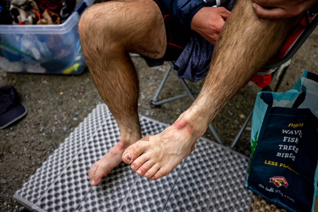
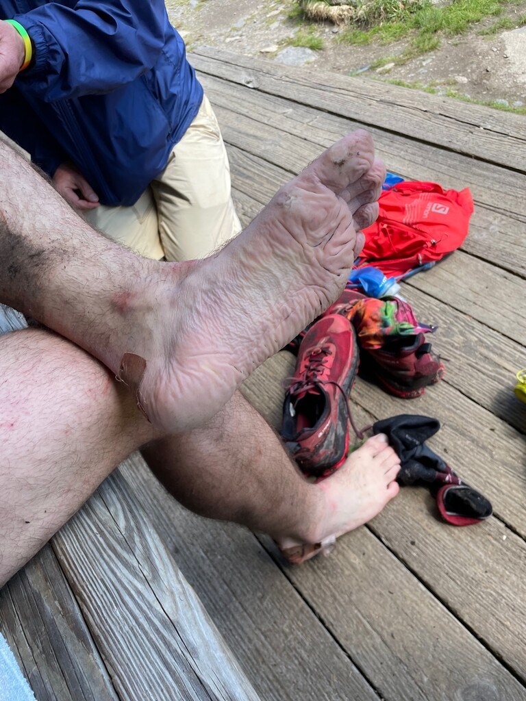
I reached the bottom well ahead of schedule at 4:37am. I asked Eric where Xander was and he replied, “he’s still near the summit of Moriah. Apparently things weren’t going too well and he said he was going to sleep on trail. Chris is headed up to meet up with him.” I was freaked out and didn’t know what to do. Even in the summer it’s pretty cold up near the summits. I knew he carried a space blanket, so that was of some comfort, but still. I wondered if the foot pain had caused him to get behind on his nutrition and bonk. I later found out that he didn’t bonk - the pain in his ankle/foot became so severe that be began hallucinating and eventually lost consciousness for a short time before regaining consciousness and deciding to sleep.
I asked if we should go back to Moriah and try to help. Eric told me that Chris, Hayes, and Jack were already over there. I knew that as exhausted as I was, I wouldn’t be much help anyways, and Jack is an experienced hiker who knows those trails very well, so that brought me comfort. We decided to continue with the attempt and headed to Waumbek.
The drive to Waumbek was about 50 minutes, during which I slept like a very uncomfortable rock. I tossed my shoes back on and headed up the Star King Trail at 5:37am. I was definitely feeling fatigued at this point, but I was happy to be on an easier mountain without a headlamp. Still, everything with Xander was in the back of my mind. Thinking about the logistical end of things, it first dawned on me during Waumbek that if I was going to finish, this was now a solo effort. I knew that the best I could hope for Xander was that he get down Moriah safely.
I summited at 6:54am and began hustling back down. On the way down I startled something ahead of me on trail which darted off into the woods to my right. I was fully convinced that it was a grown man that had just started sprinting into the woods. Startled and confused about why he ran off trail, I began yelling out to him. It stopped and looked at me and I realized that it was a deer. I think that was the closest I came to a visual hallucination. I laughed at the realization that my brain was melting and motored to the bottom at 7:56am.
When I reached the bottom, there was, all things considered, good news. Everyone was off Moriah, and Xander was safe. He could barely put weight on his foot, but he was safe. With a bit of new energy, I hopped in the car and we drove over to Hale. Like always, Eric had my new pack ready to go, and I started the short and steep Hale Brook Trail at 8:28am. Hale was uneventful, although there were a surprising number of people hiking Hale for a Wednesday morning. Looking at the gross and cloudy sky I wondered about rain, but I didn’t remember seeing anything in the latest higher summits forecast. I snagged Hale at 9:23am and sent my way back to the bottom by 10:02am.
During this section I started doing some math about when I could expect to finish. All I needed to do for the record was make it to the summit of Moosilauke by 8:00pm, but I realized that I should have time to complete my goal of going trailhead to trailhead with quite a bit of time to spare. With all the calculations done, my new goal was to beat Andrew Thompson’s record by over 2 hours while going trailhead to trailhead.
When I reached the bottom of Hale, I was incredible happy to see Chris’ car with Xander in it. He was clearly in a lot of pain and understandably pretty upset, but I was just really happy to see him. His ankle looked like someone had slipped a fluid filled donut around it. After giving him a hug, I refocused on the effort and relayed my “done and at the car by 6:00pm” directive to Eric. With that, we hopped in the car and headed towards Cannon.
On our way to Cannon, I became increasingly worried about the look of the sky. I asked my dad if the newest forecasts said anything about rain, but he said it just called for cool and cloudy. A few minutes later, as we pulled into the Tramway parking lot, it was pouring rain. He parked at the trailhead and asked me what I wanted to do. I responded “I have 14 miles to go. When you’re thru-hiking and you have 14 miles to the end of the day, you know what you do? You hike the 14 f*cking miles.”
I ran around to the trunk, put on my raincoat, and zipped it up. My brain heard this noise and processed it as a bird chirping. It took me about 5 seconds to realize that the noise I heard was my jacket and not a bird. Ah yes, my brain is melting. With that in mind, I threw on the hydration vest and headed up Cannon in the rain at 10:44am. It was pouring rain and very windy for most of the ascent, but the rain had mostly dissipated by the time I reached the summit at 11:40am. I wasn’t worried about the precipitation itself; I was worried about the state of the trail between Cannon and the Kinsmans (the Cannon Balls). It’s a very technical section with large boulders and steep descents. Extremely gross and slow when wet. It was about as gross as I imagined, but I made my way slowly across the traverse. I kept telling myself that my pace wouldn’t matter if I broke my ankle.
I summited North Kinsman at 1:02pm and South Kinsman at 1:23pm. After backtracking over North Kinsman, I descended on the AT down to the Lonesome Lake Hut (which is also a low-key treacherous descent when it’s wet), and then hurried down the Lonesome Lake Trail to Lafayette Place Campground at 2:58pm. Even though there were some very technical sections, I hit the easier sections much harder since I didn’t have much reason to save my legs and still ended up coming in 1 minute faster than my projected time for this section. After being greeted by Eric, Xander, and Chris, I hopped in the car and we went toward our final destination – Moosilauke.
The original plan was to ascend and descend the very steep Beaver Brook, but I had no interest in trying to hustle down Beaver Brook when it’s soaking wet and I’m exhausted. I knew Gorge Brook was the easiest way down, but I’d never done it before and didn’t trust myself to navigate a new trail.
“Andrew Drummond is joining for you for the last hike. He said he’ll be to Beaver Brook by 3:30” my dad told me. Great, I thought, I’ll make him navigate it for me. I told Eric the new plan and he agreed. We arrived at Beaver Brook at about 3:20pm, and by 3:23pm I’d said bye to Eric, Xander, Chris, Hayes, and Emma, and headed up Moosilauke. I was confident that Andrew would eventually catch up to me, but my new goal for speed was to see how far I could go before he caught up. Meanwhile, I accidentally left the Garmin Inreach on the dash of the car. Luckily, I had my Garmin watch and Andrew to verify that I did it.
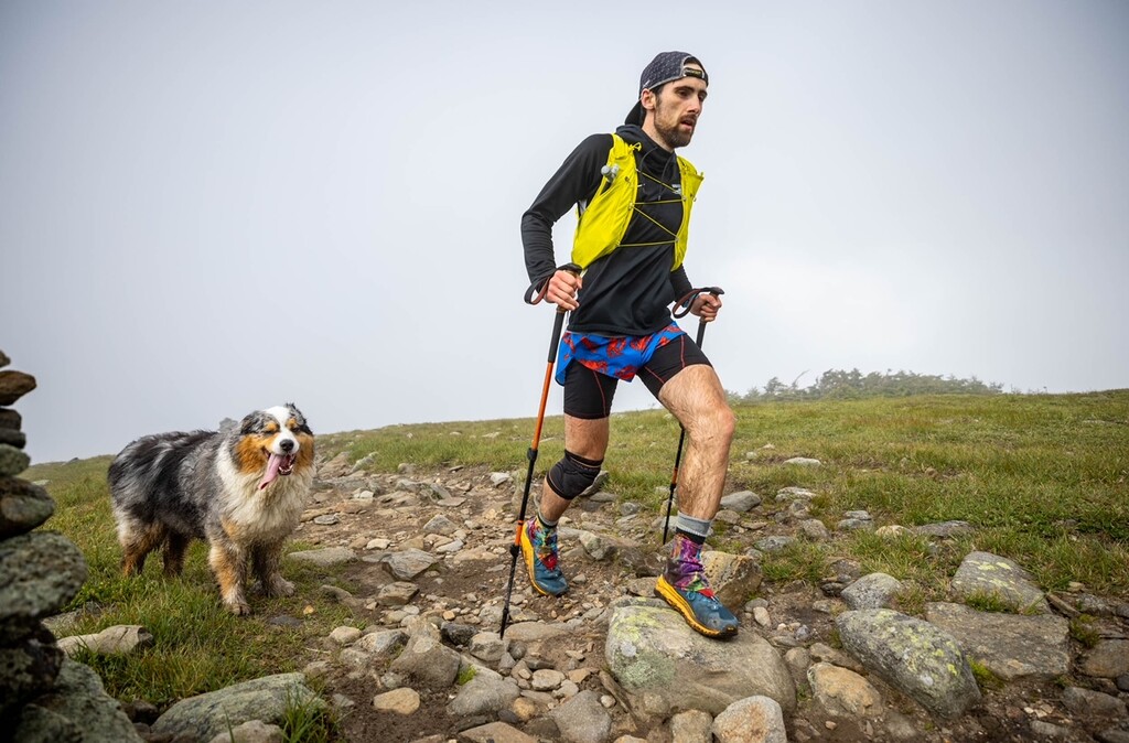
I don’t remember exactly when Andrew caught up to me, but I believe it was sometime above the Beaver Brook Shelter. And who was with him (fresh out of retirement) but White Mountains icon himself Squall (the Australian Shepard)! We talked about the effort and how the last couple of days had gone. He also agreed to the plan of descending Gorge Brook. Andrew kept running ahead to get photos, but Squall persistently photobombed and tried to trip me as I ran by. Quite rude of him. As we neared the alpine zone, Andrew remarked, “I’m really impressed by what you’re doing out here, but what Squall is doing on this hike is even more impressive!” I couldn’t agree more. We all aspire to achieve just a fraction of the athleticism that Squall achieves in his sleep. At 4:48pm, standing triumphantly in the raging winds of the cloudy mountain top, Squall summited Mount Moosilauke. I suppose Andrew and I did as well, but that’s beside the point.
From that point on it was pure hustle down Gorge Brook to get to the trailhead. We had an hour and 12 minutes to hit the arbitrary “done by 6:00pm” timeline that I’d set for myself. Luckily, Gorge Brook is really quite easy, and we bombed the descent in just 48 minutes – reaching the trailhead at 5:36pm and finishing the New Hampshire 48 trailhead to trailhead in 3 days, 12 hours, 35 minutes.
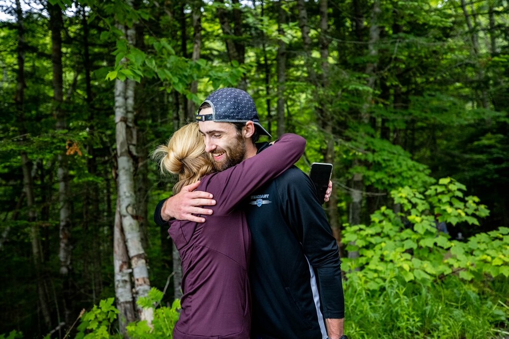
On top of Andrew and Squally pup, waiting for me at the bottom were Xander, Eric, Chris, Hayes, Bill Tidd, Emma, Taylor, and my mom Ann Peterson. It was a really special moment for me, and I’m really happy to have shared it with all of them. Once more, shout out to Xander for an incredible run of 41 mountains, and for pushing through an incredible amount of pain in the name of leaving it all out there.
Last Thank You’s
Is this trip report 3 miles long? Yes. Do I care? No. This route is such a logistical bear, it’s no wonder why no one touched Andrew Thompson’s record for 7 years. Such a long trip report is necessary to properly address how many people made this thing possible. Thank you to Eric Peterson and Chris Keiter for being our primary support crew and exhausting yourselves with every little detail for 4 days. Xander and I love you so much and am so thankful to be able to share these memories with the two of you. Thank you to Theja Putta, Bill Tidd, Ben Peterson, Andrew Drummond, Declan Kiley, Jack Kuenzle, and most of all Squall for pacing us, carrying our crap, and generally being there for us during this sufferfest. Thanks to Bill Tidd for being such an incredible mentor to me and for being so available during the planning process to throw around ideas. Thanks to Ben Peterson for doing double duty as a pacer and primary support crew on Sunday night and Monday. Thanks to Hayes Hart-Thompson and Emma Kuhlman for following us around with cameras during the race itself, as well as Taylor Stevens later on. Thanks to Hayes for following us around with a camera throughout the entire process and for dealing with us. Thanks to Zach McCarthy for doing everything he could to support the effort from home since he couldn’t join us in person due to an injury. Your presence was still felt out there my friend. Thank you to my girlfriend Lisa Sherman and Xander’s girlfriend Ella Piper for being such loving and patient partners. Thank you to our moms Ann Peterson and Betsy Wescott-Keiter for your unconditional love and support in everything we do. Thank you to all of the members of the White Mountains community and beyond that sent us well wishes, pickup messages on trail, and congratulations after the fact. You all are amazing. Finally, thank you to my best friend Xander Keiter, who taught me how to run and jumped into the abyss with me to see what the two of us could accomplish together. It’s been truly special man.
Thanks to the following companies for hooking us up with gear for this effort:
- Infinit – for supplying us with all of the nutrition that we needed for the effort, as well as water bottles, shirts, and soft flasks
- Salomon – for supplying us with ADV SKN 12 Hydration Vests
- Altra – for new Olympus 4.0 trail runners
- A Runner’s Mind – sweet apparel as well as connections to other companies.
Comments
Super excited to share the trailer for our upcoming short film, "The 48".
https://www.youtube.com/watch?v=2RxxmyAziTo