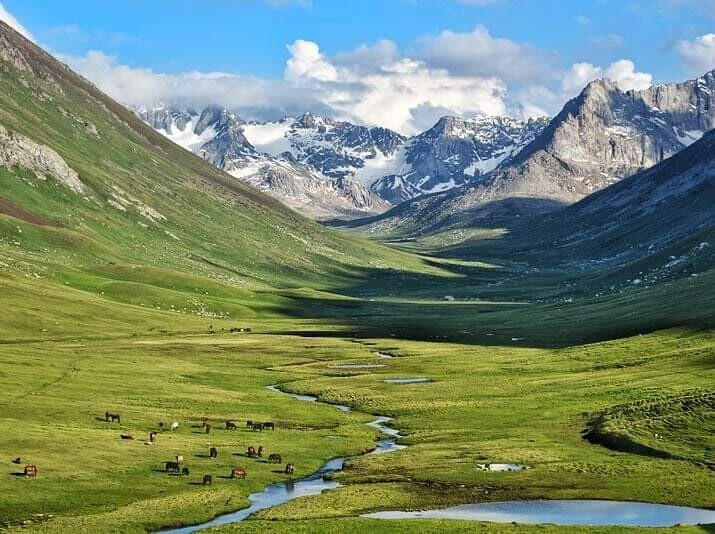
The premier long distance hiking route in the area, perhaps the whole of Kyrgyzstan. Approximately 110km with 7350m elevation gain. Route crosses 7 passes above 3300m. Lots of beautiful views of the Tian Shan mountains and many pretty lakes along the way. The Eastern section is particularly wild and remote, don't expect to find much other than a few shepherds yurts. Western section is a bit more developed, from Altyn Arashan onwards expect to see more hikers.
Typically the route is hiked East to West. However, there is no reason it can't be done in the opposite direction also.
Starting point: bridge out of Jyrgalan village.
Finish point: Jeti Oguz village.
High point: Ala Kol Pass (3907m).
Comments
Note to admins - I really do not think the official route should follow the Panorama Pass down from Ala Kul. Both AllTrails and Gaia have it labelled as “not suitable for hiking”. The bridge at the bottom is also completely washed out and the river isn’t passable for several KMs, requiring a ~6km detour. Ironically the nearest bridge is at the bottom of the alternate route (Sirota hut). Many gps routes actually have Sirota alternate as their ‘official’ route.
Context - I recently hiked this route in 4 days, and thought “this would be cool to try and FKT with only a running pack”. As of 2025 they’re building yurt camps along the route every 10-15km making it much more accessible for food resupplies and accom.
Happy to answer any questions about the route if any first timers are eyeing it up (IG: fishytim)
Hello Tim,
I submitted the route, but I actually agree with you, Sirota hut is a safer option than Panorama pass. Although some people did hike Panorama pass in the past, as you say the bridge is no longer there, so you would have to backtrack anyway so it would be much slower. It was the only complete GPS I had of the route - it's quite out of date. I plan to try and do the route in a single push later this summer so will upload a new GPS then going down Sirota hut route.
Hi guys,
Will be happy for any updates, or updated gpx if you have it
Thanks!
Hey James, I’ve been here for about 4 weeks running sections of the traverse mostly to acclimatise for an upcoming alpine climbing trip to India. however I’ve been tossing up running it this week if you are psyched?