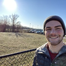
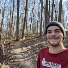
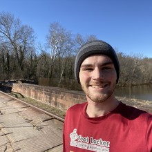
I got out of my car this morning and looked at my weather app - 21 degrees - nice... great morning to run 30 miles. I made my way from where I parked at the Oak Ridge Conservation Trailhead to Damascus High School. I took a picture at the start, got GPS, and I was on my way.
The first 5 miles flew by. I started in a down jacket which I quickly ditched around 3 miles. The first half of the trail is overall smoother than the second half so while I felt I was probably running a little too fast, I decided to let myself enjoy the well manicured trail.
The first issue came around mile 6 where I had my first stream crossing. Now, most crossings on this trail system are either super shallow or have bridges... except this one. I was faced with two options, traverse the icy log or walk straight through the stream. Falling into the stream was not an option so through the stream it was. So here I was, about a marathon to go, it’s 24 degrees and my feet are wet. Luckily, after about half a mile, my feet warmed up. Thank God for wool socks.
The next 10 miles were mostly uneventful. The only thing to remark was I went over 355 instead of under which may have been the correct way (whoops), but it didn’t cut any distance. Then, at Clopper Road, the halfway point, disaster nearly struck. While crossing the road dodging traffic, I was fiddling with my water bottle and knocked my second protein bar loose sending it tumbling towards to road. In the middle of the road, with oncoming traffic coming at 50mph, it would be obliterated if it hit the pavement. In a split second before it hit the ground and still in the middle of the road, I nailed a perfect volley which would have made my 8th grade soccer coach proud and sent the bar into the opposite guardrail. Sustenance saved. I made my way up to Seneca Lake now for the first time on this trail network in a section I knew well.
Coming through 20 miles I felt good. The section between Riffleford road and 118 came next. This proved to be the most challenging and featured me losing the trail several times. Also it was warming up and the frozen ground was giving way to a muddy slip n slide causing me to be more cautious.
At mile 23, Black Rock Road, I stopped to tab a half liter of water. At this point I only had 7 miles to go, I was pretty sure I could do it, so I turned on Vessel by Twenty One Pilots and proceeded to press on.
Just as I was getting into a groove, I came around a corner and took a hard fall slipping in a patch of mud. Audibly, I cursed, got up, inspected my legs - looks okay enough- and stumbled on. It caused a slight pain in my groin where I had strained my leg upon slipping but the pain subsided and I was back to running by mile 24.
The final 6 miles it took all my concentration not to repeat the incident at mile 23 as the trail had given away to large patches to mud and ice. At this point, I turned my mind off and just hammered out the rest.
The last 2 miles seemed to last an eternity, but at 4 hours 11 minutes and 5 seconds I crossed the bridge at Riley’s Lock and slammed the stop button on my watch... mission accomplished.
Some stats Strava won’t tell you
1.5 protein bars consumed
~25 gummy lifesavers consumed
1.5 liters of water drank
Marathon split 3:38:11
I’m sore, but overall I feel pretty good and I am extremely happy with the effort.
Current State of the Route:
The route starts at the Damascus High School parking lots and makes its away around the practice fields of the school (something I felt weird running around while school was in session.). Then it takes a left onto the Northern Magruder Branch trail which is a paved section of trail that lasts about 2 miles.
Take a hard left hand turn onto a dirt single track trial marked with blue blazes. This begins the lower Magruder Branch trail section. While there are a lot of turn offs from the trail, the main trail is always marked with blue blazes. Continue until crossing Seneca Creek, approximately 5.8 miles into the route (potentially deep). Take a right one across the stream. You are now on the proper Seneca Greenway trail. While on this trail the signs may call it one of three things: the Seneca Greenway Trail, the Great Seneca Trail, or the Seneca Trail, all meaning the same things. Also, if there are no blue blazes or two sets of blue blazes at a junction, always following any brown sign in white lettering that says "trail" or blue metal posts.
The trail continues well marked and easy to follow until Watkins Mill Road where you must cross the road, turn right, run across the bridge, then turn left onto a small access road where the trail continues. The following 3.5ish miles to 355 is well marked and easy to follow. Once at 355, it seems the proper route was to turn left at the road, run across the bridge, hop the guard rail and run down under 355. I accidentally ran over 355 and then down to the trail (this cuts no distance, but the proper way is much safer as 355 is a very busy road.) The following section to Clopper Road is fairly overgrown in parts (not bad in winter, but bad in summer) but still possible to follow.
Clopper Road marks halfway through the route and from there the trail climbs up to Seneca Lake then back down to Riffleford Road. Be careful in this section to follow the blue blazes as there are many intersecting trails that could take you off course.
Next section is about 2.5 miles between Riffleford and 118 which takes you through some of the toughest section to follow as it has been rerouted several times in the past 10 years and parts are not super well cared for. Do your best to beat back the brush and hop over the logs and stay on course. Be careful not to accidentally end up on the Pepco trail.
118 through Black Rock Road and on to 28 is all easy to follow trail and well marked. The gristmill at Black Rock Road makes for an easy place to refill water in the creek. Be sure at the Black Rock Road crossing to turn left on the road, run over the bridge, then turn right to avoid ending up on the wrong trail network.
The final section is about 6 miles and it takes you from the gravel parking lot off 28 along a generally very muddy section (for FKTs I suggest waiting for a few dry weeks in moco before attemping) of the trail. These miles are again easy to follow and easy to run if it's not muddy. Finally, you come onto Seneca Road where you take a right, run up the small incline to River Road, take a right, run across the bridge, then take a left onto Tschiffley Mill Road. Run down the hard packed gravel ~0.6 miles through the gate with the 0 mile marker sign for the Greenway trail, onto the canal, take a left, and then run across the bridge at Riley's lock where the route stops.


Comments
Hi Andrew.
Thanks for the report, it was a pleasure to read.
I'm going to give this route an unsupported shot tomorrow 08/13/2020 from Damascus HS to across the bridge at Riley's lock. Hoping for some cooling rain!
Today's attempt was cut short thanks to an upset stomach. Humidity/dew point was high and it rained the whole way but felt pretty good until I started to vomit :D
Anyway, will try again another time for sure!
A couple of observations for future runners from the part I did run:
Link to fail attempt on strava: https://www.strava.com/activities/3906962746