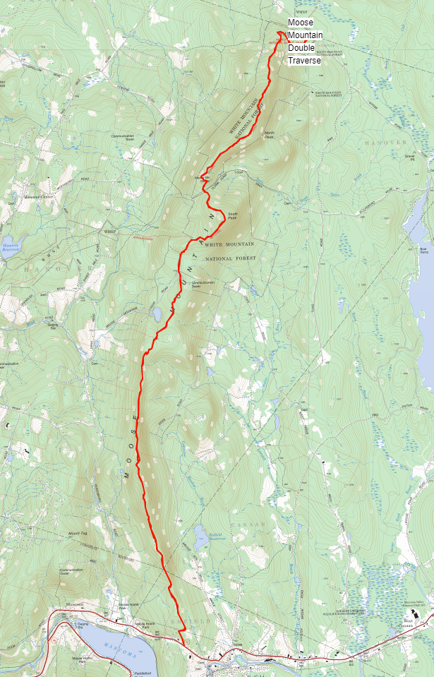
There is a striking north-south ridge to the east of Lebanon and Hanover New Hampshire. When I first moved to the Upper Valley and looked at a topo map to see what fun could be had, I immediately noticed the sharp ridge feature, and looked for trails on it. The Appalachian Trail follows this ridge from South Moose peak north to the end of the ridge at Goose Pond Rd, but I couldn't find any trails on the even sharper, more distinct south Moose Ridge. A couple of years ago, I saw that a buddy had BIKED this section of the ridge, and asked him about it. Sure enough, there was a poorly-maintained trail that followed the ridge - bikable by a certain fringe standard. I ran this section of ridge a few times, and the idea was born to introduce the full ridge as an out and back FKT from Rt. 4 in the south to Goose Pond Rd. in the north. However, the trail was not in great shape, and I wasn't sure how to manage ridge access at the southern end which runs through private property.
This year (2020), while everything else has gone to pot, the trails have been dramatically cleaned up and are far easier to follow and run. Also, with help from local trail running friends, we figured out a way to get to Rt. 4 that avoids going directly through the property owners' back yard. It still runs along private land, but takes a turn under electric lines to a public Class 6 Rd. to get down to Rt. 4, which is one of the turnaround points.
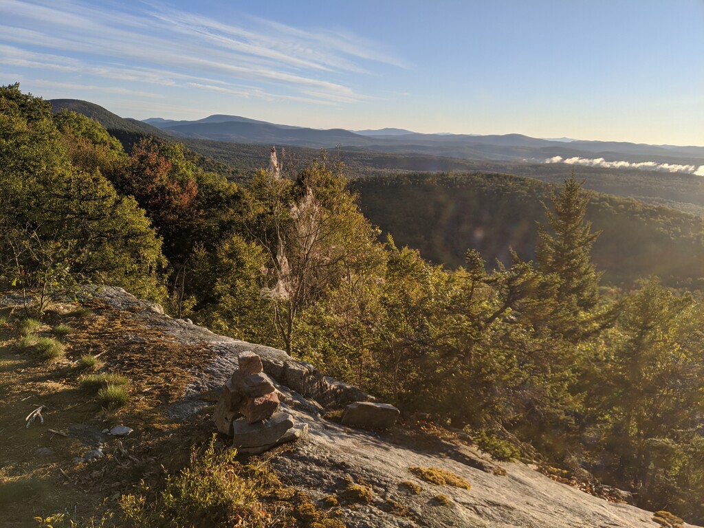
The route runs about 10 miles each direction, with about 2250 ft of elevation gain (both Rt. 4 and Goose Pond Rd. are at about 950 ft. elevation where the trails come out). From the north, the route follows the Appalachian Trail up a steep climb, then along flowy, but broad ridgeline over North and South Moose mountains, then turns off onto Orange Diamond Ridge Trail partway down the S. Moose Mountain descent. This trail can be difficult to follow in places, and is not heavily trafficked, but is vastly improved. Crossing a cell tower access road and a few other trail intersections, the Orange Diamond Ridge Trail takes a hard right before the Moose Mountain Ridge Trail takes off south and steeply uphill. This ridge trail follows the ridge closely, and has more the feel of running a spinier ridge with fun rocky exposed sections that host delightful blueberries in season. As the trail heads down toward Rt. 4, a number of trails and alternatives peel off to the left. The best route we have found continues right until a clearing under power lines, then heads right to the Class 6 Rd, then down a couple hundred yards to Rt. 4. Any legal and reasonable means to get to Rt. 4 are valid, though. The route is almost entirely single track trail, with a small amount of double track in the southernmost mile.
Comments
I made a mistake in the name I submitted for this: it really ought to be Moose Ridge Traverse - there are a number of other ways to traverse the namesake Moose mountain in the middle of this ridge.