The Kéktúra or 'Blue Route' is a national trail which circumnavigates the country of Hungary.
This FKT route is for section 14 (OKT14), the closest to the capital city of Budapest, includes some incredible trails, outstanding sights and history.
For more information about the Kéktúra visit https://www.kektura.hu/ (not affiliated!). My hope for setting this up is to garner interest in the route as a whole; maybe the Kéktúra will be ran in it's entirety one day (if it hasn't already)?
Directions & Route Info
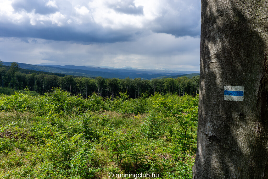
The section has been chosen to be easily accessible by public transport and simple to follow. At every step of the route follow the 'blue flashes' as seen in the pictures! The trail is mostly broad forest track which opens up in the middle section to be hard-packed earth when dry and mud when wet. Trail shoes advised, though not necessary in good conditions.
Start: Budapest, Szipka utca, 1021
47°32'32.3"N 18°57'55.7"E
Finish: The Kektura Stamp (Kéktúra bélyegzőhely) @ Rozália téglagyár
47°35'06.0"N 18°59'23.0"E
Key Sights
- Hűvösvölgy, Children's Railway - Built in 1948 and operated by children, this railway traverses though the excellent woodland to the west of Budapest.
https://en.wikipedia.org/wiki/Budapest_Children's_Railway
- Árpád lookout (Árpád-kilátó) - Offers outstanding views of the city of Budapest.
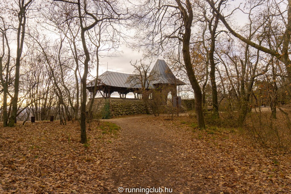
- Károly Guckler Lookout (Guckler Károly-kilátó) - The highest point. The crown of the hill is partially covered in WW2 bunkers. The lookout itself is of an interesting geometric design.
- ...And much more...
Notes on the Route
- The Start is approximately 100m from the official OKT14 start at Hűvösvölgy station. This has been done to avoid a set of stairs and a road. See the attached picture which shows a small bridge (and lots of blue route signs!) for the start of this FKT route.
- There is a short but important loop which takes runners past the 'key sight' of Árpád lookout (Árpád-kilátó). It is easy to skip a bit here.
- The final wooded downhill section has multiple criss-crossing paths. Be mindful to follow the 'blue flashes' painted on trees!
- The finish is the entry way for the 'historic' brick factory. If you feel the need to slap an inanimate object to underscore your achievement then the post which holds the route stamp would be perfect!
Good luck!


Comments
Quick note: There are a number of errors and type-o's that I thought I could correct on publication. I will try and get them cleared up asap. Especially that " excellent woodland to the east of Budapest." Should read... " excellent woodland to the WEST of Budapest." ;-)
RunningClub.hu will be tackling this on the 23rd May. Watch the announcement video and sign up to join us on Strava.
Youtube
Strava
-RCHU Anthony