In early October the UltraSignup News email blast put the Women Who FKT project on my radar. I didn’t think much about it at the time, but as our gorgeous fall weather pushed into late October and early November I started to wonder if I had a window for one more field trip and big effort, and took a look at the map of FKT routes for the first time. Part of the Women Who FKT project revolves around establishing women’s times on existing routes. When the effort began in the PNW, only 41% of established routes had a women’s time listed, and as someone who has noticed an enormous disparity in the male vs. female segment finishers for both running and biking on Strava, this did not surprise me at all. One reasonably local FKT route on Isle at Haut caught my eye, and I noticed a women’s time had not yet been established. The route involves running all 18 miles of National Park Service trails on Isle at Haut, starting and finishing at the same point to create an enormous loop. Covering all 18 miles of trails entails running some portions twice (as in spurs, or loops), so the total distance of the challenge clocked in at around 25 miles. Over the course of four or five days I found myself coming back to the idea of trying the route, and felt a growing excitement about the run itself. Having never run more than 16 or so miles on the road, and a little over 15 miles on trails, I had moments where I wondered if I could do it, but I also felt a reasonable amount of confidence in my ability to just keep going even if I wasn’t ultimately moving very quickly. To establish a women’s time I didn’t have to be terribly fast, just complete the route in the window of time between the morning and afternoon mail boat trips. I had run and hiked some of the trails on previous trips to the island, but covering the full park trail map would entail running lots of new territory.
To prepare for the effort, I spent time studying the route and trip report from the runner who holds the men’s record on the route. I planned to run the route unsupported, so I also called the NPS to verify whether the well pump just outside the campground at Duck Harbor had been drained and closed for the winter. It had, so that meant I needed to plan to carry all the fluid I expected to need for the full run with me. Lastly, I double checked the ferry schedule, confirming I would have a long enough window that it felt reasonable to give the route a go.
On the morning of the run, I arrived at the Isle au Haut Boat Services dock in Stonington on time only to learn that the ferry wouldn’t start. It wasn’t clear what the issue was, but an electrician had been called, and all I could do was wait alongside the five other passengers expecting to make the trip out while the electrician and the captain assessed and tried to ameliorate the issue (“Only the third time in the 25 years I’ve done this route that the boat wouldn’t start!” the captain told us.). Minutes ticked by, an hour, an hour and a half. I was keenly aware of my narrowing run window and trying to stay relaxed and calm since the situation was entirely out of my hands. Two new boat batteries were procured, and about 1:45 after the posted departure time, we heard the roar of the boat’s engine coming to life. Freight was quickly loaded, passengers headed aboard, and we were underway. The captain, perhaps hoping to make up for our very late departure, had us pulling into the dock on Isle au Haut 15 minutes faster than the listed trip time. I quickly grabbed my duffle and walked to the National Park Service ranger station, my planned start/finish point.
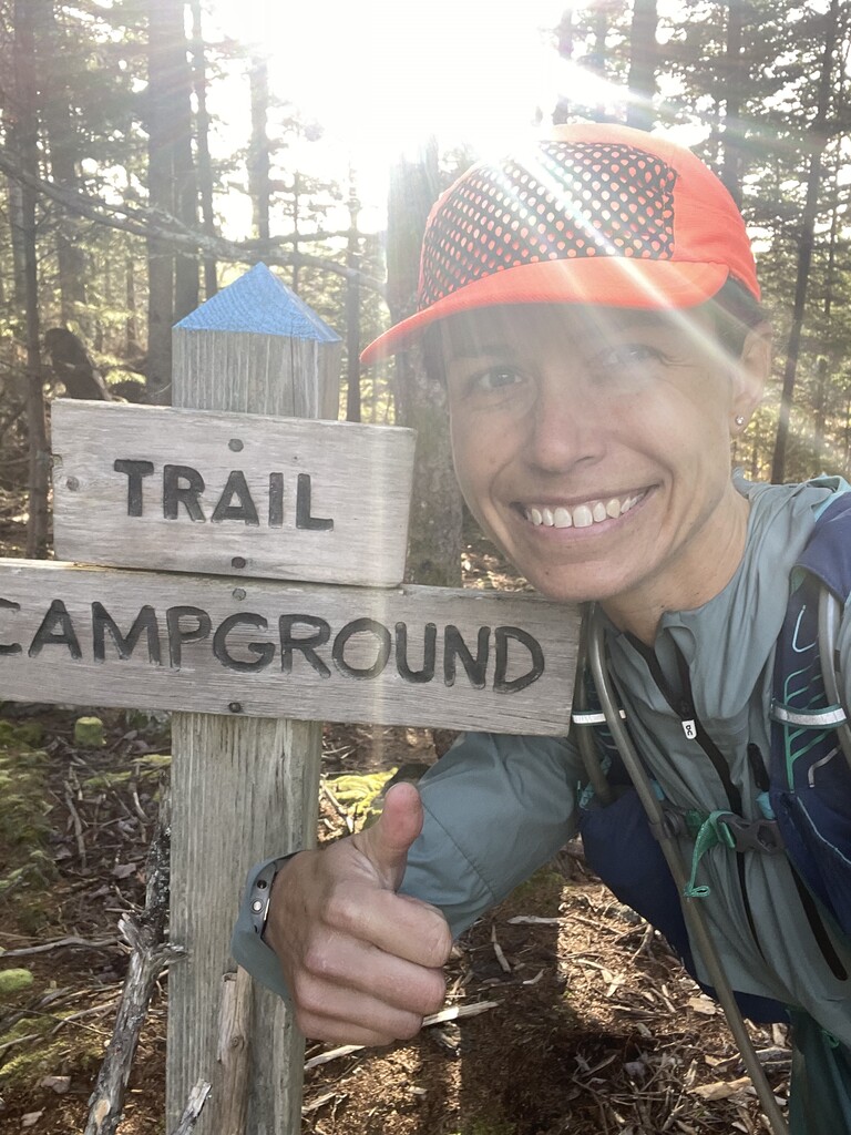
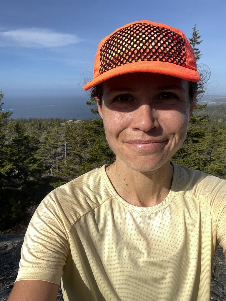
I pushed off at 9:26am, about an hour and a half later than I had hoped/planned to and leaving behind a duffle bag with post-run supplies. I had approximately 6.5 hours to complete the run and make the 4:15pm mail boat departure back to Stonington. Though the FKT guidelines for this route allow for the runner’s discretion in which order/direction they cover the trails in as long as all of them are run in a single effort, I decided to follow the route used by the men’s record holder. I left the ranger station on the Duck Harbor Trail and added the short spur to the main road when the trail came close to it. From there it was a slight backtrack to the Bowditch Trail, which I followed to the second junction with the Long Pond Trail and then did a quick out and back on the section of the Long Pond Trail that joined the main road. Then it was back north on the Long Pond Trail, right on the loop that descended to the pond itself, and then back uphill to finish off the Long Pond Trail before turning left to join the Median Ridge Trail. I followed Median Ridge to the Nat Merchant Trail spurs, completed both of those, and then continued south along Median Ridge Trail until I hit the ocean on the southern coast of the island. At that point I turned left on the Goat Trail (this was tricky to follow in places, especially as it traversed sections of beach) and eventually rejoined the Median Ridge Trail. I made a second pass over the last bit of Median Ridge before now turning right on the Goat Trail and following it to the Duck Harbor Mountain Trail. The miles up and over Duck Harbor Mountain were probably my least favorite of the day - steep technical miles on tired legs and slippery wet granite, portions of the descent that required sliding down in a seated position, and a couple of moments on exposed high points where it took me a bit to locate the next cairn or blaze in order to head in the correct direction. That said, the views from the top of the mountain were exceptional, and the terrain a nice contrast to the other miles of this run through the forest and along rocky coastal paths and beaches. At the conclusion of the Duck Harbor Trail I turned left onto Western Head Road, and this stretch of wider, auto-accessible trail was a welcome reprieve/recovery after the challenge of Duck Harbor Mountain. When Western Head Road hit the coast I turned left to do a quick out and back to finish up the Goat Trail. From there I continued around the southwest corner of the island with the Cliff Trail, a very short spur to Western Ear, and then the Western Head Trail before rejoining Western Head Road and taking it down and past the NPS campground at Duck Harbor. Following the main road I next hit the Eben’s Head Trail, running it north before taking the road south to complete the loop and then turning left on the Duck Harbor Trail to go north again. A short side spur to Deep Cove preceded the last stretch of Duck Harbor Trail north. Once I hit the road a final time, finishing off the last of the trail I needed to cover, I followed the main road back to the ranger station instead of retracing my steps on the first portion of the Duck Harbor Trail. At this point I was thrilled for some easy footing, even if I did miss the soft and loamy forest floor. I arrived at the ranger station with 5:53.26 elapsed on my watch and a nice cushion of time to have a drink and a snack and put on warm dry clothes before hobbling back to the ferry dock for the trip home.
I ran with as little as possible for gear, but my vest still ended up being the heaviest I think I have ever carried. I took 90oz of fluid (my pack’s full capacity; a mix of Trailwind and diluted Tailwind), a few Huma Gels, a GoMacro Bar, a small baggie of SaltStick electrolyte chews, my phone, a second ziploc with a few bandaids and a dry soft cloth, chapstick, and an emergency space blanket leftover from a trail race earlier in the year. I drank every last drop of the fluids and consumed most of the my calories; with temps scraping 60 and 95% humidity I tried to be very conscious of staying on top of fueling and hydration. I wore my Hoka Torrent 2 trail runners, tights, and a light t-shirt. I wore a light windbreaker for the first two or so miles and then stashed it in my vest for the rest of the run.
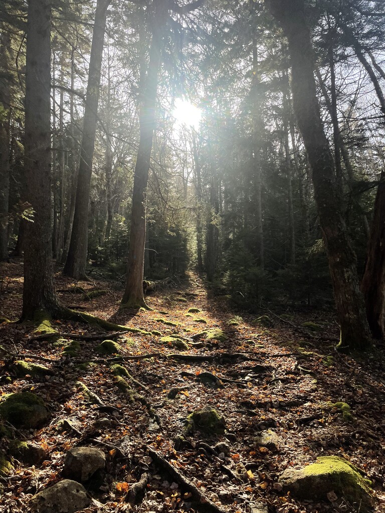
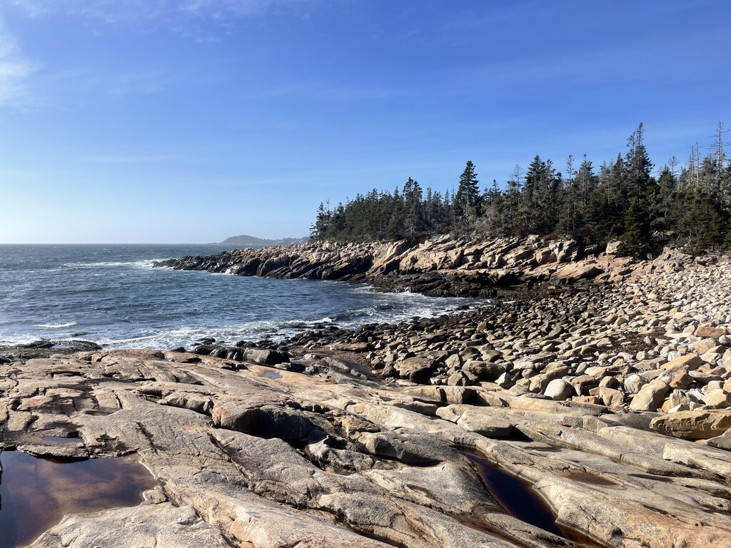
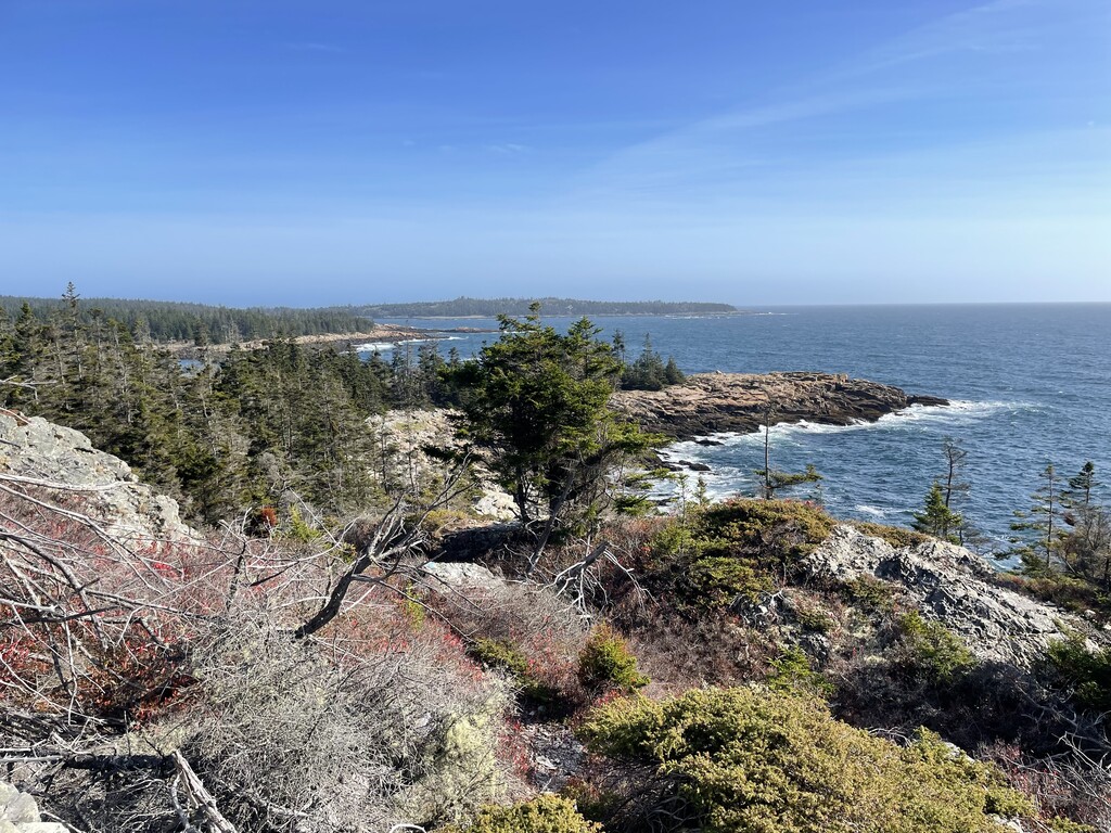
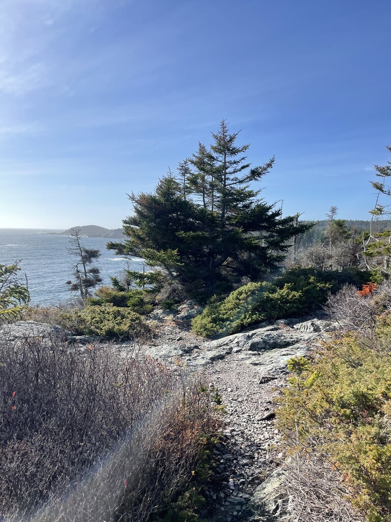
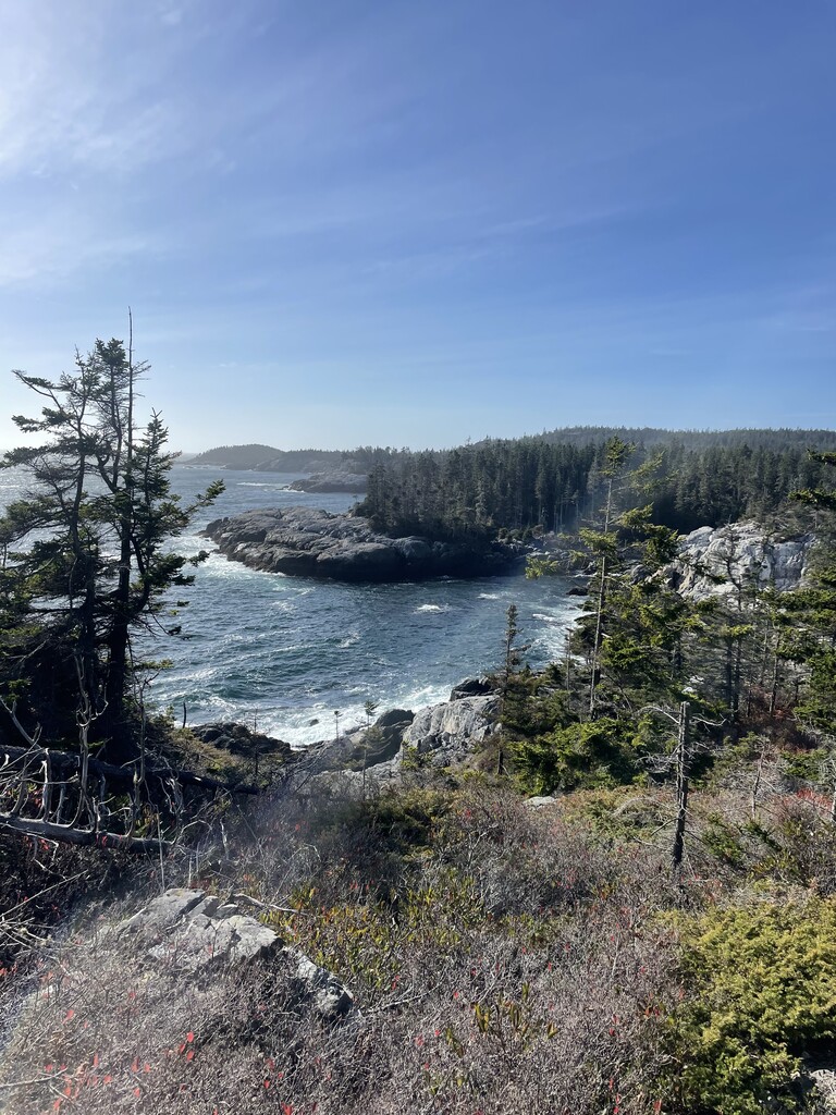
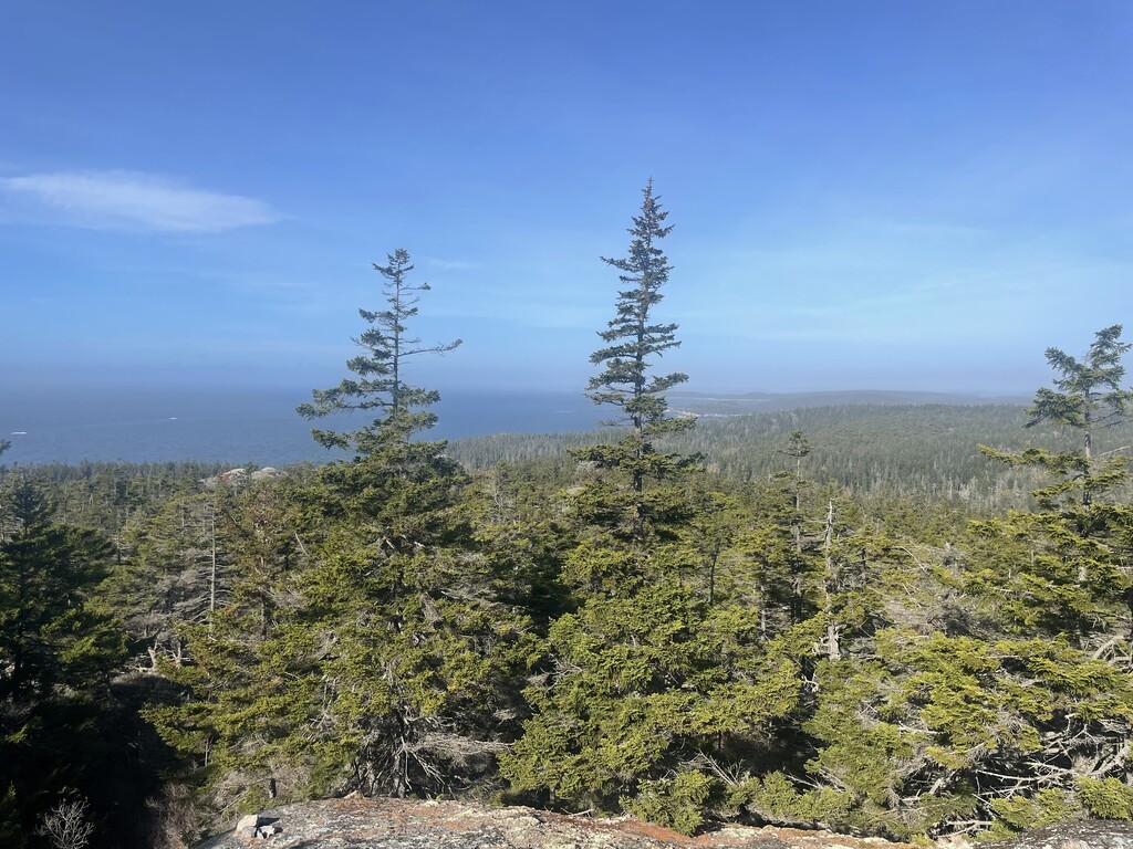
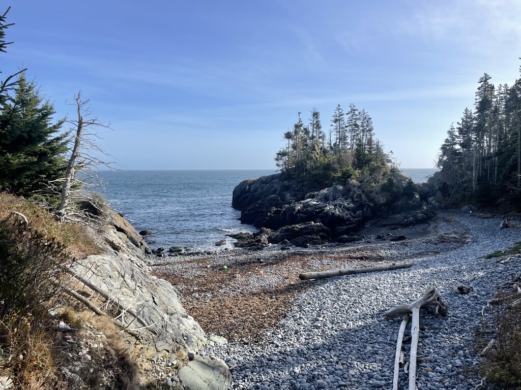
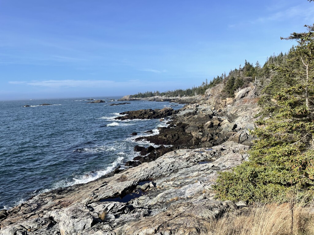
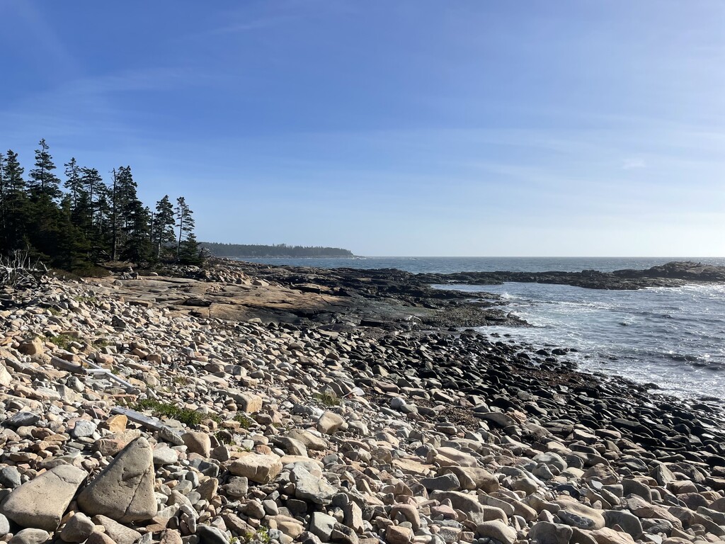
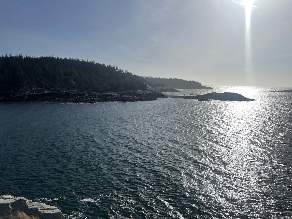
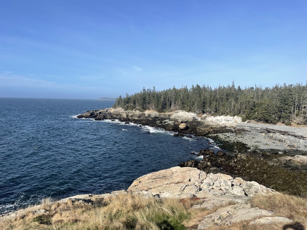
It would be hard to overstate how beautiful and wild the miles of trail on this island are, and how singular it feels to run them and have the sense of being alone on the edge of the world - in 25 miles and nearly six hours of running I did not see a single other human. The parks covers a variety of terrain, and most of the miles of trails are on technical single track (so many rocks and roots, all of them wet and/or mossy with the occasional decomposing and slippery bog bridge included for a test of balance) with some rocky beach stretches thrown in as well as some scrambling up/down exposed granite near the summit of Duck Harbor Mountain. Highlights for me were the unexpected moments in mile six where the trail tracked and crossed old stone walls now snaking their way through established forest instead of along cleared pasture, the gnarled pitch pines along Median Ridge, and the views of the rugged coast stretching east and west from the highest points of the Goat and Cliff Trails. This is a special island, and the logistics involved in visiting mean that even in the high season it still often feels like you have the trails all to yourself.
Comments
Hi Shannon, a hearty congrats on the run! I'm excited that you thought the route was worth doing and establishing an overall FKT! Great to read your report--sounds like you had a special day out there.
Derek