Cape Wrath Trail in 4 days and 14 hours
This is a report about my unsupported attempt to complete the Great Glen Variant of the Cape Wrath Trail as fast as possible, carrying all I need from start to finish. I followed the route used by and described in Detail by David Dean, the current holder of the self-supported FKT. My attempt was more of a hike as opposed to an ultra-run: I never ran and tried to get around 6 hours of sleep every night. Outside of this, I tried to be moving at all times to maximize daily distance.
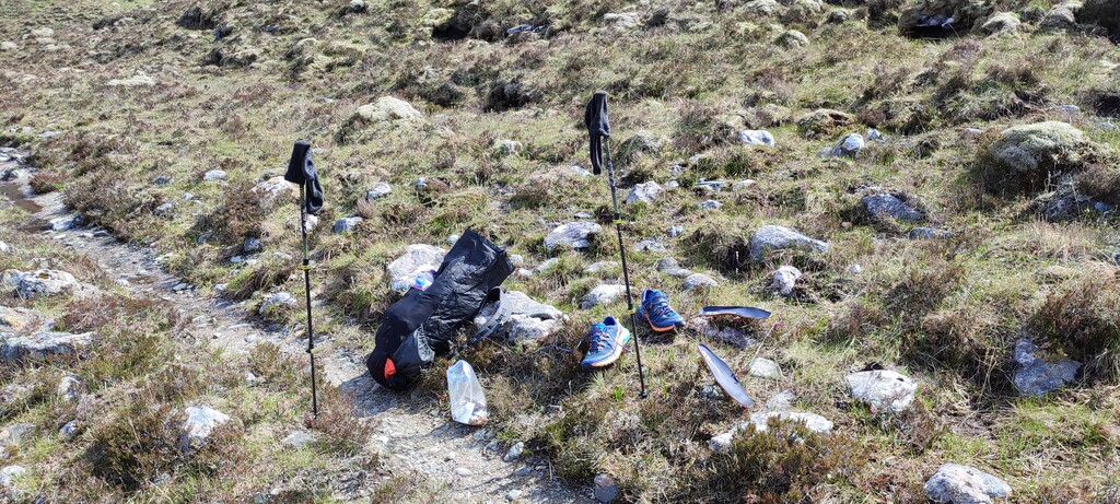
I carried an ultralight 48l pack with all my equipment and food. The base weight of the pack was 4700 grams and I started with 4700 grams of food (which turned out to be too much in the end). A detailed list can be found here: https://lighterpack.com/r/s5isvy
Please keep in mind, that I am 2m tall and some of these numbers are therefore a bit higher than they would be for a more "normally sized" person.
For a more detailed description of the route itself, please read David's report, I will focus more on my subjective experience as opposed to creating a redundant description of the exact trail which is of lesser quality due to my lesser knowledge of the area compared to his.
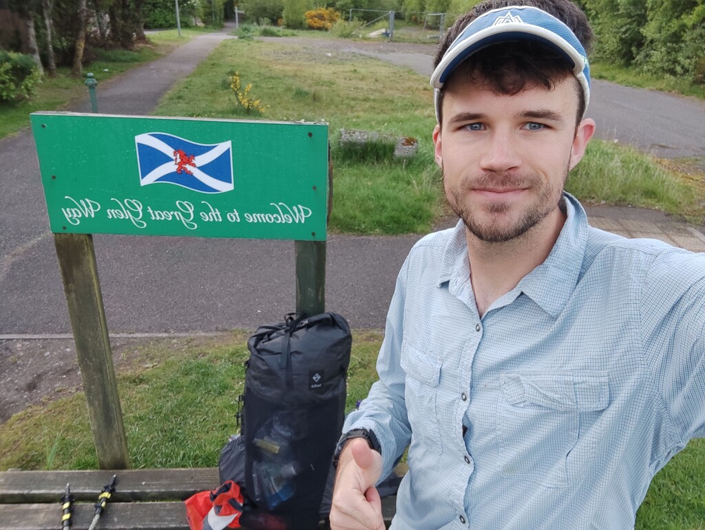
I started my trip on May 17th, 05:45 in Fort William and completed it on May 21st, 19:53 at Cape Wrath for a total of 4 days, 14 hours and 8 minutes.
Day 1 - Fort William - River Affric (65.7km/mi, 1750m/ft elev gain)
After a very noisy night in the dorm of the youth hostel in Fort William, I started with less sleep than I had hoped for at 05:45 am at the Great Glen Trail sign next to McDonald's in Fort William. The first 22 km were flat, simple, and quick before I ascended towards Geal Chàrn to bypass Invergarry identically to how David has proposed it. I went around the west side of the mountain without a trail which was exhausting and it took me longer than expected to reach the paths in the forestries on the other side. From there everything went smoothly again apart from the fact, that around 14:00, light rain set in which would not stop for the rest of the day. The crossing from A87 towards Allbeithe was one of the few parts of this whole trail that I had previously done and was prepared for the muddy mess which was now amplified by the rain. While I had previously considered going further, I settled on a nice camping spot close to the River Affric and set up my tent shortly before 20:00. With a bit of shock, I noticed that my feet had already taken damage from all the wet and some skin came off on my right foot. I would have to take a bit better care in the coming days.
Day 2 - River Affric - Kinlochewe (65.7km/mi, 1750m/ft elev gain)
In the morning, it was still raining and I started walking shortly before 06:00 with a wet tent in my pack and the same muddy mess under my feet as at the end of the previous day. Once I reached the 4x4 trail at Loch na Leitreach after 14 km, the rain finally stopped after 19 hours. I swapped socks and reached Maol Bhuide without further issues. I was at Loch Calavie when the rain returned. By the time I reached Loch an Laoigh, the wind also picked up. After a quick stop at Bearnais Bothy (BTW: I checked with FKT and the use of bothies is ok on unsupported attempts), I traversed the pass to the north in the worst possible conditions: Fog, strong winds, and rain. Fortunately, the wind was coming mostly from my back but I had to walk some of the switchbacks on the way down sideways because I could not look into the wind which was hammering rain droplets at me as if it were a pressure washer. The sound of the droplets hitting the hood of my raincoat was so loud, it hurt my ears at times. Fortunately, this was as bad as the weather would get on this whole attempt. On the way down towards Achnashellach, the rain stopped and I found new motivation and went on to and past Kinlochewe. I camped a bit outside of town shortly after 21:00.
Day 3 - Kinlochewe - Schoolhouse Bothy (66.6km/mi, 2100/ft elev gain)
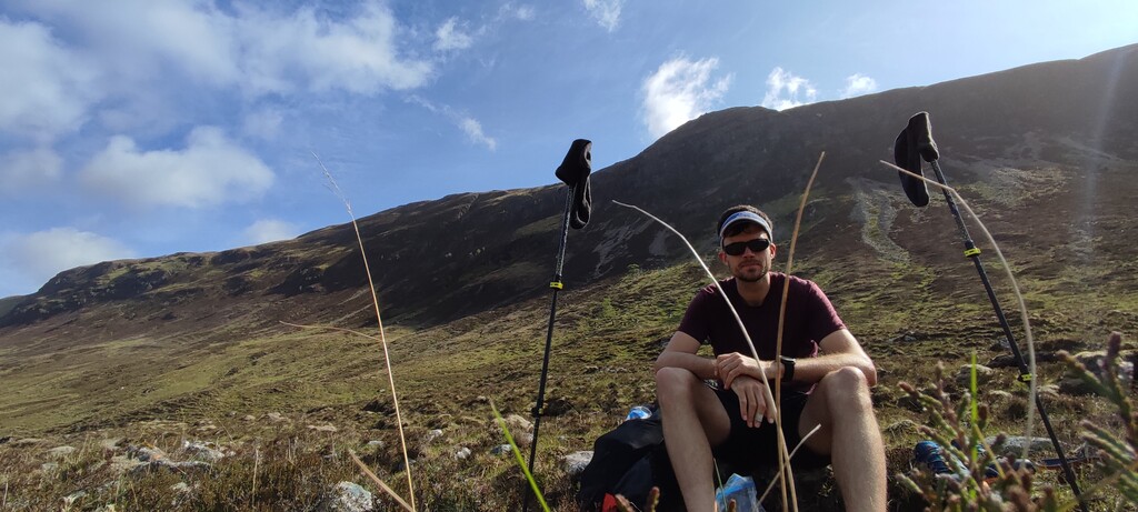
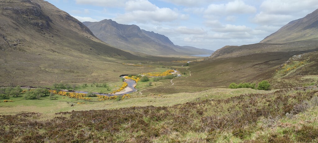
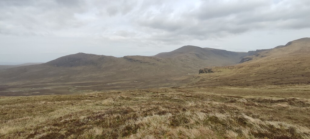
The next day, the weather was perfect. When I started at 06:15, the sun was out and I had to take care to stay hydrated. I easily reached the first pass above Lochan Fada and then descended without trail to Loch an Nid. The area I now went past may have been the most aesthetically pleasing of the whole trek. Crossing over towards A832, I started meeting more and more hikers thanks to the amazing weather. One couple asked me where I had started today and had a hard time believing I was coming all the way from Kinlochewe. I did not bother trying to explain to them that I had not even reached the halfway mark for the day. By the time I had crossed another ridge to reach the A835, I was quite tired but continued. South of Meall Dubh, the trail essentially dissolves and it was a tough fight to reach Loch an Daimh. Here I truly felt the loneliness again after all the hikers I had met in the proximity of the roads. At times the landscapes very much reminded me of the Brooks Range in Alaska. The descent from Loch an Daimh to Schoolhouse bothy was simple, fast but not any less tough on my legs. By the time I reached the bothy, it was around 22:20 and rain had just set in again. I was alone in the bothy and slept well for the first time quite a few nights.
Day 4 - Schoolhouse Bothy - Glendhu Bothy (58.8km/mi, 1680m/ft elev gain)
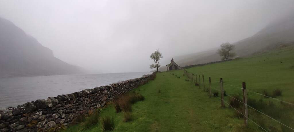
Started at 06:35 at schoolhouse bothy and made good distance despite the fact my knees and ankles really started to hurt. It was cloudy but there was no rain which were perfect conditions for me. The hiking itself was relatively boring until after Loch Ailsh. I climbed the pass without any bigger problems. On the way down, I really started to feel my knees and ankles. Despite very obvious signs of bad weather coming in, I immediately started climbing towards bealach na h-Uidhe. By the time I reached the top, strong winds set in and shortly after it started to rain. The descent was treacherously muddy and slippery. I struggled but managed to reach Glencoul Bothy which I went right past and was seemed overcrowded as it was the weekend now. I climbed over the last mountain where I met three Belgian hikers who were also still out hiking at 21:00 now that the rain had stopped. Once I reached Glendhu Bothy, the weekend hikers there were settled in already. Despite knowing, I would probably sleep better in my tent, I laid down next to a few people and tried to sleep which turned out to be very difficult despite me being very tired. People were snoring at various pitches and the ones who could not sleep were rolling around on their ultra-light but not ultra-silent air mats.
Day 5 - Glendhu Bothy - Cape Wrath (64.0km/mi, 1680m/ft elev gain)
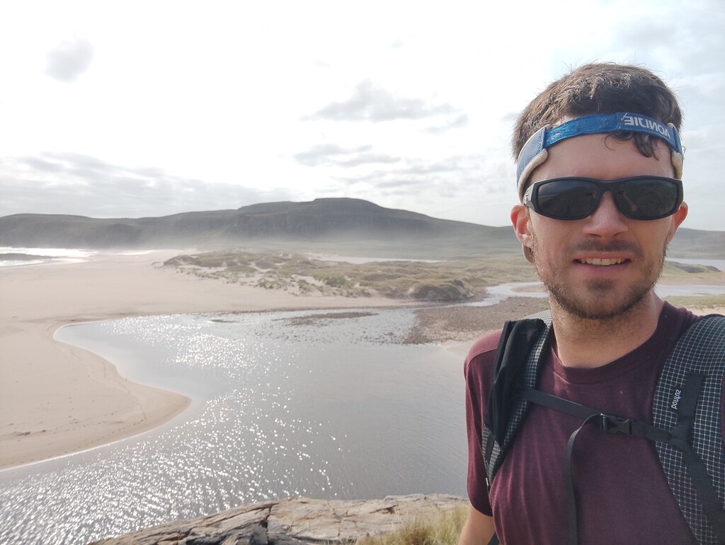
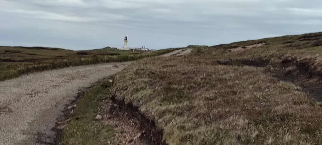
It was before 4:00 when I called it quits with 3 hours sleep at best and hit the trail around 04:30. The trail to Ben Dreavie was beautiful and I made good progress. Thankfully, the weather was great again today. On the descent it became apparent, I started to really struggle to hike down due to pain in my right ankle and both knees. Somehow I found my rhythm again and made good progress. The passage towards and along Loch a'Gharbh-bhaid Mòr was much less difficult than I had expected it after some of the struggles of the last days which was probably also due to the fact it was quite dry. From Rhiconich to Blairmore I hiked along the road, trying not to stop or waste time otherwise. From the parking lot, I followed the trail to Sandwood Bay where a lot of people were coming back from on this beautiful afternoon. One lady jokingly told me that she was going as fast on the way in implying I'd be more tired too on the way back from the bay. Again, I smiled and did not bother explaining to her that this was not exactly what I was up to. Since I now really struggled to descend, I hiked a bit freestyle and more towards the east after the bay to cross Kesgaig River at 135m asl. From there I passed over the last mountain and reached the lighthouse road at around 19:30 and hiked to the lighthouse. I had made it. At 19:53, I stopped my watch at the sign in front of the lighthouse.
I camped at the lighthouse and took the first tourist bus back the next day. From the road, I hitchhiked to Ullapool where at 17:00 I took the bus to Inverness.
I was quite happy with the outcome of this hike. To my surprise, I felt more energy and less tired than expected. I had no sore muscles. However, it was much tougher on my joints and tendons. Ultimately, this was the limiting factor for my attempt.
I have a few video logs that I cannot currently edit since I will not be home for another few days. May add it later.
Comments
Sorry, I meant to fill in the mile- and ft-values but forgot. Also, the values for day 2 are slightly off (because I accidently reused the values of day 1). So here they are correctly:
Day 1 - Fort William - River Affric (65.7km / 40.8mi, 1750m / 5740ft elev gain)
Day 2 - River Affric - Kinlochewe (63.8km / 39.6mi, 2000m / 6562ft elev gain)
Day 3 - Kinlochewe - Schoolhouse Bothy (66.6km / 41.4mi, 2100m / 6890ft elev gain)
Day 4 - Schoolhouse Bothy - Glendhu Bothy (58.8km / 36.5mi, 1680m / 5510ft elev gain)
Day 5 - Glendhu Bothy - Cape Wrath (64.0km / 39.8mi, 1680m / 5510ft elev gain)
Video log: https://www.youtube.com/watch?v=LlQtRfgCaXs
Congratulations. Only just seen this. Great to see somebody else do the same route. Makes the record seem real.
David Dean
PS, interesting kit list too - a bit heavier than I carried though I was self-supporting rather than unsupported