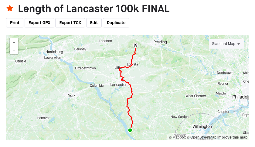
"The Length of Lancaster 100k" is a 62.36 mile, 100.35k course which starts at Lancaster County, Pennsylvania's southern border (with Cecil County, Maryland) and ends at the northernmost point of the county that lies on a public road. The first quarter of the course follows rolling hills with a steady overall incline through the shed of the Conowingo Creek before a mild descent into PA's famous Amish Country. Just after the 50k mark, the route runs through the outskirts of Lancaster City and then just next to the Lancaster Airport. Then, the course runs the length of the Warwick-Ephrata Rail Trail (~7 miles) which ends just shy of the 50 mile mark in the town of Ephrata. From there, it heads north into the area's southeasterly Appalachian ridge, up a 1.5 mile, 8% grade climb before ending at the border of Lancaster County and Bucks County.
Overall, The Length of Lancaster 100k is a microcosm of Pennsylvania: shaded rural roads, the Amish countryside, small cities and towns, and the beginnings of the Appalachian Mountain Range.
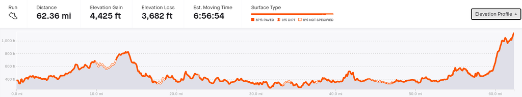
According to Strava, the course has a total of 4,425ft (1,348m) of elevation gain and 3,682ft (1,122m) of elevation loss, giving the course an average grade of 0.2%.
Comments
I am going to be making an attempt at this on Saturday, July 22nd, 2023!
Hello! I created this route and am planning on running it this November. Did you end up running it? If so how was it?