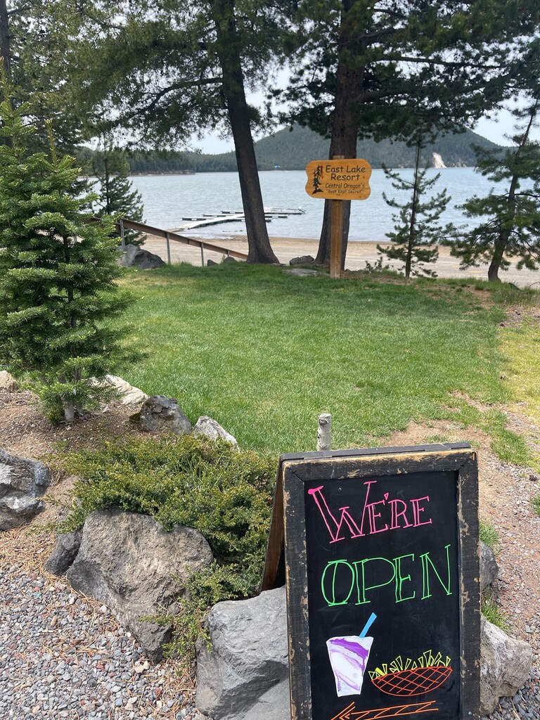
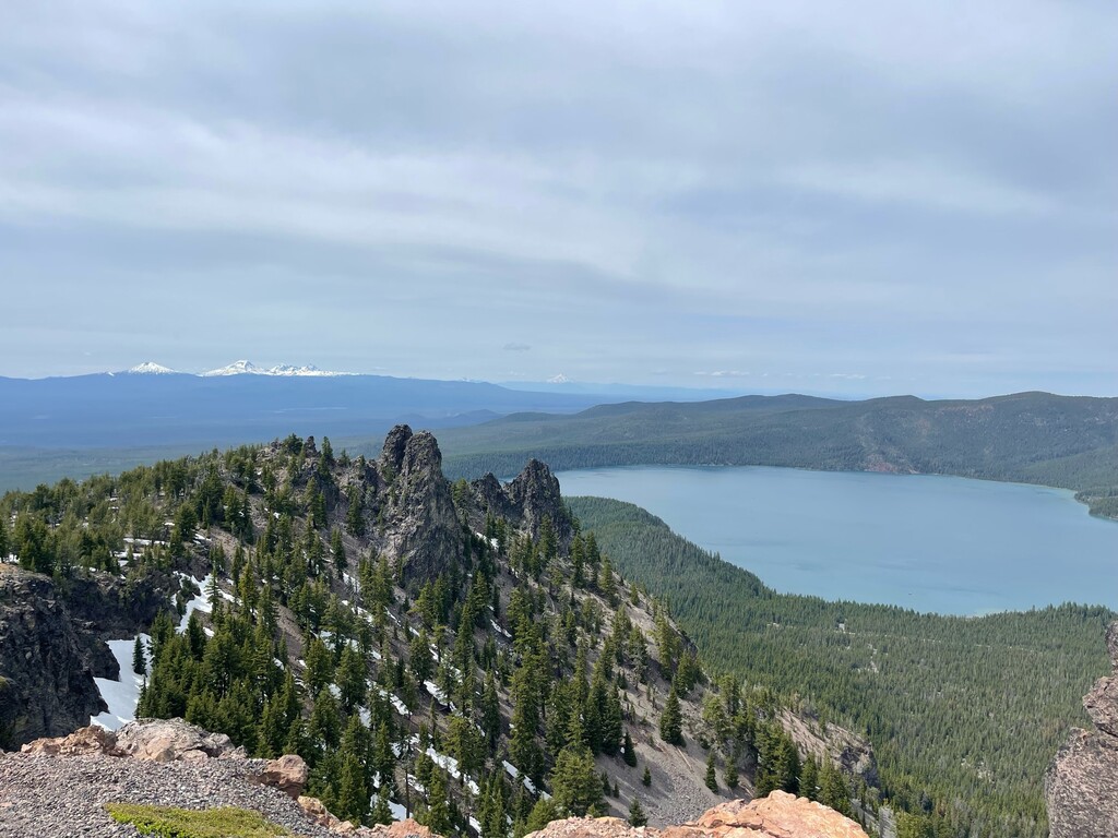
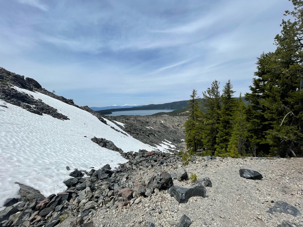
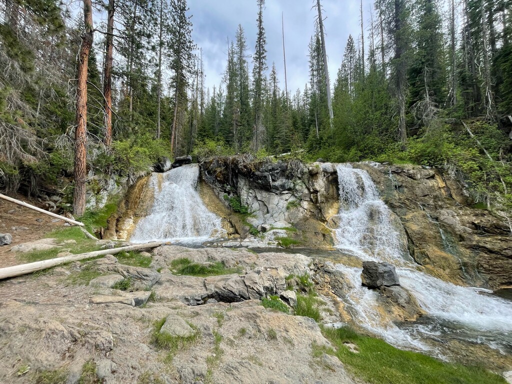
This 50-mile point to point route departs the Horse Butte Trailhead off of National Forest Road 1815 just south of Bend, Oregon and goes up and over the Newberry National Monument with stops at East Lake and the top of Paulina Peak, then drops down past Paulina Creek falls and along Paulina Creek to the finish at the trailhead near Ogden Group Camp just east of La Pine, Oregon. This route is almost entirely on rolling single track. The route starts with buttery singletrack as it climbs to the rim of Newberry National Volcanic Monument, then it visits East Lake, continues up to Paulina Peak with great views of the monument and Cascades and finally descends along Paulina Creek passing waterfalls and swimming holes. Be sure to prepare as the first 30 miles have no water, although if supported there are multiple road crossings and the Swamp Wells Horse Camp would be a good aid location. If you go solo, you can get water at mile 30 either at the Cinder Hills Campground of you can get water, snacks, ice cream and cold drinks at East Lake Resort. This is sure to be a classic route as it is 50 miles of excellent single track few with few crowds and amazing scenery in this volcanic wonderland.
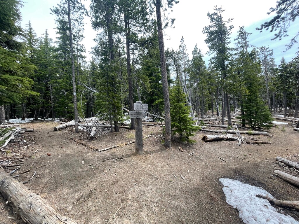
The route is pretty simple. From the Horse Butte Trailhead you head west either along the dirt road or the adjacent trail found immediately to the south of the road for quarter mile, you will then follow this trail #61 for 24 miles all the way to the Crater Rim Trail. If you need aid or support in the early miles, you will pass Swamp Wells Horse camp in about 14 miles (no water). Trail #61 junctions with Crater Rim Trail in about 24 miles, once on the rim trail you go left (east) along the rim trail for 2 miles to the junction with Cinder Hills trail. Take this right and drop down the switch backs another 2 miles to Cinder Hills Campground to resupply water. The next water will be at Paulina campground in about 12 miles. From Cinder Hills campground you can either reverse back 0.2 miles or so to get back onto the trail and continue past East Lake Resort or take the campground road to go into the resort for snacks. From the resort the trail picks up again behind the East Lake Resort private campground. Continue on this trail 2 miles to the junction with the Lost Lake trail. Take a left and head up this trail back to the Crater Rim Trail about 3.5 miles. Be sure to stay to your right as you ascend. When you junction with the Crater Rim Trail, go right and continue until you junction with the Paulina Peak gravel road, here you have the option to either cross the road and take the trail to the summit or use the road to the summit. There is a choice here as early season the snowpack on the Paulina Peak trail can create hazardous conditions. From the peak (be sure to climb the rocks and tag the summit) you can head down the road or the trail to Paulina Lake, the road is longer but less technical than the trail. At Paulina lake you can head a short distance east (to your right) and there is water resupply at the Paulina Lake Campground or more snacks and ice cream available at the Paulina Lake Resort. Leave the campground retracing your steps then go over the car bridge on the right as if you planned to go counter clockwise around Paulina Lake, however immediately after you cross the bridge take a left up a dirt road past a gate and onto the Peter Skene Ogden Trail, there are several trail junctions here the trail you want is the one on the left, closest to the creek, as the route from here descends along Paulina Creek. You then descend this trail for about 8 miles. There are multiple waterfalls along this route (be sure to take the spur to Paulina Falls) and even some nice swimming holes. The route ends as you cross the final bridge to the picnic and the parking area are near the Ogden Group Camp. Ideally you have a car or friends waiting for you here. It’s good to relax and cool off in the creek at the finish. Enjoy this super scenic and diverse Central Oregon Route.
https://www.strava.com/activities/11654251700?oq=up
Comments
Giving your route a crack tomorrow, dirk! Happy 50th!