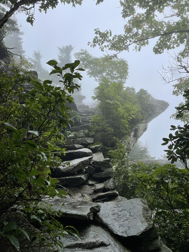
This was my solo Tanawha "Marathon" attempt, starting at first light ~6:30am. I parked in the Price Lake Amphitheater parking lot and walked across the Blue Ridge Parkway to the North-end trailhead. In typical fashion, I went passed the south-end trailhead to see the view at Beacon Heights (see photo), which was socked in with fog. I started my watch with my first step on the trail and did not stop it until I hit that same trailhead again.
This is considered a "self-supported" attempt because I stored a 3-liter bottle of water just off the trail near the Boone Fork parking area off of the Blue Ridge Parkway because the Linville Cove Visitors Center is currently closed, and all water is shut off. Other than stopping at my water bottle for refills twice (coming and going), I did not receive any assistance, carried all of my food and trash, and was completely on my own. FYI: GPS almost always runs short on this trail, so even though the NPS mileage has the Tanawha trail at 13.5 miles long one-way, my Garmin Fenix 6 only registered 24.95 miles for the double traverse.
The Tanawha Marathon used to be an annual event and there used to be data on male and female times, yet after multiple attempts, I could not find these data. There was a wiki web page with this information, yet that page is no longer available. If anyone has access to this data, please contact me.
There were several "obstacles" to overcome during this attempt that will make me reconsider doing another attempt in a different season: 1) We have had so much rain this summer that the rocks and boulders, especially at the southern end were slick as ice, so I slowed down for safety, 2) Some parts of the trail were very overgrown, 3) It rained and often poured the last half of the run, turning parts of the trail into streams, increasing the slickness and technicality, 4) There were 60+ Yellowjacket nests to contend with along the trail, and 5) At mile ~22, I had to give the right-a-way to a large group (25+) of hikers traveling uphill and moving slowly south on the trail. A subsequent attempt would be best during late winter or early spring, so around March. This would also make a true unsupported attempt easier and there are multiple opportunities to filter water along the trail.