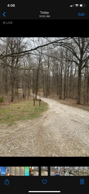
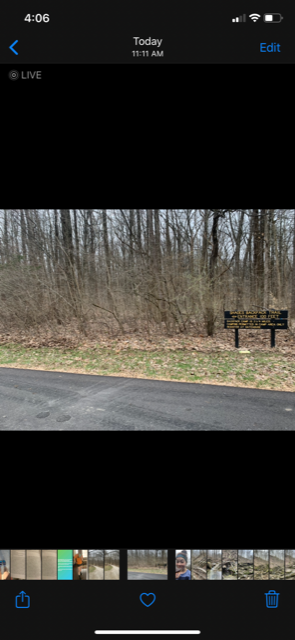
This was my first ever FKT attempt and I really just wanted to practice using the technology and learn before my big FKT attempt. The distance is short of what it should be and I wonder if it's because my watch was accidentally and unknowingly stopped for a short period of time (I think while I was scrabbling rocks on trail 8). I did backtrack a lot of trail 8 because I thought I had gone the wrong way (I hadn't), so I'm still surprised it's this short. I checked like 5 times after this to make sure I had done the route correctly (and I checked periodically during the attempt), so I'm confident I covered the correct distance. If the stopped garmin is a problem, though, I totally understand. I included screenshots of my time-stamped before and after photos (IMG_1409 is the start of the route by trail 6, and IMG_1410 is the end of the route by the backpacking trail).
According to my gps I ran the route in 1:04:48. Full disclosure, I realized near the end that I had accidentally stopped the watch at some point. My best guess is this happened on trail 8 while I was scrambling on the rocks. Believe me when I tell you I cried when I noticed my watch was stopped. I’m not sure how long it was stopped for. I do have time-stamped photos from the beginning and the end of the attempt. While it’s not precise, it’s if anything a slower time than what I really ran. The first photo was at 10:02a and the ending photo was at 11:11a, which puts my time at about 1:09. I know this isn’t precise and I’m so bummed about that. However, the main goal for today was to learn and practice using technology while attempting an FKT, and I did just that.
First of all, I took the route counter-clockwise because I was completely unfamiliar with the route, which traverses several trails, and I had watched a video about it beforehand in which a hiker goes counterclockwise. I had to stop several times to look at a picture of the map on my phone (there were no paper maps at the park like there would normally be). I mean, I stopped a lot. I was constantly unsure if I was going the right way, but I was super careful to do this right. In retrospect I would go clockwise in order to scramble up the ravines and run downhill on trail, rather than scramble down and run up. This would mean the opposite for trail 8, though, but since that would be closer to the beginning going clockwise, I would at least get to do the easier parts last. On that note, trails 7 and especially 8 were the most rugged. All the ravines were rugged (and not made for running, really), but those two were especially tough. If we’d have had any more rainfall prior to this it would have been a straight up river/waterfall to navigate. That was the fun of this, though—I had anticipated being to be able to run but it was mostly scrambling or slipping on mud and slick rock. Not the kind of route you’d take to do serious running, but definitely a lot of fun. Now that I know the route better and hopefully wouldn’t have to stop to read a map so often, I’m excited to try this again (during a drought, preferably). Next time I’ll just put my watch in my pack or something so I don’t accidentally stop it. Sigh.
Comments
Awesome job! I plan to go out there during the summer and run it for Gary Robbins #SummerOfCMTR Scavenger Hunt - and by the looks of it, there are no males so it might be an FKT!