

Prior comments
- This FKT attempt was conducted wearing running specific sandals designed for rugged terrain, and sandals were worn when the temperatures dropped. These aren't your run of the mill flip-flops, and wearing them is not some silly stunt. It took me many years of training to be able to perform well in such minimal footwear, so as much I encourage you to try them, it's not for everyone.
- I've been planning this FKT attempt for 3 years, have run or hiked almost all the sections prior, and scoped out all aid points with my crew, and I chose the Northbound direction as it's in my view the nicest way to do it in winter. In summer I might have chosen the opposite.
- Although I extended my run to start at the beach in Saint-Raphaël and finish at the Rougon's town hall for symbolic reasons, I only timed the exact FKT route.
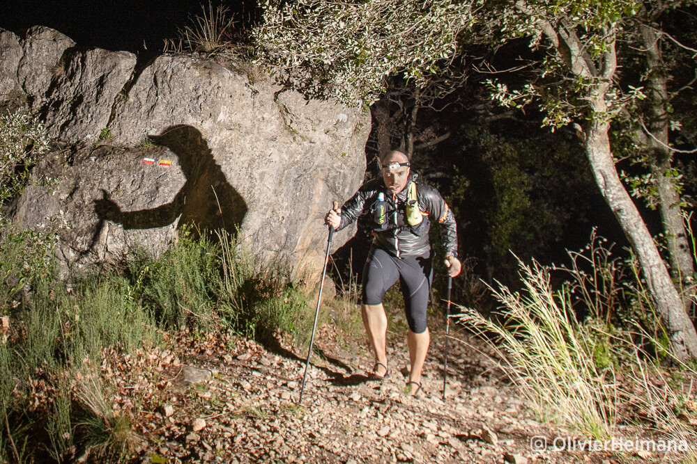
I started at the first trail marker on Friday the 4th of March at 23:01 and pursued Northwards with very little traffic in the first 4 km following streets and roads before exiting town onto the trail. The next 16 km was a mix nice fire roads and technical single-track with jagged rocks galore.
To my surprise I made it to km 20, my first meeting point with my crew, 30 minutes ahead of schedule despite keeping the pace as easy possible. I had started off with a Spot Gen 3 device, but my crew informed it wasn't working and we skipped trying to fix the issue and I left it with them, relying on my Coros Vertix 2 watch to track my progress.
Only a couple minutes after leaving them I, my headlamp started to show signs that battery was running out (unexpectedly, somehow it got discharged), so I messaged them to meet me at next road intersection to switch the batteries out. In order to not risk finding myself in the dark with only a low power headlamp as backup, I pushed the pace through the Fondurane section bordering Lac Saint-Cassien. Luckily my crew met up with me in time and I switched out batteries before resuming my journey.
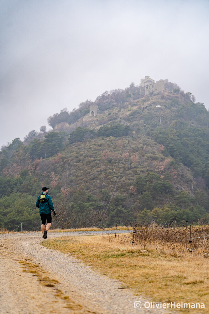
The following section trails through the outskirts of Montauroux mostly on tarmac with a couple trail mixed in, up until reaching the beginning of Siagne Gorge at km 37, proceeding down into the gorge to the Siagne river via very technical trail full of roots and loose rocks and snaking back up to the town of Saint-Cézaire-sur-Siagne on the remains of and antique Roman road. There I met with my crew for a refuel.
The next section resembles the previous to some extent as it travels through the outskirts of Saint-Cézaire before diving back into the Siagne Gorge to the Pont de Mons on the same type of technical trail as before. The big difference being that the way back out of the gorge is on much harder terrain that the previous section.
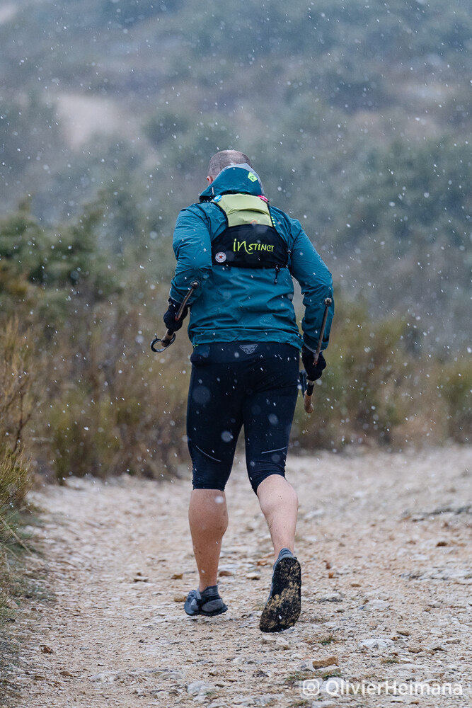
By kilometre 49, as I reached some better surface paths, the rain started falling (I had been lucky enough to avoid the forcasted rain so far), and as I moved uphill to the town of Mons the rain turned to wet snow.
At Mons I met my crew and changed clothes for some warmer options and put some socks on as we'd had reports that it was snowing consistently higher up. Indeed as soon as I got a bit higher up the wet snow was taking hold.
I followed the trail as it went around the borders of the very clearly marked military zone of Canjuers, while detonation sounds echoed far off in the distance (it's my understanding that the zone is some sort of training ground).
When I started on the ascent to Mont Lachens at kilometre 64 the snow was foot deep slowing me down greatly on the steep gradient and technical terrain.
I lost a lot of time making it up to the top where I found everything snowed to such a point I had to follow my GPS track because trail markers were no longer visible.
I charged down the mountain as fast as I could, despite the first parts being quite slippery, and made up some time before meeting the crew car at La Bastide.
Shortly after leaving the crew car I was blocked by three very aggressive dogs roaming loose which I struggled to keep at bay until some locals came to my aid distracting the dogs so I could make it though.
As I made my way through the Artuby Valley, the trail passed in front of another house with a hostile guard dog and no fence, but I was lucky that my photographer Olivier Vin distracted it with his van while I slipped through unnoticed.
My relief was short lived as the trail passed through a farmyard where 3 dogs charged at me as I held them back under the watchful eyes of their owner that didn't lift a finger to help, letting two other dogs by her side charge in my direction but I was long gone by the time they reached where I was. Thank you to that wonderful human being.
I remained weary over the next kilometres to Comps-sur-Artuby having lost so much time to all these canine encounters. To make things worse, the trail marking had been removed from the trees by axe and several fences put into place despite these being public trail so I had to swerve around a few obstacles to stay on course, only losing more time.
I finally arrived in Comps for very fast refuel with the crew, trying to make up for lost time, and shot off towards Trigance, knowing I was going to have an easier time onwards. The crew did however find a flock of sheep guarded by shepherd dogs right on the trail near Trigance but luckily the shepherd was nearby and agreed to move her flock so I could run through without any problem. Super nice of her.
At Trigance bridge I barely stopped as I was now behind schedule and wanted to make it to Rougon under twenty hours. I set back off as fast I could through town and out on the other side towards the Verdon Gorge. When finally started descending into the Gorge I was running out of daylight and was getting excessively close to my target time. I charged down the technical path towards Pont du Tusset, after only a few hundred meters of vert remained, but the clocked ticked over 20 hours running time before I reached the bridge and the rush exhausted my so much it took a almost half and hour to make it back out of the gorge, clocking in at 20hours 28 minutes 04 seconds in front of the Auberge du Point Sublime, the end of the GR49.
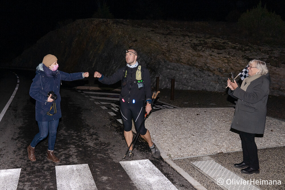
After stopping my GPS watch, I continued to the town above, and extra 2 km and a fe hundreds meters of vert, where a greeting party of locals welcomed me, and I presented them with with the city flag of Saint-Raphaël which I had carried in my pack all this way, given by the city hall as gesture of friendship to the town of Rougon. On their request I signed the flag with my official time (does that count as desecrating a city flag? I don't know, and I think nobody minded).
As a bonus, while I talked with the greeting party I dropped into hypothermia and had to retreat to the crew car to avoid trouble.
Big thank to all that participated in this event:
- Cyndia Violot my life partner & crew chief
- Olivier Vin our photographer extraordinaire
- Alexandre Tosello in charge of sports for the city of Saint-Raphaël
- Maxime Audibert and Gilles Bossuet of the Rougon local counsel
- Panta Sandals for working with me to develop the perfect sandal for this trail
- HolyFat for providing low carb nutrition that suits my needs
- La Clinique du Coureur for providing scientifically valid training knowledge
If ever you want to attempt this trail please reach out, I would very happy to share my knowledge. You can find me on instagram @benviolot.
Ben