


In a nutshell
I completed the 155mi San Diego Trans-County Trail (SDTCT) self-supported in 2 days, 23 hours, and 9 minutes. That was roughly 17 hours longer than my spreadsheet predicted. Clearly, I had not done my homework. I ended up pretty wrecked, mainly because I didn't carry sleeping gear and worked myself into a calories deficit like a beginner. Three nights without sleep and without enough calories tends to be a reliable recipe for disaster. Keep reading for all the saucy details...
The trail in a nutshell
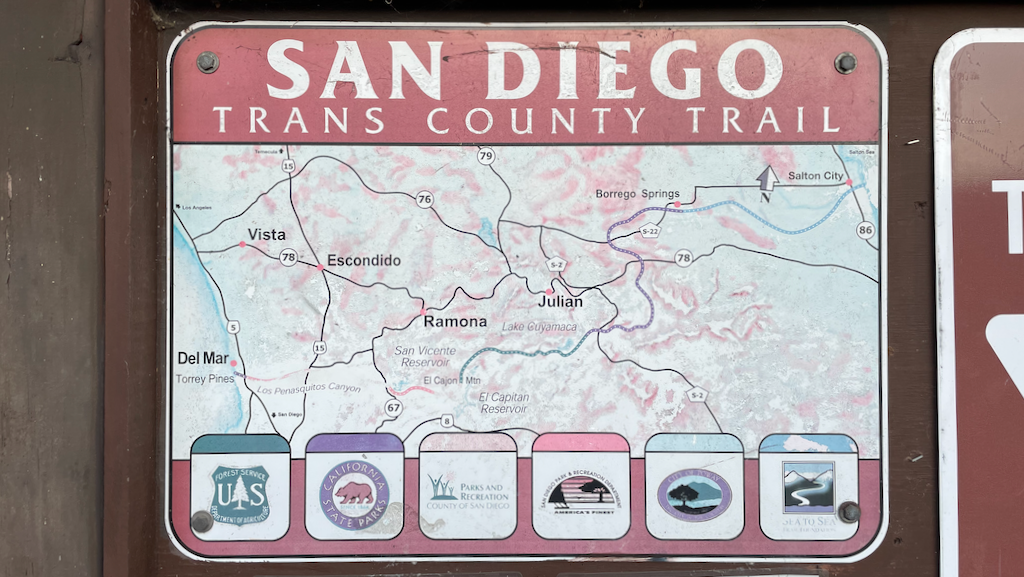
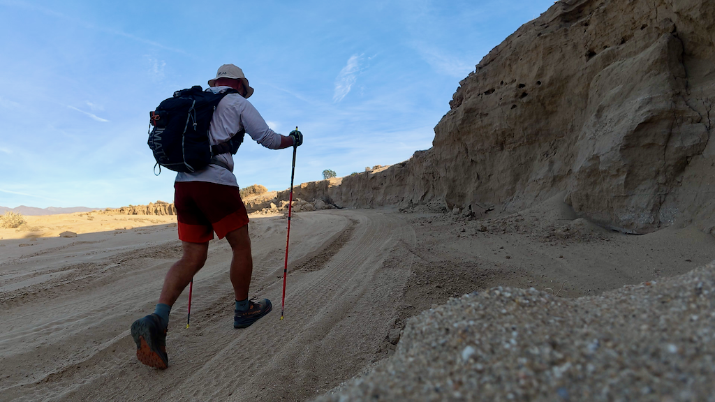
The San Diego Trans-County Trail (SDTCT), aka the Sea to Sea Trail or the TCT, is an 155-mile route from the eastern boundary of San Diego County near the Salton Sea (236ft below sea level) to the western edge of the county at the Pacific Ocean. The route connects Anza Borrego Desert State Park and Wilderness in the Colorado Desert (a part of the larger Sonoran Desert) to the world-famous Torrey Pines Natural Preserve. San Diego County is the most biologically rich county in the continental US.
The SDTCT uses a combo of existing trails, such as the California Riding and Hiking Trail. The character of the route changes from well-marked singletrack trails to bushwhacking to road walking to well-marked urban paths.
The eastern part of the SDTCT visits areas that are ancestral homes to bands of the Cahuilla people, also known as íviluqaletem or Ivilyuqaletem. The western part of the trail is the ancestral home to groups of the Kumeyaay people. Descendants and members of both groups are still active in San Diego and surrounding counties. The trail crosses Native American Reservations of the Iñaja and Cosmit and near reservations of other groups.
The route is best done between November and February. There is no permit required to hike the entire route.
The best resource for information is the SDTCT group on Facebook. The Facebook group provides maps, GPX tracks, and current route conditions: https://www.facebook.com/groups/542292329178926.
Off to no-good start
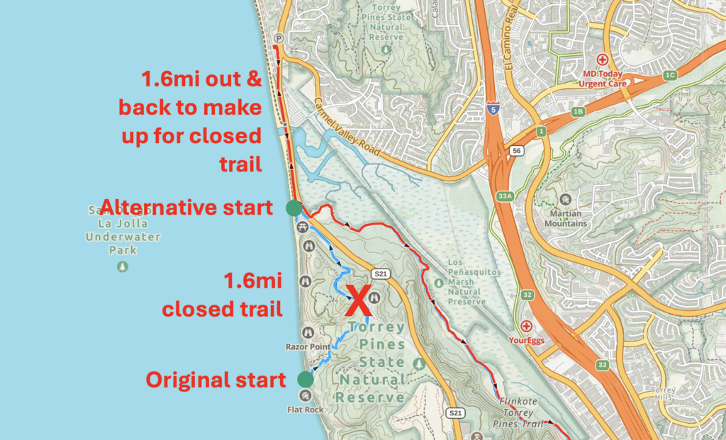
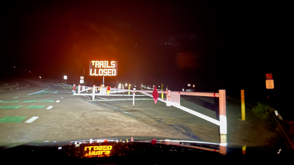
I had spent a full day on Dec 17, 2025, dropping calories, H2O, and scouting sections of the trail I didn't know yet. However, I failed to scout the start because I assumed it would be obvious. It was not. The first thing I saw at the start trailhead just past 3am on Dec 18, 2025, was a big illuminated sign that said "TRAILS CLOSED." Great.
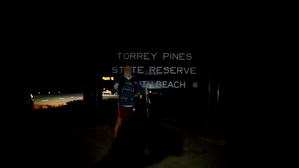
That meant I was unable to get to the real start, some 1.6mi from the Torrey Pines State Reserve North Beach parking lot. After some foggy early-morning thinking, I decided to start at the parking lot, and to do an out & back of 1.6mi on North Torrey Pines Road (S21) to compensate for the distance of the closed trail.
The adventure began at 3:35 AM on Thu, Dec 18, 2025. The moist sea air and the sound of the breaking waves made for a fine warm-up. From there, it was all downhill. Mostly figuratively.
I had decided to do the trail West to East for a variety of reasons:
- I was already at a conference in San Diego.
- I wanted to stay in Borrego Springs for a few days after finishing, which is on the route and a 30min drive from the finish.
- I wanted to start with the least attractive part (= urban environment) of the route and finish in the fabulous remote desert. Or so I thought.
- Downhill bushwhacking from El Cajon mountain would be easier than going uphill.
Everybody who completed the trail so far seem to have gone East to West. I'm not sure why. Perhaps the logistics of being dropped off at the Salton Sea are easier than being picked up.
The burrito
The first 22mi into Poway were all on urban trails. I had packed light, without sleeping gear of any sorts. I figured I could do 55h with a few trail naps, as I had done on previous adventures of about the same length. I was able to run some sections on these quite nice urban trails. Navigation was easy as there was ample signage. The worst part was the constant highway noise from one of the many highways crossing these valleys and urban communities.
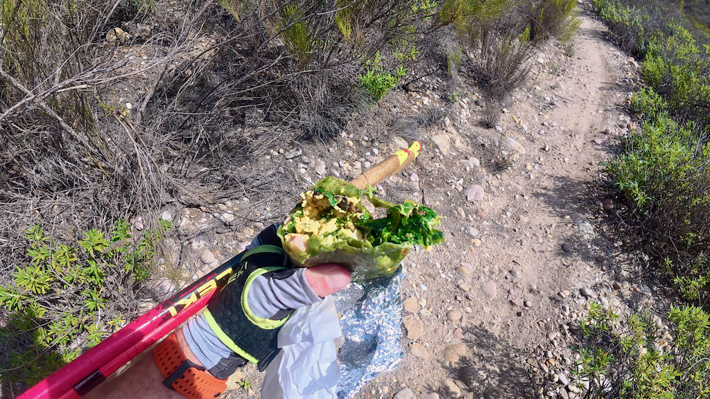
Poway was supposed to be my first resupply opportunity. I was going to be nearby a Carl's Junior and sneaking by a Costco. But without a membership and the need to buy 15lbs of Kirkland Signature Fancy Whole Cashews, I opted for a new bakery location right on the route: Nutmeg Bakery & Cafe. My goal was to resupply on liquids and to buy a hearty lunch that would get me through the day.
I looked at the menu and saw the "Amazing Burrito." I was assured that I would only need one for lunch. Happy and already smelling like a PCT hiker on day 5 without a shower I continued without dallying. I figured I would start my lunch once I passed the Costco and go out onto the trails again.
The huge car wash line on a Thursday morning at the Costco was slightly puzzling to me. Perhaps because it would never occur to me to wash my car.
Well, the burrito turned out to be the worst burrito ever. I should have read the details:
"Local eggs scrambled with organic kale, nitrate-free ham, roasted mushrooms & white cheddar cheese all wrapped in a spinach tortilla. Homemade salsa & fruit"
I rather despise kale in most of its forms, and it turned out to be impossible to separate the kale from the rest. After a few bites, I decide to gift it to a few birds sitting in bushes. I was only able to eat the fruit that came with the burrito. Unwilling to go back more than a mile to buy something else, I decide to forego my much anticipated lunch calories. This was not my last mistake.
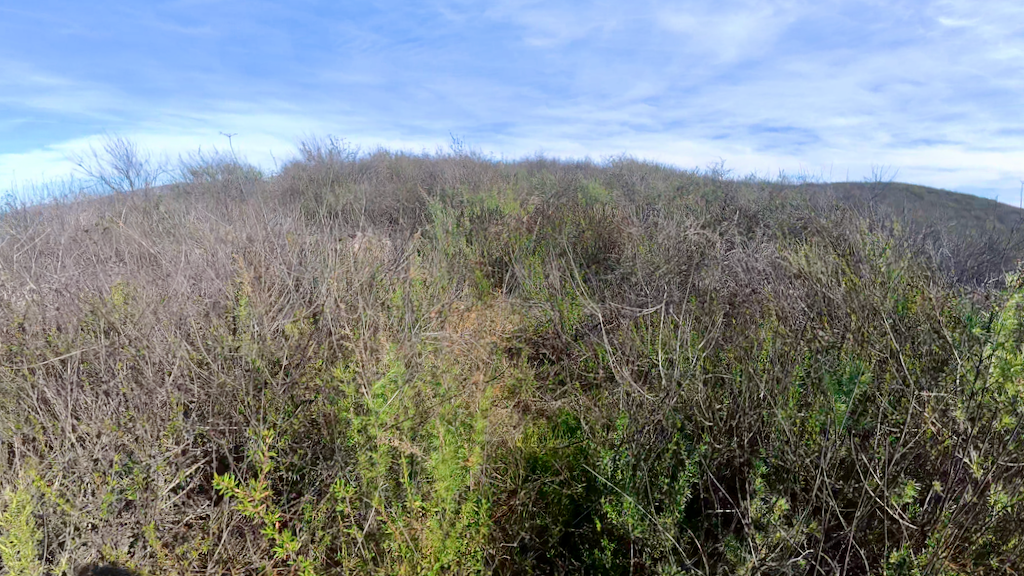
A first taste of bushwhacking
The section between Poway and Lakeside led through the Sycamore Canon Preserve. I got a first taste of mild bushwhacking on some ridge trails. There were perfectly fine trails lower in the canyon, but I was eager to stick to the prescribed SDTCT route.
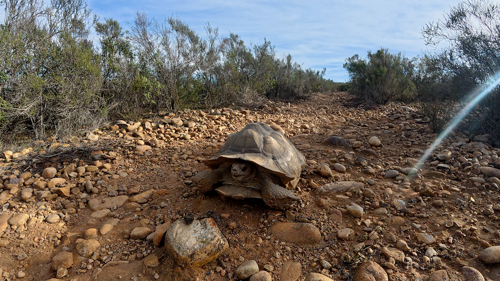
The highlight of the entire trail was seeing a huge Sonoran desert tortoise in the middle of the trail. I first thought it was a hallucination or some sort of prank. But no, it was real! Apparently they can get over 100 years old. Larger species measure 15", and this one was definitely at least 15" large. It felt great to pass a tortoise on the trail!
Private road detour
After a rather long and rocky descent down to highway 67, I hit the first significant road section. The original route goes into the hills, but there's a 2.1mi private road section in the middle. After my scouting expedition, I had decided to detour that section to avoid trespassing and getting shot or something. The detour along the Wildcat canyon road was 0.7 mi longer than the original route.
It was a horrible road walk, mostly because the road is for the most part very narrow with a very small or no shoulder at all. In addition, the traffic was very dense. Nevertheless, I'd rather do a horrible road walk than getting in trouble for trespassing in the wild west.
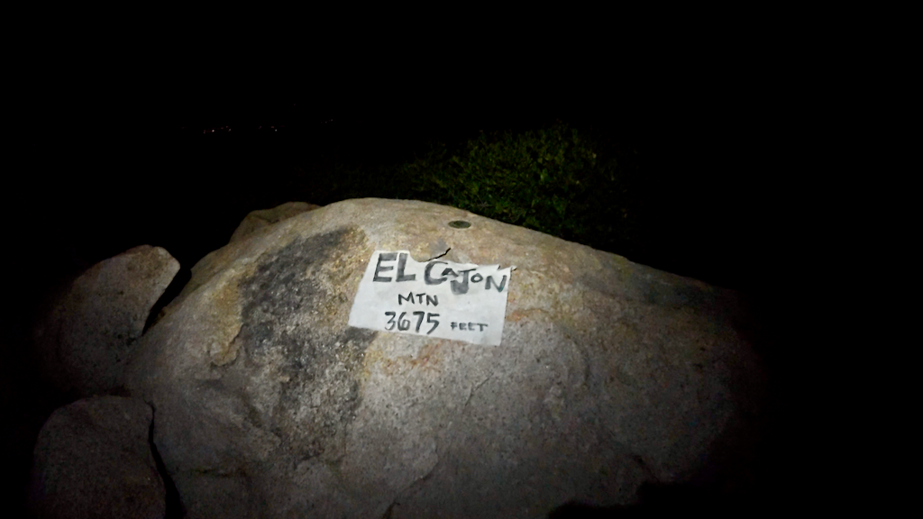
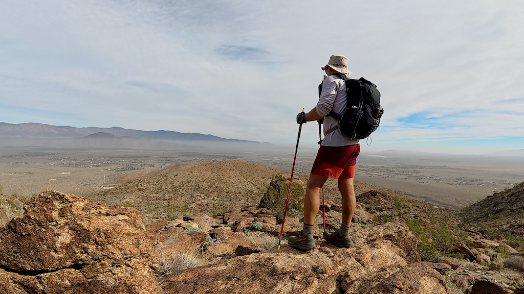
El Cajon mountain and the bushwhack
After the terrible roadwalk, I reached the El Cajon mountain trailhead, where I filled up all my bottles at a spigot in anticipation of not finding water for at 16 miles. I was also pleased to see that so far, I had been ahead of my planned schedule, prescribed by my spreadsheet. Sadly, that was about to change.
Lots of signs warned about the difficulty of summiting El Cajon mountain. It's a 6mi hike to the summit. I figured I would be fine. I was surprised to find several water refill stations on the way up. It felt like I was doing a race with aid stations. Do people rely on these water drops?
The climb turned out to be more strenuous and time-consuming than I expected. The warning signs were not completely off and I can see why people get in trouble there. I eventually made it up to the summit. The views were not great.
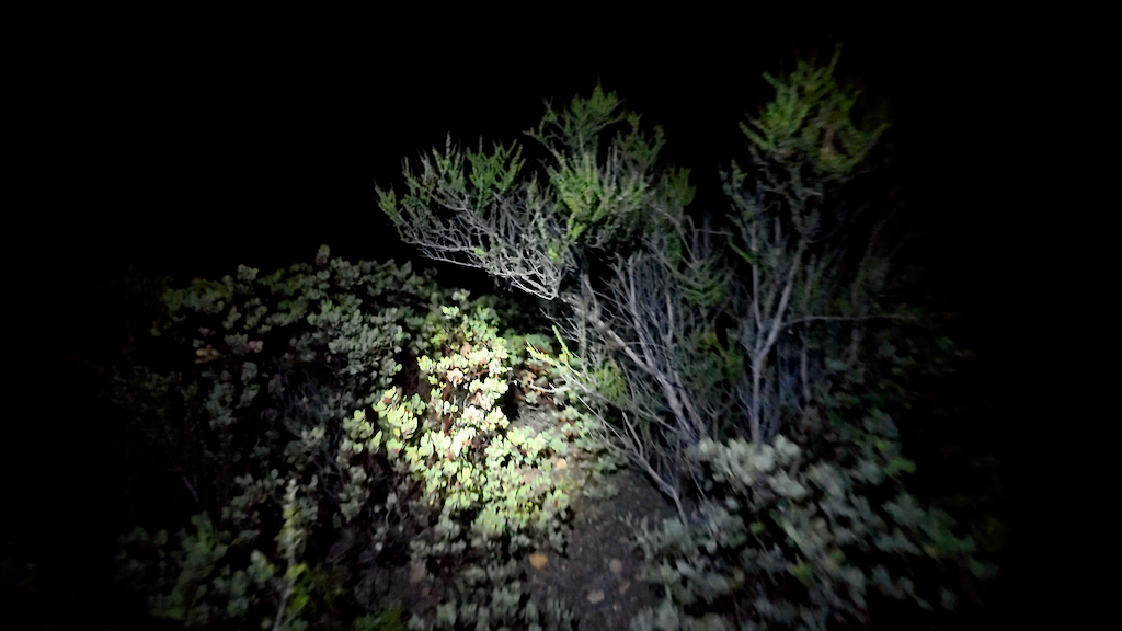
Not the real fun started: the bushwhacking section that the vast majority of SDTCT hikers simply skips. I didn't know what to expect, but figured it couldn't be that bad. Well, it was actually really bad. If you have ever tried to make your way through manzanita bushes, you know what I'm talking about. You add huge boulders and all kinds of other thorny things.
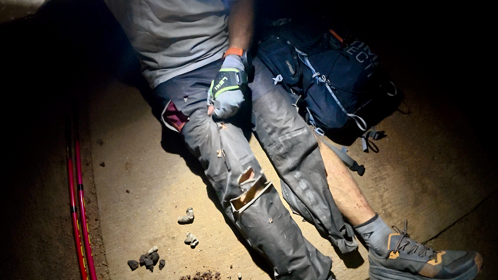
I did not have long pants, so I decided to sacrifice my rain pants to at least somehow protect my legs from the worst. The first bushwhack section follows the ridge for a bit, then you are supposed to drop down to a road. I'm perhaps 1.5mi in total. That took me over 3 hours. The night obviously didn't help because it's hard to see a good line to and to evaluate the vegetation in the dark with a headlamp only.
After a some time on the road, the bushwhacking continues. Not quite as bad as coming down from El Cajon mountain, but still bad. You follow some insane imaginary line to dodge private property and reservation lines. It goes in and out of canyons and around hills in a way that does not seem to make much sense. Well, it does make some sense if you look at the map with the private property lines.
As you can imagine, my pace slowed to tortoise speed. I was supposed to be at the Cedar Creek Falls trailhead at mile 55 by midnight, but I reached that point just past 4am. I was hungry and wrecked after a night of bushwhacking and no sleep.
Sh*t happens?
While I was refueling at the Cedar Creek Falls trailhead, four teenagers in a shiny BMW drove up and loudly started to prep for their hike to the falls. They didn't see me because I had turned off my headlamp. I let them go ahead because I figured they would be fast. They were not. Before catching up with them in the dark, I found a cellphone in the dust. I figured it was one of theirs and picked it up. Before reaching them, I witnessed one of them slipping and taking a plunge into rocks and dust. She was wearing flip flops. The phone indeed belonged to one of them. He said thanks and said "I am so stupid." He hadn't even realized his phone was gone. Apparently he wasn't checking TikTok every minute, which I applaud.
The SDTCT route doesn't go to the Cedar Creek Falls and I turned off to a different trail. I saw from far that the teenagers had followed me, then realized their mistake and turned around.
Now I was on my way to Lake Cuyamaca at mile 75. This was supposed to be the first significant climb. And it was! I was looking forward to purchasing some food and liquids at the store and restaurant. For some reason I expected a trail, but pretty much the entire climb was on dirt roads first, then paved roads.
In the morning hours, I saw my first cougar of the adventure between two bushes. When he saw me, he took off immediately.
Later, on one of the dirt roads, I encountered a new level of disgusting: someone had not only sh*t in the middle of the road, they also ran out of paper and then used a sock that they left behind too. My main question is: what did they do with the other sock? Save it for the next sh*t? Some day, I would like to talk to a person who does that and ask the following questions to understand better:
- Why in the middle of the road if you could step into the bushes a few feet away?
- What do you think happens to what you left behind?
- What childhood did you have?
Sadly, the trend of leaving feces and piles of toilet paper on or nearby trails seems to be much more popular in Europe, as witnessed many times during races. But the trend seems to be taking on here too.
After what felt like hours (and included some desperate trail nap attempts in the heat), I made it to Lake Cuyamaca. My spreadsheet confirmed that I was in even more trouble now. I was more than 7 hours behind schedule. Did this matter? Yes, I thought so. For two reasons:
- My resupply locations were now in non-optimal locations. Meaning I could possibly run out of calories and H2O.
- I would likely have to go into a 3rd night without sleep.
None of that sounded good.
At Lake Cuyamaca I decided I didn't have the time for a sit-down meal and probably couldn't finish a burger or something because my stomach was not feeling good. So I grabbed a beer, a yoghurt, and a tuna salad for the road. Only much later on the trail I realized that I absolutely wanted to buy an ice cream, but for some unknown reason, I forgot about it when I was at the store. I made up for that mistake in Borrego Springs.
To the PCT and the California Riding and Hiking Trail
It was a rather pleasant hike into the night toward the PCT intersection. Although I felt very stressed about by behind-the-scheduled-ness and the lack of gear that would allow me to get some proper sleep. It was also another reminder that, whatever you plan, may be way off, and that the need to build in redundancy and flexibility into an FKT completion is essential for success, especially on longer routes.
I made it to the PCT intersection and the California Riding and Hiking trail in the dark. I knew that section from the Anza Borrego Loop and the Anza Borrego Traverse. I was mentally preparing for the very rocky road down Oriframe Canyon to road S2, but to my surprise, it had been bulldozed and was now quite the highway. It used to be a hardcore jeep track for high-clearance 4WD vehicles, but now the signs didn't even require 4WD. Great, at least I wasn't going to lose more time.
One the way into the canyon truck stopped and very young fellow asked if I was OK in the dark. I said I was trying to set record on the SDTCT. To my surprise, he asked if they had finished the trail and that he had considered doing it some time ago. I said that it remains a concept at best and that things had been pretty rough so far.
While making my way through the box canyon toward Blair valley, I encountered my second cougar. It was sitting on a rock ledge in the canyon wall. It kept staring at me, but never made any move. It looked like it was just hanging out. I slowly passed underneath it and kept looking back to make sure it was not stalking me.
Toward Borrego Springs in the second sleepless night
Now I was going to cruise on the California Riding and Hiking trail until Borrego Springs. That was somehow comforting. At least there would be no more bushwhacking. But I knew that the 8mi section into Borrego Springs from the 2nd highpoint of the entire route would be very technical.
The night turned out to be rough. The wind was very strong and I had massive trouble staying awake. Numerous times I tried to sleep for more than 5min, but it was nearly impossible to find a spot that was soft and warm enough for that. And I wasn't picky. Sand feels soft, but it gets very cold quickly when you lay down. The best locations are juniper trees. They have a very soft bed around them. Yet, there were pretty much no juniper trees on the route that night.
So the moving was slow, and getting slower. When you wake up bent over your poles and you have no idea where you are and how you got there, it's not a good sign.
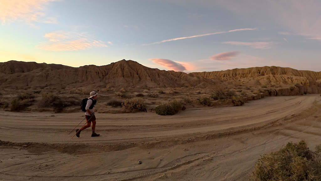
Eventually daylight crept in and that is usually a moment to revive a bit. I tried my best to do so. It was too cold to stop, so I kept moving. At least the scenery got better and more impressive by the mile.
I estimated that I would reach Borrego Springs around noon on Saturday. About 12h later than my spreadsheet said. My initial plan was do this stretch through the hottest part of the route at night, but now I would have to do it during the hottest time of the day. And with still 38mi to go, I would have to get deep into the 3rd night without sleep.
I had every reason to be somewhat worried. I considered quitting, but then I told myself that I needed to finish this because I would never ever want to do another attempt again. It was now or never.
Into the sand
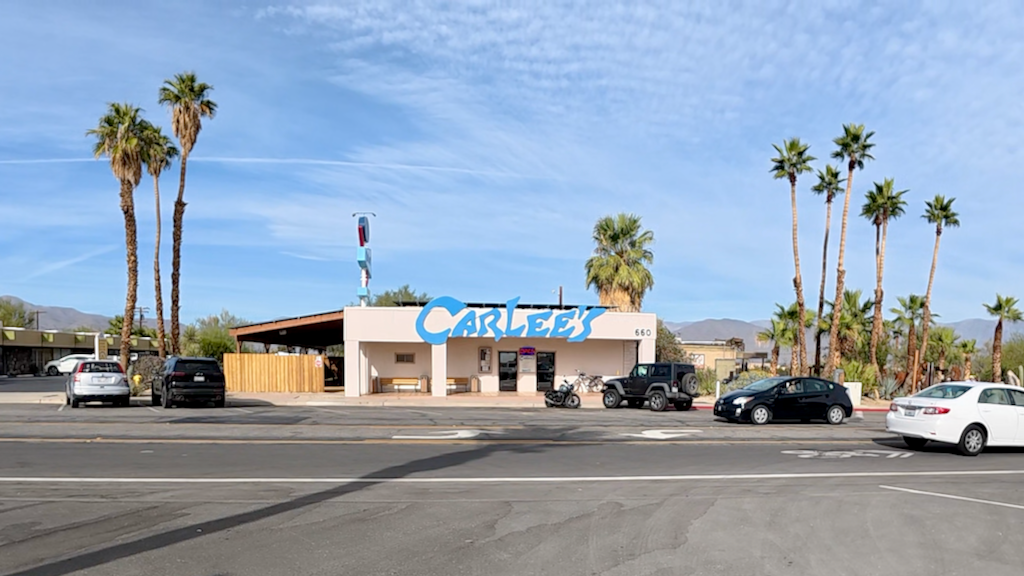
I did make it down to Borrego Springs around noon on Saturday. We've been coming to Borrego Springs since 2004, so it's a place that I'm rather familiar with. I now had to do a 5mi road walk through town. The hardest mentally would be to walk by the hotel Ursina was staying in. It would be so easy to just quit there and I'd be sitting in the pool in the next 10 minutes. However, she was instructed to hide so I wouldn't be extra tempted.
As I walked through town, I was tempted to get a burger at the legendary Carlee's, but that would taken too much time. Instead I bought two ice creams and water for the road and kept going in the heat of the day. Still 38mi to go seemed impossible at that point.
I eventually made it to the end of the road, where I hit sand. After 5mi of road, sand feels like a relief. But not for long. After 1mi of soft sand, you will want to desperately get the road back.
I entered the Dump wash and climbed up through until I got dumped out at Inspiration Point. The end of the wash is so narrow that you have to squeeze yourself through. The reward, however, is the spectacular 360 view. I was lucky to be there just before it got dark.
On the backside, I then headed down immediately into Fonts wash.
The third sleepless night
It gets dark quickly in the the desert. A few hours into the night, a ranger in a truck passed me in the middle of a wash. Wouldn't you think a ranger would stop and ask a lonely hiker in the middle of the night if he was OK and needed something perhaps? Apparently not. The guy just blasted by me without even slowing down and left me in the dust. I wasn't actually sure I was fine at that point.
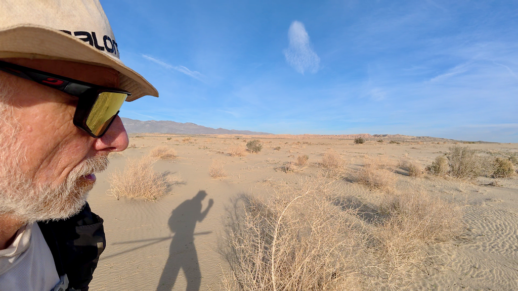
I started to have massive hallucinations and was getting increasingly worried that I would make suddenly very stupid decisions. Three events in particular came to my mind (I guess that means I was still able to think):
- The famous Alpine Lakes Grand Tour disaster (my 3rd attempt!) where I accidentally down-climbed Aasgard pass at night, thinking I was going down into the Enchantments. I was seriously sleep deprived then, lost my orientation on the pass, and then didn't realize for hours that I was going backwards on the route.
- An episode during my first Iditarod where I made it to a checkpoint more than 5 miles away without any memory of how I got there. I was massively sleep deprived and depleted of calories before that episode. Thankfully, I somehow got into an autopilot state and navigated correctly. I have no memory whatsoever how I made it to the checkpoint. It was like I woke up there. I did not want to repeat such an experience in the desert!
- Seriously sleep-reprived Roberto Zana, who lost both hands and feet on the Yukon Arctic race because he walked off into the snow after hearing voices about a warm cabin.
Nevertheless, I made it to my last water drop at mile 137. I had "only" 19 miles to go. My watch informed me that I could make it by 2am in the best case. That was better than 6am, but it was still 7h to go at my current pace. I'm not sure why I even continued.
At my last water drop I entered Arroyo Salado and never left it again until the very end. The first part was still in the Anza Borrego State Park. They do only allow highway-approved vehicles, so you can't bring your RZR and whatnot. That means that even though the sand is generally soft because of the vehicle traffic in the washes, there are not big ruts.
Things changed for the worst as I entered the Ocotillo Wells OHV area. That's where all the kids go crazy with their RZRs. The washes are generally deeply rutted with soft sand because they drive like crazy through these bends. It was past midnight and there were hordes of RZRs with crazy music and lights still making their rounds. On one hand it kept me awake and distracted, on the other hand, it was deeply annoying for my inner and outer peace.
At this point, I was only interested to make it to the finish. I wasn't eating properly anymore, and that led to an even slower pace. Navigation at night was intense and I used the Suunto so much that at some point, it told me the battery was getting low. That was really the worst moment for that. Another example of poor planning and execution. I should have charged earlier. Although, in all fairness, I did check the battery level before and decide there was plenty left to make it to the finish.
I couldn't afford to lose my GPS capabilities, so I had to get out my charger and charge the watch while still using it. If you know the magnetic Suunto charger, you will know that this is very hard to do. I ended up strapping it so tight around my wrist so everything stayed in place.
I suddenly encountered more and more wet and soft spots and realized that I had zero plans for any detours if some parts were becoming flooded and impassable toward Salton Lake. Luckily, things didn't get worse. But they could have easily.
The end was very confusing in every aspect. I lost track of distance and time. It was almost like an out-of-body experience. Only on the last quarter mile I suddenly saw the waiting car and realized that this may be it. I had made it just under 3 days: 2 days 23 hours 9 minutes 53 seconds. 17 hours longer than planned. I logged 161.72 mi, 6mi more than advertised.
I was wrecked like rarely before and collapsed in the waiting car. Ursina drove me to our hotel in Borrego Springs. After a shower and a few hours of sleep, I was hungry and thirsty at 6:15am. Then it was time for some pool...with a view of the SDTCT route. Then I was thirsty again. A "Wreck" beer seemed appropriate for the occasion.
Now I have a week to recover before the 200mi Across the Years race...
Congratulations if you made it until here. Sadly, I don't have a bonus for you. Except perhaps the lessons learned below.
Lessons learned
Most of this should be obvious, but I'll say it anyway:
- Going light is not always faster. I probably would have been faster overall, had I carried sleeping gear and gotten some decent amount of sleep. Sleep deprivation slows you down significantly.
- Things rarely go according to plan, even if you do your best homework (which I didn't!). You need to build flexibility and redundancy into the planning.
- Nothing goes fast on sand. I should have accounted for those almost 40 sandy miles.
- 1mi per hour is pretty fast for hardcore bushwhacking. You may do even less.
- Not staying on top of your calories intake always leads to disaster. I should have taken the time to sit down and eat a proper meal at one of the restaurants on the route. I probably would easily have made up for the "lost" time.
- Hot climates need different types of calories. No one wants to eat a fig bar with a dry mouth. Or at least I don't.
Full report with more pics, captions, and possible updates at https://www.christofteuscher.com/aagaa/report-155mi-san-diego-trans-county-trail-fkt
Resources
- Facebook group: https://www.facebook.com/groups/542292329178926
- Maps and GPS files: https://www.facebook.com/groups/542292329178926/files/files
- San Diego Trans-County Trail: A Guide to Thru-hiking and Backpacking: https://www.treelinereview.com/where-to-go/san-diego-trans-county-trail
- Selected trip reports:
-
https://www.fastpackingroutes.org/san-diego-trans-county-trail-sea-to-sea-trail
-
https://www.treelinereview.com/where-to-go/san-diego-trans-county-trail
-
https://thetrek.co/my-winter-thru-hike-of-the-150-mile-san-diego-trans-county-trail
-
https://twigadventures.com/introducing-the-desert-winter-thru-hike
-