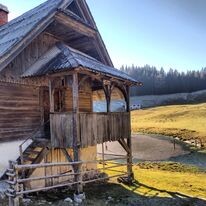


It was a supported FKT run with sun, lots of rain and a lot of snow. We started on 23-11-2021 at 12:00 local time in Kranjska Gora- the famous Slovenian Alpine town (at the starting point marked in the official Juliana Trail mobile app, - at Restaurant, Pizzeria, Hotel Kotnik, Borovska Cesta) and ran towards the direction of Jesenice. We ran a full loop around the beautiful Triglav National park to finish at the same spot as we started.
Erik Kemper helped with the logistics of the entire run (super grateful!) and joined with his RV and ran all night sections with me (a total of 100/280 km). Lotti Lohmeyer joined on the trip too and ran the first 37km with me and at a later point also an additional 10km. We used the RV for supplies and for some power naps throughout the 4 day run. We ate late in the evening/night in the RV and tried to power nap a few hours after at least each 24 hours. We once got bread and coffee (Bovec)/ as well as a strudel (Bohinj) in a cafe (but around this time of the year almost everything is closed, I encountered zero hikers on the trail, so it is very important to keep in mind that there are hardly and stops possible in November!). Generally, this is not the tourists season and there are mainly preparations being done for the ski season. Locals recommended doing this trip in summer or spring, certainly not now (though we loved the isolation, wilderness and rough weather and are used to being called crazy :) ).
After 3 days, it started snowing a lot. At this point we were at the border of Slovenia and Italy. This made the run significantly harder, as it became more difficult to navigate (a part of the trail was wiped away by all the snow). This caused us to significantly slow down, and reaching the finish became super hard due to the deep snow. Temperatures were below freezing at night. It rained for 24 hours straight before the snow started. It did add to the sense of adventure and the expedition character of this undertaking.
We followed the entire route as described in the official Juliana Trail app and according to the official GPX that was published on KOMOOT. We were also trackable due to safety reasons and so that everyone at home could follow our progress. For this, we used the reliable service of Legends Trackings BV. They provide tracking for many well-known organized ultramarathons in Europe. Erik (support tracker) and I (race tracker) were both trackable at intervals of 3 minutes. I used Strava to record the entire run (I uploaded it on my Strava and put settings on public). My device was charged in the RV while resting.
As described we followed the trail as accurately as possible, but there were a few sections that would be illegal to cross at this time of the year, hence we did not do this, and took the closest detour/ parallel route. This actually made the entire trail longer (not shorter!).
Within the Juliana Trail App small detours were mandatory/ obliged due to potential life-threatening danger. I added proof of those statements by making screenshots of the Juliana trail app (see the two pictures I attached).
1) - Part of stage 11 of the Juliana trail was closed due to construction of a cycle path and the Tolmin bypass. As described in the app, there were roadworks around Tolmin area/region and there was a sign with life-threatening danger due to falling rocks. Running there was illegal, and potentially dangerous without helmet/ due to machinery stationed there. We took the parallel route.
2)- The Predil Pass was not safely accessible due to the heavy snowfall that evening. It would be very dangerous to go there alone in the middle of the night with freezing temperatures and a lot of snow. The app states: " the stage is exposed to avalanches and can be impassable. This section has furthermore been described as extremely steep with parts that are exposed/ not secured.
Furthermore there was heavy rainfall the day before. The website states: " The mountain stream can be impassable due to heavy rainfall".
As we are not familiar with this era, nor the conditions after all the heavy rain and snow, we decided to follow the recommendation of the Juliana Trail app/ authors:
"The best choice in such conditions is the use of the regional road that runs more or less along the trail".
This is what we did.
3) In the original GPX by Komoot there were a few small single detours. I followed the first one (ending in an empty field) but soon realized they were actually navigational errors (as they deviated from the loop and just went back and forth)/ or lead to a small restaurant or cafe (that was now closed), hence they were omitted there where they were not part of the original route.
To conclude, this is a fantastic route. The winter conditions made it very challenging but also very rewarding. I can recommend this route to everyone with the right experience (in winter some alpine experience helps). Feel free to reach out if you have any questions regarding the run. I would be happy to help you prepare the adventure/expedition. Late november is a beautiful (though isolated/lonely) time for the trail. Snow can alter circumstances rapidly though, so caution should be used at all times! Though the trail is not high alpine or extremely challenging, there are sections that are dangerous with snow or freezing temperatures.
"Great is the victory, but the friendship of all is greater".- Emil Zatopek
Cheers,
Daniel