Trip Report: Cape Wrath Trail in fewer than 6 days
What follows is a report of a recent self-supported solo journey from Fort William to Cape Wrath with the objective of being as lightweight and quick as possible, particularly given time constraints. Most of the journey was speed-walked but with the occasional jog down gentle downhill sections and along the canal towpath.
The route started up the Great Glen following the original route followed by David Paterson (effectively the inventor of the Cape Wrath Trail) in the mid-1990s as far as Bendronaig Bothy then swinging north via Achnashellach and Easan Dorcha to Kinlochewe and from there following the frequently used route via Oykell Bridge to The Cape. It is estimated the total route length was around 209 miles.
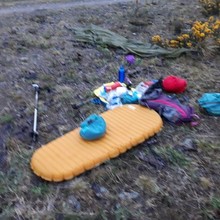
I carried a 25lt pack with sleeping bag, sleeping mattress, tarp, clothes, toiletries, accessories including power pack, first aid kit, maps, compass etc. I did not carry cooking facilities merely a mug and spoon. The aim was to source hot food and a sandwich for a later meal from one location en-route each day. I also carried one self-heated meal as well as energy bars and gels. I kept track of the route using a Suunto Ambit3 Peak watch.
Day 1: Monday 6 May. Fort William to Allbeithe Youth Hostel.
15hrs 30 mins. 41.1 miles (37.4). 4856ft Ascent
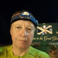
I left the sign that marks the start of the Great Glen route next to Fort William McDonalds at 3.30am in intermittent drizzle despite the sunny forecast.
After reaching the Caledonian Canal at Banavie I ran down the towpath as far as Gairlochy and then followed the Great Glen route to about 1km before Bunarkaig where there is a left turn marked St Cian’s church.
I followed this past this beautiful church hidden in the woods to the Clan Cameron museum at Achnacarry. From there I continued over a bridge at the end of Loch Arkaig west to Achnasaulwhere I arrived at shortly after 7am.
At Achnasaul I left the road heading up the track north on the long climb up to the high Bealach Carn na h Urchaire some 6-7km distant at about 650m in height. The track narrows to a path which disappears about 2km short of the bealach. The last 200 or so metres of climb are particularly strenuous over rough moorland and, on the day I was there encountered light snow and the occasional hail shower.
At the bealach the view North is to seemingly unspoilt wilderness.
About a kilometre into the descent heading NNW I re-joined the path which skirts Glas Bheinn and continues down through largely cleared forest to the road where the house which once was the Tomdoun hotel stands. I left this 1.5m East of Kingie heading north over a boggy path via another climb to Mam na Seilg at about 470m. From here the views into Glen Loyne were spectacular.
The dry weather permitted an almost direct northerly (but largely pathless descent) to cross the River Loyne almost where it joined the loch. The ascent soon picked up a meandering path that eventually joined the old military road which I followed to the Cluanie Inn. reached at about 15.45.
A mile east of the Inn a track branches north up the spectacular An Caorann Mor to the junction with Glen Affric.
The last 5km of this path are extremely boggy and tiring only partially compensated for by the great views and I arrived exhausted at the Youth hostel at around 19.00 where fortunately I was able to have a much-needed hot meal.
Day 2: Tuesday 7 May. Allbeithe Youth Hostel to Easan Dorcha Bothy.
13hours 8 mins. 34.3miles (31.2miles). 5951ft Ascent
I left the hostel at around 8am from where there is a good path running westwards along Gleann Gniomhaidh to the start of the remote Glean Gaorsaic with its three linked lochans. From hereon the going is rough and pathless though no ascent is required. Sticking at the 450m contour will after about 4km bring you to a good path heading towards Glen Elchaig. Be careful at the start of the descent to Carnach. I found the path very difficult to find and even once on it at times it was treacherous - steep and scree ridden.
At Carnach which I reached around 11.45am, I turned east up the good track to Iron lodge and from there north on the frequently trodden and in my case thankfully dry path to Maol Buidhe bothy. Here I encountered my first fellow travellers – a couple mountain-biking and a walker headed for Craig. From Loch Cruoshie I continued north, firstly over trackless ground then on a good path to Loch Calavie. The path heads west to a junction just before Bendronaig Lodge. I took the northerly turn initially up a recently surfaced gravel road which I then left where it crossed a river headed from the Bealach an Sgoltaidh and headed almost directly north across boggy ground to Bearnais bothy where I arrived at 16.40. On this section I was able to follow a rough 4x4 track for almost half the way.
At Bearnais there is a path which climbs steadily north up to about 600m towards Craig a Chaorainn though on the plateau at the top becomes sketchy. Take care not to continue on the branch that runs eastwards to Sgurr na Furtaig. Once the top is reached the view towards the mountains of Torridon opens out. The initial descent was quite treacherous, made worse by a hail storm and a lengthy descent follows into the forest south of Achnashellach. I kept going down the forest track until I reached an access road. Here I turned left, and a few hundred metres later turned right at the next junction to take me to the River Carron.
As it was dry I was able to cross the Carron relatively easily and take the path up to Achnashellach campsite. From there I headed down a short length of road to the train station. (NB here is a bin for public use where I gratefully lightened my load).
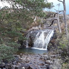
From the station there is an ascent up a rocky path to the eastern end of the majestic Coire Lair, flanked by three Munros. At each of the two major path junctions I took the right-hand fork which eventually took me on a gentle descent to the isolated but picturesque Easan Dorcha waterfall and its rudimentary bothy which I reached at 21:15. Having subsisted on snacks all day I was happythat my first experience of a self-heating meal was a successful one.
Day 3: Wednesday 8 May. Easan Dorcha Bothy to Wild Camp above Inverlael.
15hours 23 mins. 36.5 miles (34.9). 5853ft Ascent
As the main objective was merely to walk the 7.5 miles to Kinlochewe by 12pm when the Kinlochewe hotel opened for lunch this could be described as a leisurely morning. I departed the bothy at 7.20am but the task was even easier than planned as what used to be a fairly rough track from Torran Cuilin to the road south of Kinlochewe has somewhat disappointingly transformed into a full-blown forestry vehicle track. Consequently, I arrived at Kinlochewe at 10.30. I was pleasantly surprised to see what was formerly the Whistle Stop café, which had previously closed, was now under new management as the Gorse Bush and doing a roaring trade. After restocking food from the Kinlochewe Stores I sat down to a double breakfast at 11am and departed the village at 12pm, an hour ahead of schedule.
I headed rapidly up to Lochan Fada via the Heights of Kinlochewe in fair but windy weather with the occasional shower. I turned off the path eastwards slightly ahead of the loch on the route used by the Cape Wrath Ultra. The way is marked by a cairn and there is an intermitteent path passing slightly to the NW of Loch Meallan an Fhudair to Bellach na Croise. This slightly lower crossing of the Bealach makes it easier to pick up the stalkers path just NW of the Bealach. I followed this until it turned North then headed down to join the river feeding Loch an Nid crossing it a couple of hundred metres before the loch to join the good path from Loch a Braoin. At this point the rain became steady and at times torrential driven by the wind.
Rather than continue to Shenevall Bothy I took the 4 x 4 track directly north over the hill and down to Corrie Hallie which I reached around 7pm. Despite the rain I decided to continue on to Inverlael over the, frankly uninteresting, path from near Dundonnell House. By 21:00 I had reached the point of possible descent and opted to use the steeper descent path that begins near Loch an Fiona. With the weather and the approaching darkness this took some time to find and it was 21:30 by the time I reached the road at Clachan.
Knowing tomorrow could be a long day I pressed on a further 2 miles through the dark to the turn off at Inverlael and into the forest. There were several tents just off the path shortly after the forestry building to the right of the path, but I mistakenly thought I had the previous year seen a spot near where the bridge crossed the river a little further on. Here the river was actually in a gorge about 50 ft or more deep. Fortunately, I found a road down to the river to stock up on water and eventually ended up camping in a rather unsatisfactory vehicle siding off the main path at around 22.30.
Day 4: Thursday 8 May. Wild Camp above Inverlael to Inchnadamph
15hours 45 mins. 43miles. 4094ft Ascent
Fortunately, the rain had ceased during the night enabling me to get away before 6am. The first objective was to reach the Oykell Bridge Hotel before it stopped serving lunch. As I climbed the forest track spectacular views opened up SE to the snow-covered Beinn Dearg group.
I crossed the river to the open moor at around 7.30am and from here headed Eastwards to the cairn on the horizon. As I climbed up to the 525m contour I began to walk through fresh snow which heightened the sense of isolation. Once at the contour it became clear the direction was towards another large rock on the horizon. These heavy items must once have been brought via cart as ancient way-markers. As I crossed towards the stone I also encountered stones deliberately laid to ford small channels en-route. Hugging the contour but swinging North I again headed towards a large rock and from there had a view down towards Glen Douchary marked it is southern end by a circular sheepfold.
Throughout Glen Douchary there is a sketchy path on the East side of the river which at times turns into a “hidden” gorge with picturesque waterfalls. Eventually the path took me to within sight of Locha an Daimh and I crossed directly over rough ground to join the 4 x 4 track. It was easy to follow this all the way to Oykell Bridge, though shortly after The Schoolhouse Bothy I took a rougher more direct track to the hotel where I arrived shortly before 1pm.
After an hour’s break for lunch I set off down Glen Oykell, firstly on the 4 x 4 track but then, after Salachy, following the riverside path. After a couple of miles there is a sign diverting Cape Wrath walkers back to the main track.
As I walked quickly towards Loch Ailsh it became apparent that my original goal of reaching the bothy at Loch Glencoul would not be attained and that I would have to push just to reach Inchnadamph. On the way, clear views of the snowcapped Ben More Assynt/Conival ridge opened up.
I doggedly stuck to the path on the Eastern side of Glen Oykell preferring to take a more circuitous route to the pass between Conival and Breabag Tarsainn in order to limit the final climb. As it was dry I was able to easily cross the outflow of the waterfalls and continued to within a few hundred metres of Dubh Loch Mor. The result was that the final climb to the pass, which I reached at 8pm, was only about 100metres.
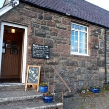
After the long descent, mostly on paths, I reached Inchnadamph shortly after 9.30pm where I was in luck. A B and B which I knew had a vacancy and for the first time in 4 days I had the luxury of a shower.
Day 5: Friday 8 May. Inchnadamph to Inshegra
14hours 24 mins. 36.7miles (35.3). 6332ft Ascent
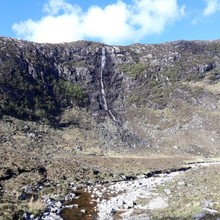
Feeling tired but clean I left Inchnadamph at around 5.45am in gloriously sunny weather, though on the climb to the pass NW of Loch Fleodach Coire there was frequent ice under foot. Views from the bealach were spectacular and there is now effectively a path all the way to the bothy at Loch Glencoul. There is a trod down to the Abhainn an Loch Bhig and from hear an intermittent path can be picked up close to the derelict rusting fence. There was also a fine view to the Eas a Chual Aluinn waterfall which mysteriously disappears into the ground rather than flowing into the river.
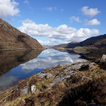
I arrived at the bothy at around 9.45am where I met a maintenance team and then commenced the climb over to Loch Glendhu in increasingly hot weather. As usual the views back to the waterfall and Loch Glencoul were stunning.
On occasions I lost the path down to Glendhu and as the tide was in had to clamber over rather than around the huge rocks where it meets the loch.
I reached the bothy at Glendhu at 11:45am, took the good path towards Kylesku and then branched off past another waterfall up the 4 x 4 track to Loch an Leathiad Bhuan. After a brief pause for lunch at the Sheiling I branched off west to Ben Dreavie and then descending across ground WNW towards a loch around two km away. Once I hit the 300m contour I turned almost north passing two smaller lochs to reach the path down to Loch Stack. I reached Loch Stack Lodge shortly around 4.45pm and from here was still entertaining thoughts of continuing on to the Cape which would have meant crossing the last 8 miles over pathless moorland in the dark.
By the time I had left the path to cross towards Loch a Garbh-bhaid Mor I had decided that reaching the Old School at Inshegra before it stopped serving dinner at 8pm would have to be the limit of that day’s objectives.
Reaching the loch at 6.15pm meant I still would have to push it to meet my revised objective and I hurtled across the narrow boggy path and then across the thankfully low Garbh Alt to reach Rhiconich by 7.30pm and Inshegra by 8.05pm where I splashed out on a three course dinner and a room.
Day 6: Saturday 8 May. Inshegra to Cape Wrath
6hours 25 mins. 17.3miles. 2444ft Ascent
I was conscious of the need to begin the journey back to Fort William to collect my things as soon as possible and that the first bus from the Cape was around 11.15am so I managed to drag myself from bed at 4am and was on the road at 4.40am to complete the last 18 or so miles.
The weather was once again sunny (once the sun rose) and I took the road route as far as Blairmore to pick up the path to Sandwood Bay. I also turned off the road at Kinlochbervie school to take the Lochside path. By the time I reached the bay at 7:15am a full-blown hail shower was in progress.
I took the usual switch-back route at the end of the bay. The river from Sandwood Loch was as low as I had seen it. I then followed a route that circuited rather than climbed across the various small hills and moved closed to the coast after Loch a Gheoda Ruaidh. As the weather was dry I was easily able to cross the Keisgaig river near its outlet (there is a stile into the MoD firing range just before this) and then began the steep climb up towards Cnoc a Ghiubais though I headed directly north from the 200m contour rather than summit. Here I encountered firstly a circling Sea Eagle and another hailstorm.
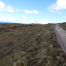
I continued along the coast to a small gorge on the southern flank of Dunan Beag into which I descended following NE on an animal track on its grassy dry floor almost to the military road. After a short climb I was on the road where I met the bus, which surprisingly had left early. After being reassured another would be there within the hour I carried on the road to the Cape in sunny but windy weather which I reached at 11.05am, 5 days 7 hours and 35 minutes after I had left Fort William the previous Monday
There I was able to sample a freshly made coffee and walnut cake and also received a tour of their innovative new bunkhouse.
The bus duly arrived and by 2pm I was hitching to Inverness which I reached at 6pm. The next morning (Sunday) I hitched to Fort William and was back in Inverness by 2pm and flew out the following day.
Started at Fort William at 03.30 on 6 May and finished at 11.05 on 11 May, 5 days, 7 hours and 35 mins in total. Estimated length 210 to 215 miles.
A few comments about distances.Firstly my watch was playing up which meant I could not use the "Good" setting which takes GPS readings every 5 or so seconds. For the first couple of days I therefore used the "OK" setting which only takes readings every minute and therefore misses any twists and turns and as a result underestimates the distance travelled. If you zoom in on the GPS maps you can see how the GPS track deviates from the track.
As the week went on and I was more confident about battery life I alternated between "OK" and "best" which takes a reading every one second and is very accurate.
Even so from Kinlochewe (7.5 miles into my third day) I followed the Cape Wrath Ultra Route which is listed as 126 miles. Despite the better accuracy I still undershot this by a few miles according to my watch.
As a result I adjusted distances to match the Cape Wrath distance and also increased the first two day's mileage by 10%. The original mileages from my watch can be seen in brackets on the report.
Doing this I estimate the total mileage at 209 miles.
As a slight extra complication I accidentally paused my watch for, according to Google Earth, more than 10 miles on day 4 before Oykell Bridge. This was relatively easy to correct as I ran two miles fewer than stage 6 on the Cape Wrath Ultra and therefore the total mileage for this stage was for my day 4 was 43. I also took pictures during the period when the watch was paused to prove I was in those locations. I have looked at the contours and estimate I climbed a further 200 ft during this 10 mile period - it was mostly descent, so have added it to the ascent.
The total ascent for the trip I estimate to be 29,530 ft.

